Brough Law, Breamish, Brandon, Branton and Bracken.
(Northumberland) September 18th.
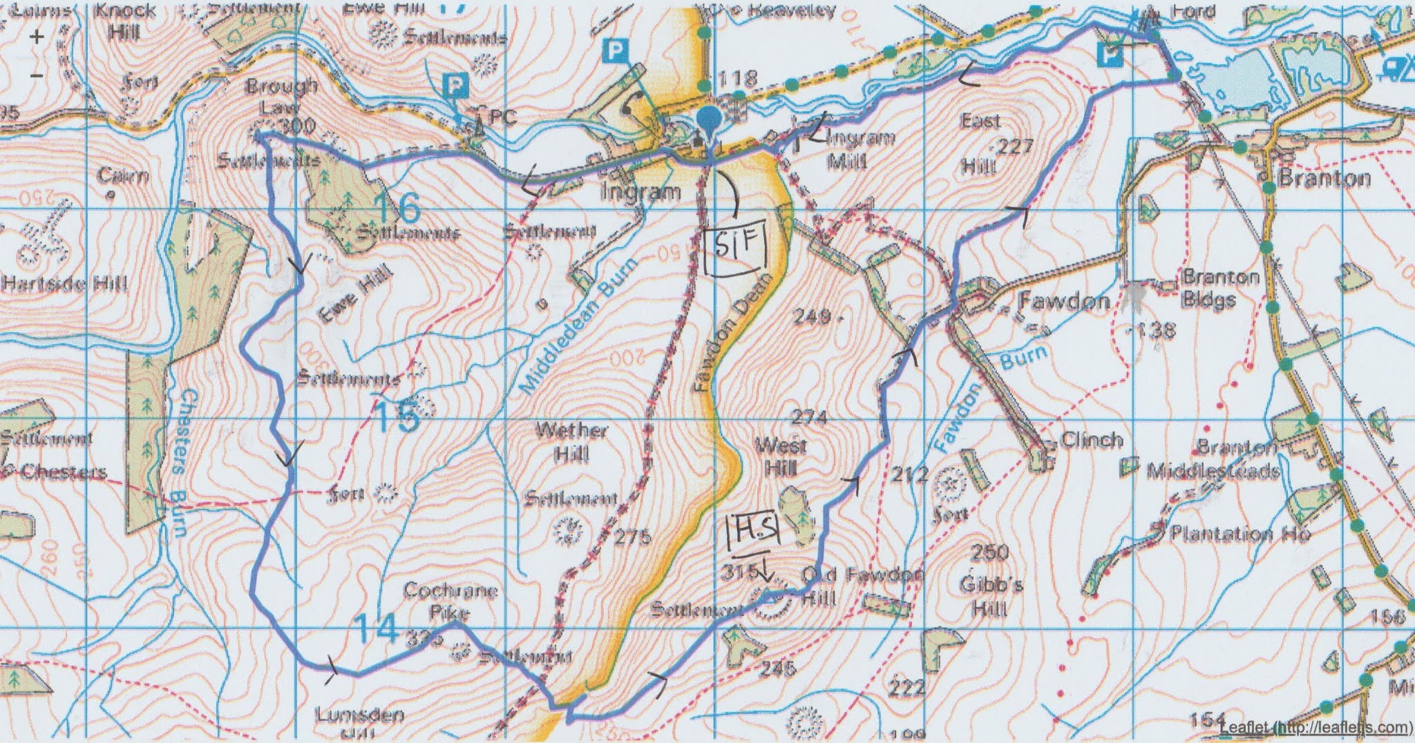
The country is having a few days of early autumn sunshine, just as another limited lockdown is put in place. On a beautiful warm day, perfect for walking and photographing, with sunshine and a light breeze to ease the cobwebs, we are repeating an old favourite, Brough Law, starting from the cafe at Ingram. To get to the start A1 North, A697 at Morpeth and just beyond Powburn turn left at the sign post for Ingram. After about four miles of narrow road, at Ingram village, turn left down the lane, past the church, turn into the car park by the cafe which was once the local information office too.
The maps for the walk are: OS OL 16, The Cheviot Hills and OS Explorer 332 Alnwick and Amble.
And as we are in Ingram a big hello to Gloria Raven in New Zealand, Hope you are all well, you seem to have coped with the pandemic better than we have. The north east of England has been put into a sort of light lockdown, pubs closing by 10 pm, meetings restricted to six people and stay in your own home and bubble.
Fortunately there are only five of out: Brian, Margaret, John H., Dave and me. We had breakfast in the Ingram cafe, run by some lovely ladies. Sitting outside in the sun eating bacon sandwiches it was almost too pleasant to get started on the walk, but eventually we did.


Car park and cafe. The cafe opened at 10am and we arrived at 10.15 so it was quiet. Well worth a visit.
Leaving the car park we walked up the lane past the village church.

St Michael's church Ingram. Origins in the 11th century with an update in Victorian times. The gate is a memorial to the First World War.
Once past the church we turned right and walked west along the valley road. So warm it was T shirt weather with just the lightest breeze, ideal walking weather. Ingram Farm was having a makeover, mostly a new roof by the look of it. We ignored the first sign post pointing uphill on the left and carried on for the best part of a mile, almost to the next car park (which has toilets too) and turned up a footpath on the left. (There is no sign post) The path climbs steadily, going alongside a plantation. The last short steep section brought us to the top of Brough Law and another chance to examine the iron age fort that crowns it.


The rubble built remains of the 4th C BC fort on the top of Brough Law. It is a bivallate fort, (two walls to save you looking it up) Experts think the inner wall would have been 10 feet (3 m) high. Unusually it is built of rubble, apparently.
Having admired the views from the top of the hill, and on such a clear day they were worth admiring, we headed south having scrambled over the rubble of the walls.

Looking down on the Breamish Valley and river from Brough Law. What a privilege to be here on such a lovely day.
The only problem on the trek south is that there are a number of quad bike tracks on the moorland. There are some marker posts but we followed tracks in a south direction before turning east and walking over Cochrane Pike.

This gate on Cochrane Pike is visible on the horizon from a mile or two away. Head for it.
Once through the gate we started walking down hill towards Rocky Burn which later becomes Fawdon Burn, sensible as it is in Fawdon Dean. The downhill track starts on grass but then enters bracken. The bracken is beginning to die back but it is high and it is strong. If we lived in Oklahoma they would write songs about the height, comparable to a pachyderm's eye level. The footpath we followed was hidden in the stuff and some of us had a battle getting through, a machete would have helped. Out of sight of the others I turned left when I got to the fence at the bottom. Eventually realising my mistake I turned round and fought my way through the leg entwining menace to the gate I knew was somewhere there. Fortunately Margaret and John had waited for me, help the aged, but the other two were well up the next hill, Old Fawdon Hill.
It's a steady climb up Old Fawdon which also has the remains of an enclosure on it, including the outlines of several round houses. In fact if you look at the OS map it is easy to see that the whole area was once the home of settlements and enclosures, some iron age some Romano British.
We declared a Herbie and sat below the top of the hill to keep out of the breeze. Once again the views were worth the effort of climbing the hill. A 360 degree Panorama of Northumberland.


Lazing in the warm September sun. We shared mini bramley apple pies, Club biscuits, almond slices, savoury buns and cake, the last two from Mrs A. It was a little cooler in the stronger breeze on the top so we put tops back on, to feel the benefit as your mother might have said.


No comments:
Post a Comment