Translate

Saturday 29 September 2018

Alnham and Ewartly Shank. (Northumberland) Sept 28th.
Reduced again by holidays and family commitments, John H., Dave and I are revisiting an old favourite and walking from Alnham, a tiny hamlet in Northumberland. To find it head north on the A1, turn on to the A697 at Morpeth and much later turn left for Whittingham. Drive through this village and follow narrow roads until you spot a sign for Alnham. Turn right and right again at the sign that say "The Church." There is limited parking on the verge outside the church.
St. Michael's dates back to Saxon times. Next door is Tower House, once the vicar's peel. Church and house were renovated in the 19th century and the latter is now a private residence.
Today's car park, number 312 in my book of northern parking spaces. It is free!


St. Michael's Alnham, currently undergoing renovation. There are the stumps of two Celtic crosses in the churchyard.
The well hidden Tower House. Across the road a green mound is the remains of Alnham Castle and three quarters of a mile to the west is Castle Hill, a pre Roman Hillfort. (Multivallate too!)
The weatherman has promised us a fine day and he is right, hardly a cloud in the sky, no wind and it is warm for September. An Indian Summer.
The map to use for this walk is OS OL 16 The Cheviot Hills.
Just beyond the Tower House, on the right is a stream and across it a footpath that climbs through heavy autumn undergrowth to a gate. Beyond the gate the track heads north across the moors but being rebels, we three continued walking alongside the field wall for some time before heading across country to the farm track. 
In  December1863 Nellie Heron, having tended a sick man in Alnham headed home, against advice, five miles across the moors to Hartside. Unfortunately she was caught in the storm and died from hypothermia. There is a small memorial to her on the moor which we have visited in the past but not today. Should any reader wish to find it it is at GR NT978134.
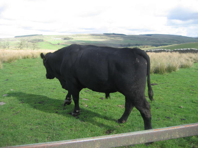
                                                                                                                                                           There are several tracks across the land but they all seem to finish at Cobden Corner, once a building, now a hard to spot ruin in a plantation.                                         From here the track heads downhill and over fields to Alnhammoor Farm. Near the farm we came across three other walkers who were slightly lost but being good gadgies we put them on the right path.
Although quite early we called a Herbie Spot and settled down on a bank overlooking the River Breamish for lunch.
View from our picnic spot. We shared flapjacks, Mr. Kipling Chocolate cakes and Belgian frangepanes.
Lunch over we continued on our way west in front of the farm, down to the Shank Burn which we crossed on a footbridge made of a couple of railway sleepers and headed west.


Alnhammoor Farm.

The track is well posted and leads across the side of Little Dod until it meets a well made gravel road.
The path across from Alnhammoor

Not sure what the restrictions are. No mountain bikes? No tanks?

This device allows quadbikes to bypass gates but animals won't walk over it. I believe they have them in Canada, probably much larger.
The road heads downhill and crosses the Shank Burn before climbing up to a plantation.
Beware the gravel path. The stones can act like ball bearings as one of our team knows.
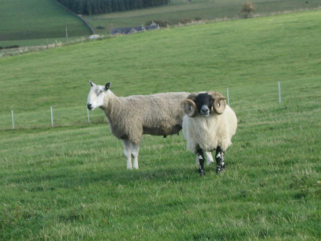
Through the plantation we came to the wonderfully named Ewartly Shank. Not much sign of human life but several dogs in the kennels warned us off.


Approaching Ewartly Shank.
Beyond the farm we followed the road, ignoring the footpath over fields, past experience telling us it is very boggy. At the point marked CG on the map we left the road and headed almost due south on a footpath marked with more traditional posts.
DON'T Follow this direction, look for marker posts!

Approaching Pigdon's Leap on Spartley Burn

The more usual marker.
Beyond Pigdon's Leap we turned south east and followed the path until we hit a farm track that took us to Hazeltonrig Cottages.
Footbridge just before Hazeltonrig Cottage

Hazeltonrig.

From the cottages we came across the sting in the tail. A short but steep climb up a track followed by a footpath across a field, through a plantation which was very dark until I realised I was wearing sunglasses and a couple more fields before we were back at the church.
Changed we headed for the Shoulder of Mutton pub in Longhorsley. Friendly staff and several beers including Directors, Tyneside Blonde and a most refreshing soda and lime.
The Shoulder of Mutton, Longhorsley
This plaque is on a cottage opposite the Shoulder of  Mutton. Emily Davison was the lady unfortunately killed by the king's horse in the Derby. A very brave lady she was buried in Morpeth and a statue to her was recently erected there.

Contains OS data Copyright. Crown copyright and database right 2018
The Matrix MMXVIII 9d
                                                                   steps                            miles
NAK                                                         28511                              10.79
OUTDOOR GPS                                                                                 9.91
Dave's NAK1                                            22132                                10.12
""""       NAK2                                           21995                                10.06
"""        USB                                                22048                               10.09
""" S M                                                       22862                                10.1
iPhone                                                         25652                                10.04
etrex                                                                                                      10,05
4hrs 2 mins walk     59 mins talking


Saturday 22 September 2018

Warking in the rain with the Pittdown men.
(Northumberland) Sept 21
Reduced in numbers yet again by late holidays and family commitments the gadgie team is reduced to three, John H., Dave and me.
Storm Bronagh  is meant to be passing over Ireland and Britain on Thursday so in case she turns up late we have opted for a relatively gentle and local walk from Wark up the North Tyne Valley.
(A69 west, turn north at Hexham for Chollerford and follow signs to Wark.)
The maps for the walk are OS OL43 Hadrian@ Wall and OS OL 42 Kielder Water and Forest.
There is a small parking area (Yorkshire variety) across the road from the Battlesteads  Hotel and we started our walk from it.
This week's car park in Wark, across the road from......


                        …. The Battlesteads hotel and bar. It also has an observatory, bookable and very good by all accounts.
   Once booted up and having donned exra lagging for the first time since spring we set off up the main street, turned left past the Grey Bull Pub, The Black Bull Pub and the village green, heading for the bridge over the North Tyne.
Village green, Wark


North Tyne at Wark, full after the heavy rain Bronagh brought, unless they had opened the sluice gates at Kielder.
Having crossed the river we turned left along the bank for a short distance before leaving the riverside path and walking the road uphill, slightly, to the junction where we turned left
We followed the road to the junction at Thorneyhirst, turned right then left into fields. The footpath is quite well marked with the usual yellow arrows and on some sections it is part of one of the "Daft as a brush" trails*.
We followed the path across fields to Heugh, passing the ruined Bastle until we were close to the High Countess Park where we turned left and walked through woods at Brooks Heugh. 
The ruined bastle (fortified house) is the left side of the also fairly ruined house.


 The path followed the line of the river, at times close to it. There were a few trees lying across the path, victims of the last storm.

Looking slightly out of place this timber cabin is next to the river
Once out of the wood we climbed the bank on to the dismantled railway track and walked past the remains of Redesmouth Station to the village, turned left, crossed the bridge and settled down for a Herbie.


                       This used to be the platform at Redesmouth station
Herbie spot, just off the road over the bridge at Redesmouth; Titans from ALDI, Mr. Kipling cakes and cookies. I regretted not having brought soup this week, it's getting colder. (The weather, not the soup)
Lunch over we continued up the road heading north west until we spotted the marker on the right just bbefore Redeswood Cottages.
This well made farm track took us in a semi circle to Rede Bridge, crossing the river of the same name and uphill to Crossing Cottage.
Rede Bridge


                Topiary peacock at Crossing Cottage. (Look carefull)
A short distance beyond the cottage we turned right onto a very straight and green track, possibly once a drove road or ancient green lane.
So straight it looks Roman, but isn't
The track took us to Buteland, a large farm which had a couple of mobile Shepherd's huts as holiday homes. I believe they were made popular by the last Prime Minister

Shepherd's hut for a holiday anyone? Comes with a supply of quinoa and zucchini
Buteland also has outdoor art. This fine example is made from discarded horse shoes and chain for the mane and tail.


We turned left at Buteland and followed a track across fields  to the road near Buteland Building.
Here we turned right and followed the road for a short distance  before taking a footpath on the right across fields until we met another very minor road. Turning left we followed the track to Lowshield Green farm, saying hello to the pony there.
My little pony at Lowshield Green
There is in this area a Holy Well which we intended to see. We left the road near Pittland Hills and wandered across fields in search of the magic well. Unfortunately we took the wrong path and so I was never able to cure my arthritic knee. Keep on with the turmeric and exercises.
Several fields later we came to Birtley, a long strung out village with a fine football pitch and a church dedicated to St. Giles.  It has Norman origins and Victorian additions.
St Giles, Birtley
Across the road from the church there is a stile that cuts a corner off on the road back to Wark. So we took it across fields until it met the road again and we walked into Wark.

           The path through the stile is better than walking the road.
Back in Wark and changed  we retired to the Battlesteads which offered Jarl, Bitter and Twisted, Seraphim and Wainwright, plus some refreshing soda and lime for the driver.


Contains OS Data, copyright. Crown copyright and database right 2018

Matrix MMXVIII  9c

                                                                                    steps                        miles
NAK                                                                           36954                        13.99**
iPhone                                                                         30462                        13
OUTDOOR GPS                                                                                           13.2
Dave's NAK 1                                                             27815                         12.73
 ""        NAK 2                                                            27531                          12.6
  "" USB                                                                      27571                         12.61
  Sylvias mother                                                          28550                         12.62

 ** John and I did some extra wandering looking for the well.