Translate

Saturday 31 December 2016

Last blog for 2016, another old favourite walk. Dec 30th.  (Northumberland)
  One final walk before the year ends. John and I have opted to blow the Christmas cobwebs away with a short walk from Alwinton, a tiny village in Northumberland, always a good starting point.
To get there, A1 north, A697 at Morpeth, turn off at Weldon Bridge for Rothbury, go through that town and Thropton and turn right at the sign post for Harbottle and Alwinton..There is a Yorkshire car park on the grass by the stream as you reach the village, plastic mesh on the grass prevents damage so don't feel too bad, or go down the street past the Rose and Thistle pub and, for a mere £2 leave your vehicle in the National Park park. The money goes to the Park and not the council, plus there is a toilet.
The map to use is OS Explorer 16 The Cheviot Hills and the National Park park is at NT919603.

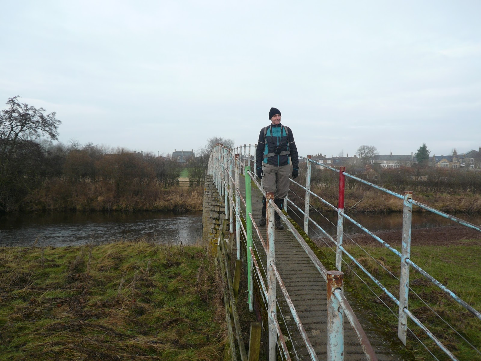
               A double dose of the car park.
The walk:
 We walked back past the pub, crossed the stream by the footbridge (The Hosedon Burn), turned left and walked up the farm track known as Clennel Street, an ancient drove road. On the left is an Iron Age settlement, hardly visible from the track, beyond it we took the second path off to the right, crossing a Cross Dyke which I am told could have been part of a holding area for cattle or part of the defences of the settlement.
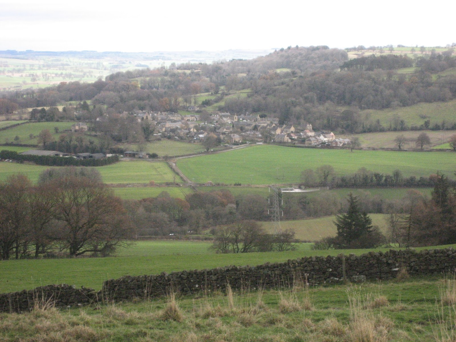
Looking back from the hills above Alwinton.
The footpath contours for a while before gently descending to meet the edge of the plantation at Kidlandlee Dean and the River Alwin. Since we were last here much of the plantation has been cut to make kitchen work tops probably.

                              Valley of the River Alwin
We followed the road alongside the river in a south east direction, crossing the stream once, before heading east up Rooklands Syke. (there is a sign post to make sure you get the right valley) The footpath climbs slowly and crosses several new fences before arriving at the ruins of Old Rookland where we called a Herbie Spot.
                     Looking back down Rooklands Syke
                                              
                                 Old Rooklands, once a farm, now a Herbie Spot. Christmas cake and sandwiches.

                   The shed on the right has provided shelter from the rain in the past.
 Lunch over we followed the grassy but muddy track east before it turned south east and became a reasonable farm track which eventually joined a road. Turning right we followed the road south west past Rooklands farm, across fields and passing Clennel Hall, a rather fine looking building now a hotel.
                             Clennel Hall, dating back to 1541.
Beyond the hall we crossed the River Alwin by the footbridge, walked over several fields and emerged on the farm track where we had started our walk.
Usually we make this walk longer by heading across fields to Newton but today we just wanted a stroll out and I wanted to be home to watch Newcastle United play Nottingham Forest (NUFC won 3-1). It is a good walk anytime of year, not too difficult, a climb at the start and a climb up to Old Rooklands and the Rose and Thistle in the village at the end.
Not having Dave with us there is not a matrix but I recorded 16748 steps and 6.87 miles on faithful NAKOSITE and iPhone claimed 16894 steps and 7.2 miles.


Contains OS data copyright. Crown copyright and database right 2016

                                                 ANNI BEATUM


Thursday 29 December 2016

A mini blog for Christmas..........Dec 29th
    For about 35 years my wife has catered at Christmas for an assortment of mothers, mothers in law, aunts, aunts friends, brothers, our girls and me. (Although I have always helped with the washing up.)
This year, now that we are getting old, we have been invited to spend Christmas at daughter Lucy's family home in Cheadle Hulme which is possibly in Cheshire but is definitely south Manchester.
On Christmas Eve I played football with my grandson and his dad on a local, very muddy field. My jeans were well coated and being me I had not taken any others so I was dispatched, wearing a pair of tracky b's, to the local retail park, with help, or they would have been wrong, to buy another pair.
 Christmas day started as it normally does with small children, opening a stocking and feverishly tearing paper from presents, the most popular being a thing called fungus mungus which reminded me in a roundabout way of the film Soylent Green.
Christmas dinner was a great family affair, Ken and Yvonne, (Mark's parents), wife Kathleen, daughter Kate, daughter Lucy, son in law Mark, Alex the grandchild and me.
                                  Some of us tucking in. Some of us had traditional turkey, the vegetarians had an amazing looking home made vegetable pie and for sweet we had a fine Christmas pud, or apple crumble.
                                      Making a gingerbread house
                                       And ginger bread letters
We had dined quite late in the day, so the rest of the evening was spent playing fun games like "Who am I?"
On Boxing Day it was agreed that we would take advantage of the bright weather and visit Lyme Park, the ancestral home and hunting area of the Legh family who seem to have run the place from the conquest until 1946 when it was handed over to the National Trust.
            No blog without a car park. This is at Lyme Park, the largest house in Cheshire and very popular too for family walks.
We strode out manfully in the wind, walking across moors and through woodland. Fascinating views across distant Manchester and its airport, the Derbyshire Peak District National Park.
                   S W M B O boots up
                  Lyme Park House, the largest house in Cheshire
                       A hunting lodge, apparently
                    Thumbs up, we are nearly back at the cars.
A fairly ordinary looking gate but look closely at the blue disc.
One for the yet to be published book on gate fastenings of the north of England.
The following day we indulged in an even more interesting walk. As a small child I was brought up near the Leeds Liverpool canal, from being five to twenty I lived near the Lancaster Canal which, before it was cut by the M6 motorway, ran from Preston to Kendal. Canals and their banks,especially out in the country, were wonderful playgrounds and, living in the north east of England, I actually miss them. Good for walking, fishing, canoeing and throwing stones by children, nowadays canals seem to be used solely by boat owners and holiday makers. Today's stroll was along the banks of the Macclesfield canal, it had nearly everything, a tow path, bridges and pubs. (But not one of those clever bridges designed so that the horse could cross from one side to the other without the tow rope being removed.                                                                                                                                     


                   The Miners Arms, beer, food and coffee for the drivers.


                          Views on the Macclesfield Canal. Memories! ( I await comment from anonymous)

And on the 28th of December we walked to and round Bramhall Park, another ancient home and now a setting for weddings and functions. Also a popular place for a family Christmas stroll.
The ladies in my life, Lucy, Kathleen, Kate. The Tudor pile behind is Bramhall Hall where Lucy got married.
All short walks and all very enjoyable but not weight reducing, I managed to put on 5 pounds but that will go with a return to gadgie walks. Happy New Year to all.

Saturday 17 December 2016

A gadgie Christmas walk.    (Northumberland ) Dec 16th

This is the last walk before Christmas as several of us will be away next Friday and we always walk on a Friday unless it is the annual Gentlemen's Week or a mid week special or walking from Stanhope which is best done on a Saturday because of the bus.
There are eight  of us out today and we are walking from Rothbury in Northumberland. Take the A1 north from Newcastle, turn off at Morpeth on the A697 and turn left at Weldon Bridge on the road to the small town.
The magnificent eight are John x 3, Dave, Harry, Brian, Ben and me and we had morning tea at Tomlinsons cafĂ© and Bunkhouse on Bridge Street. Always a warm welcome.                                   The maps to use are:
OS Explorer 332 Alnwick and Amble
OS OL 42 Kielder Water and Forest
The walk:
Breakfast over we moved the cars to the park on the south side of the river Coquet, booted up and set off.
               The team prepares to go from the Yorkshire car park in Rothbury.
We crossed the footbridge and headed for the main street, turning right and then left on Brewery Lane on the north side of the village. There is a footpath off the road that crosses fields to Hillside Road and another, also on the left that leads to woodlands. Turning left at the first gate we followed a Rhododendron bush lined footpath that eventually turned into one of the semi metalled "carriage drives" on the Cragside Estate. (Cragside for new readers was the home built for Lord Armstong, Tyneside armaments manufacturer. The house is well worth a visit, run by the National Trust).


               One misty moisty morning near Rothbury.
The track follows a semicircle across the heather, passing standing stones, cairns, ancient fort and a modern radio mast. Just beyond Brae Head, marked on the map, a footpath turns off on the left and
becomes the delightfully named Physic Lane above the village of Thropton. (Possibly "the farm at the crossroads")
When we reached the village we turned right, crossed the footbridge, turned left and followed the footpath on the right that crossed fields to the footbridge across the River Coquet.
Pedestrian footbridge, Thropton

Saturday 10 December 2016

A walk from Warden to the Wall. (Northumberland)     Dec 9th.
  Still walking near to home as the days remain short today six of us are out walking from Warden (Weard-dun .. watchplace on the hill and the same as Warton, a village near Carnforth in Lancashire) to Hadrian's Wall, a Mithraum and several other piles of stones.
Warden is reached by taking the A69 west and turning right just beyond Hexham. The walk is covered by OS OL 43 Hadrian's Wall.
The six out today are Brian, John C., Harry, John H., Dave and me and for morning tea/coffee/bacon we stopped at Brockbushes Farm Shop at the roundabout near Corbridge. Not only do they serve good coffee and tea and an amazing looking bacon sandwich, they have a nice tractor for little boys to play on.
                        Farmer Giles drives for Christmas.
 We moved on to Warden and parked near the church (GR NY 913665)
It was a warm day for December, a southerly gentle wind bringing a temperature of 14C, no jacket required.


                       St. Michael's Warden, the tower is Saxon, the rest is pretty old too


                           Yorkshire car park on the side of the road near the church in Warden.
Booted up we headed north on the road out of Warden. After climbing uphill for a short time we turned left off the road and heade3d up the path to High Warden and from there across fields to the Iron Age fort on Warden Hill. Somewhere in this area the first real Boy Scout camp was held in 1907, after the "gathering" on Brownsea Island.
The views from the fort are well worth the climb, east across fields and the village of Wall almost to Newcastle, to the north the line of the Roman Wall.
Moving west down the hill we followed a muddy track, crossing the line of a Roman road, not that anybody noticed, and past a construction site where a new sub station was being built to feed the power from wind turbines into the national grid.
                                                       Power for the people
                                                                          Beyond the site we turned left on the road and then right shortly afterwards. A footpath on the left (mile 3) took us across fields and between plantations. Two deer burst out of the plantation on the right, leaping fences like Grand National runners, but a third took some time to cross. By the time I had my camera out it was nearly gone.
                 This will not win Wildlife photographer of the year
Shortly afterwards we past the artist's cottage, complete with mysterious offerings for the Turner Prize and more worthy winners too.
                                                   Artist' s cottage workshop?
We continued on our way west before turning south and co0ming to Newbrough Hall, a large farm with unusual outbuildings.
                                    Newbrough Hall
If you do this walk watch out for the finger post on the right which points to St. Peter's church. We never saw the church but we followed the path, eventually turning north east (before mile 5) and heading up a muddy track which eventually came out into fields, a suitable place for a Herbie Spot on a windfree dry day.
                                                          Herbie time; fruit cake, mince pies, Yorkshire flapjacks and Eat Naturally, a variation on a Beatles song, although not penned by Lennon and McCartney. You can tell what a pleasant day it was. And all the rubbish was taken away.
After lunch we headed north across the fields before turning left to visit the Mithraum.
The Mithraum is the remains of a Roman temple to Mithras, a deity originating in Persia but very popular with the legions. There is a reconstruction in Newcastle Great North Museum and the original altar stones are there too. The ones in the temple here are good reproductions.


This altar stone is cut through to allow for a light to give the god a halo effect. If you want to learn more about the archaeology of the Roman wall find "Future Learn" and sign up for their course on Hadrian's construction when it is repeated.
From here (mile 7) we headed east along the Hadrian's Wall path. Most of this section is on the north side of the wall, parallel to the ditch, the wall itself being under the road!
The ditch on the north side of the wall.
The path here crosses "limestone corner" where the Roman engineers failed to break or move the rocks which are not limestone anyway, but dolorite on the Whin Sill.

                                  Limestone Corner

Limestone corner where the workers finally gave up on the ditch and told Hadrian to dig it himself.
The black lines are where they tried to cut into the rock but it was too hard. Supposedly.
 After a mile and a half on the Wall Path we crossed the road, walked through muddy fields to Walwick Field and on reaching the road followed it south, turning left at the junction, passing the sub station site again. rather than walk over the hill with the Iron Age fort again we took the footpath round it, crossed several fields until we hit the narrow path alongside the Newcastle - Carlisle railway.
By this time it was dark, the path was narrow and nobody had a torch of course, but we stumbled back to the cars, changed and went to the Warden pub/hotel, The Boatside. Very welcoming.Winston and Isa from Still Game sat at the bar which served White hot and Monument Ales, and tea.
Another good walk, but 99% of gadgie walks are. It is a bit on the long side for a short day in winter, either start early or do it in summer. Not much climbing, lots to see and a good pub at the end.


Both maps contain OS data copyright. Crown copyright and database right 2016


                                         The village of Wall from the fort


                                    Stream near Newbrough Hall


                    Info board at Mithraum; it needs replacing
                                   Long distance footpath marker for Hadrian's Wall Path
                           Flooded ditch
                                           Gadgies and ditch on north side of wall

                                       A bit of wall.

The Matrix MMXVI penultimate possibly
                                                                                  steps                        miles
NAK                                                                        35829                         14.7
Dave's 3D                                                                28865                         13.28
  ""   USB                                                                28031                          13.27
  ""   NAK                                                               27590                          13.06
Etrx GPS                                                                                                     13.5
OUTDOOR GPS                                                                                        13
iPhone                                                                      30307                         13.4
John C GPS                                                                                                 13.5
Brian GPS                                                                                                   13.15  (right?)