Translate

Tuesday 21 December 2021

 A year in the lives of the gadgies.

As with the rest of the population gadgie activity has been seriously curtailed this year by the pandemic. For the first few months several of us walked alone, staying close to home as requested. I became quite familiar with Northumberlandia, the huge earth art work just outside Cramlington. She is constructed from the rock and soil excavated to allow access to the coal beneath.

In March I was adopted by Brian and Margaret and joined their bubble. Arriving in separate cars and greeting  with "Fancy seeing you here" we had several socially distanced walks close to Newcastle. Our days out included conquering the three peaks of North Tyneside; the old pit heap at Weetslade, a heap at Rising Sun Country Park and a heap at Silverlink Nature Reserve.

                              The gnomon at Silverlink. The clock was fairly accurate too

                         Mount Weetslade, a country park near Killingworth. Popular with dog walkers.

But in April the government allowed pubs to reopen - provided you ate or drank outside. To celebrate our freedom five of us; Brian, Margaret, John Hall, Harry and I did a favourite walk based on Rothbury.

(Never mind the walk, the pubs are open; April 14)

On the way home we sat in the garden of the Cook and Barker ay Newton on the Moor, wrapped in padded jackets. The waiter brought a list of drinks. On e simply said Real Ale. When asked what sort he said Timothy Taylor's Landlord. Oh happy day.

                      The Cook and Barker, Newton on the Moor.


By June life was back to normal, almost. On the 9th several of us walked from the church of St. Andrew at Bolam , not far from Newcastle. It is an easy going walk, few climbs but on this occasion was made difficult by the team having to cross a field of oil seed rape. The farmer had kindly left a track between the rows of the crop but the ground was a tangled mess of stalks, causing more than one to trip.

                      The path looks never ending, felt that way too.

In July we were joined on a walk from Blanchland, a village just in Northumberland, by the famous cat detective William and his two lady friends Helen and Kate.


                                 Kitted out for hiking William joined the gang in Blanchland.

The proposed long distance walk on the West Highland Way from Milngavie to Fort William had to be postponed this year but four of us managed to squeeze in a shorter walk from Skipton to Kirby Stephen. Most nights we stayed in pubs, several of them dispensed Timothy Taylor's Landlord too. A good walk and thanks to Mickledore for their excellent, speedy service when one night's accommodation had to be cancelled at short notice.

                             Somewhwere in the Dales on the Lady Anne Way

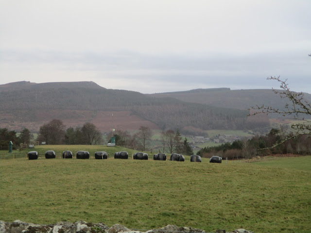
                             Lady Anne in Kirby Stephen. She was a 16th century landowner who helped the people living on her estates.

In September one of the month's Fridays was devoted to walking the coast of Northumberland from Warkworth to the River Aln and back through the dunes. The Northumberland coast has miles of sandy beaches as Britons having to stay at home for their holidays have discovered. Thankfully it never gets too hot.


                Northumberland beaches are seldom crowded.

Also in September we had for me a new walk, starting from Slaley a linear village high up above Hexham. This walk at this time is to become an annual event, a memorial walk for Ray Craven who was one of the original gadgies. Ray sadly died this month, missed by all. 


          I should keep a log of the stiles we have crossed on our walks. This one, a proper stone one imported from Yorkshire is a proper stile. Ladder stiles are fine but can be slippy. Some of the simple bar and pole ones are dangerous, especially those where the farmer has left a strand of barbed wire on the top.

And in December we finished with a walk from Rothbury, days after storm Arwen had caused havoc in the woodlands of Northumberland and my garden fence! Some of the paths through woodland were impassable for gadgies and we cut them out, using roads.


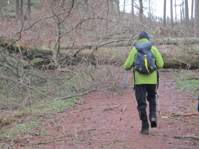
                               Arwen closes footpaths near Rothbury. Thousands of trees came down. Wood burning stove owners were delighted.

It's almost Christmas, there is a break for gadgies for a week or two before we start up again with the annual Blyth to North Shields coastal walk. 

Happy Christmas to you all and I sincerely hope 2022 is a much better year.


Monday 13 December 2021

 An urban stroll on the Wansbeck (Northumberland) Dec 12th.

 I have been invited to join the Gosforth Greens for a short Christmas walk followed by a pub lunch. Can't turn down an offer like that. 

The walk starts in Morpeth, A1 North and turn off. Cross the bridge, turn left and turn left by the tower, there is a large car park, T and C may apply. No map the walk is well posted but should you want one it is OS Explorer 325 Morpeth and Blyth. There are about twenty of us, a bit of a school crocodile.


                                Car park shot. Busy for a Sunday but some shops and stall are open.

 From the car park we headed for the river and turning right walked along the bank, admiring the ducks and geese and the families feeding them

                        I'm a swan, not an ugly duckling

And I'm an out of focus duck (Gooseander?)

At the first bridge e crossed the River Wansbeck and carried on on the south bank to the second bridge. Crossing the river again we  turned left and walked carefully and in single file along the road to the next bridge where we crossed again.

Turning right we walked a short bit of road before taking atrack on the left which took us past the ruins of Newminster Abbey, through an estate and back to the road. Leaving it again we crossed a field, negotiated a double stile  and headed for High Common House on Morpeth Common.


One by one through a kissing gate.


 The first stile is just about visible  behind the second. Not much room between but some barbed wire to add to the fun.

From this point we headed in a straight line in a North East direction across the common, accompanied by several dogs and their owners.

                     One lady had provided several types of cake so we had a mini Herbie.
Cake break over we continued on our way to the graveyard by the church of St Mary the Virgin. There were a number of trees that Arwen had blown over two weeks ago but of greater interest was the grave of Emily Davison:

                 The Davison family plot. Emily was the young lady and suffragette who ran onto the race course and was killed by the King's Horse.

Leaving the churchyard we walked down the road to a roundabout, turned right, crossed the road and headed for Morpeth railway Station, currently undergoing refurbishment. We walked parallel to the railway line for a while to a level crossing where we turned left over the tracks and walked down a road which claimed to be open for cyclists only. 
Passing some allotments we all paused to admire the roadside decorations;


At the bottom of the hill we turned sharp left and followed the footpath on the riverside back to the car park, crossing over by means of the handy footbridge.
To finish the day we went to the Tap and Spile pub on Manchester Road to enjoy a buffet lunch of;
chicken curry, quiche, ham. chips, salad, sausages and a cheese board with plenty of biscuits and a good selection of cheese too.
And there was Timothy Taylor's Landlord Ale on Draught too. Great day out.

Contains OS data, copyright. Crown copyright and database right 2021.
This pleasant stroll is under 6 miles.


Saturday 4 December 2021

Oh little church of Rothbury. (Northumberland) December 3rd.

 As we finished our walk last week (November 26 ) storm Arwen struck Scotland and the north of England. Winds up to 100 mph (160 km/h) caused damage to buildings, blew down power lines and uprooted thousands of trees, many of them in the plantations in Northumberland. A forestry spokesman on the local TV station advised walkers to stay out of forests. So today we are having a walk part of which is in the plantation on the north side of Simonside. Not to brave the damage but to see a cave with the name Little Church.

The walk starts from the Rothbury car park, south of the river. (A1, A697, turn off at Weldon Bridge for Rothbury. In the town turn left down Bridge Street to the large and free car park.

There are eight out today, Brian, Margaret, Harry, John H., John C., Ben John L. and me.

Rothbury is on the edge of two maps and so is the walk;  OLOL 42 Kielder Water; OS 332 Alnwick.

                   Rothbury car park, next to the Coquet, free.
Leaving the car park we turned left towards the bridge  and almost immediately turned right on a narrow road, part of St Oswald's Way, which eventually became little more than a track. we passed Sharps Folly:


                                                   Sharp's Folly.
We followed the track, crossing fields  to Whitton Hillhead and on to the minor road from Great Tosson. 
having crossed the road we entered the plantation and started our way along a forestry road. 
After  a few yards we came to the first tree that had been blown over across the track. And then some more;

                      More than just leaves on the track this time.

Having scrambled round or climbed over a dozen or so tree trunks, and having been tripped by brambles we decided it was too much of an effort struggling on and retreated to the road. Sadly this meant we would not visit the Little Church, leave it for a warm day in summer when the plantation roads have been cleared.

We walked along the road to Great Tosson, a collection of cottages and farms which were without power thanks to Arwen. One house had a generator, the rest were without lighting and it was a gloomy day. Tosson does have the remains of a tower too.


                             The ruins of Tosson Tower. A watchtower in the reiver days.

Moving on we decided to Lunch at the picnic tables close to Tosson Lime Kiln.

                  On the menu today. Soup for some, flapjacks, apple pies, two varieties of ginger biscuit, savoury buns and lemon cake from Mrs A.

                   Tosson lime kiln, inside and out.
Herbie time over we headed across the fields to the footbridge over the Coquet near Thropton, crossed it, headed along the footpath to the village where we turned right and took the footpath over the Wreigh Burn.
As soon as we were over the bridge we turned left and followed a muddy footpath alongside the burn until we reached a minor road. Turning right we soon joined anothe rminor road, crossed it and took the footpath across fields heading east before joining the track that is labelled Physic Lane. At the end of the track we came to a spot that has been frequently used as a Herbie Spot on walks along the Rothbury Terraces. It was decision time. Three of us decided to take the shorter route back along a track to Rothbury, the other five followed the tracks across the moors back to the town.
And then we went home, or to the Shoulder of Mutton in Longhorsely.
Look carefully and see the squiggle in the third square on the bottom row. This is where we battled fallen trees before surrendering.

The planned route. Little church is in the second square on the bottom row.
Both maps: Contains OS data, copyright. Crown copyright and database right 2021.
The shorter walk was 8.6 miles, the longer version about 11.


Saturday 27 November 2021

 Walking from the very centre of the island. Northumberland, November 26.

 Haltwhistle (from OE Hautwisel meaning the hill near the fork in the river) claims to be the geographic centre of the island of Britain, so does Darwen in Lancashire and Shelley and a point in Morecambe Bay. Today's walk is from the town, partly one of the "Haltwhistle Rings", a series of walks provided by a group of people from the town. It is covered by OS OL 43 Hadrian's Wall.

A team of eight are making the trip; me, Harry, Dave, Ben, Brian, Margaret, John H and John C. Going with out breakfast as days are short this time of year we met on the Bellister Road. Reached by travelling west on the A69, taking the Haltwhistle by-pass for a short distance before turning right onto a minor road that is also a dead end. There are two bridges across the South Tyne on the road, both closed to vehicles. We parked near the most westerly on the side of the road.

Almost ready to go from the car park, maps being consulted I think.

Walkling back along the road we s[otted the sign post that led us across fields to the A69. A busy road needing care. It is a section of the main route across northern England from Newcastle to Carlisle. It needs dualling but it is in the north.

Having safely got over the road we continued following a defined footpath that crossed the dismantled railway that is now part of the South Tyne trail and climbed up to Broomhouse Common. Not so much a footpath, more a struggle through tussocks of tough grass with hidden bogs and ditches, several stiles with slippery steps too, until we reached the Park Burn.


Waterfall on the Park Burn. The stream meanders at this point too, aboon for Geography teachers, there is the hint of an ox-bow lake forming.

We crossed a footbridge, carefully avoiding the group of men out shooting on the hillside, and took a straight lane heading west of south for a few hundred yards. At the end of the lane we turned right, climbed a stile and continued our battle with the tussocks and ditches. At one point I heard a cry from harry who was behind me: "Oh gosh, I have fallen into a ditch and my feet are soaking" he cried.

Skirting a small wood we headed downhill to Featherstone Rowfoot. a hamlet close to The Wallace Arms. A good pub, but not today. A short distance beyond the pub we settled in a car park for a Herbie. No benches but a short series of steps made a reasonable picnic spot.

Herbie time: Festive bakewell, bakewell slices, ginger biscuiots, flapjacks and savoury and cake from Mrs A.

After lunch I decided that the knee had had enough and I intended to take the soft option, walking back to the cars by way of the South Tyne Trail, a walk that descends gently on a dismantled railway line back to Haltwhistle, Harry chose to return with me and we covered the three miles back at a gentle pace. 

The other five noble walkers followed the loop shown on the map. Eventually we all met up at the Wellington pub in Riding Mill and enjoyed hand pulled beers or coffee.


Contains OS data, copyright. Crown copyright and database right 2021.

The short walk was 7 miles, the long version about 11.