Translate

Saturday 29 February 2020

A tale of three bus stations by Dick Charlton (Durham)
February 28th
The gentleman on local TV promised a grey day with snow. Thinking most of the country walks would be soggy five of us opted for another railway walk in County Durham. The fearsome five are Ben, Dave, Harry, John H. and me.
Another walk that can be done without a map but should you insist you need three:
OS Explorer 305 Bishop Auckland
OS Explorer 307 Consett
OS Explorer 308 Durham and Sunderland.
We met on Eldon Square bus station in Newcastle;
                          Eldon Square  Bus Station, Newcastle
And from there we went by bus to Durham;
                  Durham Bus Station. The city is getting a new one, eventually
 And from there we caught a bus to Crook;
                        Crook, bus station and a car park! Best I could do, sorry girls.
Once off the bus we headed across the car park to a street in the north west corner. Like an old fashioned shopping street, plenty of small shops selling a whole variety of things.  
The Deerness Path is well marked at regular intervals, offering encouragement on a cold, windy day.

                                                                                                                                                                                   At the end of the street we joined a footpath that had once been a wagon way for the moving of coal. The path, Deerness Valley Railway Path, climbed steadily for just over a mile, the only real climb of the day until we reached the road at Stanley Crook.
Close to Stanley Crook we passed this  interesting memorial to an unfortunate young man who had died far too young.
                                                                                                                                                                         We crossed the road and followed the well marked trail on solid ground with only the occasional puddle. The walk passes  number of Durham pit villages, easily recognisable as  small terraces of neat houses.
One of the first was Waterhouses:
           Erected for the queens Golden Jubilee in 2002. 
We had started the walk in a light drizzle which turned to heavy but wet snow which didn't settle on the ground. It did however easily persuade us to stop for a Herbie under a bridge.

                         Shelter from the storm. Nowhere to sit but dry at least: Ben's ginger biscuits, Bliss Bars, flapjack and almond slices, and hot coffee to keep the cold out.
Refuelled we headed on to Durham, passing the village of Esh Winning, a name that suggests it was a working mine. Miners were said to "win" the coal.
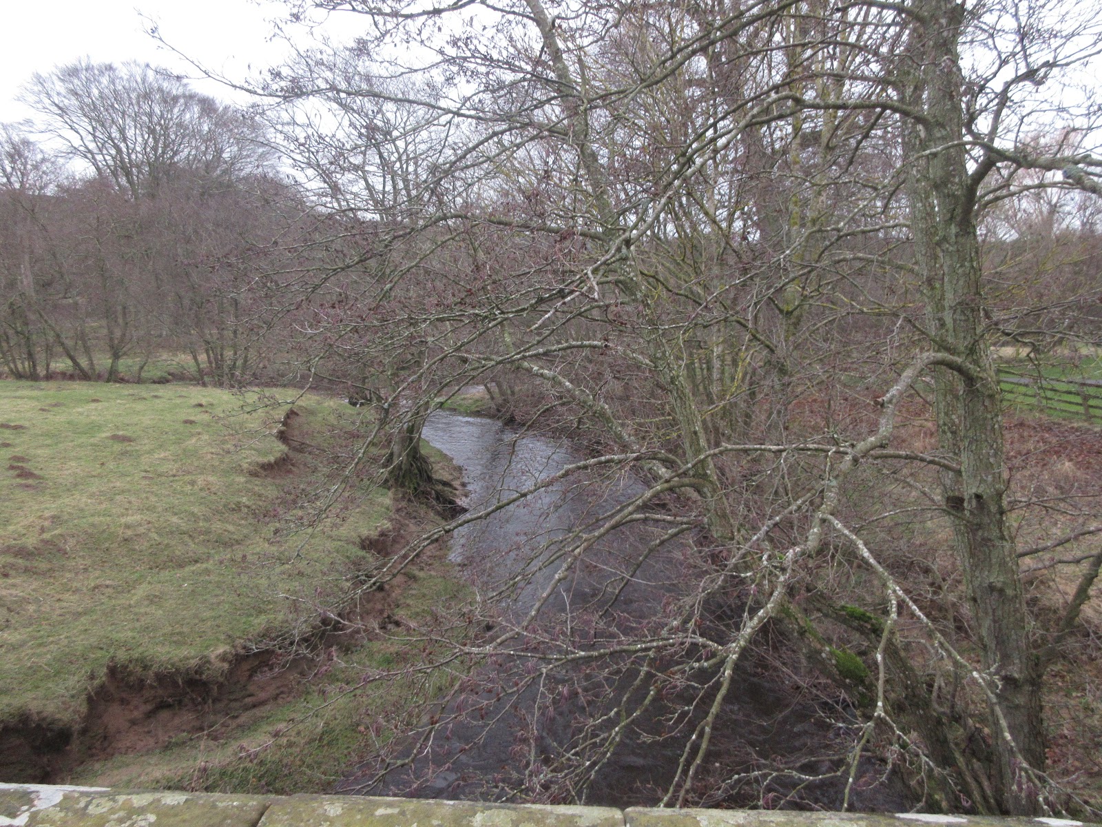
Much of the path follows the Deerness River through woodland which has taken over at the side of the old lines too. Most of the walk is through pretty country, we thought we might return in spring or summer.
Walking on we passed between Ushaw Moor and New Brancepeth before joining the Lanchester Valley Railway Path for a short distance.
                          The junction of three railway paths; Deerness Valley, Lanchester Valley and the Brandon to Bishop Auckland Railway Path
                                                                  Turn on to the path on the left.
We turned off the railway path and walked up to a road, turned right and crossed the bridge over the East Coast Main Line and walked to the roundabout, Stone Bridge, at the bottom of the hill. Once safely across the junction we turned left then right and climbed uphill to a cross roads. Here we turned left then took the path through the grounds of Ustinov College.
                          Art work in the grounds of Ustinov College. The college was originally Neville's Cross Teacher Training College (I think) but is now the Graduate College for Durham University.
It is named for Sir Peter Ustinov, actor, who was once the University Chancellor. He is famous for doing impressions of a chicken on the Michael Parkinson Show where he also admitted to having done National Service and to have met Noel Coward.
Once through the grounds we followed the road downhill, past a school and at the next junctionkept right and walked the street parallel to the River Wear. It's worth going this way for the views of the Cathedral and Castle.

                      The Cathedral of St. Cuthbert, Durham's Norman/Gothic masterpiece.

                                    The castle, part of the university.
Soon we were back at the bus station and we took the first bus back to Newcastle. Once there we went to the Three Bulls Heads pub in the Haymarket before going our separate ways home.

Contains OS data, copyright. Crown copyright and data base right 2020

The walk is just over 11 miles, easy going on the old railway line.

A Matrix for the day
                                                                                       steps                      miles
NAK                                                                          25441                        11.24
Dave's NAK 1                                                           22442                         10.98
"""""""""""""2                                                           22364                         10.94
""""""""""""""SM                                                     22385                          10.95
OUTDOOR GPS                                                                                          11.14

Not a day for photos but here's a few:


Saturday 22 February 2020

We're going downhill. (County Durham) Feb 21st.
Reduced in numbers for a variety of reasons, three remaining gadgies, John H., Dave and me, are walking from Consett in County Durham on an old railway line through the Derwent Valley.
This route has been chosen because the country has been battered by storms and heavy rain this week and an old railway line, well adapted by the County council, has a relatively firm surface. And from Consett it goes downhill, another advantage.
Easily followed without a map but the walk is covered on OS Explorer 307, Consett and Derwent Reservoir.
A proper gadgie walk too as we are getting to the start by bus which is free for us old men!
Consett was  a steel town high up in the county, supplying metal for the heavy industries on Tyneside and Wearside, and Blackpool Tower. The works closed in 1980 and there is very little sign of them left, moreover the town has had to reinvent itself, light industry and crisps.


As this is a bus walk there is no car park to add to my collection but instead, especially for the three who really admire the car parks, here's Eldon Square Bus Station at the top, a Consett car park and Consett Bus Station. Th doors at Consett are automatic and will only open when there is a bus on the stand. This can lead to older gentlemen, ignorant of the fact, waving their arms at a sheet of glass.
Once we had escaped the bus station we headed up the street roughly north west, under Dave's supervision as he knew the way. Having got lost in a cul de sac a lady shouted to us from her doorway and pointed out the correct route. She was obviously familiar with walkers having lost their bearings. 
We walked through a park which had some fascinating public art;
               "He's got the whole world in his hand" Who remembers that song as a hit for Laurie London in the late 50's? His only major hit. He made other records and appeared as "singer" in a German film "Und Du, mein  Schatz, bleibst hier." made about the same time as Elvis sang "Wooden Heart" in his film GI Blues. In case you wondered the German is the original song. 
                                                                                     ?
Once through the park and past the cemetery we soon found the start of our railway walk;
                                                           Starting point for us today.
There are several old railway lines in County Durham which have been converted into walks/cycle tracks/horse trails/dog exercising trails and this is but one of them.
The first place we walked past was Shotley Bridge, which has a hospital and was the birthplace of Paul Collingwood, former cricketer for Durham and England. Shotley Bridge was once a centre for sword makers too!
 Probably because the forecast was for heavy rain the trail was quiet,  we were sheltered from the wind by the trees on the side of the track. Several dog walkers passed or approached us, much to Dave's delight, a number of cyclists came up behind, one rang a bell, one announced his approach by shouting and some just hurried by.

              This used to be Shotley Bridge Station
                                                      The Shotley Swordsmiths
Most of the way the walk looks north west over the Derwent Valley. Several old mining villages clearly visible on the hillsides or down by the river. We passed close to Ebchester, once home to a Roman fort, walked close to Hamsterley and generally admired the view.
We stopped for lunch just beyond Lintzford, which once had an ink making factory. Who was ink monitor in their junior school? I was for one term in the last year of junior school, if you were rally lucky you got to mix the ink powder in water and also to pour it into the little white pots in the desks. And get it on your fingers!

                               Views across the valley. Lunch was a bit on the light side today as there were only three of us: Bliss chocolate coated chewy biscuits, almond slices and flapjacks.
                           Mile post close to lunch spot.
Moving on  we joined the Red Kite trail. Red Kites were reintroduced to the Derwent Valley in 2006.
                      It was a windy day, the chief ornithologist suggested the birds would be keeping their heads down. Nevertheless we saw two, high up in the distance. We also saw two grey squirrels.
At Rowlands Gill  the trail crosses a road and continues on the pavement of another for a short distance before entering the Derwent Walk Country Park. The route back to Winlaton Mill is well marked and we finished our walk at the Red Kite Inn, Winlaton, caught a bus to Newcastle and went to rehydrate at the Mile Castle, a Wetherspoon pub.
One of the company's larger town pubs, all three floors were packed at 4pm on a Friday afternoon. We had to stand for a while before we managed to get a table. On the next table about a dozen young ladies were starting what looked like hen party, they all wore the same T shirt bearing the same slogan. On the table to our other side a group of young men seemed to be starting a stag party.
The pub had a wide range of ales including Abbot, Spitfire, Ruddles and Doom Bar. Great pubs, great prices and the food is well worth the low prices.
Then we went to our respective homes.
Inspite of the forecast for heavy rain and strong winds we did not experience so much as a single drop. (Of rain that is)
                             Contains OS data, copyright. Crown copyright and database right 2020.

And a matrix
                                                                         steps                             miles
NAK                                                                24628                           10.1
Dave's NAK 1                                                 21646                           10.26
"""""""""""""2                                                 21651                            10.25
""""""""""""SM                                               21628                            10.24
OUTDOOR GPS                                                                                   10.4
And just a few more pictures


                         There are several viaducts on the walk


                       Statue to British Liberty in Gibside Park.


Saturday 15 February 2020

At last, a walk in the park. I (Northumberland) February 14th❤
 The estate office informed me that Hulne Park would be open today so seven of us are off to try again. North up the A1, through Alnwick town following the one way system, left at the castle main gate and after about 200 yards left again on the road to the park gate. Some parking on the left, but no cars or dogs in the park itself. The park opens from 11am to sunset most days.
If you need an OS map use  Explorer 332 Alnwick and Amble or download a leaflet and map from www.northumberlandestates.co.uk. The map shows three walks, colour coded. I would print it but I am afraid I might break copyright law and finish up in one of the Duke's dark and dingy dungeons. The three walks are very well marked with posts.

                           Just follow the paths but note some areas are closed to the public
Breakfast at Barter Books in the old station again just as you enter the town on the left.

                   Barter Books has thousands and thousands of second hand books and CDs and DVDs and a café too.
Today's team; Brian, Ben, John H., John Ha., Dave.,John L. and me
The walk:
Having parked outside the park entrance, booted up and read the instructions on the board at the entrance we set off past the Forest Lodge.
                    This week's car park at last, and the entrance to Hulne Park.
We walked along Farm Drive, to start with all three walks follow this  metalled road, tree lined, which gave way to open fields, one of which has a fine example of a;
                 A  hemmel. Barn with arched openings used for storage and shelter.
Just beyond Ely Burn we turned left and followed the yellow markers up Brizlee Hill to see the famous Brizlee Tower.


                  Built in 1781, possibly to the Duke's design. There must be great views from the top.
Having admired the tower we continued the circular path round the hill, passing the walled area that will eventually become the resting place for the members of the family.

                     The magic tree and the gates to the burial site. The crescent is part of the Duke's badge and is seen on many buildings.
We also passed the statue of the hermit guarding his cave;
                            Hermit, and cave.
Back on the blue walk we followed the Farm Drive past several house in East Brizlee, crossed the River Aln at East Brizlee Bridge and along Palmstruther Drive alongside a wood to Hulne Haugh, before turning north and approaching Hulne Abbey which is on a hill overlooking the valley. Although it was chilly we took shelter by the walls of the abbey for lunch.
Today's feast included chocolate biscuits, Bliss bars, flapjacks, fruit cake, almond slices and chocolate cake from Mrs A. Or was it chocolate cheese cake?
After lunch we looked round the abbey.


                       Founded in 1242 by William de Vesci the Carmelite (Whitefriars) is one of the earliest foundations of that order. The curtain wall dates to the 15th century and encloses a rectangular area. Well worth visiting but no picnicking in the grounds! Quite right too.
                        This Yew tree is first recorded in 1567. Brian says there are many trees of this variety in England, they are ubiquitous.
As we were leaving we saw a small herd of deer in the valley, they ran up and down a field then dashed across the river and vanished.
                              Running deer.
From the abbey we followed The Lady's Well Drive close to the river. part of the walk in open ground, part through woodland. Opposite the remains of Alnwick Abbey the road climbs uphill, joins Farm Drive again and soon we were back at the cars.
Changed we headed to the familiar Cook and Barker at Newton on the Hill;

                      Cook and Barker and offerings.


                 Contains OS data, copyright. Crown copyright and database right 2010


The walk is about 8.5 miles, easy going with a couple of short climbs. A good day out for all.

And a matrix
                                                                          steps                              miles
NAK                                                              20778                                            8.5
Dave's NAK 1                                               18339                                            8.6
"""""""""""""2                                               18308                                            8.66
""""""""""""SM                                             18392                                            8.77
OUTDOOR GPS                                                                                                 8.6
Brian                                                                                                                    8.5(?)