Translate

Saturday 26 March 2022

Five go off to camp, almost

 Five go off to camp, almost. (Northumberland) March 25th

After last week's lay off, caused by Covid mostly, John C., John H., Harry, Dave and me are having a walk close to Haltwhistle, starting  from a hamlet called Halton Lea Gate, a new experience for me.

To get there: A69 West, on thye Haltwhistle by pass turn left and best of luck finding it. There is some parking on the roadside.

The map to use is OS OL 43 Hadrian's Wall and is essential.

 The forecast, as for the early part of the week is good, temperature rising as high as 17C.

And Harry excused himself as he had a cold and thought it might be covid but I didn't want to change the title.

The walk is one of the dozen or so devised by the walkers of Haltwhistle, this one is walk number 9. They are all good walks of varied lengths and can be found with a bit of googling or even print copies if you try hard enough.

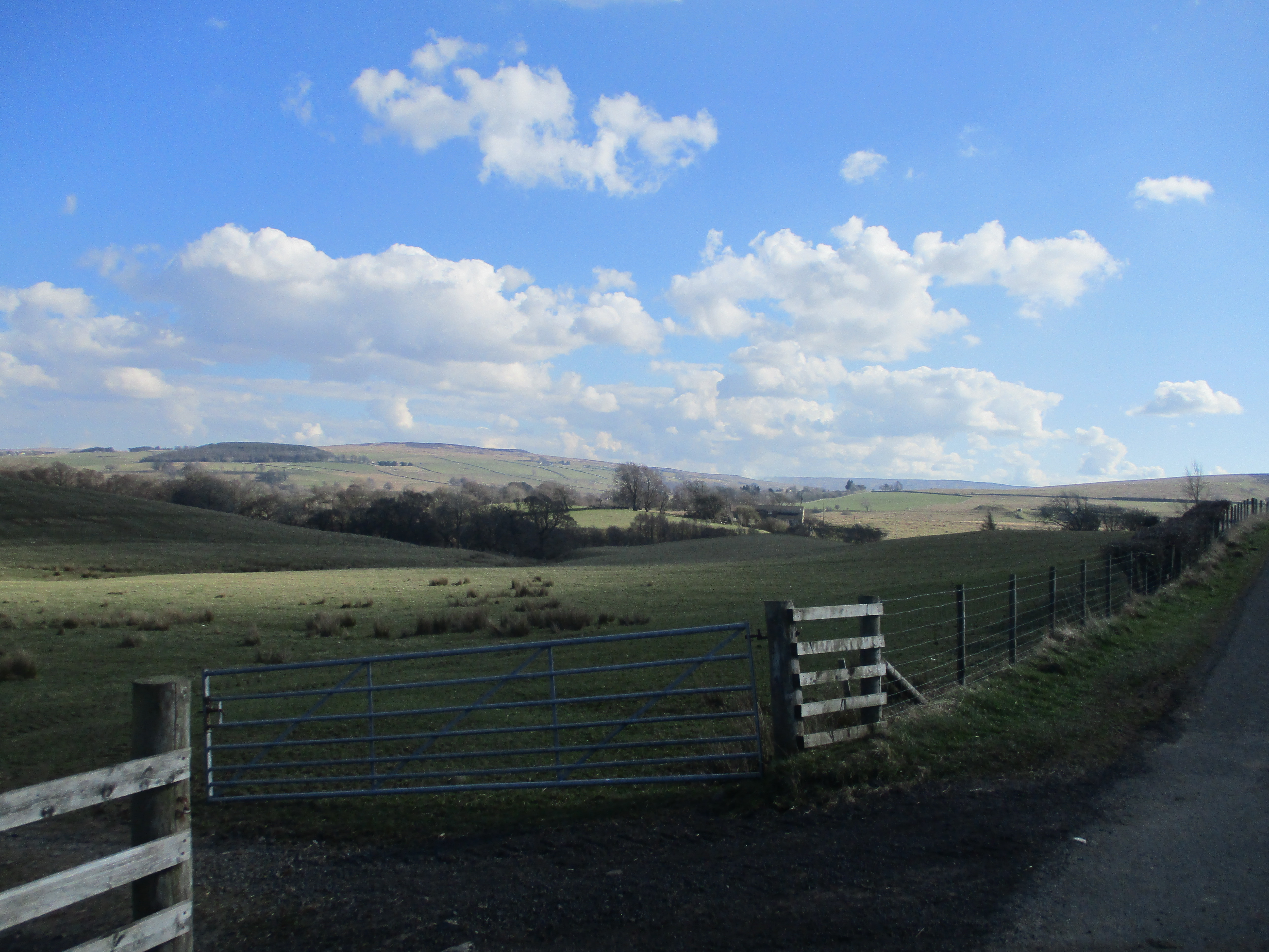
At the east end of the village is a rough lay by big enough for two or three cars:

Today's car park at Halton Lea Dale, once a small mining community, producing coal from drifts.

Once ready for the day we walked back towards the village for a couple of hundred yards before turning right, passing a bungalow, climbing two wobbly stiles and heading uphill towards Clover Hill Farm. Several horses were in the field and recent rains, followed by a dry period made the ground bumpy, ankle turning terrain. At the farm we chatted with a man holding a saw. He pointed the way with it so off we went heading north and going downhill until we hit a road.


Just three of the horses of Clover Hill.

Turning left on the road we walked downhill to a bridge crossing the Hartley Burn.  (mile 1)Before the bridge we turned left into fields, crossing the stream by means of a footbridge and following an almost undefined path which passed an old mine shaft before heading uphill towards the ruined farm at Hill House. (mile 2 almost)

             Rusting horse drawn hay rake at Hill House. My uncle had one of these, many years ago!
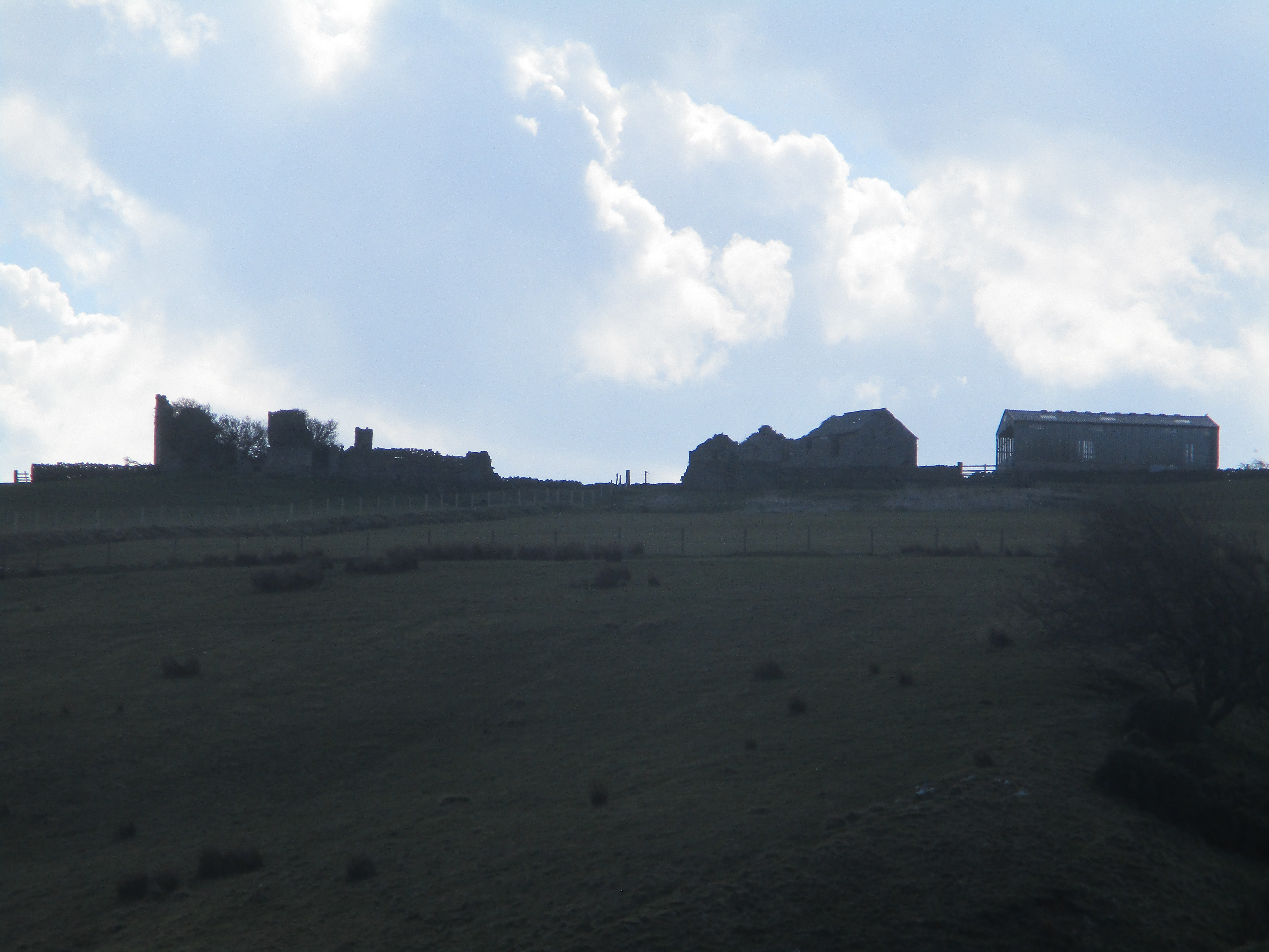

                                 Hill House

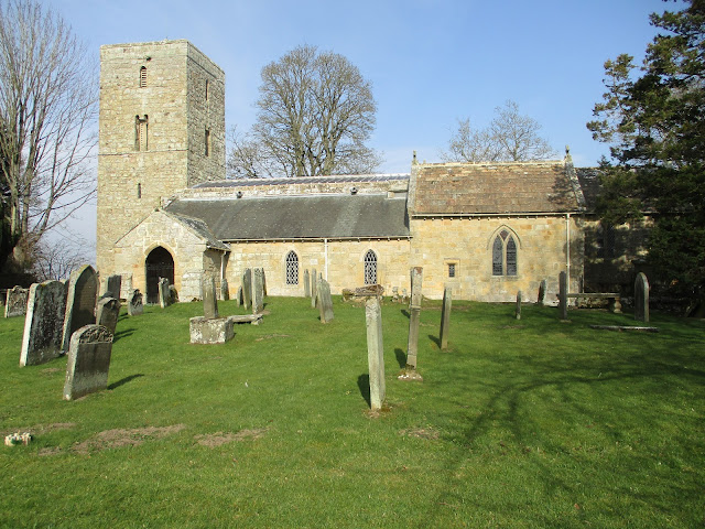
Beyond the tumbledown farm buildings we crossed a couple of fields, walking downhill and slightly off the official path, before crossing a stream and climbing up to Haining House. Through the yard and beyond until we reached  a road at point 217 on the OS map.

Crossing the road we headed east through fields until, close to the Pennine Way (long distance footpath) we chose a sunny bank as a Herbie Spot, sitting facing the sun on a day when the temperature was closer to a summer's day than the end of March.


Herbie time. Not much sharing, apple pies and flapjacks. We passed a pleasant half hour or so discussing ailments: arthritis, eye problems, hernias, back ache. The joys of ageing generally.

Break over, back on our feet, we continued surrounded by beautiful panoramic views of Northumberland, until we reached a road. (Mile 4)

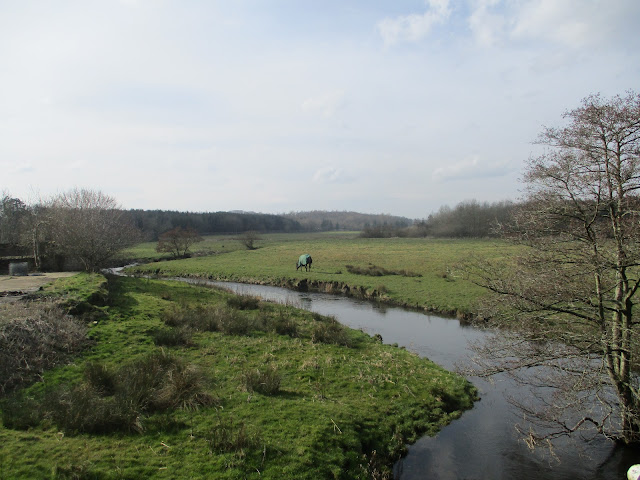
Turning left we followed the road for a while until we reached the confluence of the Hartley Burn and the South Tyne.

                                          South Tyne.

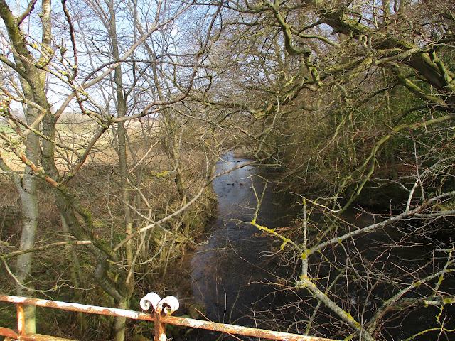
The footpath here followed the river. On the north side of the Tyne we saw the few remains of the old WW2 Prisoner of War Camp.

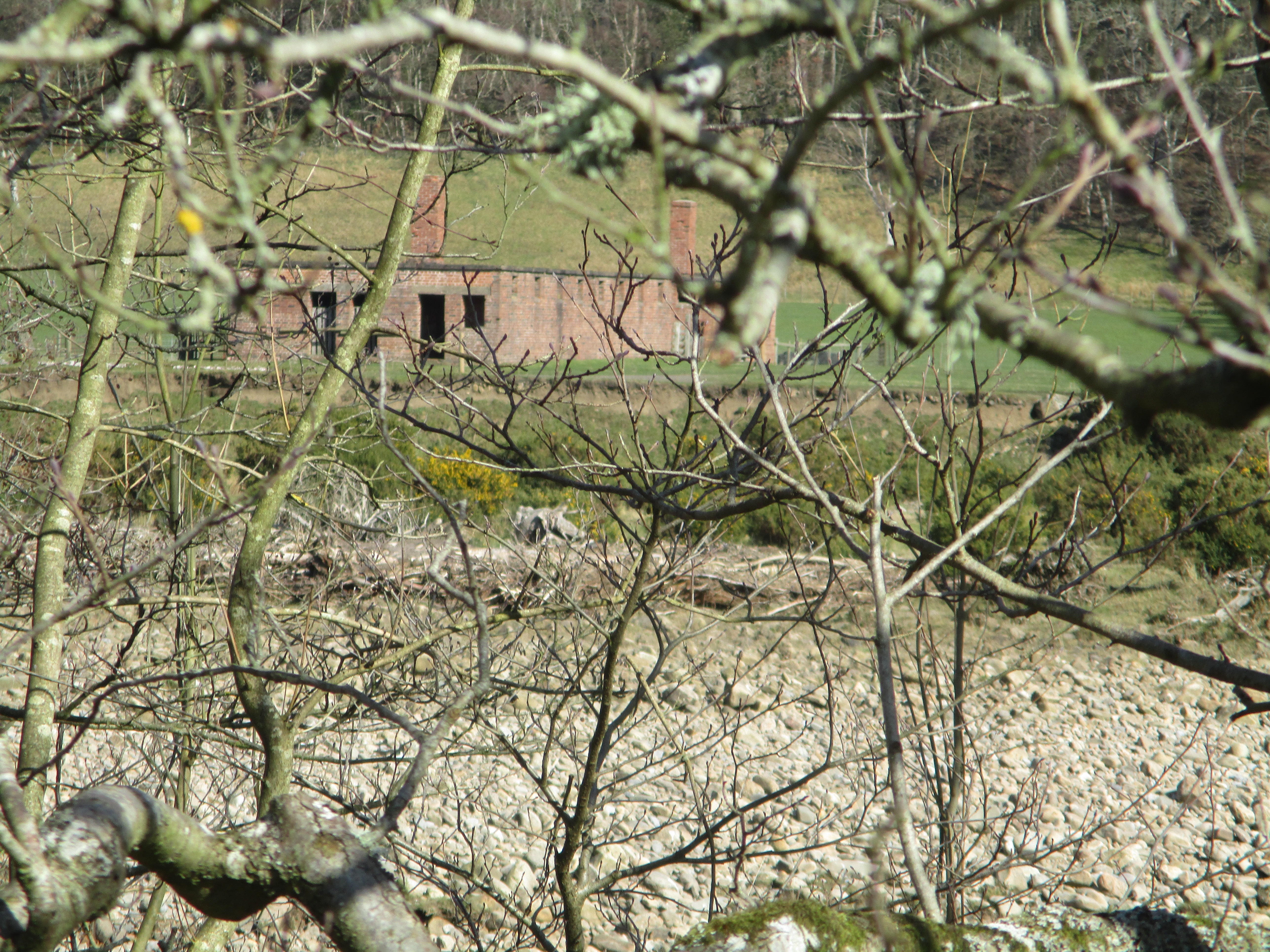
Remains of the POW camp. It held mostly German Officers who apparently crossed the Tyne...........

Leaving the river bank  (beyond mile 5) we climbed through Birch Wood  and crossed Oxen Hill to a road, turned right, crossed the Hartley Burn again and turned left into fields. For a short distance we followed the Pennine Way and leaving it, headed overland to the road (Mile 7). Turning left we walked uphill until we reached the sign post directing us back to Clover Hill and the cars.

Changed we headed for a pub we had visited before, the Wallace Arms at Rowfoot, but it was full of elderly walkers so we moved on to the Wellington at Riding Mill which served a very refreshing soda and lime, or beer for non drivers.

Mile markers are approximate.
Contains OS data, copyright. Crown copyright and data base right 2022.
This very enjoyable walk is 8 miles. Some short steep climbs and spectacular views.


Saturday 12 March 2022

Bolam Angerton Middleton Shaftoe

 Bolam, Angerton, Middleton, Shaftoe (Northumberland) March 11th.

Regular readers will be right in thinking they have followed this walk before but my job is to record gadgie walks, not find new ones although fresh fields are always welcome.

 Today seven of us (John x 4) Brian, Margaret and I are starting and finishing a walk from St. Andrew's Church in Bolam. Several ways to get to the start, we went through Ponteland, turned off right at Belsay for Bolam and just beyond the lake turned right up the hill and then to the church where you can park all day for free. You may use the lake car  parks for a fee.

The weatherman said fair today with rain late afternoon.

The map to use is OS Explorer 325 Morpeth and Blyth. 

                  St Andrew's Church Bolam. Beautiful little church with a Saxon tower and mostly 12 and 13 Century body. The small window is where a WW2 bomb penetrated the wall but fortunately failed to explode.

              Parked outside the church, preparing to walk. The seven of us walked in formation at times.

                                          Margaret                                      John C

                                Brian                          John H                                    John L

                                                    Me                               John Ha

(Slowest at the back! )

We headed off through the church yard, passing the tower and going through a gate into fields.fairly dry after recent rains with one soggy stream to negotiate  before we came to Angerton Steads, farm and bungalow with its own tennis court too. Continuing north and being good boys we walked the edges of fields, crossing a dismantled railway line converted into track for horse training, until we reached the next farm  at Low Angerton.


                      Low Angerton and the River Wansbeck.

Just beyond the farm we crossed the river and a little further on at a finger post turned west to cross a series of fields to Middleton Mill. At times the path is close to the river:


Further on the path crosses a field sprouting this year's crop. Last time we came this way the field had a fine growth of oil seed and although the farmer kindly leaves a path through it, tall plants crossing the way kept tripping us. Not his time though. (mile 3)


                    So different from the last time!

At Middleton Farm (mile 4) we walked the farm road and turned left, crossed the Wansbeck and almost immediately followed the sign post on the right, walked a short way across a field to a shelter wall like a flattened V and decided it would make a good spot to Herb.


Herbie time: Viennese whirls, biscuits, flapjacks, savoury and sweet from Mrs A and a special biscuiut John L said he had stolen from a hotel. It's not really stealing if they are in your romm though is it. Discussion on which book we remembered reading first; Tom Sawyer, Wind in the Willows, Famous Five and so on. 

Lunch over we resumed, walking to the next farm at Middleton South (mile 5) and then across more fields towards Shaftoe Crags, passing a Standing Stone on the way.

                                     Standing stone, standing alone, a sort of singular henge.
Turning south east we followed a track lined with sorry looking trees to a gate where we turned south, passing the entrance to the Salters' Nick (a gap in the crags) and on to Shaftoe Grange. On previous occasions we have walked the few yards up to the rock known as Piper's Chair but today we followed the path below it to East Shaftoe Hall.(mile 7)

East Shaftoe Hall, it doesn't really slope.
The farm road beyond the farm is partly a concrete road and partly laid with old concrete railway sleepers which came all the way from Glasgow! Makes a mud free walk anyway. At the nd of the track, Bolam West Houses we turned right towards Bolam Lake Country Park. The plan to take the footpath on the west side of the lake was scuppered when a couple of men who were tidying up timber from recent storms told us the way was passable but difficult. We took their advice and a little further down the road entered the park and walked the footpath round the east end of the lake, taking time to admire the wooden chairs:


                                   Bolam lake and furniture.
At the visitor centre  (mile 9) we struggled a bit to get past fallen trees but having made it we walked up the road and back to the cars.
On the way home we stopped for rehydration at the Blackbird Inn in Ponteland.

The Blackbird. Approximately fifty five and a half years agoin this pub there was a beginning.............

Contains OS data , copyright. Crown copyright and database right 2022.
Mile markers are only approximate.
The walk is about 10 miles, easy going.


                         Stll wearing his courting clothes

                         Fox hunting at Middleton South

                       First frog spawn seen this year
                                        The Piper's Chair
                                 Ready for the fields


Saturday 5 March 2022

Back to Riding Mill

 It was a muddy day, every cloud was in the sky.

(Northumberland) March 4th

TRIPLE MUD WARNING!

Four of us out today on what we have been told will be wet and cold until late afternoon when it will be only cold. The walk starts from the village of Riding Mill: west on A69, turn off at Corbridge roundabout and follow the signs for about four miles. Call in at Brockbushes Farm shop and cafe on the roundabout though, great place.

Four of us out today, numbers reduced by weather and family commitments. We are: Brian, Margaret, John H and me. 

The walk, though relatively short is on three OS maps:

OS Explorer 316, Newcastle upon Tyne, OS 307 Consett and OL43 Hadrian's Wall.

There is a car park in the old school playground close to St James' church which is an 19th century building.

                   Parking in Riding Mill. Old school in the background.

                               St James' Riding Mill.

The walk is well marked with the usual little yellow arrows. 

Walking past the church we climbed a road lined with detached homes before turning off into a muddy field through which we continued to climb until we reached High Plains. (Mile 1) No sign of Clint Eastwood but a couple of fields were laid out for equestrian events.


Walking in front of the house we soon came to the first wood of the day. A very muddy footpath arced through the wood which also had a few downed trees to negotiate until we came to a road. (Mile 2)

Crossing the road we entered a field (mark 158 0n OS map) before entering the second wood of the day and followed another muddy footpath downhill to March Burn, crossed by a footbridge, and then climbed up the other side of the valley to a road (Point 123).


             There has been a lot of rain recently........................

Going left and heading west we soon came to a sign post on the right (Mile 3 and a little bit) which sent us off to Todburn Steel and the third wood of the day., Dipton Wood.

The track through Dipton Wood  was relatively mud free and a tumble down wall made a satisfactory Herbie Spot. (Just after mile 4) We shared apple pies, flapjacks and Mrs A brought a savoury cake and vegan apple cake.


                     Fairly dry and mud free in Dipton Wood.

Lunch over we continued north to a road, turned left and walked the tarmac to the next junction. (Mile 5)

here we turned right towards West Farm but went through a fine gate on the left hand side, across a field and into another section of Dipton Wood.


A fine gateway, entered from the other side.

The path here was as muddy as any today and to add to the difficulty it went downhill to High Town (just after mile 6). 

Here we entered a field and were met by a very friendly lady walking two Labradors. She cheerfully told us that the end of the field was very muddy and she was right. However, across the field we joined a road lined with a few houses and followed it to the Hexham Corbridge road. (Mile 7)

There was a bus stop! Margaret and I caught a bus to Riding Mill, the journey only took a few minutes, and then drove back to pick up the other two. Why not all catch the bus? Margaret and I were the only sensible ones who had brought our passes!

Changed from muddy boots we called in at the Wellington; Blacksheep and Old Golden Hen.


Contains OS data, copyright. Crown copyright and database right 2022.

The walk is about  7 miles. Lovely in summer when it is dry.

Keep going to the end