Translate

Saturday 26 January 2019

A country stroll from Belsay (Northumberland) 
January 25th

It has been cold this week in the northeast of the UK, not as cold I suspect as Indian Head in Saskatchewan but cold enough for heavy frost. But today the temperature is going to rocket to 11C. With the possibility of rain in the west of the county we have opted for another local walk centred on Belsay, a village some few miles northwest of Newcastle with a hall, a castle and some fine gardens.
It also has a smart coffee shop, the Blacksmiths, where we can breakfast and leave cars.
To get to this delightful spot from Newcastle drive through Ponteland and keep going until you reach Belsay. The café is on the left just as you enter the village.
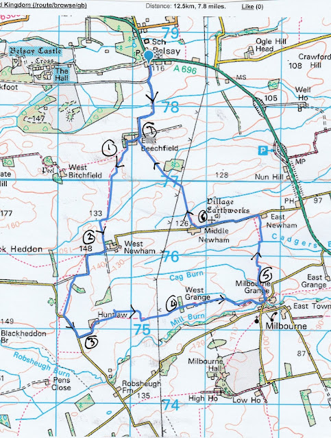
The map for this walk is OS Explorer 316, Newcastle upon Tyne and it would be useful. 
Warning: This walk can be very muddy.
And it was. Not a lot of rain but several heavy frosts which had melted on a much warmer day made the ground in the fields muddy, or claggy as we say in the North East of England.
Eight of us out today, making up what Ben has called an atrophy of gadgies, (or the atrophic eight today) collective noun of the week.
We are John x 3, Ben, Brian, Harry, Dave and me.

There is a small parking area opposite the café, room for several cars.
Today's car park in Belsay, across from.....

the Blacksmiths coffee shop. Busy place, most of the clientele were like us, mature, somewhat sophisticated and probably cultured.


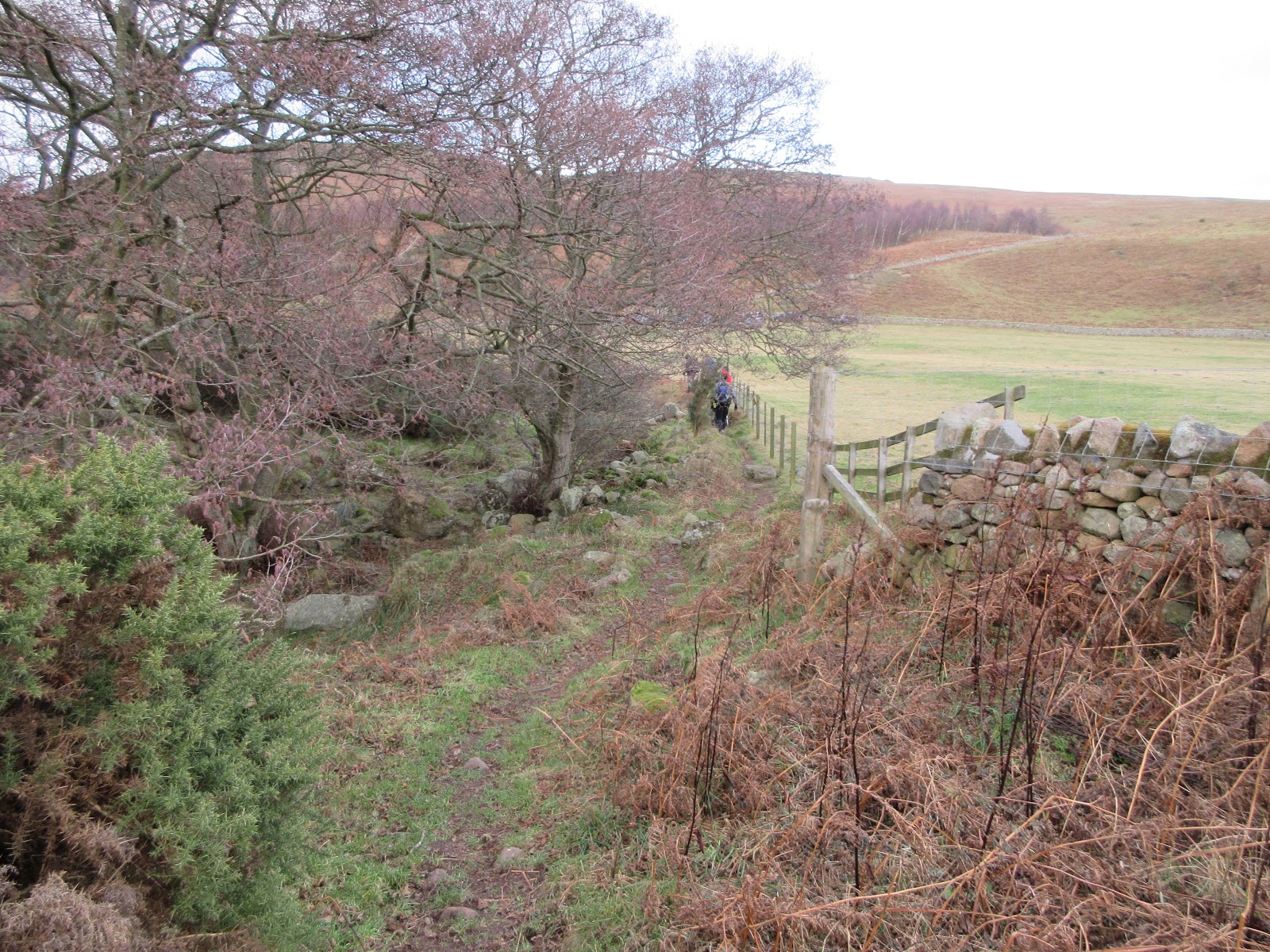
Leaving the café we headed south on a farm track, passing  the Belsay Woodland Burials field,   turning through couple of neat right-angled bends until we reached the first farm on our country walk, East Beechfield. We walked through the large farm yard, turned left and almost immediately took the footpath across the field. No signpost or marker but it is marked on the map. The field has a collection of unusual looking mounds, not marked on the map, but as Dave explained, possibly the remains of a medieval village.
Way to go
East Beechfield

Medieval Remains?


We crossed the fields, climbed over a couple of dodgy stiles, got the first layer of mud on boots, until we reached the farm at West Newham. From here we took the road, turned through two neat right-angles until we spotted a sign post on the left pointing over more muddy fields. We followed it until it joined the road, walked the road for a short distance before turning left to the next farm at Huntlaw, home of three fine looking alpacas, several geese and some sheep.
You can call me Betty, and I can call you Al

The geese that saved Huntlaw


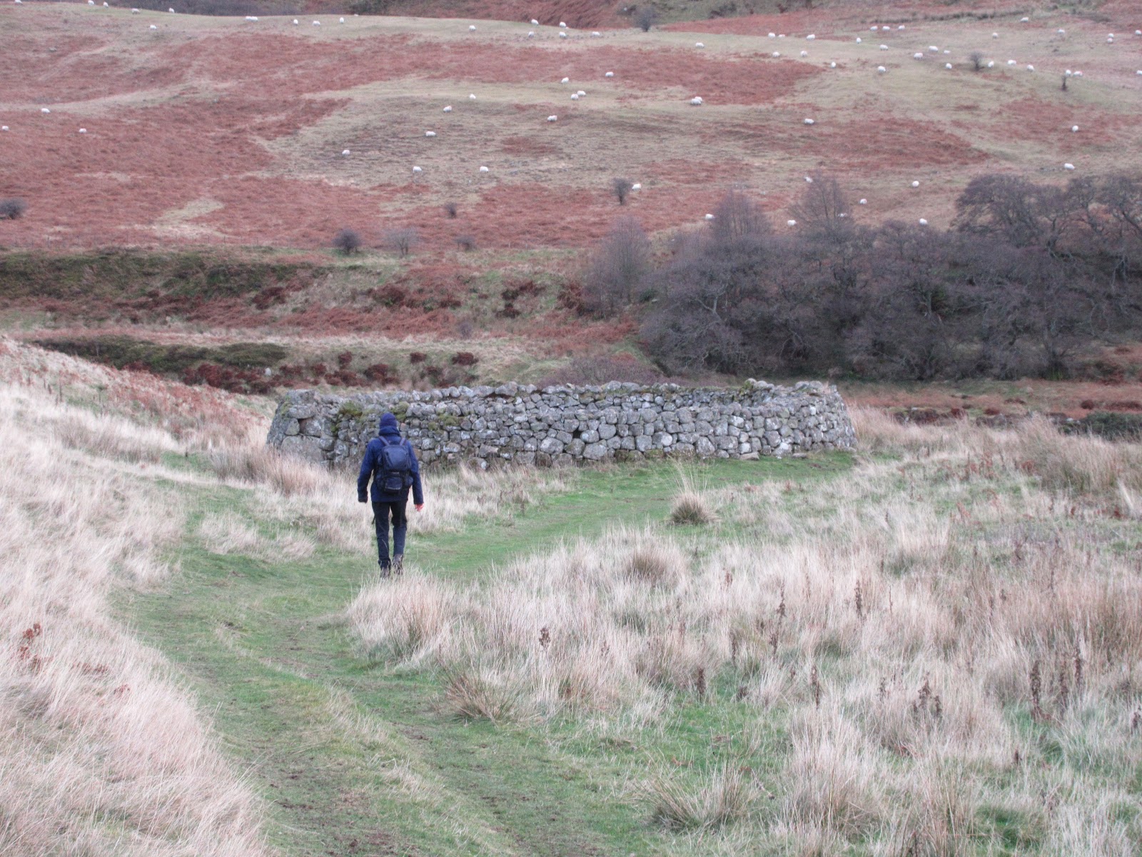
Beyond the farm, some way down the track we took the footpath across more fields to the farm at West Grange. And from there we followed a track to the road at Milbourne Grange.
Milbourne Methodist chapel built 1903


Turning left on the road, just past the brick built Methodist Chapel, we spotted a signpost on the left and entered a wood. As it was out of the breeze we called a Herbie and sat or stood among the trees for lunch.
Merry men of Milbourne. We shared Titans, cookies, flapjacks, Ben's ginger biscuits and scones from Mrs A.


Lunch over we continued north on our muddy way, scrambling round a small pond on the nicely named Cadgers Burn and walking up a slight gradient to East Newham.

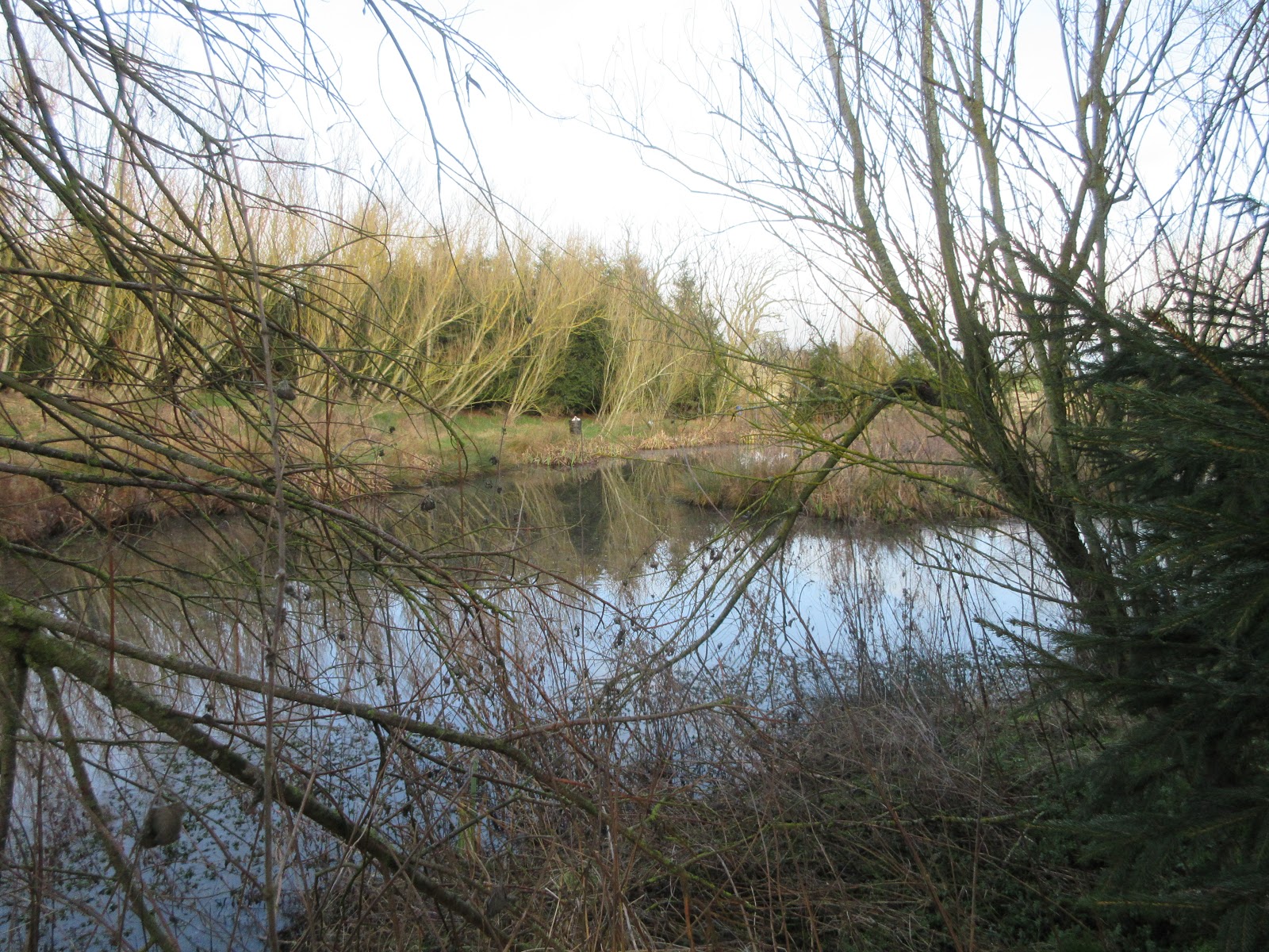
Pond on Cadgers Burn
Remains of an old windmill at East Newham.


Turning left we walked along the road to Middle Newham, spotting on the right a gate with marker. In the field were more unusual mounds, marked on the map as Village Earthworks in Gothic Script so they must be old.
Not much to see but once it was a village


Muddy footpaths across across the fields brought us back to East Beechfield and the track to the car park.

Having scraped some of the Northumberland mud of boots we headed for the Seven Stars pub in Ponteland. Several hand pulled beers on offer, Speckled Hen, Rivet Catcher and the famous Timothy Taylor’s Landlord. The coffee was good too for the driver.
Contains OS data, copyright. Crown copy right and databaseright 2019


MATRIX  MMXIX  1d

                                                             Steps                                miles

NAK                                                   20810                               7.55

Dave’s NAK 1                                    16452                              7.53

“””” NAK 2                                        16446                              7.52

“””””””USB                                        16708                              7.64

“”” SM                                                16169                              7.55

Etre 2hr 46 min walk   54 min talk                                             7.97

Brian                                                                                            7.5

John C                                                                                          7.8
And a gallery


Saturday 19 January 2019

A walk in the woods again (Northumberland) January 18th
Another favourite and fairly local. The forecast is for a bright cold day and shorter daylight hours still suggest we don't travel so far. 
Thrunton woods is another good place to walk but we started in the village of Whittingham which is easily found: North on the A1, turn off onto A697 at Morpeth and turn left at the signpost for Whittingham. We parked on the roadside- free.
On the way we stopped at the Running Fox in Longframlington for breakfast. Very popular and not surprising as it is a branch of the Running Fox at Felton.
Grand turn out today; a gerontology of gadgies or an octet of gadgies or a limp of gadgies were the more polite collective nouns offered.
Eight of us: John H., John Ha., Brian, Harry, Ben, Dave, guest walker John Lockey and me. A map is advisable and the one to use is OS Explorer 332 Alnwick and Amble.
Car parking in Whittingham. I feel disappointed that one of my readers made no comment on last week's super car park shot.

It was suggested three letters were missing from this bin


Having booted up we set off back along the road we had just driven down and continued on the track past Whittingham Lane and on to the road that skirts Thrunton Wood. In one of the fields on the right were two large flightless birds. Not sure whether they were Ostriches, Emus or Rheas we decided on the last. Brian said one of them was Welsh called Dia.
The Welsh Rheas

Is this the way Thrunton crag?

Even looks cold on the track on Thrunton Crag


At the first gate we turned right into the wood and followed the forest road uphill. Several breaks in the trees gave beautiful views of the Cheviots to the north.  Benches provided to allow you to sit and admire.

Looking over the Cheviots


At one point we had a brief look for the famous McCartney’s Cave but it remains as elusive as before. The problem was a rough scramble down, it might be better to search from below.

Out of the wood and onto heathery moorland we arrived at a cairn near Hard Nab. Room inside for the team, we declared a Herbie. The temperature was rarely above freezing all day and although the woodland walk was relatively warm the wind on the tops was cold, the cairn offered shelter for the traditional exchange of goodies.
Hunkered down out of the cold wind.
We shared chocolate cakes, flapjacks, cookies, ginger biscuits from Ben, mini apple pies and cheese scones from Mrs A.


Lunch over we headed down a track just beast of south. We missed the footpath off to the right but followed another one heading generally west across trip you up heathery moorland.

After walking through a sparse wood we followed a farm track down to Lorbottle Hall which had a model railway track and locked gates. Fortunately we were all able to squeeze over the fence and through the gap on the right.
Leaves on the track at Lorbottle prevented services from running

Locked gates but we squeezed through the fence on the right

There were several calls of "You can call me Al"

Turn left here


From Larbottle we followed the road for some distance before turning left at a sign post just before Dancing Hall and taking the farm track over fields to Crosshill.

Back on the road, past the entrance to Callaly castle and then on the track to Callaly Mill. From here we followed a footpath across the fields to the road back into Whittingham passing St. Bartholemew's Church.
Aren't they always slow?

St Bartholemew's. Nellie Heron is buried here. In the 19th century she died on the moors having been caught out on a bitterly cold night. "The hunt for Nellie Heron " has had more hits on this blog than any other walk.

Contains OS data, copyright. Crown copyright and database right 2019


Changed we headed home, stopping at the Shoulder of Mutton in Longhorsley to check on their hand pulled offerings. Two  this week; Directors and Ossett Blonde. Being a Yorkshire Ale the Blonde was in fine condition, well worth sampling at least twice.

SUPER MATRIX MMXIX 1c

                                                                          Steps                          miles

NAK                                                               29625                              10.75

Dave’s NAK 1                                               23648                              10.82

“”” NAK 2                                                     23580                               10.79

“””” USB                                                       23943                               10.95

“””” SM                                                         24460                               10.81

Etrex 3h 43m walk 1h 22m talk                                                           11.2
A mini Gallery


Saturday 12 January 2019

Once more into the burn dear friends, once more.
(Northumberland) January 11th.
 Daylight hours are still short so we have opted for an old favourite; Carey Burn and Cold Lawvia Broadstruther. It's one of my favourite walks, not too long, not too high, just right for a winter's day
There are seven of us venturing out on what promises to be cold, dry day;John H., John C., Brian, Ben, Harry, Dave and me.
We start at Carey Bridge in the Harthope Valley which is found by heading north on the A1, taking the A687 at Morpeth, turning into Wooler, taking the first left up Cheviot Street, take the right fork and turn right at the signpost for Langleeford. At the bottom of the hill past Skirl Naked there is parking space on the right. Warning; passing cattle once decorated one of our cars with muck so park at right angles, at least only the back end gets covered.
The map for this walk is OS Explorer 16 The Cheviot Hills. The parking area is at NT976249 approx
Breakfast at the Terrace café in Wooler, bacon sandwiches and tea to start the day before we started of course.
The Terrace café, Wooler
This has to be the best car park photo ever.


The walk starts at the signpost just before Carey Burn Bridge and on the same side of the water as the car park.
The start, looking back


If you have an old OS map like mine the footpath is not marked but it exists, is quite well worn and has marker posts along the way. On the right of the path in a field was an array of motor vehicles, the occupants having  come out to shoot. They were probably after pheasant as grouse shooting lasts from August 12th to Dec 10th.
Shooters army. Most of them dressed uniformly in waxed jackets, wellies and flat caps.
You are allowed to shoot pheasants in Great Britain between October 1st and February 1st. Partridges from Sept 1st to February first


The footpath mostly clings close to the burn, is a little rocky in places, passes a waterfall and enters an area of woodland before crossing the Carey by a footbridge.
Carey Burn waterfall

Shooters shelter. Empty today

It must embarrass somebody. We didn't spot the higlanders

Footbridge over Carey Burn. With a gadgie in the distance.


Once over the stream the path crosses open moorland, goes through a gate and continues to a footbridge over the Broadstruther Burn. Ahead of us at the gate was another party of walkers, two couples and a dog. Although I was only a few yards behind her one lady called back to say she was closing the gate as it had a notice to do so and she always obeyed orders. I asked if she was German, fortunately she had a sense of humour. Brian wondered if she would like to make use of the glue he had in his rucksack as the sign also told walkers to stick to the path.
Broadstruther

Heading for the dining room. We shared Titans, Ben's ginger biscuits, flapjacks, chocolates and vegan carrot cake from Mrs A. 


Once over Broadstruther Burn we joined the farm track that leads to the old farmhouse converted to a shooting lodge. It was locked up, presumably it’s for grouse shooters, but we sat in the remains of an outhouse to have a Herbie.

Early lunch over we continued on the track for a short distance before taking the footpath on the left. This path crosses moorland in a southerly direction before joining a farm track.

Eventually reaching a gate (boundary stone on the right) we turned left and walked in a very straight line alongside the fence that took us to the trig point on top of Cold Law.(452 metres, 1482 feet in real terms)

From this point there are great views of the Cheviot Hills to the south and west and the plain to the sea in the east. Not the brightest of day and a bit smokey too from the heather burning.
The straight path up Cold Law

There are few things that excite a gadgie more than a trig point. (Beer is one of the few of course)

The heather is burnt off to encourage new shoots which will be food for the grouse which will then be shot. (Actually I'm trying to send a message to my friend Eileen Pete in Saskatchewan. Hi Eileen, hope you are well, from me and the lovely one.


From Cold Law there are three routes, we took the footpath south(also not on some OS maps) which wandered downhill to Cockshaw Syke and the road in the Harthope Vallley.

Turning left along the road we walked to the bridge across the Harthope Burn to Langlee Farm. It’s a private bridge but is also a genuine footpath. We went round the farm and walked up the steep path to Brands Hill. We stayed on the farm track to a junction going left and from there the route is downhill to woodland above the Carey Burn, now named Coldgate Water. 
Langlee farm

Harthope Burn from Langlee


From here we walked the footpath through the woods to a footbridge,  crossed it and turned back over the Carey Burn road bridge to the cars.

On the way home we stopped to rehydrate at the Shoulder of Mutton in Longhorsely. Four hand pumps but only one ale, Directors so we had to settle for that.  The lady behind the bar complained it was Friday night and only one real ale. Perhaps by evening the others would be on.
Contains OS data, copyright. Crown copyright  and database right 2019 
Matrix MMXIX 1a
                                                                                     steps                                   miles
NAK                                                                         20579                                    8.92
Dave's NAK 1                                                           17967                                   8.22
"""""NAK 2                                                               18406                                   8.25
"""" USB                                                                    18166                                   8.31
SM                                                                              18822                                    8.32
OUTDOOR GPS                                                                                                     7.95
Etrex   2h 36 min walking 1h 24 min talking                                                          8.25
Brian                                                                                                                         8.3
John C.                                                                                                                      8.5


Gallery