Viva les Vegans... (Lake district) May 29*
Friday May 26th was a hot day in the Lake District as you will know if you looked at "The Lake Country is a glorious region". Monday, May 29th, being a bank holiday in the UK was cold and wet, with a strong wind on the hill tops.
Today Dave and I have been invited to join my daughter Kate's small group of friends for a walk up Great End from Seathwaite (Field of rushes) at the bottom end of Borrowdale in Cumbria which legend says is the wettest place in England if not the UK.
To get to Seathwaite take A69 west to Carlisle, M6 south to Penrith, A66 west to just past Keswick and follow the road signs for Borrowdale. Just before Seatoller turn left by the yurts and drive as far as you can to the farm at Seathwaite. For years walkers have parked here on the side of the road but the farmer has put boulders on the edges of the road near his farm. There is a car park for £3 a day or the side of the road some way back from the farm. It is a popular starting place, get there early.
The walk is designed to cross over two OS maps and they are OS 4 English Lakes North West section and OL 6 English Lakes South West section. Photocopy and laminate, it keeps it dry.
The farm is at NY 236124, approximately.
Kate Dave and I met the other walkers at the farm and made introductions; her friends were another Kate (qualifies as a gadgette), Marcia and her husband to be Ian and Michael from the Republic of Ireland.
 This week's fuzzy car park. Camera accidently in macro mode.
 Off we go through the farmyard.
The good thing about this walk is that you get a good flattish walk in before you start climbing. It was raining as we set off but full of enthusiasm we walked the path to Stockley Bridge, crossed the stream, went through the gate and turned left for Grains Gill.
 Stockley Bridge, still in macro mode.
Grains Gill is a long but steady pull uphill alongside the stream. It crosses a neat footbridge and then climbs steeply before morphing into Ruddy Gill, dipping down to a ford and continuing uphill on more open ground to a cairn.

 It was a cloudy day, not a sun was in the sky
At Esk Hause we turned west, following one of the popular routes to Scafell Pike, several other groups were also on the path, including families with young children. Nice to see them out.
Close to Calf Cove (hard to say how close, the cloud was so low) We called a Herbie Spot and huddled down behind the walls of a cross shaped shelter.

 The weather did not dampen appetites
Not being a gadgie walk there was no exchange of goodies, perhaps these people need teaching.....
It was getting cold and, being higher up the wind was cold so after eating we continued our trek to the top of Great End. On a normal day the views from the top are well worth the effort made climbing there but visibility was limited. I felt some concern for the family heading for the face of Great End which is very steep, but they must have survived. Not having a panorama to admire we turned back, following the cairned route to our dining room and headed back to Esk Hause. Here we turned north west and headed down the valley to Sty Head, passing Sprinkling Tarn on the way.
 Misty Sprinkling Tarn, wettest place in England.
Approaching Sty Head Tarn the cloud began to lift, slowly, as it always does towards the end of a wet walk, and the surrounding mountains gradually came into view.
 Sty Head Tarn, the path down is visible on the far side.
Rounding the end of the tarn we followed the footpath, crossing a footbridge and walking down Sty Head Gill back to Stockley Bridge and then back to the cars.
Before going our separate ways we enjoyed some chocolate brownies from.www.jesmondcakecompany.com. Rich cake and richly deserved. A good walk in spite of the weather.
The Matrix MMXVII RRRRRRRR
steps miles
NAK 26140 10.1
iPhone 26875 9.4
Dave's 3D 29851 12.24 (?????????)
"" USB 24211 10.69
"" NAK 23431 10.35
Kate's iPhone 26394 10.6
OUTDOOR GPS 9.8
 * The group we joined were all members of the North East Vegan and Vegetarian Society. I enjoyed their company very much and may go along with them again.
My wife is a third generation vegetarian and our daughters became vegetarians, having been brought up as normal fish finger eating seventies kids. Occasionally journalists have a pop at vegetarians and vegans, they should meet this charming group.
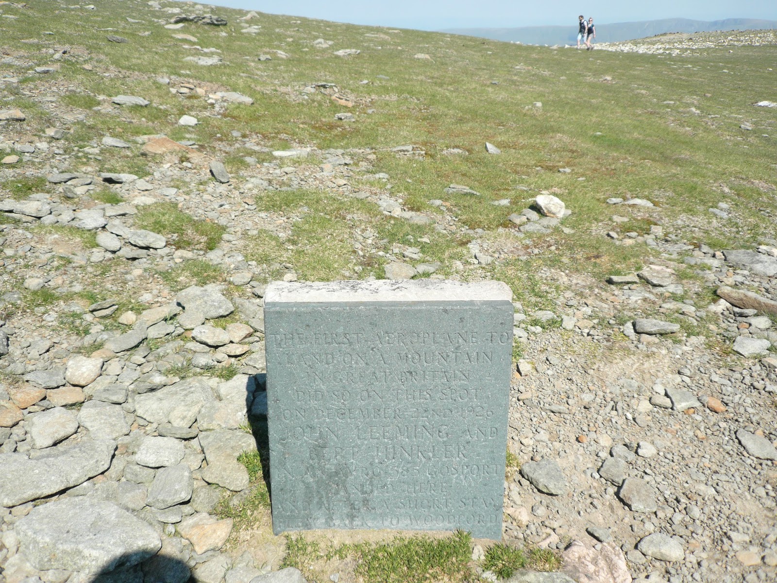
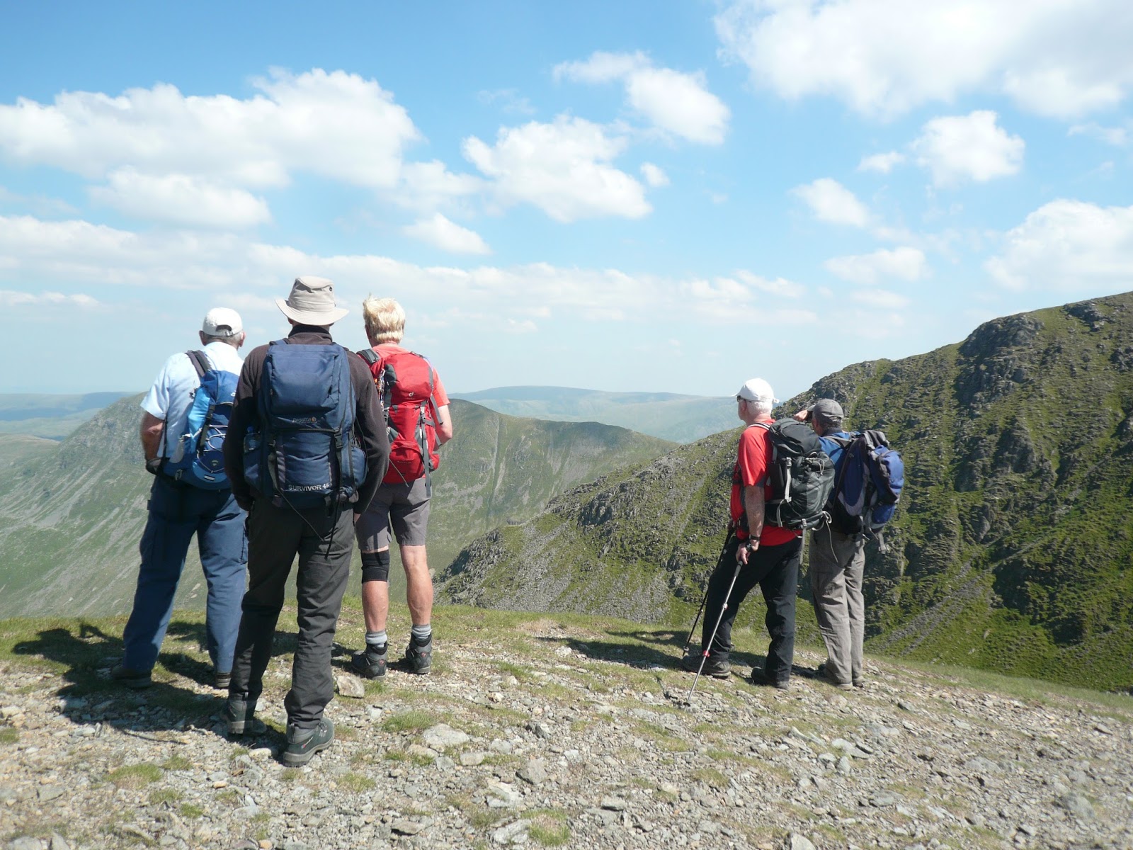
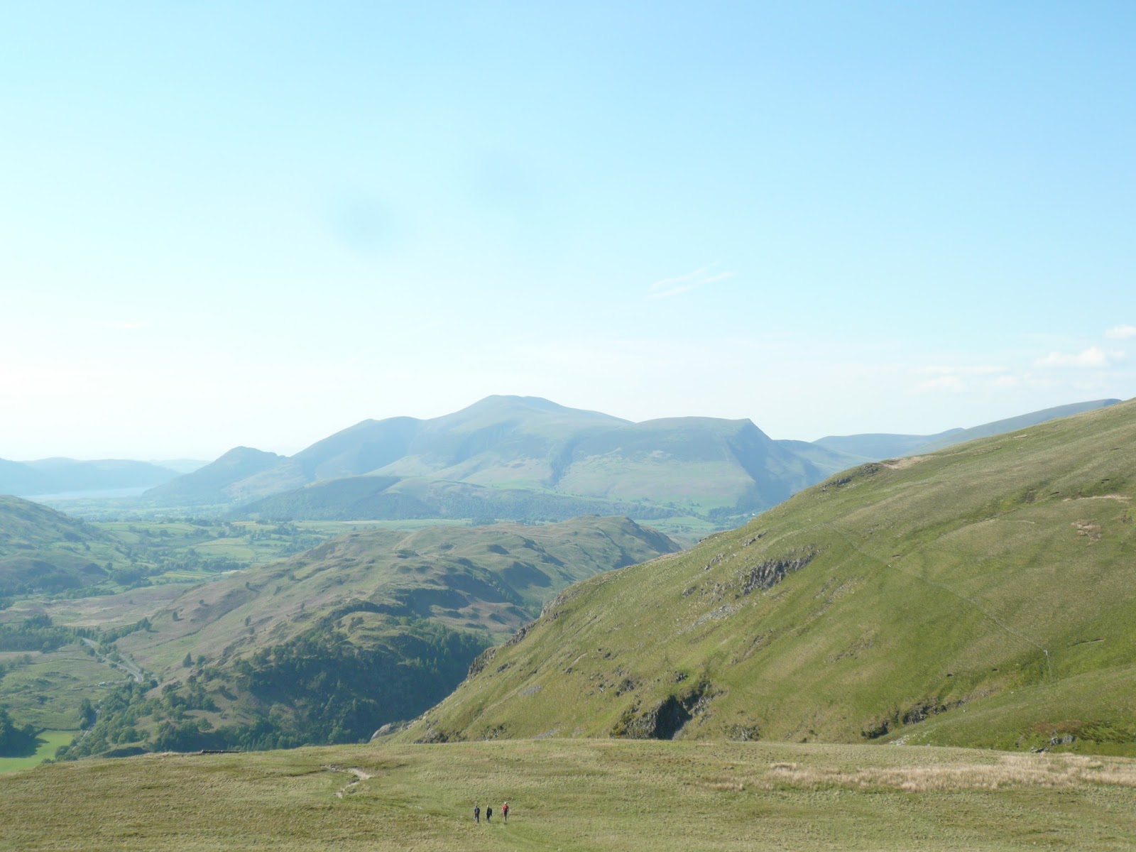
The Gallery. The first ones courtesy of jesmondcakecompany.com


Friday May 26th was a hot day in the Lake District as you will know if you looked at "The Lake Country is a glorious region". Monday, May 29th, being a bank holiday in the UK was cold and wet, with a strong wind on the hill tops.
Today Dave and I have been invited to join my daughter Kate's small group of friends for a walk up Great End from Seathwaite (Field of rushes) at the bottom end of Borrowdale in Cumbria which legend says is the wettest place in England if not the UK.
To get to Seathwaite take A69 west to Carlisle, M6 south to Penrith, A66 west to just past Keswick and follow the road signs for Borrowdale. Just before Seatoller turn left by the yurts and drive as far as you can to the farm at Seathwaite. For years walkers have parked here on the side of the road but the farmer has put boulders on the edges of the road near his farm. There is a car park for £3 a day or the side of the road some way back from the farm. It is a popular starting place, get there early.
The walk is designed to cross over two OS maps and they are OS 4 English Lakes North West section and OL 6 English Lakes South West section. Photocopy and laminate, it keeps it dry.
The farm is at NY 236124, approximately.
Kate Dave and I met the other walkers at the farm and made introductions; her friends were another Kate (qualifies as a gadgette), Marcia and her husband to be Ian and Michael from the Republic of Ireland.


The good thing about this walk is that you get a good flattish walk in before you start climbing. It was raining as we set off but full of enthusiasm we walked the path to Stockley Bridge, crossed the stream, went through the gate and turned left for Grains Gill.

Grains Gill is a long but steady pull uphill alongside the stream. It crosses a neat footbridge and then climbs steeply before morphing into Ruddy Gill, dipping down to a ford and continuing uphill on more open ground to a cairn.


At Esk Hause we turned west, following one of the popular routes to Scafell Pike, several other groups were also on the path, including families with young children. Nice to see them out.
Close to Calf Cove (hard to say how close, the cloud was so low) We called a Herbie Spot and huddled down behind the walls of a cross shaped shelter.


Not being a gadgie walk there was no exchange of goodies, perhaps these people need teaching.....
It was getting cold and, being higher up the wind was cold so after eating we continued our trek to the top of Great End. On a normal day the views from the top are well worth the effort made climbing there but visibility was limited. I felt some concern for the family heading for the face of Great End which is very steep, but they must have survived. Not having a panorama to admire we turned back, following the cairned route to our dining room and headed back to Esk Hause. Here we turned north west and headed down the valley to Sty Head, passing Sprinkling Tarn on the way.

Approaching Sty Head Tarn the cloud began to lift, slowly, as it always does towards the end of a wet walk, and the surrounding mountains gradually came into view.

Rounding the end of the tarn we followed the footpath, crossing a footbridge and walking down Sty Head Gill back to Stockley Bridge and then back to the cars.
Before going our separate ways we enjoyed some chocolate brownies from.www.jesmondcakecompany.com. Rich cake and richly deserved. A good walk in spite of the weather.
The Matrix MMXVII RRRRRRRR
steps miles
NAK 26140 10.1
iPhone 26875 9.4
Dave's 3D 29851 12.24 (?????????)
"" USB 24211 10.69
"" NAK 23431 10.35
Kate's iPhone 26394 10.6
OUTDOOR GPS 9.8

My wife is a third generation vegetarian and our daughters became vegetarians, having been brought up as normal fish finger eating seventies kids. Occasionally journalists have a pop at vegetarians and vegans, they should meet this charming group.
The Gallery. The first ones courtesy of jesmondcakecompany.com