The Belford Four (Northumberland) August 30th
A new season of walks for gadgies, although numbers are still down because of holidays, family commitments and bowling competitions. (Green not ten pin)
Four of us, Brian, Dave, John H. and I are off for a walk from Belford in Northumberland. We have started walks here several times but today's wander is, apart from the first mile, a new adventure.
Belford is easy to find, head north up the A1 past Alnwick and turn left at the Belford sign, opposite the grain silos.
As you approach the village turn left into the Sunny Hills farm shop and café. Very busy this morning and service was a bit slow but worth the wait.
 Free plug for Sunny Hills, it doesn't really lean.
Drive up the main street and turn left on the Wooler road. After a few hundred yards there is some parking outside the Village Community Centre, which looks a little dilapidated.
 This week's free parking in Belford, outside the Community Centre
On the left of the car park is a lane, the start of the walk.
 Way to go. (It's the strap on my walking pole)
We followed the lane, passing through the farmyard at Westhall (Not on the St Oswald's Way/Northumberland Coast Path) until we reached Swinhoe Farm.
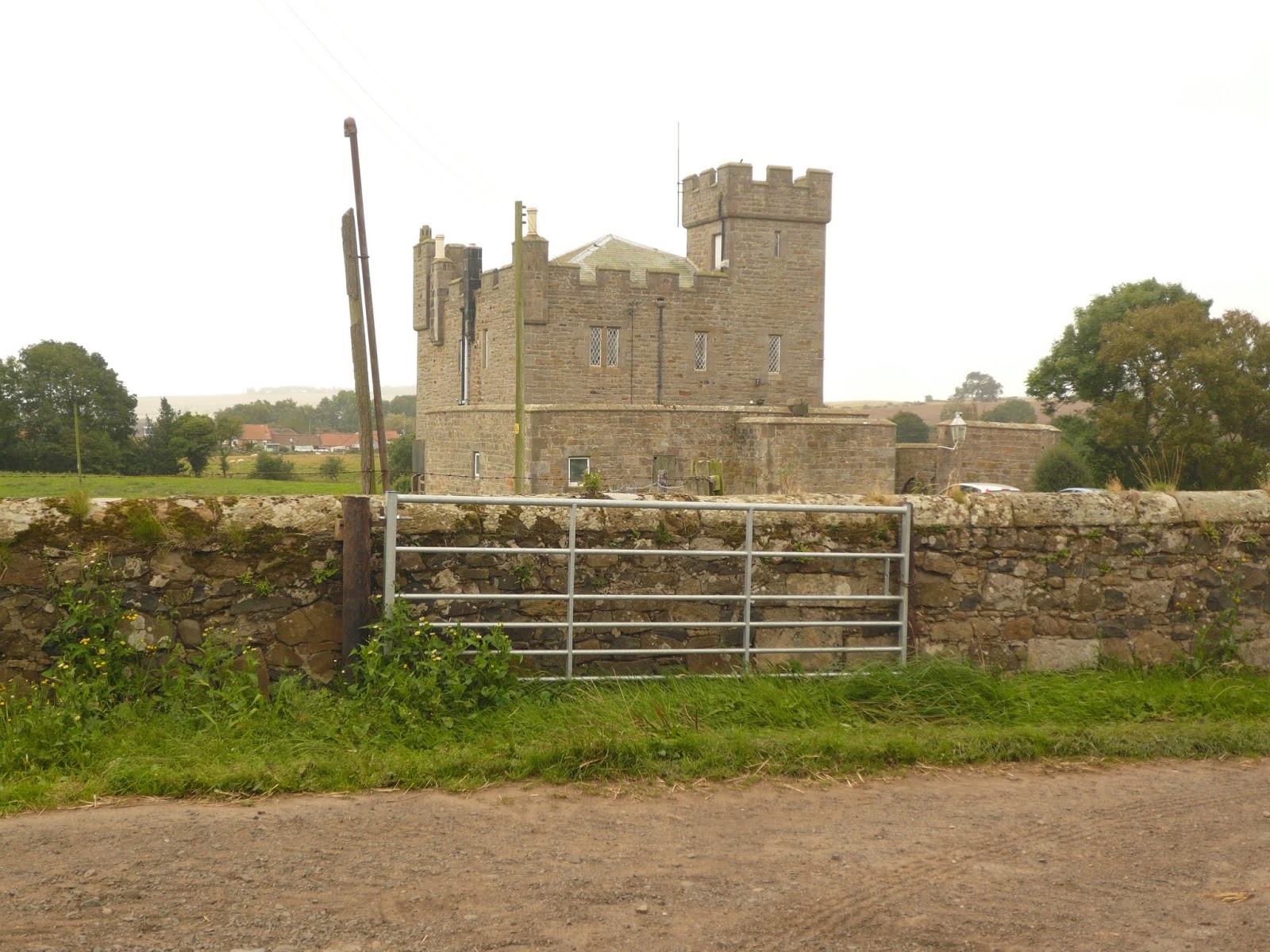
 Old farmhouse at West Hall 19th Century castellated
 Lime kiln near the farm at Westhall
 Swinhoe Farm
At Swinhoe there are two tracks which both lead to St. Cuthbert's Cave. For this walk we took the left fork and walked in a south west direction across fields, through a wood, across another field to a second wood. On the left, hidden by a large pile of stones (not archaeological in this case) is a sign post. Following its suggested direction we followed a grassy trail through the trees until we reached the crags of Colour Heugh where we had to battle with bracken, barbed wire and a stone wall to get into a field.
 Colour Heugh, look carefully, there are two climbers just right of centre.
Once across the field we turned south east and walked on a minor road above Bowden Doors, another popular climbing spot, until we reached a slightly less minor road, turned right and almost immediately turned left at the sign post for Newton Moor.
It was a windy day but the hedge in the field offered shelter so we sat on the ground, telling sad stories and eating lunch; frangipanes, savoury slices, flap jacks and Mr. Kipling's chocolate slices - and a sandwich.
The path at this point is almost free of markers but we navigated successfully past a number of long disused coal workings to a road which we crossed and then across more fields to another road.
 A new style of stile, sheep proof and almost human proof
 Two members of the world famous "Where the hell are we tribe."
At the road we turned left and walked to Warenton, small settlement that appeared to be a collection of holiday lets.
Beyond this hamlet, at a point where the road turns right we spotted a sign post saying "Belford 2 miles" Initially a narrow path between nettles, bracken and a wall it was transformed as it crossed a narrow but steep sided stream into a battle ground against more bracken and piles of stones.
Having beaten all we emerged onto a good track that ran alongside fields. On one side were thousands of hens, on the other a combine was safely gathering in, ere the winter storms.
 Hens to the right of them
 combine to the left.
The track took us back to Belford. Changed we went to the Cook and Barker at Newton on the Moor which had three beers on offer, Red Rowan, Running Fox (?) and another one. Friendly pub, popular restaurant and Dawn from our days in the Anglers Arms was most welcoming.
 Newton on the Moor hostelry
 Contain OS data, copyright. Crown copyright and database right 2019
The walk came in at about 10.5 miles on an assortment of pedometers and GPS systems.


A new season of walks for gadgies, although numbers are still down because of holidays, family commitments and bowling competitions. (Green not ten pin)
Four of us, Brian, Dave, John H. and I are off for a walk from Belford in Northumberland. We have started walks here several times but today's wander is, apart from the first mile, a new adventure.
Belford is easy to find, head north up the A1 past Alnwick and turn left at the Belford sign, opposite the grain silos.
As you approach the village turn left into the Sunny Hills farm shop and café. Very busy this morning and service was a bit slow but worth the wait.

Drive up the main street and turn left on the Wooler road. After a few hundred yards there is some parking outside the Village Community Centre, which looks a little dilapidated.

On the left of the car park is a lane, the start of the walk.

We followed the lane, passing through the farmyard at Westhall (Not on the St Oswald's Way/Northumberland Coast Path) until we reached Swinhoe Farm.


At Swinhoe there are two tracks which both lead to St. Cuthbert's Cave. For this walk we took the left fork and walked in a south west direction across fields, through a wood, across another field to a second wood. On the left, hidden by a large pile of stones (not archaeological in this case) is a sign post. Following its suggested direction we followed a grassy trail through the trees until we reached the crags of Colour Heugh where we had to battle with bracken, barbed wire and a stone wall to get into a field.

Once across the field we turned south east and walked on a minor road above Bowden Doors, another popular climbing spot, until we reached a slightly less minor road, turned right and almost immediately turned left at the sign post for Newton Moor.
It was a windy day but the hedge in the field offered shelter so we sat on the ground, telling sad stories and eating lunch; frangipanes, savoury slices, flap jacks and Mr. Kipling's chocolate slices - and a sandwich.
The path at this point is almost free of markers but we navigated successfully past a number of long disused coal workings to a road which we crossed and then across more fields to another road.


At the road we turned left and walked to Warenton, small settlement that appeared to be a collection of holiday lets.
Beyond this hamlet, at a point where the road turns right we spotted a sign post saying "Belford 2 miles" Initially a narrow path between nettles, bracken and a wall it was transformed as it crossed a narrow but steep sided stream into a battle ground against more bracken and piles of stones.
Having beaten all we emerged onto a good track that ran alongside fields. On one side were thousands of hens, on the other a combine was safely gathering in, ere the winter storms.


The track took us back to Belford. Changed we went to the Cook and Barker at Newton on the Moor which had three beers on offer, Red Rowan, Running Fox (?) and another one. Friendly pub, popular restaurant and Dawn from our days in the Anglers Arms was most welcoming.


The walk came in at about 10.5 miles on an assortment of pedometers and GPS systems.


