Oh Canada. (Northumberland) February 22nd.
Most sources state that Canada gets its name from the Huron-Iroquois word "Kanata", meaning village or settlement. Apparently this word was used to Jacques Cartier in 1535, actually referring to the village of Stadacona, the site of present day Quebec City.
This is nonsense. The word comes from a tiny place in Northumberland near Edlingham which is called Canada. In 1529 a group of Northumbrians, tired of being robbed and ruined by the marauding Scots, took themselves off to Newcastle, hired a boat, sailed round Scotland and off into the west. Up the river they named the St. Cuthbert and off to a new life. To feel at home they called their settlement Canada. And it grew, in spite of the French.
Today there are five of us out on a warm February day, temperatures a possible and unseasonable 18C, according to the young lady from BBC Look North. We are John C., John H., Dave, Brian and me.
The walk starts in the village of Edlingham (Eadwulf's people's settlement).
Head north up the A1, A697 at Morpeth and turn right at the signpost for Edlingham. There is limited parking by the church. (St John the Baptist, 11th century onwards) and nearby is a ruined castle (late 13th century) and a railway viaduct, (19th century) not in use.
The map to use is OS Explorer 332 Alnwick and Amble.
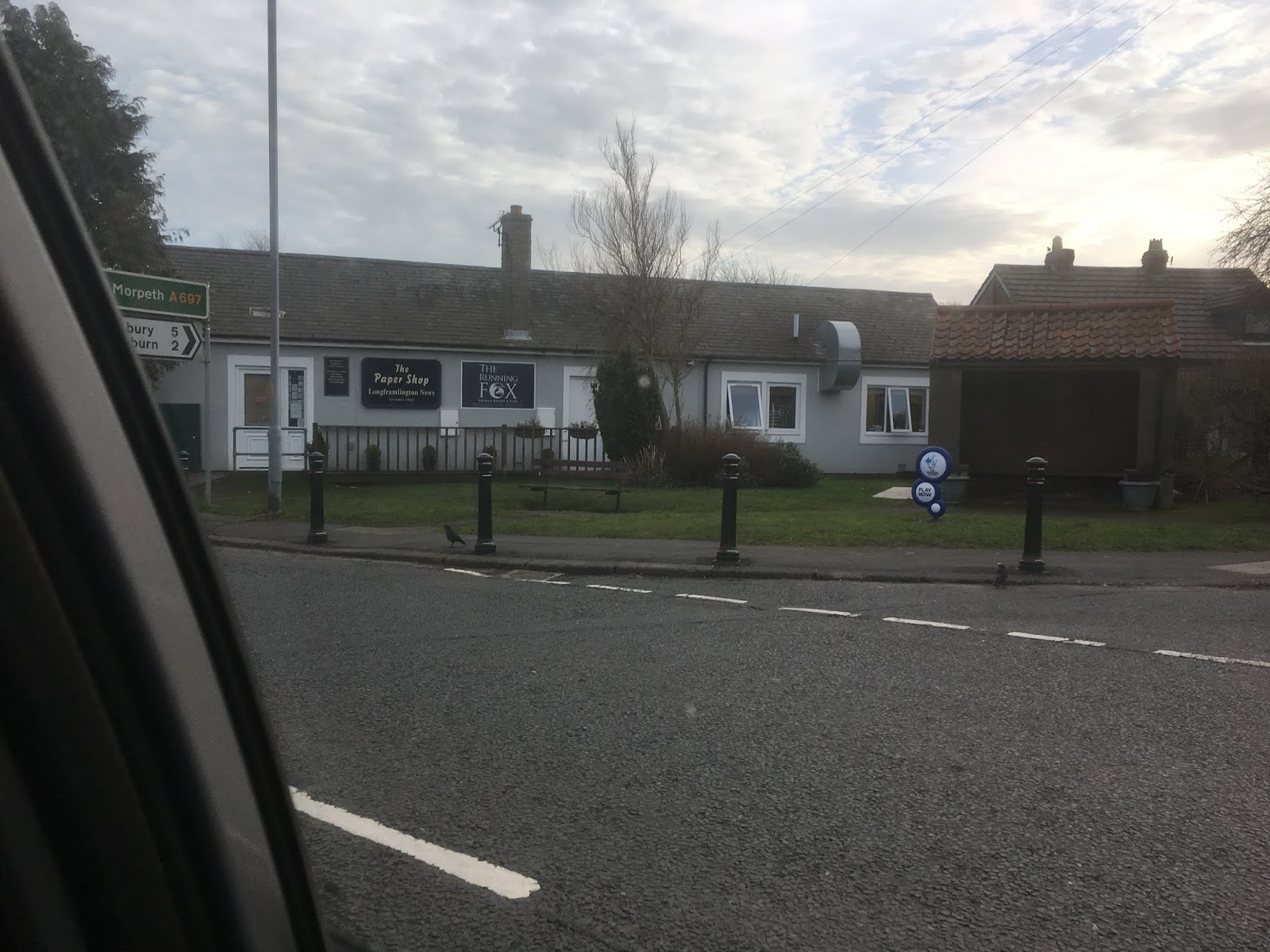
The place for breakfast is the Running Fox in Longframlington. Great place and always busy, Brian's bacon sandwich looked like a whole meal.


Most sources state that Canada gets its name from the Huron-Iroquois word "Kanata", meaning village or settlement. Apparently this word was used to Jacques Cartier in 1535, actually referring to the village of Stadacona, the site of present day Quebec City.
This is nonsense. The word comes from a tiny place in Northumberland near Edlingham which is called Canada. In 1529 a group of Northumbrians, tired of being robbed and ruined by the marauding Scots, took themselves off to Newcastle, hired a boat, sailed round Scotland and off into the west. Up the river they named the St. Cuthbert and off to a new life. To feel at home they called their settlement Canada. And it grew, in spite of the French.
Today there are five of us out on a warm February day, temperatures a possible and unseasonable 18C, according to the young lady from BBC Look North. We are John C., John H., Dave, Brian and me.
The walk starts in the village of Edlingham (Eadwulf's people's settlement).
Head north up the A1, A697 at Morpeth and turn right at the signpost for Edlingham. There is limited parking by the church. (St John the Baptist, 11th century onwards) and nearby is a ruined castle (late 13th century) and a railway viaduct, (19th century) not in use.
The map to use is OS Explorer 332 Alnwick and Amble.
The place for breakfast is the Running Fox in Longframlington. Great place and always busy, Brian's bacon sandwich looked like a whole meal.

St John's, castle an viaduct

Free country parking
Booted up
but without the winter clothing worn for the last few walks we set off up the
only street in the tiny village. A steep road, lined with cottages, most of
which seemed empty of people, possibly they are holiday rentals. At the Demesne
(Land attached to the manor house, property of the local lord) we joined “ The
Devils Causeway”, the line of a Roman road, and it is still obvious it was once
a metalled highway.

Once tramped by Romans, now muddied by tractors
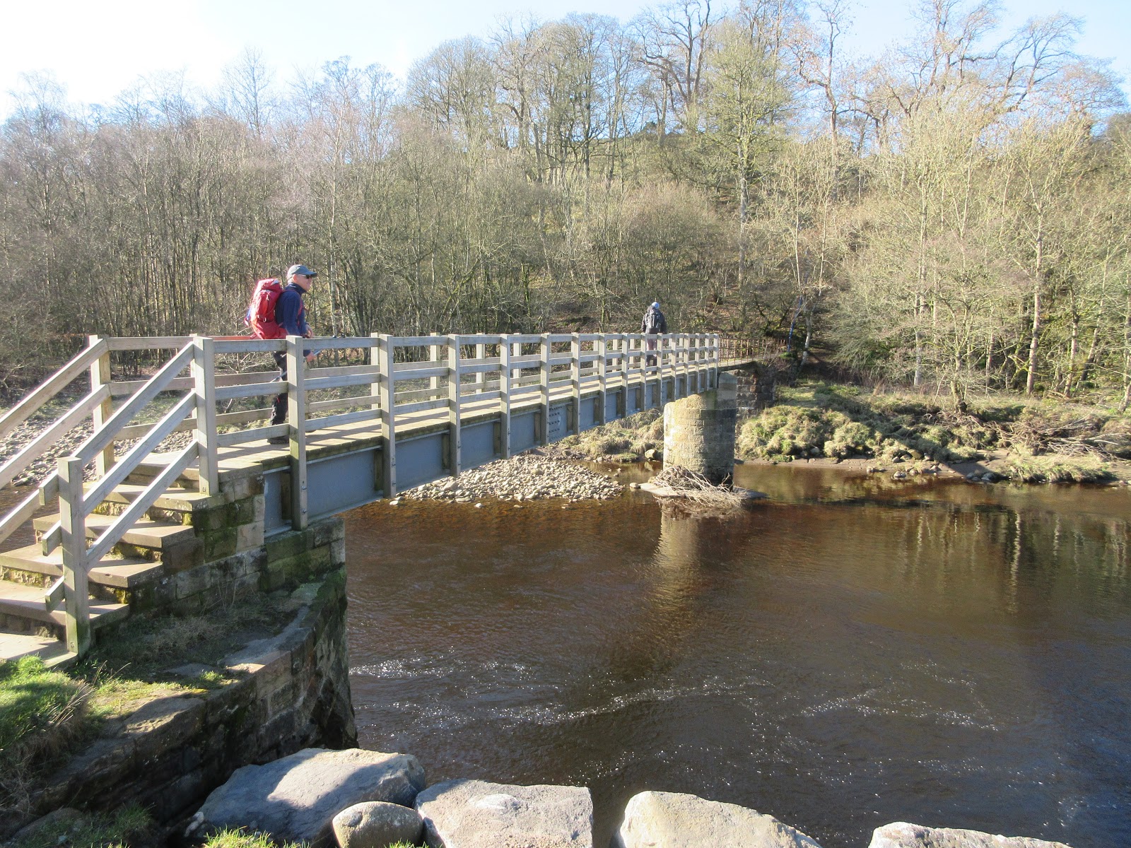
Crossing
several fields we walked in a southerly direction, using the footbridge over
the Edlingham Burn and climbed up to the B6341 Alnwick to Rothbury road.
Straight across and through the gate with the Open Access sign. The footpath
exists, but not too clearly but we
followed it uphill past rocky outcrops on Caller Crag to the gate into the
plantation.

Footbridge over Edlingham Burn
A wide
forest track through the rows of pines brought us to the house at Wellhope.
Years ago the family that lived here spent much of the year living in a wigwam
but they seem to have moved into the stone building. After a short chat with
the residents we followed a narrow footpath round a boggy bit of the wood
before heading uphill on drier ground and eventually emerging on to the moor.

Wellhope
Dave and
Brian went off to search for Cup and Ring marks*, three of us followed a grassy
track to Snook Bank farm. A short distance beyond the farm we settled down for
a Herbie, sitting on a grassy bank with a fence at our backs. Wonderfully warm
for February.

I think this was an accident. Anyway we shared mini apple pies, cookies, chocolate cakes and savoury, carrot flapjacks from Mrs A
Break over
we crossed a couple of fields and came to Canada. The buildings looked like a
group of low circus tents, corrugated walls and a domed roof, built around a
central lobby. Nearby some workmen were levelling the ground, possibly for an
additional tent. As we reached the front of the buildings and the old farm
house a man emerged so we asked what the place was. He said they bred gyr
falcons and peregrines, mainly for export to Middle East countries where
falconry is a popular hobby. The round buildings were an indoor flying arena
for the birds. Brian thought it more likely they were raising Canada Geese.

Internal flying zones for gyr falcons and peregrines

The original Canada farmhouse

Canada, and for you Eileen Pete I am wearing my Dakota Nation cap!
The track
from Canada to the A697 is not the usual messy farm road but a well constructed
tarmac strip, there’s money in falcons!
Once across
the A697 we headed north west on what is the old drove road, used before its
modern neighbour. A grassy track, easy walking and with a slight diversion to a
cairn with views all-round the county.
Beyond the
cairn and back on the track we came to a ruined farmhouse. On the left, through
a narrow band of trees is a gibbet, including a plastic skull. A board on the
gibbet once gave an explanation, saying who had been executed and displayed
there, sadly the board has been damaged.


The hanging tree
A little
further on we came to the cross roads at New Moor House, crossed the B6341
again and after a hundred yards or so crossed the A697 and took notice of
the signpost directing us across fields to Edlingham by way of the farm at
Wandystead and Sergeant Law.
A few fields
later we were back at Demesne and on the rod through the still quiet village to
the cars.
On the way
home we stopped at the Shoulder of Mutton in Longhorsley to rehydrate. Four
hand pumps but only one dispensing, a shame. The one beer was Yo.rkshire Blonde
from the Ossett Brewery. It’s from Yorkshire so it must be good. Across the road from the pub is the house from which Emily Davidson set out. She jumped in front of the King's horse during the suffragette movement days and was tragically killed.
* Cup and Ring marks appear in many places in the north. They are rings and depressions cut into rocks, usually horizontal. Nobody is sure what they were for.

Contains OS
data, copyright. Crown copyright and database right 2019.
Matrix MMXIX
2d
StepsA miles
NAK 28205 10.23
Iphone 22784 10
Dave’s NAK1
21389 10.12
“”””NAK
2
21355 10.11
“”””USB
21600 10.22
“”””SM
21545 10.03
Brian
9.67
Etrex 3h 45m walk 1 h talk
10
A few more pictures