Translate

Friday 24 January 2014

Happy Mithras, everyone      January 24th
With rain promised in the afternoon it was decided to have a walk near home and we chose to walk from the village of Warden to the world famous Hadrian's Wall and visit the Mithraeum at Brocolitia.
There are seven of us out today, Ben, Harry, Dave, Brian, John, Ray who has not been seen for a while, and me. To get to the start of the walk take the A69 west from Newcastle and a couple of miles past Hexham turn right at the sign post for Warden. A map is advisable, OSOL43 Hadrian's Wall and the church in Warden is at NY913664.
The church of St. Michael, patron saint of Marks and Spencer has ancient origins, the west tower predating the conquest (1066)..The transepts are 13th century much much of the remainder is 18th and 19th  century. A good deal of the older part of the building is constructed from recycled Roman blocks.


                          St. Michael and all Angels, Warden 
The walk:
We left the church, where we had parked, and walked  back down the road in the direction which we had come, until eagle eyed John spotted the footpath on the right hand side that took us alongside the railway for a few hundred yards before  turning right and climbing north across muddy fields. The official path continues on the west side of the Laverick Plantation but we took the opportunity to turn north east across two fields to examine  the fort on Warden Hill.
               Sheep, safely grazing on the remains of the fort
                Look carefully, you can just see the banked up earth
                  of this iron age fort.


And  a circular depression that could have
been a hut.
having examined the fort we headed north west to rejoin the official path. It is difficult to make out but the path crosses the Stanegate, Roman service road across northern England.
Coming to a minor road we turned left and then right at Tilesheads Woods to follow  a road heading just west of north  until ,after about a mile we followed the finger post  north west that brought us out onto what is usually called The Military Road. Parts of this road were built in the 18th century when history was not important and bits of it cover the wall but not here.  We crossed the road and joined the Hadrian Wall Path, a long distance footpath that, not surprisingly, follows the Roman wall from west to east, or vice versa if you prefer. 
 The Vallum, a ditch dug on the south side of the wall
A section of the wall itself, carefully reconstructed, but not to the
real height.
We followed the line of the wall, or more correctly the ditch dug on the north side, until we reached Limestone Corner, where we called a Herbie Spot.
Packing after lunch in the ditch. The Romans found it difficult to dig the ditch here and left  some rocks for future use as picnic seats.
Lunch today included several treats again, flapjacks from Witney in Oxfordshire, ginger biscuits from Ben's in Killingworth and individual Bramley Apple pies from Sainsbury's. None of us have lost the Christmas overload, no wonder.
Lunch over we continued west before crossing the road and heading for the Mithraeum at Brocolitia.
Long before Christianity became the official religion of the empire, the Romans had a good choice of gods to follow, and Mithras was popular with soldiers. 
Mithraism originated in Persia but spread throughout the Roman Empire. Mithras himself was born from a rock and was fond of sacrificing bulls. His adherents had small subterranean temples built for their ceremonies which, unfortunately were kept secret on pain of death probably, although it is known that there were seven  levels to work through and there was a special handshake!Most members of the cult were men, although my classicist adviser tells me there is some evidence that a few women were involved. Probably making sandwiches. Does this seem familiar? Did they roll their trouser leg up? It is reckoned there were 480 temples in Rome alone; "Just off to see the lads Calpurnia," "OK Justinian, don't be back late pet, and watch out for that Marcellus, he's a bad influence and here's the larks tongue pie I promised."
 Votives at the Mithraeum, money and a hippopotamus, although my classicist advisor tells me it is more likely to be a bull. Someone cruelly said it was obvious what type of person visited. The offerings remain .
 The altars. These are copies, the real ones are in the Great North Museum in Newcastle along with many Roman artifacts.

                      The Mithraeum at Brocolitia. (Reconstructed)
                      Not as friendly as a Christian altar scene.
Mithras slays the bull, a snake drinks the blood and the sun god watches.
From the temple we headed east to join the footpath south across several boggy fields and stretches of moorland.
Along the way we passed what looked like a dacha. In the yard were two ancient tractors, a change from the almost ubiquitous John Deeres.


Real Tracotrs
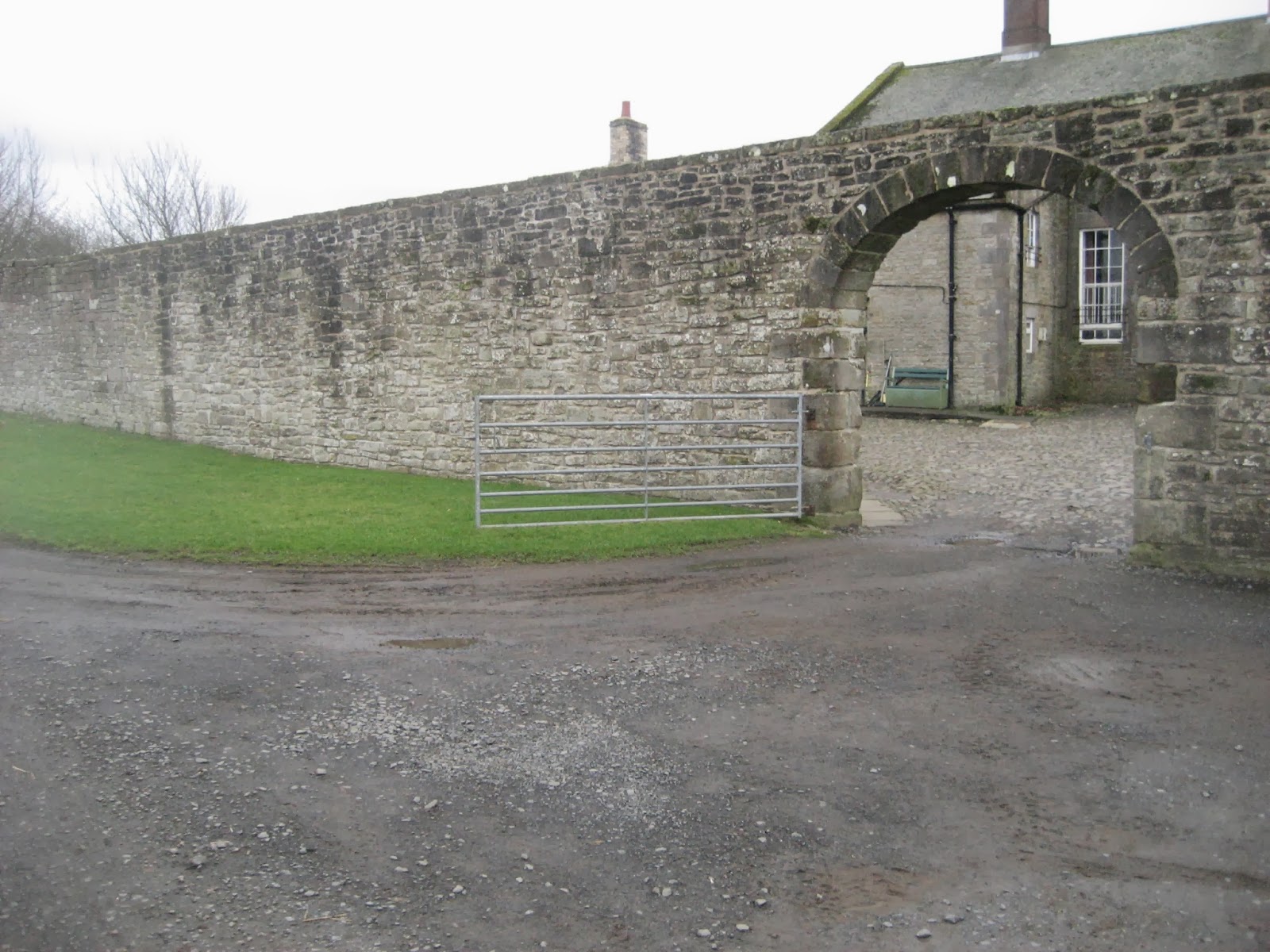
Crossing a footbridge we passed Newbrough Hall and turned right to walk uphill to Prudhamstone House.
Sculpture at Prudhamstone.
Shortly after this house we  were back on the same track as we started  and followed it back to Warden.
The village has a pub, the Boatside, and we were made welcome. Nice bit of extra business, seven thirsty men although the drivers were very well behaved.
Another successful walk, and when we left the pub it was raining!

The Matrix MMXIVD
                                                   steps                 miles
LIDL3D                                    29947               13.47
HiGear                                       29291              13.8

Dave's 3D                                  28807               13.25
Dave's USB                                28256               14.27

Brian's GPS                                                           13.2
Ben's Bragometer                                                 13.25
Unfortunately I forgot to switch OUTDOORSGPS back on after Herbie Spot but what a collection of results. I will claim 13.2 miles

Gadgie Distance 43.4


Section 1

                                      Section 2
Contains OS data, Copyright.
Crown Copyright and database right 2014


Friday 17 January 2014

From Longovicium to Durham...January 17th.
     A lengthy debate in the pub last week came to the conclusion it was about time to have a railway walk so today we are repeating an old favourite and following the old line from Lanchester to Durham.
A true gadgie walk as we are using bus passes to get to the start and to get home. This also means we can all have a drink.
To get to Lanchester from Newcastle take the X30/31 from Eldon Square bus station. The journey takes just over an hour.
                    No car park this week, but you do get a bus station
                                    (Eldon Square)
Lanchester, as the name implies, had Roman connections.
It was a Roman fort, Longovicium, on what is  now called Dere Street, the Roman chariot way that went from York to Bo'ness in Scotland. Longovicium was between two other forts, Vindamora (Ebchester) and Vinovia (Binchester).
The stones from the fort were used to build All Saints Church in the village in the 12th century Norman and Early English in style. The church is Anglican as you would expect but the Roman Catholic church, built in 1901 is also called All Saints. This could lead to some confusion, you could finish up not knowing what on earth was going on or have to do a spell in Limbo. There is also a Methodist Chapel.
Dere Street takes its name from Deira, the Anglo Saxon kingdom that was established after the Romans went home. Part of it is now the A1 road from London to Edinburgh and another part is the A68 from Corbridge north. And you can spell it Deere Street if you like.


                          All Saints C. of E  Lanchester

The walk:
  You do not need a map for this walk but should you choose to take one you need two. OS Explorer 307  Consett and Derwent Reservoir and OS Explorer  308 Durham and Sunderland.
 From the bus stop in Lanchester head south west on Station Road for a few hundred yards to find the start of the walk, on the left hand side of the road. (If you chose the right hand side you finish up in Consett. This rather fine piece of work stands at the entrance to the railway walk to Durham.
                      Salve Caesar ad Longovicium.
There is also this piece of interesting woodwork.
                        Creepy crawlies in Lanchester.
All you have to do now is follow the railway path for nine miles to Durham. After a couple of miles the track passes on the north side of Langley Park, like many of the villages in Durham it was once home to a pit but Langley's main claim to fame is being the birthplace of Sir Bobby Robson, international footballer and successful manager of several teams, including England and Newcastle United. The late Sir Bobby was a much loved and respected  gentleman, unusual in footballing circles these days.
The other thing of interest in Langley Park is Diggerland, a delight for boys and girls of all ages. It is possible to ride on a variety of machines used in the construction industry. Fortunately it was closed or we may never have finished the walk.
                         Diggerland, Back hoes and fun

Two miles beyond Langley Park the path is on the north side of the village of Bearpark. On the left a sign tells you that a track goes to Bearpark Hall farm. Take it and cross the bridge over the River Browney before taking a muddy path up to the ruins of Bearpark.
  Originally Beaurepaire, or fine retreat to us Anglo Saxons, this park was one of the largest in medieval England and the Prior of Durham Cathedral chose the site to build himself a retirement home which eventually became a holiday home for monks. Started in 1258 it was destroyed by marauding Scots and rebuilt in 1346. After the dissolution it remained part of the dean's estate but suffered under the Scots again in the first English Civil War in 1640 and the buildings fell into ruin.


Two views of the ruins at Bearpark.
A weekend retreat for up to forty monks who
sat around playing Monopoly and Scrabble.
 Back on the railway path for about another mile and half to a junction. It is possible to continue along the Brandon- Bishop Auckland Railway Path or do as we did and follow the sign that points left to Durham by way of Baxter Wood Farm.
                          
                             Seventeenth century Baxter Wood Farm
Once through this beautiful farm the track goes down to the River Browney. Cross the bridge and take the muddy path on the right hand side.
                         River Browney near Baxter Wood Farm
The path becomes a road that serves a few houses and the joins the busy A67. There is a footbridge across the road, it has an information board giving some details of the Battle of Neville's Cross which took place here in 1346. An English army beat a larger Scottish army and sent them home, to think again.
Look it up on Wikipedia or some other site. The Battle  of 
Neville's Cross took place here.
There are several ways to get to the centre of Durham from here, we took what I think is the best. Cross the road and follow the A67 for a few yards east and spot an opening between the houses, unmarked. Turn right at the end of the path and go up the street of quite large houses. At the top, on the left another narrow alley (or ginnel as Yorkshire folk say) leads to a sports field. Follow the path to the right which eventually becomes a road past The Durham School. On the bend take the left fork and very soon come across the magnificent view of Durham Cathedral
.
The west front of Durham Cathedral on a greyish day.
Durham Cathedral always knocks me for six. The Cathedral Church of Christ, Blessed Mary the Virgin and St. Cuthbert it dominates the university city. The second cathedral on the site it was started in 1093 and the main body of the church was finished in a mere forty years. The west end, the two west towers and the massive central tower, along with the nine altars chapel at the east end of the church were added over the next 360 years. Oliver Cromwell, who was not too keen on cathedrals had several hundred Scottish prisoners incarcerated inside during the English Civil Wars and they did some damage inside. It is a World Heritage site and a must if you come to Durham. It is possible to climb to the top of the central tower too. (And it was used in the Harry Potter films).
                           The Sanctuary knocker on the great door 
                            of Durham. (A replica, the original
                            is kept inside)
 Cross the river by the old bridge below the castle and go through the market square. Head for the Gala Theatre but make for the Bishops Mill, a Wetherspoon pub which had some fine Abbot Ale to drink. 
Then we caught  buses home. A true gadgie day out.


The Matrix MMXIVC

                                               steps                    miles
Hi gear                                   10032                  4.74  (used to be
                                                                                     reliable)
LIDL3D                                  21300                 9.5
Dave's LIDL3D                      20763                  9.56
LIDLUSB                               20456                  9.68
OUTDOORGPS                                                  9.68
Ben's Bragometer                                                9.78
Gadgie total  30.2 miles

A final word:
Last week I past 30000 hits which pleases me anyway
Top score goes to the UK    with 11875
Second is the good ole  US with   10651
Third Canada with                        1361
Troisieme Canada avec                 1361
Fourth Russia with                           939

Thank you, merci, cпаcибо 

Friday 10 January 2014

Reservoir Blog II.....................January 10th.
Today's walk is a repeat of Reservoir Blog way back in 2012. Another easy winter walk and not too far from home. It starts near the village of Hallington in Northumberland and is completely covered by OS Map OL 43, Hadrian's Wall. It would be useful to  carry the map,or at least a laminated section. To get to the start take the A69 west of Newcastle, turn north on the A68 near Corbridge and look out for signs. Just beyond the village at the point spot height marked on the map as 176 (GR NY982769) there is a space for a couple of cars.
Five gadgies out today, John, Harry, Ben, Dave and me, and we have chosen, in Brian's absence to go without bacon or tea, such has been the effect of Christmas feasting.

                                         Car parked, gadgies almost ready.
The walk:
Look carefully at this weeks photograph of a car park and you will spot a nice wooden signpost. It directed us through a gate and along a track until we reached Hallington Reservoir East, built in 1863 for the Newcastle and Gateshead Water Company. Turning left we walked along the footpath on the side of the reservoir  until we reached Hallington West Reservoir, built for the same company in 1880.
                                       Cheviot Farm on the edge of the reservoir
                                            Reflections in a reservoir

                              She sells sea shells on the reservoir shore doesn't quite have the same ring.

Continuing round the perimeter of this splendid Victorian piece of engineering we walked to a gate at the north west corner and exited left as they say, onto a service road which led to a minor road. Turning right we walked north up the road to a bend. On the left, almost hidden by bales of straw a rickety stile sent us across a field before turning right on a track which rejoined the road. At this point however we headed up a farm track marked "Private; No access for Vehicles" which brought us to the farm at Little Swinburne. A large farm with a beautiful walled garden and the remains of a pele tower to the north.
                                               "Oh wall, fair wall,
                                                  Show me thy chink                     
                                                   That I may blink through
                                                      With mine eyne"
                                                              I had to say these words as Francis Flute the bellows mender in a school production of A Midsummer Night's Dream in 1959

                                                 Fuzzy view of the pele tower at Swinburne.
We walked through the farm yard, turning south west then north west to follow the footpath that took us to Little Swinburne Reservoir which was home to a collection of ducks and swans. Crossing the causeway we crossed two muddy fields in a north west direction.
                                                     Little Swinburne Reservoir

                                                                                                      The fields are shining examples of ridge and furrow farming and also had the remains of long boundary walls. Rather than slug it out across the boggy Folly Moss to the gate into  Colt Crag Reservoir we headed north and climbed a fence  into the grounds, stopping at the old boathouse for a well deserved Herbie Spot. Sitting with backs to the wall of the house we dined as well as ever. John had mini mince pies to share, Dave had Yorkshire Flapjacks (How Much?), Ben had ginger biscuits and I had Czech Chocolate Christmas Tree Decorations. No wonder we are FPs. (See Glossary) We had sandwiches too.


                                                 Colt Crag Reservoir, home to ducks,
                                                  geese, cormorants and a murmuration.
We continued  north around the edge until we came to a gate, turned right and then after a few hundred yards we turned left on the road to Thockrington.
The striking thing about this village is the church, St Aidans, built on an outcrop of the Whinsill. A pretty little Norman church, once the centre of a fair sized parish. In 1296 Thockrington had as many as 18 taxpayers, and this before income tax. In 1666 there were 11 houses paying the Hearth Tax, 17th century equivalent of today's council tax and bedroom tax!. The village lost its population at the end of the 19th century, now all that remains is a large farm and the outline of several old buildings.
Lord Beveridge, architect of the British Welfare State is buried in the churchyard, with his wife and her daughter by her first marriage. Her daughter wrote a jolly good book on anthropology, but I forget her name.
How happy would he be with the way his welfare idea has grown?
                                                             Lord Beveridge, one time MP for Berwick
                                                    East end of St.Aidan's Church

                                                        St Aidan's, Thockrington

Leaving the farm we headed east before turning south east on a road. At the end of the road we turned left, but after a few yards we pretended to be foreign and ignored the sign on the gate that said "Private, No Public Access" and headed uphill to look at the Dovecot, built as a folly in the centre of some ancient looking earthworks.
                                                    The Dovecot, and gadgies.
Heading south east we meandered across several muddy field until we reached a corner on the road. Turning right we returned to the car.

                                                 The last stretch!
 On our way home we stopped at the Boathouse in Wylam which had its usual large selection of good beers, plus Staropramen lager on draught.

The Matrix MMXIVB

                                                                            steps                                miles


LIDL3D                                                            21749                                    9.78
Higear                                                                15287                                    7.23  (on short time)
Dave's 3D                                                         20824                                     9.57
LIDLUSB                                                         20016                                      9.47

OUTDOORGPS                                                                                               9.7


A good day for the birders too. Cormorants, tufted ducks, other ducks, blue tits, finches, nuthatch ,heron, pheasant, fieldfares, redstarts and lots more.

                                          AMBULO ERGO SUM


Gadgie total 20.5 miles

Friday 3 January 2014

Stastny Novy Rok    с НовыМ  ГодоМ   
Novus annus
Bonne annee
Gluckliches neves Jahr  Happy New year
(Although it's January 3rd)
Gadgies usually start the new year with gentle walk, not because of Hogmanay hangovers but because of the weather. The local weather forecast is for another damp day but not as wet as the last few have been, and the wind has died down at least until Saturday. So we have agreed to repeat a walk last done on January 11th last year entitled Picnic at Stag Rock.
The walk starts at Seahouses on the Northumberland coast. Seahouses has fish and chip shops, souvenir shops and pubs, as well as a large car park in the centre of the fishing town. It also offers trips out to the Farne Islands which are now a nature reserve, home to a vast number of sea birds and seals. Should you opt to visit them, be warned, well worth it but the smell! The islands are National Trust properties and there is an additional landing fee, unless you are a member.
The whole of the walk is covered by OS Explorer 340 and the best way to get to Seahouses is to head north up the A1 and follow signs from Alnwick, or use a Satnav.
Six out today, Brian, Ben, Harry, Dave, John and me.

There had been more than the usual discussion on where to walk, mainly because of the uncertain weather. At one point Dave sent an email saying that "Like Lord Stanley at the Battle of Bosworth* he would wait and see how things were before joining in" to which Brian replied "Typical Stanley, wait to see who's winning and then stick the knife in!"**

The walk.
We started at the car park in Seahouses. at the back of the car park a gate leads to the Northumberland Coast Path which is the route we are to follow today. If you think this path is on an old railway line, you are right, it is.
                                           Yes it's a car park. (£3.50 for a whole day)
                                               Seahouses is famous for fish and chips


                                    The blue sign marks both paths and appears frequently
                                                making it an easy route to follow.


 At the end of the path we turned right on the road past a small industrial area and after about fifty yards crossed into a field, well sign posted. Being winter and having suffered a few days rain the path was muddy but easy to follow across several fields, past North Cottage, several more fields to Saddlershall, along a short stretch of road to Fowberry. From here we wandered across more muddy fields to Redbarns and Quarry Cottage. If you look on the OS map the path goes directly from here, behind Armstrong Cottages, to the road and on to the castle but we faithfully followed the signs across yet more muddy fields before arriving at the castle car park. From here new followed the road for a short distance to the cricket field.
                                                       Mighty Bamburgh. There is evidence of
                                                  pre Romano British occupation of the site.
                                                 The castle was built in the 12th century and
                                                 modernisation took place in the 18th and 19th.
                                              Beneath the walls at Bamburgh
                                         The Fugawee tribe were camped at Bamburgh,
                                                       they thought.
To the left of the cricket pavilion a footpath took us along the dunes  to The Wynding, and soon we reached Stag Rock and declared a Herbie Spot.  Stag Rock is not named on the map, it is at  Blackrocks Point next to a lighthouse and is quite sheltered from the westerly wind.
                                                  Stag Rock
                                                 Looking back at Bamburgh
Future archaeologists may well look into the lunchtime eating habits of groups of gadgies.
Excluding sandwiches we shared Guinness flavoured Truffles, ASDA flapjacks, Ben's superb ginger biscuits and Co-op cereal bars. This is becoming almost a ceremony or ritual. (This is a phrase used by archaeologists when they are not sure.)  Actually archaeologists wont know because we take our litter home.
Lunch over we climbed the steps behind the lighthouse and carefully crossed Bamburgh Golf Course.

      
                                       Trinity House runs British Lighthouses.
                                                       Budle Bay
The course is above Budle Bay and the footpath meanders between the holes and fairways, across a couple of fields. until it emerges on a road. We turned left and after a couple of hundred yards turned right at the sign for Dukesfield entered  and crossed several more fields, slipped, literally , down  a path through a wood and emerged on a road at the old Spindlestone Mill, now converted into luxury apartments.
                                                          Spindlestone Mill
From here we followed the road to the wonderful Outchester Ducket. Originally built as a Dovecote, they had very large doves in Northumberland, it was also used for storing food and manure! Now it is a holiday let, complete with great views and circular bedrooms.
                                                      The Outchester Ducket.
We turned right at the Ducket and took the left fork at the next junction until we came to the Warren Mill Caravan and Camping site. Beyond the gate to this camp a footpath led us alongside the site, past several static vans before we entered and crossed several more fields before arriving at the crossing on the main London Edinburgh line. A notice informs walkers to ring the signalman for permission to cross, this time the honour of making the call fell to Harry.
                                          I just called to say we're crossing

                                                      Perspective perspective
Once safely across we walked past the coastal grain stores to the A1, main road between London and Edinburgh, not that you would think so, it's a single carriageway here, but hat's what we get in the north of England.
                                            Northumberland produces much grain..
Across a couple more fields and we were in Belford, the end of the walk.
Belford possibly comes from Old English, bel haga a glade in a forest or dry land in a swamp, today it looks like the small town is dying, two pubs and a café up for sale. We waited a while and caught the Travelsure 418 bus which whisked us back to Seahouses in about 20 minutes. Debooted we headed for The Old Ship hotel hoping to annoy the locals by sitting in their seats but the pub was packed at 4pm with mostly visitors. Several beers on offer, I chose Directors as a second pint, the first, Alnwick Longstone, being disappointing.

The Matrix MMXIVA

                                                           steps                                       miles

LIDL 3D                                          25317                                      11.41
Higear                                              23947                                      11.32
Dave's LIDL3D                               23478                                       10.81
Dave's LIDLUSB                            23126                                        10.94

OUTDOOR GPS                                                                              10.81
Brian's GPS                                                                                       11
Ben's GPS                                                                                          10.9

Pretty consistent for once


Gadgie total for the year                                10.8miles

* Battle of Bosworth 1485. The end for that son of York the much maligned Richard III who, calling for a horse, died and was dragged to Leicester. His remains were discovered a couple of years ago under a council car park and lawyers are now making a fortune arguing where he should be buried. York Minster gets my vote.
** Lord Stanley fought in the battle of Bosworth. In the UK a Stanley knife is a short bladed knife with interchangeable blades, used for hobbies, opening boxes etc. A sharp remark from Brian.