Translate

Saturday 25 March 2023

The friendly farmers of Kirkwhelpington

Thge friendly farmers of Kirkwhelpington. (Northumberland) March 24th.
I missed last week's wander as I contracted the dreaded Covid. Rather than infect my friends I stayed ay home and threatened the family.
Back today and trying out my shiny new boots which I have been wearing around the house, as advised by the young man who sold them to me. They have been outside locally but this is their first taste of the countryside.
Five of us, John H., John C., Ian, Harry and I are having a fairly flat walk from the village of Kirkwhelpington in Northumberland. Follow the A696 through Ponteland and after a few miles the village is on the right.
The settlement was first mentioned in 1176 as Welpinton. The name comes from Old English and means the settlement of Hwelp's people. The prefix Kirk was added later.
The church of St Bartholemew has 13th century origins.
There is free but limited parking in front of the village hall.
OS OL 42 Kielder Water and Forest is more than useful, the track is not well marked on gateposts.
                     This week's car park.
                    St Bartholemew's church Kirkwhelpington.

Once booted and coated as we were told to expect showers and a strong breeze we heade the short distance north from the hall, turned right, crossed a  stream, turned left up a lane and headed north across fields. At the first pair of gates we came to a friendly farmer pointed out we were taking the wrong one. We took his advice after a chat about the weather and carried on uphill to the farm at West Whitehill. Just beyond the farm we turned left and walked to the A696 at Knowesgate.
The hotel at Knowesgate.
Crossing the road we continued west to a plantation (mile 2) and followed a good track crossing the dismantled railway and passing the low remains of a bastle before reaching Ray Demesne.
             Remains of the bastle (fortified house) at Ray Demesne.
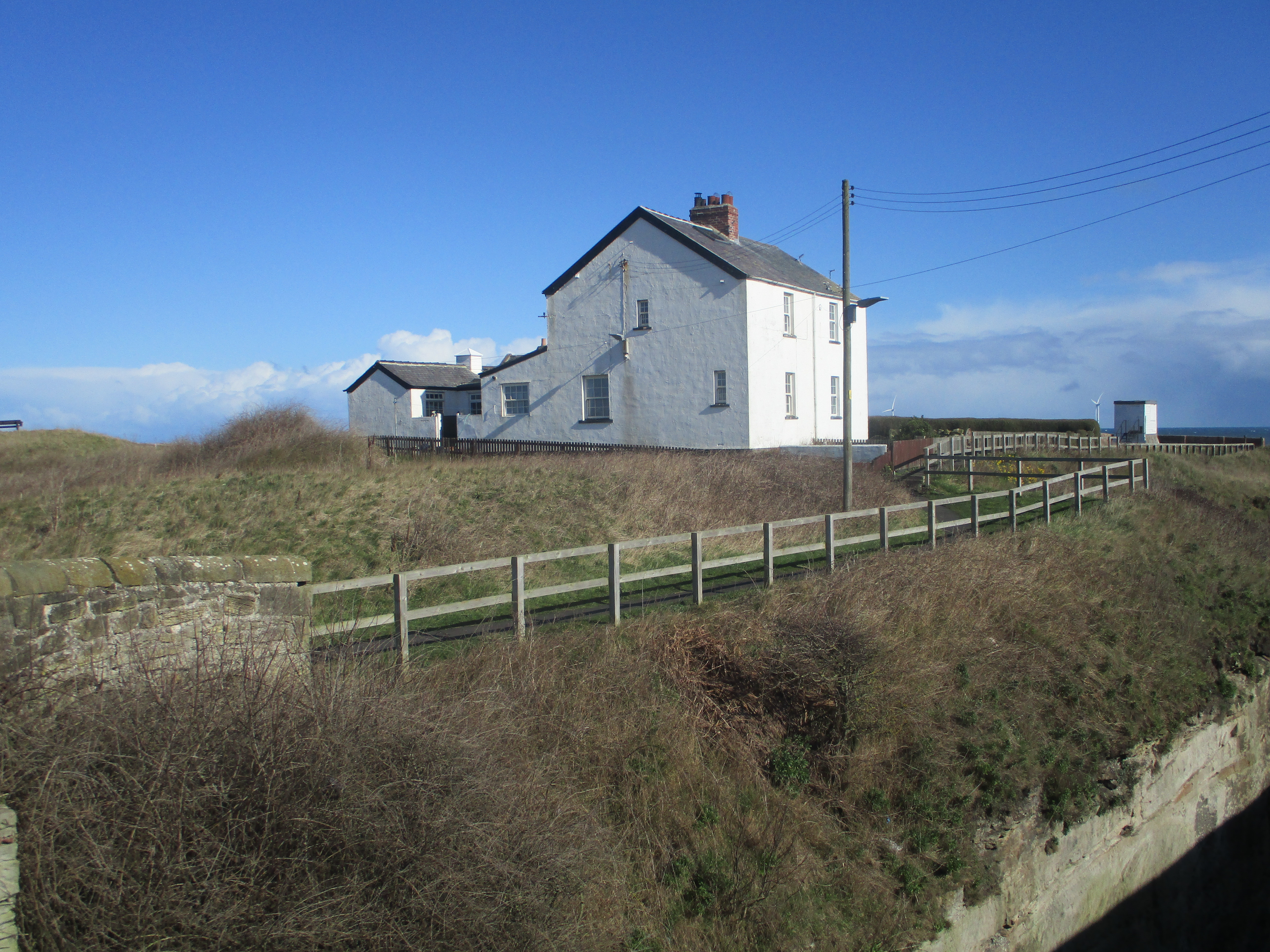
Ray Demesne was once the home of Charles Parsons, the engineer who invented the turbine and demonstrated its capabilities in front of the navy at Spithead using his boat Turbinia, now on dispay at the Discovery Museum in Newcastle.
From here we climbed, steadily, and I'm not used to it, until we reached the wind farm on Ray Fell.
(mile 4)
                                   Just a few of the windmills on Ray Fell
                     Information on Sir and Lady Parsons. 

                                            And a single windmill. They are very noisy.
Once past the farm we entered a plantation, turned south and just beyond the mile 5 marker on the map called for a Herbie. Sitting on the ground as there were no picnic benches or conveniently felled trees around we shared Snickers and chocolate whips.
Lunch over we went through a gate and headed over rough ground, lots of Lauder Grass (qv) until we came to a bridge under the dismantled railway line.
A track took us to  a road (mile 6) and we turned left. Ignoring the original route across a field as advice said it was extremely boggy, we followed the road to the next junction and turned right. Not too far along the tarmac we took the track by Lunga Crags  (mile 7) and followed it to Hawick farm.

                  Stell at Lunga Crags (sheep pen)
Warning of storm damage at Hawick (Storm Arwen I suppose)
From Hawick we crossed rather wet fields in a fairly straight line heading east to the farm at Crookdene.
The farmers pointed out, very gently, that they had had the footpath moved so it went round the farm rather than through the yard. A fair point I think. Chatting to them we admired their bright shiny new John Deere tractor. He asked me what I thought it cost. Not being in the business I hazarded a guess, £100000. Spot on the farmer replied. He also had what he called a "runaround" for the farm, a small JCB. They wished us well and off we went across wet and muddy fields. passing Kirkwhelpington Quarry (mile 9) to the last farm of the day at The Shield. Through the yard again, mud churned up by animals, but the farmer stopped to discuss the weather. What do you expect, we are British.
From the Shield we followed the farm track, crossed the A696 and were back in Kirkwhelpington.
Contains OS data, copyright. Crown copyright and database right 2023. M
Mile markers are approximate.
The walk is about 10.5 miles, a few gentle climbs. And there are stiles.

And the boots were fine, muddy but fine.


And a few more from Harry


Saturday 11 March 2023

Birds, Big Waters, Boots and Blyth

 Birds, Big Waters, Boots and Blyth.

Wednesday March 8

In order to aid the post operation recovery of one of the team two of us are out for a day's  bird watching.

First stop Gosforth Nature Reserve, run by the Natural History Society of Northumbria. And well run too, great improvements since I first visited about 30 years ago. There are four hides, several observation platforms an earth toilet and a classroom near the entrance. The reserve is open to members of the society, non members are asked to pay £5, returnable on joining.

Three of the hides are kept unlocked but one requires a key, available on joining.

The first hide is near the entrance and looks out onto a collection of bird feeders suspended from trees and several tree stumps also provided with feedstuff.

*

                     Bug hotel and bench for human diners near the entrance

                       Bird and bat boxes


                    Birds and beast at first hide.

Moving on in a clockwise direction round the reserve we came to the second hide which is approached along a well made board walk through the reed beds.


All quiet on the Gosforth lake. Parts were frozen and there was a corpse of a greylag goose on the ice. The warden thought a number of birds had died from Avian Flu which is certainly around.

The third hide, which currently has a new boardwalk entrance under construction, also looks over the lake and was equally quiet. A coot or two and a distant view of a heron.

We walked round the lake to the north side and found the next hide, a new one and the only one which is kept locked, requiring a member's key. It is close to  the race course. (near 48 on the map)

Quiet like the others.


                                Fourth hide view.

Bird watching over we continued on the perimeter path, close to the straight on the race course. Finding a tree that had been felled by storm Arwen we decided to lunch. At this point I realised that somewhere along the way I had lost a glove so we retraced steps and found it.

After a chat with the warden we left the reserve and drove to Big Waters reserve near Brunswick. It is possible to walk there by cheekily crossing the race course, walk through the park area to the old A1, turn right and walk to the Travellers Rest. Turn left and go along the road to the very last house and make your way down the rough track to the lake.

Big Waters is not a natural lake but is a result of mining subsidence. There is a footpath going around the south side but it leads to a forbidden area which has been left to go wild.


                 Big waters and some inhabitants.

There is a hide accessible from the car park and along a track that appears to be leaving the lake. The hide is run by the Wildlife Trust and needs a members key to get in. 


There's an excellent feeding station at Big waters. The squirrel got in.


Contains OS data, copyright. Crown copyright and database right 2023.

Friday March 10th.

The weather forecast promised a day of heavy snow and ice. being sensible septuagarians we considered a gadgie walk was probably not the best of ideas so the proposed expedition was postponed.

I was disappointed because I had bough a new pair of boots a month ago and, having obeyed instructions to wear them round the house for 28 days before accepting them I  wanted to give them a try. (Didn't wear them all the time of course, the SWMBO would not have permitted!)

I drove down to South Beach in Blyth, donned the boots and headed along the Eva Black Causeway walk to give them a whirl. I followed the walkers/cyclists path to Seaton Sluice, had a look round and returned.


Car park in Seaton Sluice added by request. It's a free one too.


        The Blyth Battery dates back to World War One when Blyth was  a submarine base, as it was in WW2 also.

                          The Kings Arms at Seaton Sluice. Built in 1764, keeps some excellent beer too.
                       The Lookout House. Now a museum that opens on a Sunday
                     
                              The cut at Seaton Sluice. Excavated to make access to the harbour easier
                  The harbour at Seaton Sluice, once exported coal, glass and salt. Quiet now.

                         And the boots were fine.


Saturday 4 March 2023

The gadgies of Eachwick

 The gadgies of Eachwick. March 3rd

(Northumberland)

This walk is very, very muddy.

Today's gadgie outing is a circular walk from Stamfordham, a village  a few miles west of Newcastle. There are several ways to get there, best to look at a map and make your mind up. Today's team is made up  of five, me, Harry, John H, John C and Andrew, Harry's son and apprentice gadgie. (And very sensible, his dad carried the sandwiches and flask)

The map to use is OS Explorer 316 Newcastle upon Tyne. Could be useful too.

Stamfordham is a pretty village with a large green, a mostly Norman 13th century church, St. Mary's, a village butter market from the 18th century and a village lock up from the 19th century. And two pubs, one of which seems to have closed.

The name Stamfordham is Old English meaning " the settlement by the stony ford". Not to be confused with Stamford Bridge in Yorkshire where Harold took on his brother Tostig and the Norwegian Harald in battle, beat them and then weeks later lost a replay to William the Conqueror at Hastings in 1066. Nor is it where Chelsea FC play football of a sort.


               Parking in Stamfordham near the Bay Horse pub which is closed.

                          The Butter market, Stamfordham

                                Thye village lock up, must have had a few naughty boys in the 19th century.

Once booted and coated up on a cold day we set off east along the edge of the large green, crossed the road and took the path next to the village school. Crossing the first muddy fields we followed Nettley Bank to Mill House. Turning right on the road we crossed the River Pont and took the footpath on the left, high above the stream and a bit on the slippery side. (Dotted line on the map, blame GPS or someone.)

                       The River Pont which joins the River Blyth later and then enters the North Sea.
Leaving the wooded path by the river we crossed muddy fields to Eachwick Red House and then walked along a road to Eachwick Hall.

Eachwick Hall through the trees. Built in the early 18th century and once owned by the Delavals and later by the Spearmans. Daffodils, snowdrops, crocuses and aubretia on the wall and roadside. 
We walked up a lane at the side of the hall and crossed muddy fields to the village of Dalton. A lovely little village, publess but attractive. The footpath to it crosses a footbridge and there is a steep set of stairs . After a short walk down a good track we were back in muddy fields to Dalton Hillhead. Here we turned west, crossed a field, walked through a wood and found a suitable bank near Brixter Hill for a Herbie. 

                          Footbridge near Dalton.
Not much sharing today, John H and I exchanged a cookie for a Titan, ALDI's answer to Mars Bars. Then we moved on, crossing fields to Heugh which has some ancient Earthworks, hard to spot.
From Heugh we crossed the muddiest fields ever, churned up by a herd of young beeves our boots got heavier by the step.

This bird/deer scaring device goes pop every now and then.
Once across the sea of mud we came to proper grassy fields and walked towards Fenwick Lodge. Crossing the road and passing through the lodge gate we followed a good track for a short distance before following the path across muddy fields to Fenwick Shield and Horse Bog. After walking a reasonable track for a short distance we took to the fields again near North Lough House  and headed  to Stamfordham, passing through the graveyard and back to the cars.

 St. Mary's Stamfordham. Mostly 13th Century Norman with some Saxon bits and 19th century "improvements".
Contains OS data, copyright. Crown copyright and database right 2023
The dotted line is our actual walk on the south side of the River Pont
The walk is bout 10.3 miles, easy going apart from the mud.