Walking with the White Monks (Northumberland)
January 24th
It's a while since we've walked from Blanchland in Northumberland. (Just)
Founded in 1165 by Premonstratesian Canons, (known in Britain as the White Canons which explains the village name too) bashed about a bit by the Scots and finally dissolved by guess who in 1539, the remains of the monastery are now a hotel, The Lord Crewe Arms. The village is pretty and the car park is close by.
There are seven of us walking, John H., Brian, Dave, Harry, Ben, John Ha. and me.
Blanchland is on the edge of two maps;
OS Explorer 307 Consett and Derwentwater and OS OL 43 Hadrian's Wall. Most of the walk is on the latter.
To get to Blanchland A69 West, A68 South at Corbridge and watch out for road signs. There is a café in the village, the White Monk but it opens at 10.30 so we early birds breakfasted at Brockbushes on the roundabout where the A68 leaves the A69.
 Heading for breakfast; bacon, sausage, tea, coffee.
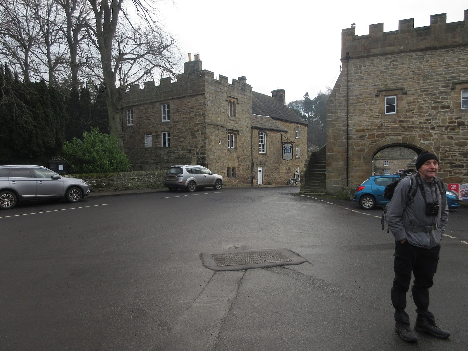
 Preparing for the walk in Blanchland's large car park. Just to the right of the farthest car is an honesty box which asks for a contribution.
The walk, which is a ten mile tramp over fields and moors from one isolated farm to another and much of it is on farm or shootists tracks.
Having donned boots and gaiters and coats too as it was a cold day with a breeze we left the car park and walked towards the village, taking the first road on the right, sign posted for Baybridge. (you can start there too, there is a car park/picnic area and it's free)
After the last cottage we went through the gate on the left and walked the footpath roughly west until we came back to the road. There is a large gateway saying private but it is a public right of way. We walked past the last few houses at Newbiggin and then followed the track past Beldon Shields. Some of the plantations alongside the road had been cleared and the rubbish was being burned off.
After just less than four miles we came to Riddlehamhope farm, much of it demolished and what was left, presumably waiting the wreckers, is in a poor state. However it offered some shelter so we declared a Herbie.

 Herbie time at Riddlehamhope. Cheese scones from Mrs A., gingers from Ben, almond slices, chocolate biscuit bars and Bliss, a bar that requires more calories to eat than it provides.
Lunch over we continued along the track heading north west then north to Harwood Shield.
 Harwood Shield.
Just beyond the farm, on the right, is a footpath, not clearly marked, that crosses fields down to Stobbylee Burn which, fortunately, has a footbridge.
 Much better than the struggle to cross a stream two weeks ago.
From the burn we climbed gently to Stobby Lea then on to Steel and Hesleywell.


 Stobby Lea, Steel and Hesleywell, possibly.
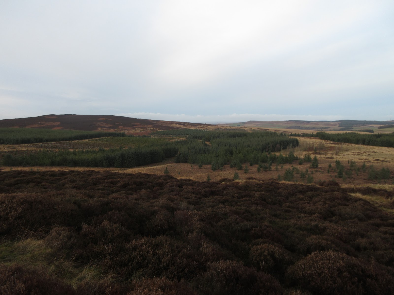
At Hesleywell we crossed fields to Burntshield, another farm and from here, after much discussion we headed up a path along Devil's Water before heading east, uphill until we found a track that took us across Burntshieldhaugh Fell. The fell is a grouse moor and on a cold day in January, in poor light does not have a lot to offer, apart from safety for the grouse.
 Grouse Butt, designed to protect shooters from squadrons of attacking birds.
Eventually we turned right and walked downhill to Pennypie House which is on the Pennine Way long distance footpath.
 Pennypie House, hiding. It is on an old Carriers Way and once upon a time offered refreshment to men using the road, pies for a penny would be hard to find today!.
From here we followed the metalled road back down the wooded Shildon Burn to Blanchland.
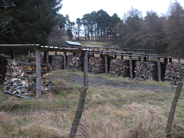 Logs for sale
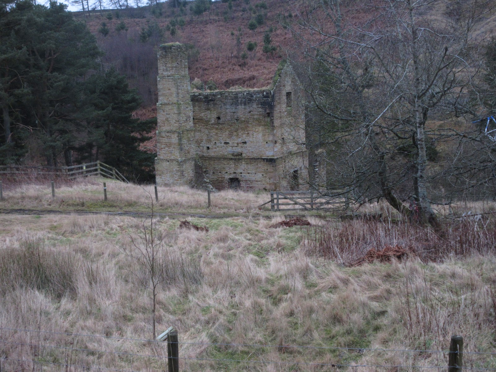
 Leftover from days when mining took place in the valley
Changed we headed back to the Boathouse in Wylam for rehydration purposes. The Boathouse had its usual selection of a dozen or so hand pulled beers.
 Contain OS data, copyright. Crown copyright and database right 2020.
The walk is approximately 10.4 miles, mostly easy going with some gentle climbs.

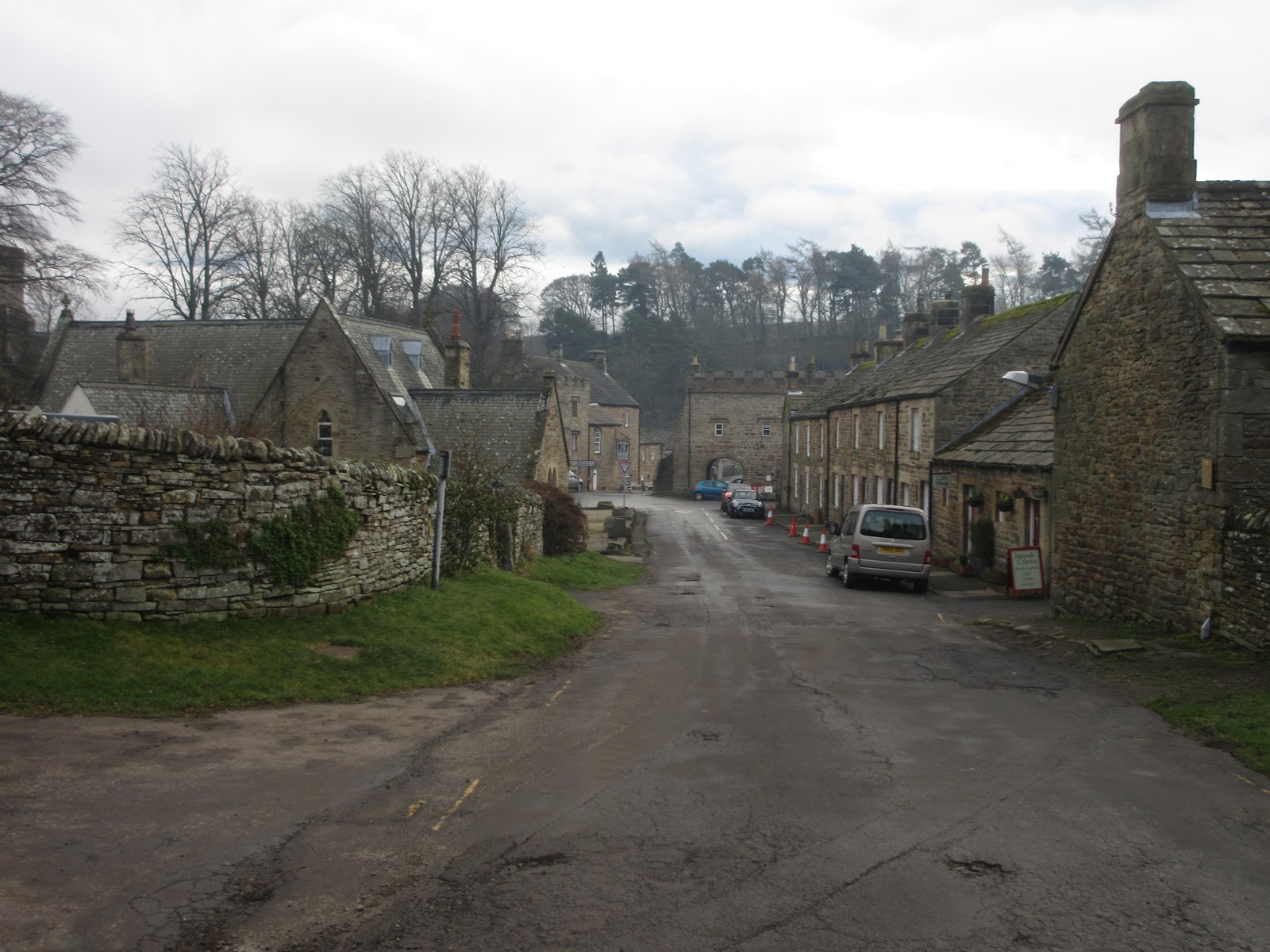
 Blanchland
 Lord Crewe Arms, Blanchland
 Follow this sign
 But not this one


January 24th
It's a while since we've walked from Blanchland in Northumberland. (Just)
Founded in 1165 by Premonstratesian Canons, (known in Britain as the White Canons which explains the village name too) bashed about a bit by the Scots and finally dissolved by guess who in 1539, the remains of the monastery are now a hotel, The Lord Crewe Arms. The village is pretty and the car park is close by.
There are seven of us walking, John H., Brian, Dave, Harry, Ben, John Ha. and me.
Blanchland is on the edge of two maps;
OS Explorer 307 Consett and Derwentwater and OS OL 43 Hadrian's Wall. Most of the walk is on the latter.
To get to Blanchland A69 West, A68 South at Corbridge and watch out for road signs. There is a café in the village, the White Monk but it opens at 10.30 so we early birds breakfasted at Brockbushes on the roundabout where the A68 leaves the A69.


The walk, which is a ten mile tramp over fields and moors from one isolated farm to another and much of it is on farm or shootists tracks.
Having donned boots and gaiters and coats too as it was a cold day with a breeze we left the car park and walked towards the village, taking the first road on the right, sign posted for Baybridge. (you can start there too, there is a car park/picnic area and it's free)
After the last cottage we went through the gate on the left and walked the footpath roughly west until we came back to the road. There is a large gateway saying private but it is a public right of way. We walked past the last few houses at Newbiggin and then followed the track past Beldon Shields. Some of the plantations alongside the road had been cleared and the rubbish was being burned off.
After just less than four miles we came to Riddlehamhope farm, much of it demolished and what was left, presumably waiting the wreckers, is in a poor state. However it offered some shelter so we declared a Herbie.


Lunch over we continued along the track heading north west then north to Harwood Shield.

Just beyond the farm, on the right, is a footpath, not clearly marked, that crosses fields down to Stobbylee Burn which, fortunately, has a footbridge.

From the burn we climbed gently to Stobby Lea then on to Steel and Hesleywell.


At Hesleywell we crossed fields to Burntshield, another farm and from here, after much discussion we headed up a path along Devil's Water before heading east, uphill until we found a track that took us across Burntshieldhaugh Fell. The fell is a grouse moor and on a cold day in January, in poor light does not have a lot to offer, apart from safety for the grouse.

Eventually we turned right and walked downhill to Pennypie House which is on the Pennine Way long distance footpath.

From here we followed the metalled road back down the wooded Shildon Burn to Blanchland.

Changed we headed back to the Boathouse in Wylam for rehydration purposes. The Boathouse had its usual selection of a dozen or so hand pulled beers.

The walk is approximately 10.4 miles, mostly easy going with some gentle climbs.