....and the first walk of 2020. January 3rd.
Staying with a tradition going back at least three years we kick off the walking year by taking the England Coast Path from Blyth in Northumberland to North Shields in Tyne and Wear.
A proper gadgie walk, requiring bus passes, we met at the Coastline café in the South Beach car park, Blyth and headed south. No need for a map but the walk is covered by OS Explorer 325, Morpeth band Blyth and OS Explorer 316 Newcastle upon Tyne.
Almost a full squad out today for the New Year;John x3, Ben, Harry, Brian, Ray me and Paul who came over from near to Grange over Sands on Morecambe bay for the day.
I walked an extra mile or so from Blyth Bus Station to the café, taking in the sights;
 Blyth Library
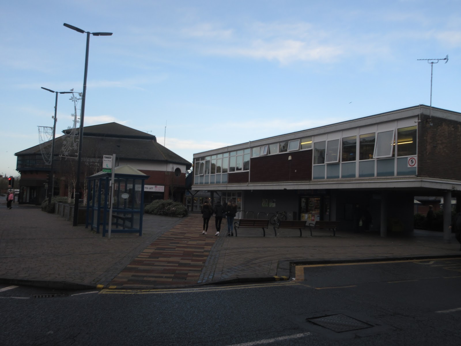
 Bus station
 Originally built to store aluminium ore for the ALCAN smelter at Lynemouth
 Blyth is now a centre for offshore windmills and will be the British end of a pipe line bringing electricity from Norway to the UK
 Quayside art

 A Blyth claim to fame.
 Café and car park allin one, plus the photographer's shadow.
Once breakfast was over, about 11am, we set off south. Some of us followed the Eve Black footpath/cycle track which wanders through the dunes, others walked along the sandy beach which is hard going, the sand is soft at the beach has a slope. We all met up at Seaton Sluice.
 The cut at Seaton Sluice. Built in the 18th century to improve access to the harbour which was used for exporting coal and glass. The sluice, designed to clear silt from the river has disappeared.
Beyond Seaton we walked on the road round Collywell Bay, known to most of us as Collywobble Bay and then followed the footpath across the fields towards St. Mary's Island. Again we split up, some going straight across the fields, the birders heading towards the island itself which is cut off from the mainland at high tide.
 St Mary's Lighthouse
 Friendly ponies in the nature reserve.
At St. Mary's we went down steps onto the sand and walked along the beach at Whitley Sands until we reached the promenade. At a shelter on the prom we called a Herbie and ate our lunch watched by several hundred passers by exercising their children or their dogs or just themselves. Well it was a lovely day for a walk, chilly but bright with a fairly light breeze.
 The Spanish City in Whitley Bay. Always busy when Britons holidayed at home. For many years it was closed but has recently been refurnished and reopened, mainly a restaurant.
The England Coast Path goes along the promenade at Whitley Bay and then round Cullercoats Bay, once a fishing harbour, now a residential area.
 Newcastle Marine Laboratory at Cullercoats.
Beyond Cullercoats is the seaside town of Tynemouth which has an elegant row of houses overlooking the sea and the ruins of a castle and priory. Excavations have shown the site was occupied by Iron Age Britons and Romans. The priory started in the 8th century bur was dissolved along with many others in 1539. The castle remained a bit longer.
 Tynemouth castle gatehouse
 Tynemouth pier, unusual because it is straight
 Tynemouth Priory ruins
At Tynemouth we descended the steps to the last leg of the walk, the promenade that goes to North Shields. Above the promenade is the imposing statue of Admiral Lord Collingwood.
 Admiral Lord Cuthbert Collingwood who took over at the battle of Trafalgar after Nelson was shot.
At the end of the promenade is a fine statue by Ray Lonsdale as a memorial to all the fishermen lost at sea.

 Roy Lonsdale's statue of a fisherman. Dedicated to all lost fishermen.
And then, at the end of our walk, we went to the Low Lights pub. Several local brews on offer and as it was John H's birthday and John Clarke's we had a fine hour drinking Low, Light, Reivers or Golden Hen in a proper old fashioned and very popular pub. Finally some were picked up by wives, some took the metro home and some went by bus.
 Low Lights pub, good beer and good pies
 The sharp eyed will notice the route goes south to north. It's an old one, we went from Blyth to North Shields.
Contains OS data, copyright. Crown copyright and data base right 2020
The walk is about 9 miles, fairly flat and much on hard surfaces.
 Blyth Pier
 Memorial to three Blyth men who were tragically killed by a drunk driver
 Seaton Sluice Harbour
 Arty bus shelter and Brian
 St. Mary's Island
 Cullercoats looking towards Tynemouth
 Architect designed bathroom (look in the middle)
Staying with a tradition going back at least three years we kick off the walking year by taking the England Coast Path from Blyth in Northumberland to North Shields in Tyne and Wear.
A proper gadgie walk, requiring bus passes, we met at the Coastline café in the South Beach car park, Blyth and headed south. No need for a map but the walk is covered by OS Explorer 325, Morpeth band Blyth and OS Explorer 316 Newcastle upon Tyne.
Almost a full squad out today for the New Year;John x3, Ben, Harry, Brian, Ray me and Paul who came over from near to Grange over Sands on Morecambe bay for the day.
I walked an extra mile or so from Blyth Bus Station to the café, taking in the sights;


Once breakfast was over, about 11am, we set off south. Some of us followed the Eve Black footpath/cycle track which wanders through the dunes, others walked along the sandy beach which is hard going, the sand is soft at the beach has a slope. We all met up at Seaton Sluice.

Beyond Seaton we walked on the road round Collywell Bay, known to most of us as Collywobble Bay and then followed the footpath across the fields towards St. Mary's Island. Again we split up, some going straight across the fields, the birders heading towards the island itself which is cut off from the mainland at high tide.


At St. Mary's we went down steps onto the sand and walked along the beach at Whitley Sands until we reached the promenade. At a shelter on the prom we called a Herbie and ate our lunch watched by several hundred passers by exercising their children or their dogs or just themselves. Well it was a lovely day for a walk, chilly but bright with a fairly light breeze.

The England Coast Path goes along the promenade at Whitley Bay and then round Cullercoats Bay, once a fishing harbour, now a residential area.

Beyond Cullercoats is the seaside town of Tynemouth which has an elegant row of houses overlooking the sea and the ruins of a castle and priory. Excavations have shown the site was occupied by Iron Age Britons and Romans. The priory started in the 8th century bur was dissolved along with many others in 1539. The castle remained a bit longer.


At Tynemouth we descended the steps to the last leg of the walk, the promenade that goes to North Shields. Above the promenade is the imposing statue of Admiral Lord Collingwood.

At the end of the promenade is a fine statue by Ray Lonsdale as a memorial to all the fishermen lost at sea.


Contains OS data, copyright. Crown copyright and data base right 2020
The walk is about 9 miles, fairly flat and much on hard surfaces.


Love this walk....but I always halt at the Kings Arms for fish 'n chips & a warm by the fire! Keep up the good walks & keep up your excellent posts! Happy New Year!
ReplyDelete