Translate

Wednesday 29 February 2012

It's only a short walk..........
said Dave as we settled on the metro from Newcastle Haymarket.
Four of us out today for an extra, midweek gadgie walk by coast and country,  Harry, Dave, Herbie and I. Dave has discovered that he has 13 pedometers and feels he should be known as a "pedometer fetishist." Bearing in mind the sad fate of the paediatrician from Plymouth who was attacked by a gang of ignorant vigilantes I think he should take care! Herbie has raided Greggs for sandwiches and his tardis* rucsac is overflowing.
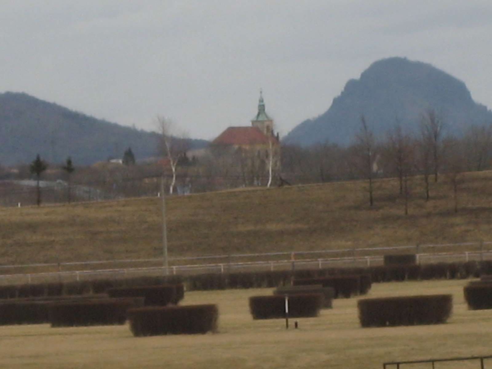
This short walk begins at East Boldon metro station where we got off the train. Immediately out of the station turn right on Station Road, cross over and walk down Cleadon Lane.  At the end turn right onto Boldon Lane and continue to the village of Cleadon. Across the road from the village pond and heading north is Sunniside Lane and after about threequarters of a mile a signpost on the right hand side points you towards Cleadon Hills. Follow the footpath to the top of the hill, unmistakeable as the tower of a windmill sits there, no sails, just a tower.

The windmill on Cleadon Hill.


The view from here is breathtaking. North to Tynemouth Priory and castle, west to Newcastle with St. James' Park** clearly visible, south west towards Consett and south to Sunderland, the Stadium of light also clearly seen.
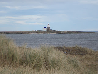
The footpath going south east towards Whitburn is "Bede's Way", some imaginative person possibly claiming this is the route followed by the Venerable author on his way from St. Peter's in Monkwearmouth to St. Paul's in Jarrow. The path, quite rightly, goes round the edges of the fields to Wellands Farm and a road then takes you to Whitburn where we declared a Herbiespot sitting on a bench in warm February sunlight. The temperature in Durham reached 17.4 C today and it can't have been much cooler in Whitburn. After sandwiches we walked down to the parish church which was first built in the 11th century. Although the building was locked the tower offered evidence of Norman construction. I may well be wrong, I often am according to my wife, but this church does not appear to be dedicated to any saint.

Aconites in Whitburn.

The church does claim to have a ship's bell taken from a Spanish galleon attempting to sail round Britain after the defeat of the Armada in 1588. And Lewis Carroll was inspired to write "The Walrus and the Carpenter" in Whitburn on a visit to his cousin. Furthemore George Farrow, member of the 1953 Blackpool FA Cup winning team came from Whitburn and at the time Blackpool were my team. I watched, as a nine year old, the "Matthew's Final " on a tiny TV, in black and white too.

From the church we walked across a park to the sea front and turned north on the coastal path, the same as the one in "Curry and Rice Pudding". Today there were more cormorants on the stack, some appeared to be nesting already.

Cormorants on a stack off the north east coast.

Walking up the coast we saw, as well as the cormorants, kittiwakes, redshanks, wagtails, pippits and a male sparrowhawk. Good day for the vogelmeister.
At Marsden we left the coastal path, crossed the road and found a footpath  near a caravan site that took us through Marsden Quarry, now a nature reserve, across a golf course and back to the windmill on Cleadon Hill from where we returned to the metro station along the route we had used in the morning.
Although not out in the hills this was a thoroughly enjoyable walk, thanks to the last government for its generosity with bus passes and metro gold cards.
The outdoors GPS claimed 9.92 mile, good old higear made it 10.3 and the pedophiles ASDA chunkies gave an average of 9.55. Dave measured it at 9.8 and my precision German Mapmeasuregefunkengeleit came in at 10. So 10 it was, on a warm February day.
* tardis. Dr. Who, childrens Scifi character on BBC tv travels in a tardis. Originally a policebox, used before radios and mobile phones, they were about 5 feet square but once inside Dr. Who's they become infinite.
**St. James Park. Home of Newcastle United FC . The club owner has renamed it Sports Direct Stadium but not many people seem to listen.


Sunday 26 February 2012


A gadgieman abroad  February 16th - 23rd.
Czech mates.
  In 1993 I was invited to take a party of sixth formers on an exchange visit to the mining town of Bilina, some 50 miles North West of Prague in the Czech Republic or Czechia as I prefer. Trusted with a dozen teenagers!
 I made friends with one of my counterparts in Czechia, Helena Patkova and over the past twenty years we have visited each other on about eight occasions. For the last three years I have gone to Bilina in February and in exchange for some hospitality have talked to children in Helena's school, the Bilina Gymnasium, and to her classes of miners who wish  to learn English. As a retired sums teacher I do my best. So instead of going out with the gadgies here is a brief account of what I did.
February 16th.
 Flew from Newcastle to Prague with Jet2.com, nice flight even if the plane had a henparty determined to drink the capital dry. The Czechs welcome our money but have reservations when it comes to the behaviour of some of our citizens.
I was met by Helena and her son in law Marian and taken to Bilina, a town I have come to like. I do not stay with the Patkovs as they only have a one bedroomed flat so I checked in as usual to The Lion Hotel. The rooms are clean the water in the shower is hot and the TV set shows Czech and German programmes.

The view from my hotel window. The castle in Bilina. More like a mansion or chateau.


The town square. The Lion Hotel is through the arch on the left, the tower is on the church originating in the 11th century. The building on the right is the library and the hill in the background is Boren, a nature reserve, the summit is about 550 metres of pleasant stroll with a terrific view of the area from the top.


After dinner at Helena's house I was invited to join her at choir practice. If you have read my Gadgie Ramble blog you will know I do not like to sing but I went anyway. I recognised some of the tunes the choir sang and, as it was one member's birthday, was invited to drink some wine and eat some home made cakes. Perhaps I should have joined a choir, too late now.
I returned to my hotel room quite early, noticed MASH was still being shown on TV, in German. The ipod is one of the world's great inventions, far more useful than the wheel.
Friday February 17th.
 Helena's teaching day began at 7am, mine at 9. I presented myself at the local gymnasium (grammar school) and was introduced to my first class.

The Gymnasium in Bilina, part of the Most Gymnasium. The school has about 250 students.


They listened politely as I talked about life in North East England, illustrated with a carefully prepared Powerpoint presentation, the first I had ever done!
The children seemed quite pleased that I had bought, and praised, a Skoda car, although I expect that given the chance they would opt for a BMW or Mercedes.
 Schools in England usually have uniforms, some heads become quite obsessive about it and the usual arguement is that uniform is a great leveller, without it children would attempt to outdo each other with stylish clothes. The students in Bilina, presumably in other Czech schools too, are not required to wear a uniform. Jeans and sweat shirts seemed to be the order of the day, they looked smart too and I saw no evidence of competition in style.


 Me at work in the Bilina Gymnasium.


Two lessons later I was invited to join staff at the school canteen for lunch. A fixed menu, soup, risotto with sauerkraut fruit juice and an apple. Not a chip or burger in sight, and nobody complained, not an overweight child in sight either!
After school I joined Helena on a shopping trip to the local Spar Supermarket. Not an enthusiastic shopper, nevertheless I looked at prices, as requested by my wife. With the exception of beer* and bread, prices seemed similar to ours, sadly wages are  not. I also noticed petrol was pretty much as expensive as it is in the UK.
In the evening, with two of Helena's friends we drove to the Jazz Club in Teplice, a town about 8 miles away. A folk/rock group from Prague were performing and although they sang in Czech I recognised the Everly Brothers ballad of teenage agony  Crying in the Rain, Procul Harum's  Whiter shade of Pale and a song by Elton John. The patter between songs went over my head but I enjoyed the evening and retired to watch an episode of MASH in German

February 18th, Saturday

 We were met by Marcella, friend of Helena and local librarian. Marcella had her dog with her too. We drove to a small village called Milesov, not too far away and walked up mountain called Milesovka, 837 metres high, ( 2745 feet) and higher than most English peaks.


Milesovka, the highest peak in Central Bohemia. On the summit is a meteorological station - and a small cafe.


Quickly donning my leather patched jacket I can tell you that this mountain was formed by volcanic action below the surface of the earth, causing an extrusion of basalt. There are a number of hills such as this in the area. Geologists may well want to correct me. Back to the gym in my tracksuit.
 Although the mountain looks steep the path zig zagged gently upwards through the snow, never more than about a 20 degree slope and as the path was well worn and  had markers the walk was quite easy. On the summit we had lunch and coffee in the small cafe, decorated mostly with an assortment of firearms.


Milesovka cafe, Helena on the left, Marcela on the right, dog under the table.


Three intrepid climbers about to tackle Mount Milesovka, without sherpas too.


Back down the mountain, after a walk of about 5 miles according to old faithful Higear, we went to a country pub for a Czech lunch, which always includes beer. It was, of course, excellent.
Back in Bilina we said our farewells to Marcela and her dog, had a light tea and watched The Queen, starring Helen Mirren as Her Majesty. Afterwards.......MASH in German. Thank you Mr. Jobs for the ipod.

February 19th Sunday
 We went to Helena's brother's house nearby in Bilina. Merek and his wife Hannah took us to Most, another mining town nearby.
Most was built near an existing village in the sixties as a centre for the mining industry. It consists mainly of blocks of apartments with a well laid out centre. Many of the blocks have been painted pastel colours since the revolution and the effect is quite pleasing. The most interesting building in Most is the church. Quite old and large it was in the way of the mine so it had its tower removed, was put on rollers and taken out of the way. On its new site, with tower replaced, it is not correctly alligned for a Christian church so I am told, and as I didn't have a compass with me I accept this. I ask  scouts and guides not to tell me to point the hour hand of my watch at the sun and divide the angle between hands to find north, let me tell you it was a cloudy day. Quite close by is another church, built completely of wood and belonging to the Ukrainian Orthodox Church.  It is quite new so presumably points the right way.
 We paid a visit to the towns race course, sadly there was no meeting. Unlike English courses it was perfectly oval. It was built on reclaimed mine land. Much reclaimed land has been planted with trees, in one area vines. So successful is the reclaimining that deer and wild boar have returned.


Most race course. Movable church and Boren in the background.


After  lunch in another pleasant Czech pub we returned to Mereks for coffee and cake.


Lunch in the Asas bar and restaurant.
Me, Helena, Hannah and Merek.


In the evening we went, with Marcela, to the cinema in Usti to see Hugo. A very enjoyable family film with a strong English cast. Sir Ben Kingsley, Christopher Lee, Richard Griffiths, Frances de la Tour and Jude Law.
Usti nan Lebem is at the point where the River Labem (The Elbe) is joined by the Bilina river. An industrial town with a new shopping centre and cinema complex it also has an interesting church. In World War II an American bomb missed the church but exploded nearby, causing the church tower to lean slightly, it is the building with the largest tilt north of the alps. I would print a picture but if you have read  "Curry and Rice Pudding" you know that in my photograph it would be vertical.


February 20th  Monday
If you have never been to Prague, make the effort and go. One of Europe's most  beautiful cities, sitting astride the Vlatava it has so much to offer.I have been several times and wandered through most of the four towns that make up the city centre. Today we visited the castle to see  an exhibition of artefacts lent by the Russians. "The court of the Tsar under the Romanov Dynasty". The display included gold and silver plates and bowls, horse harness and some kaftans worn by the Tsar in the early 17th century. An interesting account of choosing the Tsarina too: take 100 young, healthy and pretty maidens, whittle them down to 10 and let his majesty choose. And the Tsarevitch when he arrives ? Keep him in luxury but out of the public eye until he is about 15.
I walked round the courtyards outside St Vitus' cathedral and then we headed down to Mala Strana for lunch.


St. Vitus' Cathedral, Prague.


No visit to Prague is complete without crossing the Charle's Bridge and rubbing the statue, so we did. My friend Ian Lennox has recently published another novel, The Net,** a crime thriller with a soccer background. At one point a character in the book aattempts to shoot a Russian oligarch from the Charle's Bridge. I think I found the exact spot.


On the Charle's Bridge. St Vitus Cathedral and Prague castle in the background.


We went to the old town square in search of a T shirt with Hasek, the Good Soldier Svejk or Franz Kafka on it but there was very little choice, just the usual tourist ones. In Wenceslas Square we visited the Palace of Books which sell books in nearly every European language. Puts Waterstones to shame !
After coffee and cake in a small French cafe we caught "The Hungaria" back to Usti. It is strange for an island dweller  travelling on a train that is crossing several countries. This one was going from Budapest to Berlin. Should you catch it the drinks trolley and restaurant car only take Euros.

Hungry Helen on the Hungaria.

February 22nd  Tuesday

It had been -6 degrees overnight. Amazingly buses were running, trains were on time and the schools were open. It was the day of my trip to the mine!
This is the third visit to the Bilina mine. On my first trip I was taken round the huge surface mine. To give my readers some idea of its size the coal face is 7 kilometres long, a number of 3000 ton rotating coal cutters work round the clock to remove coal. It is put on to conveyor belts with a total lenght of 70 kilometres and moved to the washing plant. Once cleaned 80% is used in the nearby electricity plant, 10% is used for domestic heating and the rest goes to Germany. The mine digs out 25 million tons a year. The Shotton Colliery, an opencast site near Cramlington, delivers 2 million tons a year. The Bilina power plant, when complete will deliver 660 megawatts from its French machinery.
Today I was taken round the computer controlled washing plant which separates coal by quality, washes it with water from the Elbe, which is then filtered clean, and delivers the clean coal to the power station or the waiting trains and trucks.
Dressed in protective clothing we were shown round by George, a gentleman I have met before and very knowledgeable on the mine and its workings.
A distant view of the power plant.


Happy and Dopey prepare to go down the mine.
My reward for getting dirty being shown round this huge plant was lunch in the company canteen. I always think you should at least try the local dishes when abroad so I opted for  pork and potato dumplings. Delicious, just what a hard working miner needs. The company allows pensioners to eat in the subsidised canteen. The company allows its workers to follow a programme of education too, which is why I am here, conversational English.
 I spent the afternoon talking to the miners about life in North East England, using my Powerpoint presentation. I had met some of the miners last year and, thanks to Helena their teacher, their English had improved. One of them, Peter had been a Chelsea fan when I first met him last year. He now follows "the toon"*** and watches them regularly on TV. (In most foreign countries you can take your pick of English Premier League games on a Saturday)
My class were interested in other aspects of British life. Pensions and health care in particular  but also the EU and I hope I managed to answer all their questions well. I got the impressioin that this group had very strong reservations regarding their country joining the Euro. They feared it would lead to a rise in prices as apparently it has in neighbouring Slovakia.


                                      One of the classes of miners.
After tea we went to see Blanka and Marian, Helena's daughter and son in law, for tea and cakes and followed that with a rail trip to Teplice to see the film Safe House.
Not really my sort of film but it illustrates what safe cars BMWs are. Riddled with bullets, crashed into, crossed traffic lanes, they drive on and all you get is a scratch.

February 24th Wednesday.
My hostess was occupied this morning so I was left to amuse myself. Rather than watch MASH in German I went for a walk round Bilina. The town has a park that probably looks great in spring and summer but a bit drab on a February morning. There is a spa building in the park, sadly unused as it is a handsome structure. There were quite a lot of Mallard Ducks on the river and some cormorants too.

                                              The Bilina Spa.
In the afternoon I had another lesson with the miners. This time the group were beginners so I had to work a little harder, but still enjoyed it.
In the evening we watched The Young Victoria.  I need to brush up my 19th century history. I remembered Melbourne and Peel, but, apart from  the latter inventing "bobbies", couldn't remember their politics.

February 24th  Thursday.
Up fairly early, packed, washed and scrubbed, I was taken to Prague airport and by 4pm was back home. On the approach to Newcastle Airport the plane flew over Blyth, I could see our street in Cramlington and could pick out the huge earth statue Northumbria, built from the spoil taken out of Shotton open cast. How my miners laughed when I told them about her.

Book of the blog: The Good Soldier Svejk by Jaroslav Hasek. The hilarious adventures of the non too enthusiastic Czech  called up to the Austrian Imperial Army in World War I 
or 
Munich Appeasement  by Neville Chamberlain. A beautiful young lady is betrayed by an older man. After years of abuse by various cruel masters she finally finds her freedom.

* Czech beer is mostly a light coloured lager type, but unlike the insipid lagers brewed in the UK it has taste and strength and several hundred varieties. The best, according to my friends is Pilsner Urquwell, but we all have different tastes. There must be an awful lot of small breweries in the country and when I have finished my book on Cumbrian Gate Fastenings I shall write a dictionary of Czech beer which wouild of course, mean having to sample them.
** The Net  by Ian Lennox. The author's third novel                                            ISBN number978-0-9546359-2-3  Gordon Libert Publishing.
***Newcastle United FC


Saturday 25 February 2012

Curry and Rice Pudding; along the coast from Sunderland to Shields, February 24th.
I have a very understanding wife. Yesterday I returned from a week in the Czech Republic, leaving her to cope, and today I am off on a Gadgie walk. On the other hand perhaps sheis just glad to see the back of me.
 Today there are a record number of gadgies out - 9, a nonagadge. The usual six plus Alan Lauder (FTA), guest Roy Eden and a happy return for Herbie. This walk is so straightforward I am not including map references but should you require maps Explorer 308 (Durham and Sunderland) and 316  (Newcastle upon Tyne)
We met at the Haymarket Metro Station and caught the metro to St. Peter's, a stop before crossing the River Wear and entering true Makem land.
Crossing the road outside the station we made for St. Peter's Church, one of the oldest in England, built in 678AD by Benet Biscop with the aid of a grant from Coelfrith, king of the Saxon kingdom. Amongst its alumni was the Venerable Bede who joined at the age of seven but at thirteen moved to the monastery at Jarrow where he wrote a history of the church of England.
 A gentleman gave us an interesting tour of the church, including the tower, the only remaining part of the original building. He told us that St. Cuthbert himself had passed through the tower, we were walking in the footsteps of the greats. Like the monastery on Holy Island St. Peter's was knocked about a bit by the vikings, rebuilt in the 11th century and ruined again in the "delusions" (sic)* of the monasteries in Henry VIII's time.
The slightly leaning tower of Peters. The original tower consisted of the two lower sections only. There are carvings of herons on the entrance making it a proper gadgie walk. The rest of the building is Victorian, badly damaged in 1984 but beautifully restored. Many Americans bring their "ancestors" (sic) to visit the church.*


Leaving the church we walked to the National Glass Centre and stopped for refreshment. I had coffee, a teacake and the cream from Harry the routemeister's scone.
Some of us went to watch a demonstration of glassblowing, it was very interesting and the gentleman produced a very nice vase.
 Moving on we walked along the promenade by the Wear, past the marina and some anglers before we hit the coast and headed north. The walk passes Roker, close to the old Sunderland Football ground which they used before moving to the Stadium of Light. It is now a housing estate but on a cold Saturday afternoon when the sea fret rolls in you can still hear a ghostly "Roker Roar".
This part of the coast is interesting for geologists. The first archaegeologvogelmeister pointed out were the "cannon balls" naturally formed spheres of some type of limestone, although I stand to be corrected here.
Beyond Whitburn there is a rifle range so be careful if the red flag is flying and walk inland and round it. Shortly afterwards the next point of interest is Souter Lighthouse, now owned by the National Trust.
Souter Lighthouse, National Trust property.


The next stretch of coast is also interesting, although slowly crumbling. Offshore is Marsden Rock, once the home of families who cut rooms from the relatively soft limestone, Its sea arch has gone, the cliffs and caves are also crumbling away. One of the stacks is home to a good number of cormorants but only four of the birds were visible today. Beyond these are the Leas**, grassed areas which as recently as 1965 was Marsden village, complete with pub, cooperative, Methodist chapel and of course, a pit. All gone, but the limekilns remain and fine examples they are too.


Limekilns at Marsden. Once served by the "Rattler" a railway that ran along the coast from South Shields.


The Great North Run from Newcastle to South Shields ends on the Leas, one half marathon from the start on the Town Moor. Beyond are the Bents recreation ground and park. Past the South Marine Park with its pond and childrens' railway, we turned onto Ocean Road and took in the smells of the curry houses that line one side, but did not stop. Instead we walked the length of the street, across the market to the Alum Ale House on the banks of the Tyne. Looking up river was the Ijmuiden ferry about to leave, and an oil rig being serviced. In the pub was a fine selection of real ales, I chose and enjoyed a couple of pints of Banks Best Bitter. Rested after the walk we strolled back down Ocean Road to the Asha Balti House and enjoyed a curry and several bottles of Cobra, plus a strange story from Harry about a TV show called Men Behaving Badly some tissues and rice pudding. Difficult to explain
Back down Ocean Road to the metro station and home. Nine happy gadgies

My old faithful Higear gave the walk 9.3 miles.
I forgot to switch on the battery booster so had no GPS reading
One of twoped Dave's ASDApeds opened and gave an incorrect reading, the other claimed 11.5 miles. He measured it as 10.1
The exagerometer also claimed 10 miles. Seems good enough to me. Good walk on a bright but breezy day.

* I don't want to offend the enthusiastic man who showed us round the church but I did enjoy these Malopropisms.
** Old English for meadow, pasture or arable land
I was not there but......   February 17th


Bacon, Birds and Brains


Friday 21st February 2012


The Blogmeister is away in Czechia1, so there are only 3 gadgies out on today’s walk, which in truth is more a bird watching expedition with the walk as an appendix.  However, in true gadgie style Dave, Harry and Brian met at the Haymarket Bus station to take the No.518 to Amble.


Amble is a small seaport on the Northumberland coast lying at the mouth of the River Coquet.  The town sign includes the words “The Friendliest Port”2.


The first “port of call” was a cafe for tea and bacon bun.  It was perhaps not the best cafe in Amble but the sandwich was fine and the lady who served us was welcoming and particularly helpful to a lady with impaired vision.

Coquet Island


We walked from here down onto the harbour and were rewarded with a close view of some Eider ducks – the drakes have particularly fine colours in their plumage.  The route then walk turns south over some dunes and onto the beach.  About a mile off the coast lies Coquet Island which is an RSPB reserve and home to the rarest of our nesting seabirds, the Roseate Tern.


Our bird watching destination is Hauxley Nature Reserve about 1½ miles down the coast and to get there you have to go through the very attractive village of Low Hauxley.  The Low Hauxley Reserve is part of the former Radcliffe open cast coal mine, which was landscaped to produce a lake with islands. It is managed by the Northumberland Wildlife Trust3.  The reception hide was burned down in 2010 but will be replaced and upgraded in the autumn of 2012.

The original reception hut/hide at Hauxley.


After a bit crack* with the warden we lunched and spent an hour or so in the Wader Hide. Top spots of the day were Red Breasted Mergansers, a Goosander and Goldeneye along with many other colourful species. 

Goosander.

There are several hides around the lake and we visited each of them.  At the last there was a heron so it must indeed have been a real walk.  Time was beginning to become a bit pressing so we returned to the beach and headed at some speed with good walking on solid sand.  After a couple of miles we turned inland thinking the day was over.  However there was one more birding treat in store.  Walking up the track towards Widdrington we passed the ruin of Chibburn Preceptory, a house of the Knights of St. John of Jerusalem, and spotted what was generally agreed to be a Short Eared Owl (maybe a Long Eared Owl).  Short Eared Owls are quite numerous this year on the eastern coast because of the mildish winter in Britain compared with mainland Europe.  Dave and Harry also saw a bird of prey but because of the fading light were unable to identify it.


The walk ended at the Widdrington Inn where the gadgies enjoyed pint of Brains4 beer before taking the bus back to Newcastle.


With no Ben or Mike today, Dave’s pedometers ruled supreme and with both hips recording the same distance of just under 8.5 miles we settled for that.


1  Is the preferred name for the Czech Republic by a number of its people.

2  For further explanation http://en.wikipedia.org/wiki/Amble

3  You can join the Trust or make a donation at http://www.nwt.org.uk

*"a bit crack" north eastern dialect for friendly conversation

The editor writes;
Many thanks Brian, this could well encourage others to submit their notes when I am away. The three pictures are somewhere in the ether, I will try and catch them with a Higgs boson and put them in their places.


Saturday 11 February 2012

On the Beach                         (February 10th)
is a novel by Nevil Shute, set in a post apocalyptic world. It was made into a film starring Gregory Peck who played the captain of an American submarine. He also starred in Moby Dick as Captain Ahab and went down  with the whale that attacked his ship.* I don't think I would go to sea with Gregory Peck, he seems doomed as a sailor although he was excellent as lawyer Atticus Finch in To Kill a Mockingbird. Pub quiz question: Who played Boo Radley in that film?**
 Because of the poor weather the planned walk to the Schill in the Cheviots was postponed and instead we opted for a beach walk with the promise of not only beer but fish and chips at the end.
 We started the walk in Craster. For those of you who like place names it comes from
crowe- caestre and means "the old fort inhabited by crows". There is some evidence of Roman occupation in the area, even though it is north of the wall. Today Craster is famous for Kippers.***
 To get to Craster from Newcastle, head north on the A1 and turn off just north of Alnwick, follow several minor roads signposted Howick, Craster, Dunstan and hopefully you will find your way. There is a car park next to the Tourist Information Centre, a mere £2 for the day.
There is no real need for a map for this walk but should you need one Craster car park is at GR256198 on LR 75 Berwick upon Tweed and surrounding area.
Turn left out of the car park and follow the village street past the harbour. Ahead of you across a couple of fields is the ruin of Dunstanburgh Castle.

Dustanburgh Castle from the south, and on a grey day.


This magnificent castle was started in 1313 by Earl Thomas of Lancaster. Sadly he was executed in 1322 and never saw the finished building which was later completed by John of Gaunt the kingmaker who left his horse shoe at the junction of Penny Street and Market Street  in Lancaster. It is still there.
Dunstanburgh means the "fortress on a rocky hill". The site is the largest of the northern castles and came complete with moat, fishponds and a small harbour. As a castle it was not a great success, more a symbol of power and it fell into decay. By 1538 it was descibed as " a very reunynus howsse of small strength".   Today it is a Grade 1 listed building, property of the National Trust and best visited in summer.
Walking on the path on the west side of the castle you can see the remains of the fishponds; they are not very interesting.
Just north of the castle is Embleton Golf Club so watch out for men resting their balls on a tee before they drive off and wish you too had a Rolls Royce.
 Also in this area is a geological phenomenon of considerable interest, enough to make you reach for the Geography teacher's leather patched jacket. It is a fine example of an anticline, part of the Whin Sill that stretches across northern England.


An anticline, also on a grey day.


For the next part of the walk, take the beach and stroll across Embleton Bay. Northumberland has some of the most beautiful beaches in Britain. If we lived in sunnier climes the bays would be lined with hotels and the beaches would have neat rows of sun-loungers. There are some advantages to our northern climate.
At the north end of Embleton Bay is the coastal village of Low Newton by the Sea. There is a good pub, the Ship but we opted to walk to the National Trust bird hide on Low Newton pond for a Herbiespot.
Brian explained that he had been to Holywell Pond recently where the small island was being extended to encourage more Terns to colonise it.  After all, one good tern desreves another. Terns are very seasonal I answered, in fact to every season Tern, Tern, Tern.
There were few birds on the pond, a heron flew over and a small flock of greylag geese circled but, in spite of the reeds, not a bittern in sight.
Lunch over we resumed the walk. A footpath on the rightn hand side of the village road leads across fields and eventually back to the beach on Beadnell Bay, even larger than Embleton. About half way across the bay the wonderfully named Long Nanny Burn runs into the sea. Take care, sometimes the water is shallow enough to walk across but today it was quite deep and we had to walk a short distance inland to the footbridge. A man was windsurfing in the bay, it looked amazing as he leaped waves, twisted and turned in the air and generally had a good time. Braver than me, and probably much younger. The other thing of interest was the large number of Sanderlings on the waterline, their little clockwork legs working overtime as they searched for food on a cold day.
 Approaching Beadnell the outstanding feature of the small harbour is the disused lime kilns, not as good as the ones on Holy Island but at least I remembered to take a picture this time.

Beadnell Lime Kilns, a useful Herbiespot on other occasions.


Follow the road through Beadnell, keeping the sea on your right and shortly after the Post Office and General Store return to the beach. The vogelmeister was pleased to point out to us the ringed plovers, bar tailed godwits and more sanderlings. There were also a few eider ducks.

Seahouses is a small town very popular as a day out for north east families. It has several pubs, fish and chip shops, gift shops and is the centre for trips out to the Farne Islands a nature reserve teeming with seabirds and home to seals too. Most of the boats are run by Billy Shiels whom I always thought was the man "who is going to sing a song" on the opening track of Sargeant Pepper's Lonely Hearts Club Band  until I read the lyrics.
We chose the  Olde Ship Hotel for a drink. A lovely, friendly  old fashioned pub with several rooms instead of the one large drinking area favoured by modern breweries. And the pub had a good selection of real ale.I opted for Farne Island Bitter, a great pint.


The street in Seahouses that leads down to the harbour and Billy Sheills boats. The Ship pub is on the right.


After drinks we visited one of the fish and chip restaurants and enjoyed a traditional English meal; cod, chips, bread and butter and tea.
And to round off the day we caught a bus back to Craster. A true gadgie walk using bus passes.

Higear gave a distance of 10.58 miles, two ped Dave averaged at 9.55 miles, the Benbragometer gave a distance of 11.2 miles and OutdoorGPS behaved well today, claiming 10.94 miles and it drew a map. No flying visits to foreign parts on this walk.
Not a long way on a flat walk but walking on sand can be hard going.

* An additional service I have introduced; Book of the Blog.
Today's book is In the Heart of the Sea by Nathaniel Philbrick. It is the true story of the American whaling ship attacked by a giant whale which inspired Herman Melville to
write Moby Dick.
** Robert Duval

*** Kippers, for my foreign readers unfamiliar with peculuiar English ways are smoked herring, often eaten for breakfast. Lots of bones and very tasty.

Saturday 4 February 2012

Across the Borderline.  February 3rd.
is an album and track by Willie Nelson, (Not the February 3rd bit).
Last week I had my "MOT" which consisted of a nurse weighing me, measuring my height, taking blood and asking questions about my drinking. As a result the Government has declared me overweight with a BMI of 27.7 Officialy a FAT PLODDER!
Today five FPs and an FTA are walking from Barrowburn  to Windy Gyle on the border with Scotland.
  To get to Barrowburn from Newcastle head north on the A1, turn onto the A697 at Morpeth, take the B6341 to Rothbury and about one mile after Thropton follow the minor road through Sharperton, Harbottle and Alwinton until you arrive at a car park and picnic site on the left hand side of the road.  There is an old building next to it which always looks closed. On OL16 the car park is at GR866104.
 Across the road a footbridge takes you over the River Coquet. This area is called Wedder Leap because years ago a labourer stole a "wedder" (sheep) and in an attempt to cross the river he stumbled, the weight of the wedder dragged him down and he drowned. It was that or a one way ticket to Australia.
Follow the footpath across the field and past the old school house, which is now a camping barn. Stay on the footpath which leads uphill until you reach a plantation. Inside the wood you have the choice of two paths. Take either, they join up later on.
Emerging from the wood and crossing a field pause to admire the view. Today the hills have a dusting of snow.

 Looking towards Usway Ford.


At the farm track there is a finger post. Take the track that heads almost due north between two plantations and stay on it until you reach a gate on the border fence. At the moment there is no need for  a  passport or other form of identification but if Alex Salmond has his way...
There is a finger post at this point, which is on the Pennine Way as well as the border.


On the border line.
Michael wears Regatta trousers (£13.99 from Great Outdoors market stall. Regatta jacket (£48 from Gaynors in Ambleside )and HiTec boots (£29.99) from Go Outdoors. Ben wears Meindl boots(a lot) Berghaus fleece (a lot) Rohan bags (£55) and Rohan sun glasses. This man has class, but he still speaks to us. The shadow by Michael's right foot is Harry the photographer, but he says he can clone it out
  Follow the Pennine Way in a south westerly direction and climb steadily on a paved path from Yorkshire wool mills. There are several cairns on the way up, originally used to mark the border, and a delightfully named spot called "Blair's Hole." Eventually you reach Russell's Cairn, a well established Herbiespot  on Windy Gyle. We stopped for lunch. My GPS said 5.6 miles, this is important.


Russell's Cairn on the border. Supposedly named for Lord Francis Russell, an Englishman, who was murdered in the area at a meeting with the Scot Thomas Ker in 1585. The trig point was added later.


Packing to leave Russell's Cairn


 Instead of pies I brought, at my wife's suggestion, some Quorn mini egg bites. They went down quite well, even with the carnivores. We chatted to a young Scot at the cairn, he was walking independently.
Near the top of Windy Gyle is a large block of porphry, named "Split the De'il" Nobody seems to know why, great name though, sounds like a Scottish folk dance.
 Leaving the cairn we followed the Pennine Way along the border west to Plea Knowe.  Normally at this point we gadgies turn south over Black Braes and back to Barrowburn. But it was a beautiful day, cold, crisp and bright, so we headed up to Mozie Law and on to Beefstand Hill, Lamb Hill  (Nice Names) and the Mountain Refuge hut. On the way we saw at least three flocks of the Cheviot feral goats, about twenty to a flock, and a lone group of three billy goats gruff,  looking for a troll, probably suffering from  BO and avoided by the rest.


Feral goats. Photo not taken today, and there were more.


  At the refuge I checked the distance on my Outdoors GPS App. We had now walked 23.5 miles, hard to believe but we gadgies are tough. This reading is important.
  From the hut the footpath, across Lauder grass, heads east. At the first fork take the left branch.  The path, heading east then south east crosses an area which is about to be forested and has lots of holes ready for the trees, until it comes to the farm at Carlcroft. Here we split, three of us opting for the road back alongside the river and three taking the bridle path back to Barrowburn. On the way we watched a dipper patrol his patch on the river and saw a heron, but generally it was quiet.
 Back at the car my GPS said 28.4 miles, my Higear ped said 14.9 and Ben's GPS said 14.8. Two ped Dave averaged 13.9 and he measured it at 14.3. Seems about right for a good walk out in perfect winter conditions. Quite good for Fat Plodders.
  On the way home we stopped at the ever welcoming Anglers Arms for beer or tea, one of these days we  will stop the night, have dinner and lots of beer. And breakfast.
When I got home I "drew" a map of the walk on my amazing but apparently faulty GPS App. For some reason I had shot off in a straight line from Russell's Cairn to a village called Lanton north west of Jedburgh and returned in a straight line to point on the path some hundred yards off the cairn. Not being able to collar a child to explain this I have decided that the young Scot must have had a similar device and that  he came from Lanton. The satellites got confused.
Great walk out though, and when I had erased the extra trip to Lanton from the walk, (yes you can!) it measured 14.1 miles. I'll settle for that.


Thursday 2 February 2012


Ancient and Modern - Tuesday February 1st
An archaeological outing.

This walk is a repeat of Alnham- gateway to the north  January 13th so I will not repeat the directions. The purpose of the day's walk was to make a greater effort to find Nellie Heron's memorial stone and also to look at various archaeological sites on the way. There are just the two of us out, me and vogel/archaeologistmeister Dave.
  We parked at Alnham church and had a look round the churchyard. Close to the gate are three Cross-bases, removed from roads and tracks in the parish, their actual original sites unknown, but one is a Grade II listed building. There is also a medieval earthwork in the churchyard, possibly the remains of a greater one that surrounded the church and neighbouring peel tower.
  The next stop was at Northfield Hill Iron Age settlement, almost 60 metres in diameter, surrounded by a turf covered earth bank and containing at least fifteen round houses, each about 8 metres in diameter.
 By now we were high enough to be walking on snow covered ground, the pools on the track were frozen, fortunately there was no wind so we were not too cold.
 Dave had got some information from a friend about the exact whereabouts of Nellie Heron's memorial stone and using this and the remains of a fence line the site proved quite easy to find, some hundred metres from the plot we had searched on the previous walk.


Eleanor (Nellie) Heron's memorial stone.  She died from exposure on 3rd December 1863. Walking home between Rothbury and Hartside in the Breamish Valley she was caught out in wintry conditions. She was not too far from Cobden which presumably had been a farm then, although now it is a ruin in a plantation.


              Dave standing at Nellie's stone. A lonely place to end one's life. A tragedy for Nellie, and her family. She and her husband John are buried in Whittingham Churchyard.


  The wonderful "Outdoors" App (£4.99 from Apple, national park maps included) told us that the site is at GRNT9789113429 and the map is OS 16 The Cheviot Hills) The information board at Alnham gives GRNT979136, quite a way out.
  Walking in an easterly direction we found the next site, Leafield Edge Deserted Village. Dating
from the 12th century the site is roughly 400 by 150 metres. There are three main groups of buildings, mostly rectangular foundations and banks surrounding gardens or small fields.  The village is on the edge of roughly 5 hectares of fields, ridges and furrows plainly visible. This site was finally abandoned in the 17th century and is a Scheduled Monument protected by law. A point in the centre is at GRNT9870113498. The magic of GPS!
 I have a soft spot for "Cobden Corner" our next stop. It is a familiar point on walks in this area. But being a romantic at heart I like it for the silly reason that I spent the first three years of married life on Cobden Road with my hardy annual (see Holy Island Jan 29th) But today we are looking for Cobden Syke Cairn. Originally discovered from an aeriel photograph it is 35 metres in diameter but only 1 metre high. There is a small cairn within the larger and both are edged with kerb stones. They are burial cairns, the smaller being older and they probably date from the Iron Age or Bronze age.  Forgot to take a Grid Reference reading!
  The next stop was Alnhamoor Farm, a favourite Herbiespot.     Sitting behind the wall for some protection from the cold we could plainly see Alnhamoor ruined farmstead next to the stream, building foundations and stone walled enclosures.  However the wall became shelter from another danger. As the first gunshots rang out a few grouse flew low over the wall and dived for cover although I do not think they were the targets as it is not grouse season. And I am sure a pellet hit the strand of wire above the wall.  Had I brought a walking pole I would have tied my handkerchief to it and waved it above the wall as a sign of surrender. The shooting eventually subsided and we stopped a passing mole catcher to ask what was meant to be caught in the traps placed on logs that were laid across the stream.
 "Nothing to do wi' me," he told us in a beautiful Scottish accent, "I'm here to catch the moles. The traps are set by gamekeepers to catch vermin, mainly stoats and weasels which take eggs and young grouse."
 Off he went on his quadbike, molehunting. How do you tell the difference between a stoat and a weasel? Weasels are easily identified and stoats are totally different.
  Lunch and shooting over we walked on. The next site was the deserted Medieval Settlement on Rowhope Burn   (GRNT9655415373)  The earthworks are scattered on either side of the burn and the site is probably the medieval village of Alnhamsheles. There are rectangular houses and walled gardens. Excavations carried out in 1983 on one of the houses found stone and clay walls, the 20 by 5 metre building was divided into three rooms, one of them probably a byre or barn. Pottery and coins  found at the time of excavation suggest the stone house was 14th or 15th century. The excavation of banks on the nearby field system found they were paved with large stones. The name Alnhamsheles suggests the settlement could have originally been a seasonal upland settlement for shepherds, which became a more permanent settlement. Another Scheduled Monument it fell out of use in the 16th century probably.
  And finally, for today, a Romano-British settlement. A large circular enclosure containing a smaller, roughly rectangular enclosure. Both enclosures have earth banks and two entrances and nearby is a circular house, 5 metres in diameter. This small settlement could have been home to a large family, with shelter for animals in bad weather. No direct dating has been made but similar sites belong to the Roman period.


Hillside in evening sunlight on a cold day.

 After this we walked back to the car, past Ewartly Shank and the delightfully named  Grey Yade of Coppath, a more romantic name than the rather dull building deserves.. We passed the Shepherd's Cairn and Castle Hill, saving them for another day.


And another, worthy of sending to Hannah Beyman at the BBC!


Back at the car we checked pedometers. Outdoor App said 10.28 miles, which included some wanderings on sites, but on at least one occasion I switched it off. Higear gave a generous 11.2 miles and Twoped Daves ASDA peds said 9.35 and 9.30 miles. The walk was measured at 10.3 so well done Outdoors.                                                                                                                      
A different sort of walk  but very enjoyable. I learned a lot and would shyly admit to being pretty good at spotting things. And thanks to Dave for supplying the notes.