Hadriana vallum ambulantes (Northumberland) October 27th.
Walking the wall is always a pleasure, at least to me, especially this bit in the middle of the 80 Roman mile structure that was northern boundary of the Empire. Built by Hadrian's legions in a few years, starting AD122, some of it has been lost beneath the B6318, some beneath the streets of Newcastle. But in between Northumberland and Cumbria much remains, not as high as originally built, and it has become a popular long distance path.
To reach the start take A69 west, find the B6318 and drive on to the reach the Sill, newly reopened visitor centre, conveniently placed next door to the Twice Brewed pub/brewery.
The map to use is OS OL Explorer 43, Hadrian's Wall. For fanatics the National Trust has a large scale map pinpointing all the milecastles, turrets and forts along the way.
Quinque ambulates out today, Brianus, Haraldic, Jovanus,me and Ben Hur, whose chariot we are using. (Thanks Brian) and we are starting the walk from The Sill after breakfast of tea/coffee/bacon. The car park is at GR NY752668.
 The Sill, there is a footpath that leads to the roof. Great views from the top. It was sunny when we arrived.............
 ..............and misty when we left the car park!
Leaving the car park we took the road south, after about half a mile turning left on the road to Vindolanda. On the left hand side of the road is the remaining stump of a Roman milestone, the first of many piles of stones we saw today.
 Remains of Roman milestone. This road is built over the Stanegate, once the road across the country built south of Hadrian's Wall.
And a little further along is one of the few thatched cottages in Northumberland.
 Thatched cottage on the way to Vindolanda.
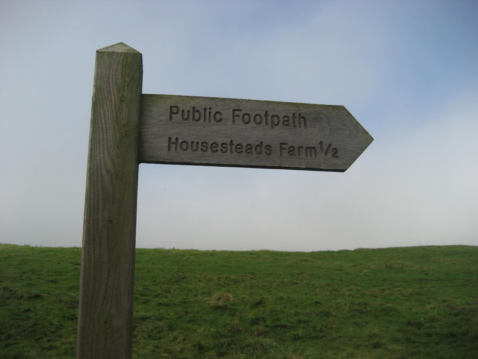
Built as a service fort for the wall, Vindolanda is one of the best excavated forts on or near the wall. Great museum, wonderful piles of stones so you can see where the barracks and granaries were. But not for us today.
 Vindolanda Fort.
A short way beyond the fort, on the left is a whole Roman milestone.
 Did they really need such a large milestone?
At the end of the road we turned left. At a road junction we turned right, having admired the limekiln of course.
 Limekiln
At mile 3 on the map we turned left on the farm track to East Crindledykes. At the end of the track, by the farm, we dutifully followed the footpath markers across fields towards the B6318, usually called the Military Road. Follow our route on the map, not the marked path, cross the stile and the road and take the metalled track that leads to the museum outside Housesteads Museum. If you want to go into the fort at Housesteads (Vercovicim) you need to buy a ticket. We walked uphill to a gate and were on the wall. Turning left we walked west, some of us on the wall itself, this section is the only one where people are allowed on the top of the wall.
 Remains of the west gate at Housesteads
 The wall heading west from Housesteads, not its original height. There is a footpath on the left.
At the 5 mile marker on the map we called a Herbie, sitting on rocks at the base of the wall. (I forgot to mark HS on the map)
 Herbie time. Two course dinner again, pork pie for mains and Lion bars, ginger biscuits and heavily seeded cake from Mrs A. Wall behind.
Lunch over we continued heading west on the Hadrian's Wall Path. At one point, not far from lunch the wall is crossed by the Pennine Way and for a short distance the two paths are as one. The mist was quite heavy, allowing some to recite the first few lines of Keats "Ode to Autumn", nobody could remember much more.
Beyond Hotbanks Farm the wall, and the path, climb high above Crag Lough. This section is my favourite stretch of the wall. High above the water, which usually has a pair of swans at least, the wall has gone but the views north are so well worth viewing you need to watch your step as the path has a very steep edge going down to the lough.
 Milecastle 38, with a gate on the north wall.
 Season of mists and mellow fruitfulness....................
 Crag Lough from east of Hotbanks
 Looking down on the lough.
Beyond the lough there are several steep descents, followed immediately by steep ascents. The most famous of these dips is "Sycamore Gap" because it appeared in the film Robin Hood, Prince of Thieves, along with Kevin Costner and Morgan Freeman.
From the crag above the final of these descents on our walk there is a view of a turret. With a few exceptions all the turrets, or their sites, on the wall are numbered. For example turrets 37A and 37B are between milecastles 37 and 38.
This one is not numbered, possibly built as extra protection on a vulnerable part of the wall which is in a dip here.
 The turret with no name, and some of the many walkers out today.
We took a footpath across a field and turned down the road back to the Sill, and more important the Twice Brewed pub and micro brewery. We did have a good look round the Sill first, café, gift shop(!) and YHA. I have my doubts about the architecture but what do I know.

 Twice Brewed: The pub had Sycamore Gap, Vindolanda Pale and Twice Brewed bitter on offer, plus something called Kaffir Lime Leaf. The bitter was in fine form, so I had two.
This walk is a bit shorter than our usual expeditions, apart from the short steep climbs on the wall itself it is easy going too, and there are plenty of piles of stones.
MATRIX MMXVII Z to the n+4
steps miles
NAK 14993 6.15 too few, too short
iPhone 18569 8
OUTDOOR GPS 7.84
No Dave today, and I forgot what Brian and Ben said.
 Contains OS Data, copyright. Crown copyright and database right 2017
And a few more pictures
 Crag Lough. I took this picture two weeks ago, in the sunshine


Walking the wall is always a pleasure, at least to me, especially this bit in the middle of the 80 Roman mile structure that was northern boundary of the Empire. Built by Hadrian's legions in a few years, starting AD122, some of it has been lost beneath the B6318, some beneath the streets of Newcastle. But in between Northumberland and Cumbria much remains, not as high as originally built, and it has become a popular long distance path.
To reach the start take A69 west, find the B6318 and drive on to the reach the Sill, newly reopened visitor centre, conveniently placed next door to the Twice Brewed pub/brewery.
The map to use is OS OL Explorer 43, Hadrian's Wall. For fanatics the National Trust has a large scale map pinpointing all the milecastles, turrets and forts along the way.
Quinque ambulates out today, Brianus, Haraldic, Jovanus,me and Ben Hur, whose chariot we are using. (Thanks Brian) and we are starting the walk from The Sill after breakfast of tea/coffee/bacon. The car park is at GR NY752668.


Leaving the car park we took the road south, after about half a mile turning left on the road to Vindolanda. On the left hand side of the road is the remaining stump of a Roman milestone, the first of many piles of stones we saw today.

And a little further along is one of the few thatched cottages in Northumberland.

Built as a service fort for the wall, Vindolanda is one of the best excavated forts on or near the wall. Great museum, wonderful piles of stones so you can see where the barracks and granaries were. But not for us today.

A short way beyond the fort, on the left is a whole Roman milestone.

At the end of the road we turned left. At a road junction we turned right, having admired the limekiln of course.

At mile 3 on the map we turned left on the farm track to East Crindledykes. At the end of the track, by the farm, we dutifully followed the footpath markers across fields towards the B6318, usually called the Military Road. Follow our route on the map, not the marked path, cross the stile and the road and take the metalled track that leads to the museum outside Housesteads Museum. If you want to go into the fort at Housesteads (Vercovicim) you need to buy a ticket. We walked uphill to a gate and were on the wall. Turning left we walked west, some of us on the wall itself, this section is the only one where people are allowed on the top of the wall.


At the 5 mile marker on the map we called a Herbie, sitting on rocks at the base of the wall. (I forgot to mark HS on the map)

Lunch over we continued heading west on the Hadrian's Wall Path. At one point, not far from lunch the wall is crossed by the Pennine Way and for a short distance the two paths are as one. The mist was quite heavy, allowing some to recite the first few lines of Keats "Ode to Autumn", nobody could remember much more.
Beyond Hotbanks Farm the wall, and the path, climb high above Crag Lough. This section is my favourite stretch of the wall. High above the water, which usually has a pair of swans at least, the wall has gone but the views north are so well worth viewing you need to watch your step as the path has a very steep edge going down to the lough.


Beyond the lough there are several steep descents, followed immediately by steep ascents. The most famous of these dips is "Sycamore Gap" because it appeared in the film Robin Hood, Prince of Thieves, along with Kevin Costner and Morgan Freeman.
From the crag above the final of these descents on our walk there is a view of a turret. With a few exceptions all the turrets, or their sites, on the wall are numbered. For example turrets 37A and 37B are between milecastles 37 and 38.
This one is not numbered, possibly built as extra protection on a vulnerable part of the wall which is in a dip here.

We took a footpath across a field and turned down the road back to the Sill, and more important the Twice Brewed pub and micro brewery. We did have a good look round the Sill first, café, gift shop(!) and YHA. I have my doubts about the architecture but what do I know.


This walk is a bit shorter than our usual expeditions, apart from the short steep climbs on the wall itself it is easy going too, and there are plenty of piles of stones.
MATRIX MMXVII Z to the n+4
steps miles
NAK 14993 6.15 too few, too short
iPhone 18569 8
OUTDOOR GPS 7.84
No Dave today, and I forgot what Brian and Ben said.

And a few more pictures