Translate

Saturday 29 May 2021

 Longhoughton, Craster and Howick. (Northumberland) May 28 th

 On the first dry and warm day of May, or so it seems, five of us are repeating a John Clarke walk that has not been done for a couple of years. It follows a route by the coast and in the country, starting at the village of Longhoughton in Northumberland. To get to the start either follow the Northumberland Coast route on the A189, the scenic route, or take the A1 to Alnwick and head east.

The five are; Harry, Dave, Brian, Margaret and me.

The walk is covered by OS Explorer 332 Alnwick and Amble.


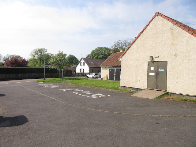
Two views of the car park at Longhoughton. Not the prettiest but free. It is behind the village hall which used to be the local store and NAAFI for the nearby Boulmer RAF base.
We left the car park and turned left but then just as quickly turned left again and walked towards the farm at Low Steads. Beyond the farm is a small parking area but we turned through a gate on the left at the farm and walked across fields of crops to join the coastal path.
Heading north we were soon at Sugar Sands, noted for the fresh water spring that enters the North Sea here. Considering the amount of rain that has fallen recently it was a surprise to find the spring a mere trickle.


             Top the beach at Howdiemont Sands and bottom the mysterious spring is somewhere here at Sugar Sands.
Walking north we past Iron Scars, Howick Haven, Rumbling Kern and other delightfully named places. At Cullernose Point we paused to watch the Kittiwakes nesting on the cliff, no chicks visible yet though.


                           Kittiwakes kingdom
Continuing north we soon reached Craster village and called a Herbie, making comfortable use of a couple of benches overlooking the harbour. Today's sharing was apple pies, almond slices, savoury cake and sweet cake from Mrs A.


                           Craster Harbour and a memorial plaque
Herbie time over we continued north towards Dunstanburgh Castle but before we reached it turned left across a field to walk behind the Heughs back to Craster.


                     Dunstanburgh and the Heughs.
The path behind the heughs arrives in Craster at the visitor centre, closed at the moment because of you know what. From there we took the footpath through woodland before crossing fields to Craster South Farm. More fields and a footpath to the car park at Howick Hall. From here we followed the road south for a short distance before entering Greenseat Wood and taking the footpath across fields and in front of Howick Hall. Part of the footpath is a concrete strip, laid across a meadow.
                                 Sheep safely grazing in the shade

                 Howick Hall, home of the Grey family of tea and reform.
The footpath reaches Howick Grange and after a short walk on the drive we were on a road, turned right and soon turned left through a gate. The footpath is not marked but follows the edges of a couple of fields, a short strip of woodland and back to Longhoughton.

                            Contains OS data, copyright. Crown copyright and database right 2021.
The walk is about 9,5 miles, easy going and considering recent rain, mud free.


Wednesday 19 May 2021

 Back to Blagdon. (Northumberland ) May 18th.

 Today's walk is almost a repeat of one of our recent ones round Blagdon Estate and Plessey Woods.

The walk starts in Stannington, a few miles north of Newcastle and just off the A1. The map to use is     OS Explorer 316 Newcastle upon Tyne but it is not essential.

There are three of us for this midweek extra: Me, Brian and Margaret.


                  The large and free car park in Stannington, next to the Ridley Arms and in front of the village hall.

Next to the village hall at the back of the car park is a footpath that took us straight to the A1, busy dual carriageway. There is a crossing of sorts, marked with bubbly paving and "Look Right" or "Look Left" signs but the road is busy and the traffic is fast moving. Cross with care.

Once safely over we took a short footpath to a tarmac minor road /farm track, turned right and walked a short distance before turning left on the track to Briery  Hill Farm. At the farm we followed the footpath across fields alongside the River Blyth Valley until we came to a style taking us into Plessey Woods.

We took the paths to the visitor centre, unfortunately it was closed.

                             Into Plessey Woods
                                             One of several works of art
                                     Plessey Woods visitor centre, closed today.
We retraced our steps from the centre to the sign pointing us down steps to the riverside walk. The woods were filled with garlic and bluebells, nice English sight on a sunny day. A large log by the riverside made a reasonably comfy Herbie spot overlooking the water which supported a pair of mallards and a single solitary wagtail.


            Herbie time with garlic; Titans, savoury muffins and almond tarts.
The Herbie spot was close to the A1. Once we had crossed again we walked south for a few hundred yards and entered the Blagdon Estate at the New Kennels. The tracks through the estate are all firm and permitted routes are well marked, passing the Home Farm and the nicely named Bog House as well as being close to the old kennels, until we reached the Cheese Farm at Make me Rich.

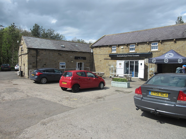
The Cheese Farm at Make me Rich. Sadly closed but takeaways were allowed so we sat in the sun with coffee and cheese scones.
  After the break we followed the farm track to the next road and turned right towards Bellasis Bridge.


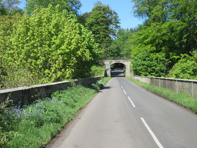
                     Heading for Bellasis Bridge
          Bellasis Bridge, Hump backed, narrow with poor visibility. Cyclists take care! I always do.
Over the bridge we took the footpath on the right which took us on the edges of several fields to Bellasis Farm, and through woods. The tracks were slippy, it has been raining recently. 
                 The paths through the estate are well marked.
Leaving the woods we walked across several fields to the old A1 road, now a lay by, turned left and finished the walk at the Ridley Arms where we met Margaret's sister and her husband for a drink. Pubs have reopened for drinking inside but we sat in the sun with a couple of pints of Farne Island or Anarchy Blonde.

Contains OS data, Copyright. Crown copyright and database right 2021.

The walk is about 9.5 miles. easy going, very little climbing and some very pretty woodland.


Saturday 15 May 2021

Carey and Cold, a favourite walk. (Northumberland) May 14th 

The Carey Burn again, I love this walk, my favourite in  the lower parts of the Cheviots. It starts at Carey Burn bridge in the Harthope Valley. A1 north, A697, turn into Wooler, turn first left (Cheviot Street), take the right fork and turn right at sign for Langleeford. Off road parking by the Carey Burn  bridge.

Six of us out today: Harry, John Ha., Brian, Margaret, Dave and I. The forecast is for cloudy skies but dry

The map to use is OS OL 16 The Cheviot Hills.

Parking close to Carey Burn Bridge. The notice on the wall is to warn parkers that herds of animals pass this way and have been known to decorate cars.

Looking towards the Carey Burn Bridge. Just about visible is the finger post at the start of the walk. If you have an old OS map the path is not marked.

 Once through the gate we followed the footpath close to the burn. On our side of the path fields, over the stream steep cliffs that have been home to peregrine falcons. Nothing like that today but a pair of Mallards flew downstream. The path in places goes very close to the water, in places it is a very stony track, hard on the ankles and there are a couple of places where walkers meet a mini scramble. Too cold for adders to be out today but no rain to dampen clothes or spirits. Eventually, about a mile and a half in there is a gate into a wood, the sign reminding walkers to be careful of Higland cattle has been vandalised, probably by a teacher of English. 

                                    Waterfall on the Carey Burn

        John admires the Carey Burn 

Once over the stream the path continues over scrubland until it reaches a footbridge over the Broadstruther Burn. From this point the path turns a little before joining a farm track that goes to the old farm at Broadstruther where we called a Herbie, early perhaps but it's a tradition to eat here and it was well after noon.

            Broadstruther. Once a farm now a shelter dining room for shooters out after grouse starting August 12th.

                     Herbie time; Apple pies, chocolate cake from Mr Cadbury, chocolate biscuits from Mr Rington and savoury tart and cake from Mrs A

Early lunch over we set off and followed a farm track for a short distance before turning off onto a marked footpath going south. Eventually it joined a farm track and we came to a new gate.
In the absence of Ben the official gateman, Dave demonstrates his skills on a new-fangled fastening.
this point (marked 377 on OS map) we normally turn north east and take the straight path to the top of Cold Law but for a change we continued along the farm track, going downhill on a pebbled surface which can be tricky as at least one member of the team will tell you, The pebbles can be like ball bearings.
At approximately mile 4 we left the track and followed the narrow footpath down the side of Hawsen Burn. This valley is a home for Ring Ousels but none were visible today, nor were there adders.
The path goes down to the valley road at another parking area. We turned left and followed the valley road to the farm at Langlee. Here Dace, Brian and Margaret opted to cross the Harthope Burn and take the steep path up the hillside beyond the farm. From the top a track took them back to Coldgate Water  and a footpath back to the cars.

Harry John and I took the easier but not much shorter route back along the valley floor.
We all met within minutes and headed for the Cook and Barker at Newton on the Moor. The promised Timothy Taylor's was not available but they had a  blonde beer and Black Sheep on offer, plus tea or coffee for the drivers.

Contains OS data copyright. Crown copyright and database right 2021

The walk is about 7 pleasant and easy going miles even with the Langlee cut off.