Translate

Tuesday 27 April 2021

 Not a chase, more like a steady plod. (Northumberland) April 26

  Because of restrictions most walks this year have been local, fairly flat and even urban but today four of us are breaking out and walking a Gadgie classic from Langleeford in the Harthope Valley, across to the College Valley, up the Cheviot and down again.

To get to Langleeford :A1 north, A697, turn into Wooler, turn left on first street in Wooler (Cheviot St, very apt) take the right fork, turn right at the signpost for Langleeford and drive carefully for about four miles as the road is pitted with potholes.

There is parking on a grassed area just before the farm.

The walk is possible without a map but it is covered by OS OL 16 The Cheviot Hills.


Such a beautiful parking area I thought it deserved two photos. (It's free too, an added bonus)

Directly opposite the parking area is a narrow footpath which follows the north side of the Hawsen Burn. At one point the footpath joins a farm track but only for a short distance before leaving it on the left for more path, and then more track.

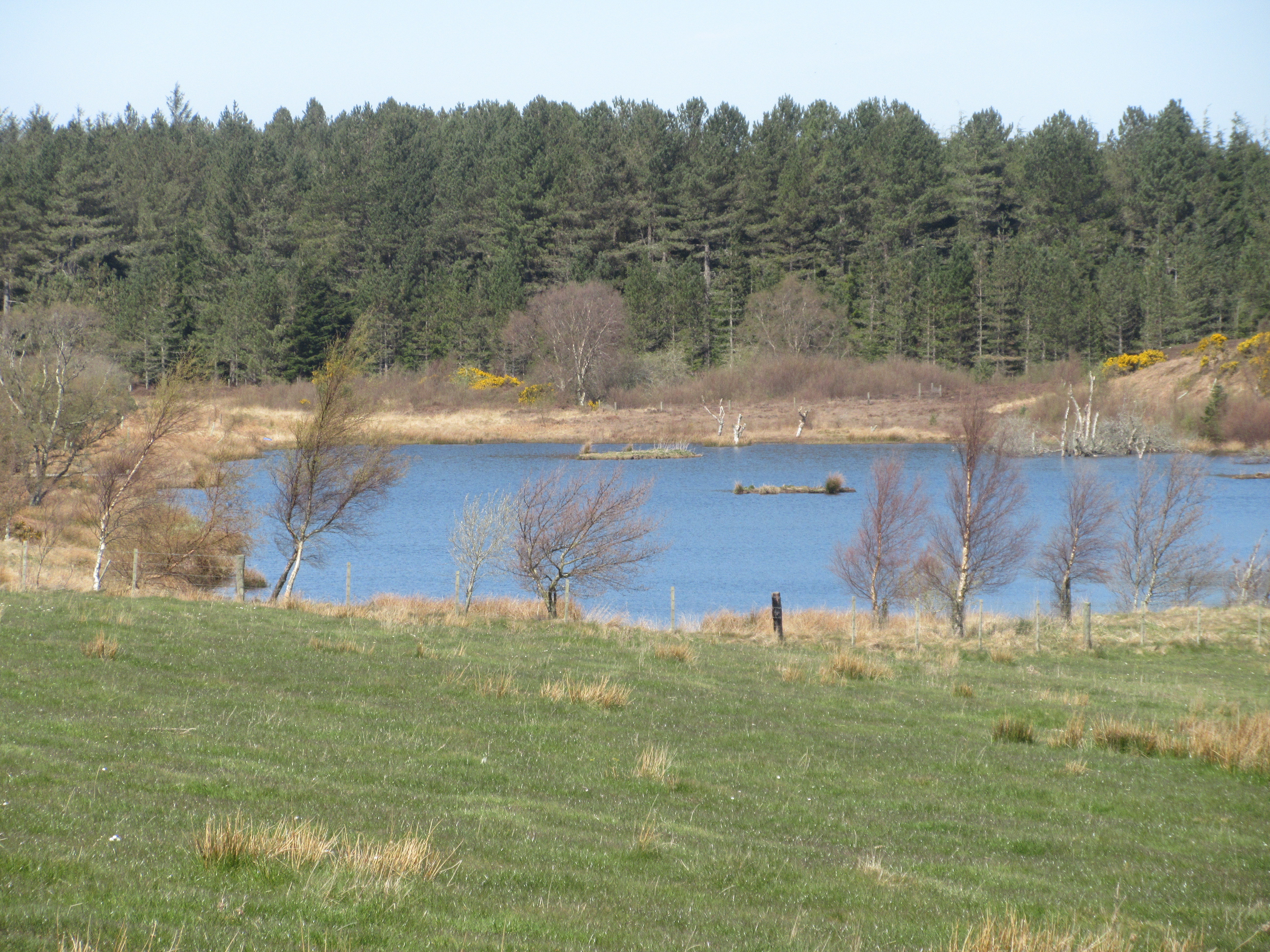
Looking back down Hawsen Burn with Langlee Crags on the far hillside.

Eventually the path comes to a fence, there is a stile  to cross, more path to walk and then a farm or forestry track. Turn right and walk the track. At one point there is a footpath on the left which goes through a wood. Several trees have been blown over making the path a bit of an assault course but once out of it the walking is easy to Goldscleugh Farm.

                              Assault course
                         Old Goldscleugh Farm house. There is a new one just round the corner.

                               Le Coq d'or.

From Goldscleugh the walk goes by road alongside the Lambden Burn to the next farm at Dunsdale which was declared a Herbie Spot.

                            Herbie time at Dunsdale : Racer bars, savoury tart and lemon cake from Mrs A.
                                  Dunsdale, a holiday let I think

                              But with some exciting looking farm machinery.

From Dunsdale the walk goes through the farmyard and across fields, very dry and lumpy today, almost ankle breakers. At one point the path looks down on Mounthooly, once a Youth Hostel but now an independent bunkhouse.


                                   Mounthooly at the head of the College Valley.

Watch out for the ladder stile on the left as the path goes downhill and ignore it, it is problematic on the other side.

Nice stile but difficult path through the wood.
The better path goes downhill and immediately turns left and heads for the stream which is easy to cross as there has been so little rain this April.
The next part of the walk is an easy going track through newly planted deciduous woods and open fields to the start of a steepish climb up to Red Cribs and the mountain Refuge. (Harry and I opted to climb over Lauder grass to reach the Pennine Way on the ridge. It cut a corner but was hard going.) The path offers fine views of the Hen Hole. This is an alternative route to Auchope Cairn. It requires some scrambling and is steep in places, we took the easier option.
                                      The Hen Hole, with snow.

Once on the well worn Pennine Way the path climbs steadily for an eternity until it reaches Auchope Cairn where a second Herbie was called.
                         A cairn from the cairn

Auchope Cairn, like the ridge from the Mountain Refuge is on the English/Scottish border. From the cairn the footpath has been paved with flagstones all the way to the Cheviot Summit. Before they were laid it was a soggy, boggy area difficult to walk across, especially in wet weather. The flagstones are useful for that reason but make it all a bit boring.  

                                     The flagstoned path across the Cheviot

                                                                             Eventually, turning left at the junction and passing Scotsman's Cairn the path reaches the Cheviot Summit which is at the grand height of 815 metres or 2674 feet in proper units. Not the most exciting of summits, a dull plateau with fine views.


                         Cheviot Summit
Not far beyond the summit cairn the flagstone path reverts to hard ground and starts the long descent, apart from the slight rise again at Scald Hill. About a half mile from Scald Hill top the path on the right takes walkers downhill, passing grouse butts, until it reaches the valley road close to Langleeford farm.
Turn left and very soon you are back at the car park.
                        Grouse Butt. (Not sure? They are to protect men with guns when they shoot grouse on the moors.)

                          Langleeford Farm.
On the way home we called in at The Cook and Barker, current favourite watering hole. Sadly no Timothy Taylor's but they offered Tyneside Blonde or Secret Kingdom. Tried them both.
              All the little ups and downs come to about  3000 feet

Contains OS data, copyright. Crown copyright and database right 2021


Four photos from Harry, with thanks


Saturday 24 April 2021

 Sunnyhills and Cuthbert's Cave (Northumberland)

April 23rd.

  Things are slowly getting back to normal. Five gadgies out for a Friday walk; Brian, John H., John Ha., Harry and I are following a favourite route from Belford in Northumberland.

Belford is a fair sized village north of Alnwick. Easy to find, head up the A1  and turn off at the sign post. When you reach the village turn left and visit the Sunnyhills farm shop and tea room. Still under some restrictions we had to consume our bacon and coffee outdoors but the recent warm spell of weather continues so al fresco dining was a pleasure. Is a bacon sandwich dining?

Having fed we drove up the main street and turned left down the Wooler road. A few hundred yards along, on the right is a rather dilapidated building that looks as if it was once a community hall or maybe a club. There is room in front for half a dozen cars and a convenient wall to sit on as you change your shoes for boots.


Neat parking, especially from the reverse parker.

On the left hand side of the hall, as you look at it, is a good track, the beginning of the walk. We followed the track, passing the crenelated farm house, Craggy Hall and a lime kiln, all below Sunnyside Crag.


                    Crenelated farm house, Sunnyside Crag and lime kiln.
After walking through a stretch of woodland we reached a junction, turned left and headed for Swinhoe Farm.
At the farm there are two tracks, we took the right hand side one and walked along in the pleasant sunshine to Swinhoe Lakes.


                             Swinhoe Lower Lake. Very quiet bird wise.

We had joined the Northumberland Coast Path at Swinhoe farm, this section is also part of St. Oswald's Way. Beyond the lakes we walked through Virgin Hill Wood, and across a field until we reached a four way junction. 

Looking east there was a hazy view of Holy Island.


Not Holy Island but the sandy road leading to it.

We took the track for Holborn and walked alongside a couple of fields before coming to Shiellow Wood, passing a small lake that had a small cabin next to it on previous walks. A JCB machine was parked in its place. The track curves round, goes below Raven Crag and then heads south.

On the left, when the track overlooks Holborn Farm, there is an unmarked but visible footpath. We followed it, uphill but not steep, past Holborn Lake and on the ridge of Greensheen Hill.


                         Turn left at this view of Holborn Farm.


                       Holborn Lake.

A short distance beyond the trig point on Greenshee Hill we crossed a ladder stile and settled down in the rocks for a Herbie. Warm sunshine and a view over the Cheviots which still had one or two tiny patches of snow on them.

                                       Hazy Cheviots (with snow)

                 Sunny Herbie time. We thought the temperature was about 20C. We shared Snickers, Apple pies and cake and a savoury tart from Mrs A who had not joined us today.

Lunch over we walked on to a gate in the corner of a wood and joined St. Cuthbert's Way. The path through the wood goes to St. Cuthbert's Cave.


St. Cuthbert's Cave. It is roped off and there are notices asking people not to enter because a fire lit inside the cave had caused, possibly, structural damage to the rocks. 

I don't know for sure that the Saint's body rested here on its long journey to Durham where his remains lie behind the high altar.

Leaving the cave we walked to the bottom of the hill and turned left on St. Cuthbert's Way. The saint's way turns off to the right but we remained on the forest track back to Swinhoe Farm.

At the farm we walked through the yard, back on the Northumberland Coast Path and St. Oswald's Way.

We walked over a small hill with a radio mast at the top and crossed several fields before reaching the crenelated farm house again and the track back to Belford and the cars.

 On the way home we sat in the sunshine in the beer garden of the Cook and Barker hotel which still had Timothy Taylor's on offer.


 Contains OS data copyright. Crown copyright and database right 2021

This pleasant and easy going walk is just over 10 miles.