Translate

Saturday 26 June 2021

 walk on the Wylam side. (Northumberland)      June 25th

Four of us, John H., John Ha., Dave and I had planned to spend the day walking the shore of Kielder Water looking for Ospreys. However the forecast was for a day of drizzly rain and Dave the ornithologist said ospreys were unlikely to be out much so we changed plans and chose a walk nearer home. The walk, devised by John H., starts and finishes in Wylam, a village ten miles west Of Newcastle. A69, turn off for Wylam. Head through the village and just before the bridge over the Tyne there is a car park on the left and it's free!.

The walk is covered by OS Explorer 316 Newcastle upon Tyne and it is recommended although there are plenty of markers.


           Wylam free car park, the walk starts on the track at the back.

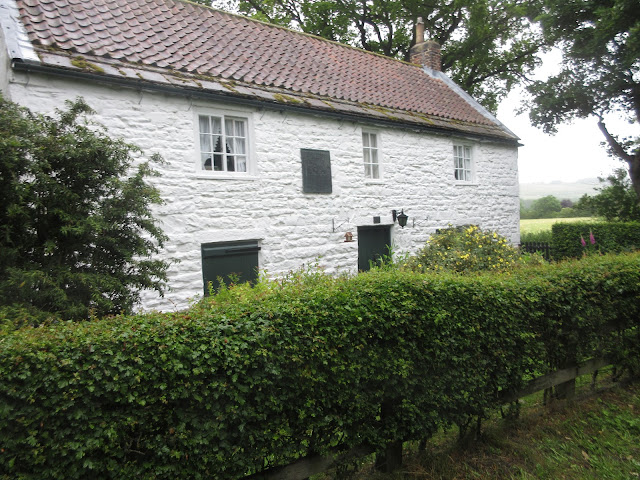
Wrapped against the light rain we started off on the walkers/cyclists/riders track at the back of the car park. The track is built on an old disused railway line and goes most of the way to Newcastle. On the way it passes Stephenson's cottage, the birthplace of the railway pioneer.

                              Stephenson's cottage, Wylam, closed.

beyond the cottage and only for a short distance, we joined the Hadrian's Wall Path which goes off to the right and is closer to the river though further away from the eponymous wall. We stayed on the old railway line until we reached Heddon Haughs where we turned left, walked through a farmyard and started the first climb of the day up Station Road to Heddon on the Wall. The best part of a mile and quite steep. Just before reaching the village centre we took the first street on the left and wandered through a small estate before reaching the road at Heddon banks Farm and heading downhill, a bit annoying having just walked uphill. Turning left at Close Lea we were soon in the Close House golf course area. We followed a footpath through Ashbank Wood and Raven's Dene before crossing a couple of fields and taking the road downhill to the outskirts of Wylam village. 

Turning right at the junction we walked uphill on Holeyn Hall Road before taking the path on the left across fields. Turning right we walked the edge of fields to Horsley Wood where we followed a woodland path that on a sunny day would have been a delight. We joined the road for a short distance near Wylam Hall and then continued on a footpath to Wylam Cricket Field, suitable place for a Herbie in the rain.

                        Grey day in Northumberland

                    The Tyne from close to Hagg Bank bridge. The smoke is from the toilet paper factory at Prudhoe.

After a lunch including chocolate mini rolls, snickers, Bliss bars and apple pies we headed into Wylam, passing the home of another railway pioneer,


                                       Timothy Hackworth, another Wylam railway pioneer.

Walking on we crossed the river by the Wylam Bridge, crossed the Newcastle- Carlisle Railway line, passed the Boathouse which claims to be" probably the best pub in the world". It usually has at least a dozen ales on hand pump but today we walked on by, the shame of it.

Someway beyond the pub we took the footpath on the right through Daniel's Farm. This part of the walk is on the Heritage Way, an eighty mile ramble that circles Tyneside and Wearside.


                                 Heritage Way marker and common footpath marker.

The footpath through the farm has deer fences on either side. We must have seen a hundred deer in the fields. They are raised for venison. They are beautiful animals, the almost vegetarian in me was not happy.


             Several fields later we were at Bradley Hall Farm and having crossed Bradley Park we reached the old stretch of road parallel to the A695. Turning right we walked to Crawcrook almost before taking the footpath on the left that turned back for a while before heading downhill across fields back to Daniel Farm where we made friends with a turkey and some Llamas.


Back on the road we were soon at the car park (passing the Boathouse again!) and off we went, home.


Contains OS data, copyright. Crown copyright and database right 2021

The walk is about 10.5 miles and even on a damp day is very enjoyable, woodland, fields, views and normally a great pub at the end!


       Hang Bank Bridge, model for the Tyne bridge

                  Mother duck. Her babies are below the weir


Saturday 19 June 2021

 We're going to Gilsland. (Northumberland) 

June 18th.

A much reduced gadgie team of three, due to holidays, Dave, John Ha. and I are off to  follow a walk not covered for several years. 

The forecast is for a warm, dry day and so it proved top be. The walk starts near Gilsland which is found by driving west on the A69, turning right for Greenhead and then left, sharp right and down a road to a small but perfectly formed National Park car park on the right near a short terrace of houses..

The walk is covered by OS OL 43 Hadrian's Wall and is recommended although part of the route is well marked.


                            Rural car park for about a half dozen cars.

The walk: We went a short distance down the road and followed the sign post for Thirwall Castle. The path crosses the Carlisle - Newcastle Railway line and a path took us to the ruin.


                  A fine ruin, Thirwall Castle. Probably recycled Roman Wall which is nearby.
Having admired the ruin we walked alongside the railway to Longbyre where we took a footpath  that followed the Pow Charney Burn across a boggy field to the farm at Barron House. The path goes through the farmyard, there was a collection of sheepdogs which chorused our way through.

Slightly nervy collie.
From the farm we walked a track for a short distance before taking a footpath on the left across fields to an isolated house that made it clear it was not on the path.

                                   Not this way.
We walked a short way down the road and then entered the woods on the right. It is only fair to say that we wandered on good trails through the woods, across at least one footbridge until we emerged at the Gilsland Spa Hotel. It is equally fair to add that the woods, with splendid English sun shining through the trees casting shadows and lighting up the flowers were a delight.

Gilsland Spa Hotel which appears empty at the moment. Starting life in the 18th century it has been hotel (visited by Sir Walter Scott and Robbie Burns), convalescent home for the Co-op movement and hotel again, currently being refurbished.
We followed a footpath at the back of the hotel. Initially across a field and then through woodland where the path was a bit muddy but easily passable.
Eventually we reached a road and walked alongside the RAF bombing range to a small car park on the right. From here we took the footpath down to Crammel Linn.


                       You have been warned. We could see in the distance the remains of a jet on the ground. A pretend MIG?

The Linn is a waterfall and there were already a few people bathing in it, sunbathing around it or leaping from a low cliff into it. Interestingly the gates to the area were well and truly locked, we climbed the wooden one, some young men vaulted the metal one which had wire mesh to stop people putting feet on bars.. A polite notice from the RAF pointed out that it gave permission to enter the Linn, but behave.
We stopped for a Herbie.
                   Crammel Linn from our Herbie Spot; (Apple pies, almond slices and peanut and chocolate bars.)
For the return journey we followed a footpath parallel to the stream (River Irthing) through woodland until we re-joined the path we had taken from the hotel on our way to the Linn. The path is well marked with black and yellow arrows. Easy to follow.
Back at the hotel we walked down the road and just beyond the church of St. Mary Magdalene took the footpath on the left downhill across fields to the stepping stones and then on a footpath to the village of Gilsland.
                     St Mary Magdalene, Anglican parish church for Gilsland, built 1852
                      Substantial stepping stones across the Irthing.
In the village we turned left and walked along the road, under the railway bridge before joining the Hadrian's Wall path. The path runs alongside an impressive Roman ditch, crosses fields and soon had us back at the car park.

Roman ditch, dug by hand!


Contains OS data, copyright. Crown copyright and database right 2021

The walk is about 10.5 miles, fairly easy going with a few short climbs


Wednesday 16 June 2021

 John Martin with a variation (Northumberland)    June 14th

Another popular gadgie walk, based on the route along the River Allen that inspired the work of artist John Martin who created huge pictures, often with jolly biblical themes such as the destruction of Sodom and Gomorrah and the Last Judgement.

The walk starts from a small car park near the Shaftoe Academy for the sons and daughters of gentle folk in the small Tyne Valley town of Haydon Bridge. Drive west on the A69, turn off into Haydon Bridge, take first left, appropriately called John Martin Street, go past The Anchor Hotel and turn left by the club, up a short stretch and park, free.

The walk is covered by OS OL 43 Hadrian's Wall but is well marked.

Parking near the Shaftoe Academy for the children of gentlefolk.

Leaving the car park we walked down to the road, turned left, took the right fork and headed towards East Lands End, the farm where the artist was born


  Top: plaque recording John's birthplace

Middle, part of info board

Bottom Lovely warning sign.

Continuing on the lane, overtaken by a lady on an electric bike, we reached The Lees Farm.

                 When I was a lad, Old Shep was my dog, o'er hills and meadows we'd stray

The path goes through the farm yard, several dogs around, all friendly

The path goes through the farm yard and then climbs across several fields to a minor road. We turned right and walked downhill to the entrance to the National Trust Allen Banks Woods.


             Entrance to the wood and more information about the man.

The path passes a charcoal burner;

                 The people who operate the charcoal burner use Rhododendrons and sell their product

            Overgrown pond, hardly room for a pair of Mallards.

We walked through the woods to a junction on the paths, Normally we turn right and follow the path downhill to walk along the riverside and through fields. Feeling a little adventurous we took the left hand path and walked the higher ground above the valley.


                       Destined for the charcoal burners.

Eventually we left the woods and crossed a couple of fields to a small house on the road, turned right and wandered downhill to Plankey Mill, Herbie Spot.

                At Plankey Mill. Slim pickings today as there are only three of us; apple pies, savoury flapjacks and tarts from Mrs A. As Brian said, probably lose weight for a change on this walk.


                    River Allen near Plankey Mill
Back on the track we crossed the fields to Allen Banks Woods and climbed the footpath, quite steep too, until we reached the ruins of the old peel tower.


                 Top; remains of peel tower. Bottom , information board.
From the ruins we walked the narrow ridge to a field and crossed diagonally to th a gate. Through the gate the path goes steeply down to a footbridge and then steeply up to more fields. We crossed the field to the farm at Harsondale, turned right and walked the concrete track to the road end. Turning left we continued on the road to a junction. Straight across and down through sheep filled fields to West Deanraw. 
At this farm we turned right and walked even more hard tarmac to Langley Castle.

Look carefully, Langley castle through the trees.

We took the track opposite the entrance to the castle, walked uphill and then across fields above Haydon Bridge. The footpath turned left, went through woodland and emerged on a road heading for the town. We walked under the A69, turned right, crossed the playing field and were back at the car.

Today's rehydration point was the Duke of Wellington at Riding Mill which was serving its own brew, named for Arthur Wellesley, and Black Sheep. Both were in fine form.

Contains OS data, copyright. Crown copyright and data base right 2021.

The walk is about 10.5 miles with several short, steep climbs.


John Martin; The Last Judgement and The Garden of Eden