I'm going to Rooklands, again! (Northumberland)
June 1st
Another favourite walk revisited and slightly extended. Starting from Alwinton and calling at the ruined farm Old Rooklands before heading back.
There are four of us; Brian, Margaret, Harry and me. The weather is very warm after the wet month of May, might even need sun cream. To get to Alwinton:A1 north, A697 at Morpeth, turn off at Weldon Bridge, drive through Rothbury and turn right at the sign post for Alwinton. Free parking on the right as you reach the village.
The walk is covered by OS OL Explorer 16 Cheviot Hills.
Parking in Alwinton, pretty but no prize-winner.
At the back of the parking area is a stream, crossed by a wooden footbridge, the start of the walk. Over the bridge, troll free, we headed north on Clennel Street, one of several ancient drovers' roads in the area. The route passes several ancient sites too, including Castle Hills fort, several overgrown settlements and a Cross Dyke, once a barrier for cattle on the drive south to English markets.
Castle Hills, spot the ancient walls, I can't.On previous occasions we have gone through a gate on the right and followed a gentle downhill path to the River Alwin Valley but on a warm and sunny day (about 20C) we continued on the Border County Ride route, passing the remains of what was once a Youth Hostel.
Ruins of a hostel. (Not the shed, the stones)
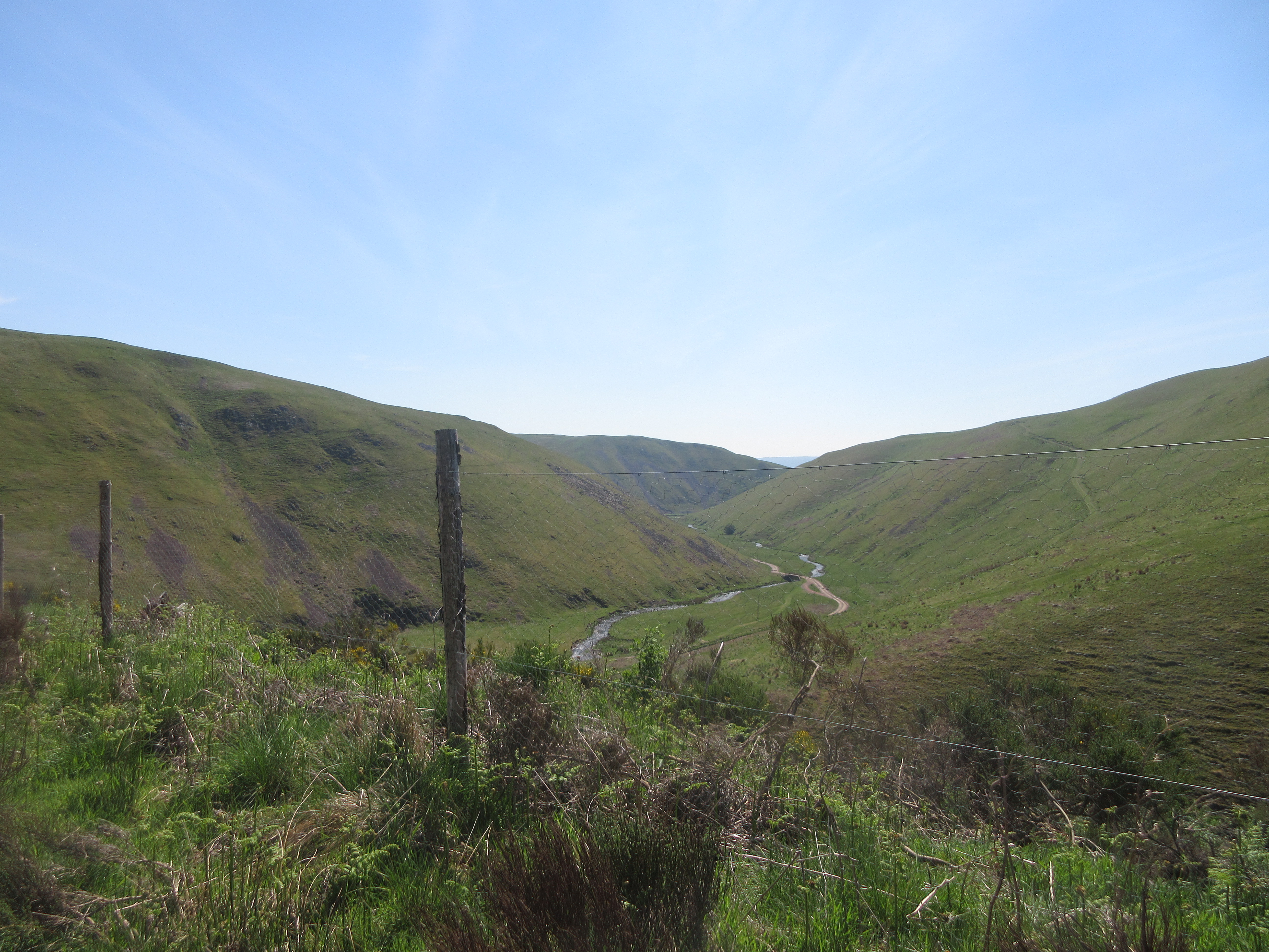
Beyond the ruin, at Wholehope Knowe on the map we joined a forestry road, headed initially east and descending slowly to the valley bottom. Several mountain bikers were slowly pedalling in the opposite direction.
Looking down on the River Alwin.
The road follows the river, it is easier on the feet to walk on the grass verge. Brian, ahead of the others, spotted an adder which immediately took off. The first turn off is for Puncherton which we ignored, the second, signposted and close to a bridge is for Old Rooklands and this is the footpath we took. Narrow with a steep fall on one side we climbed slowly in the heat to a rocky outcrop on the wonderfully named Weasel Burn where we called a Herbie.
Lunch time view on Weasel BurnLunchtime. Titans, savoury buns and almond buns from Mrs A.
Lunch over we followed the footpath, for a change, alongside the Rooklands Syke instead of heading for the ruined farmhouse.
Ruins of Old Rookland.
Eventually the narrow footpath joined the track over the hill and down to a road. Sharp turn left followed by a sharp turn right followed by a right turn brought us to Newton. (There is a footpath across a field but H and I took the long way round out of consideration for the hard work of the farmer who had ploughed, harrowed and plante)
Just beyond the farm at Newton a gate led to paths across fields to the end of Brownrigg Wood.
Is the sign about an animal or one of Harry's tales?
Walking the edges of recently ploughed fields again we came to Well House Farm. From the farm back to Alwinton the route is easy to follow, passing the Peels to rejoin the Border County Ride to Park House and Low Alwinton.
Lime Kiln near Low Alwinton, and instructions.Changed we headed for the Shoulder of Mutton pub in Longhorsely which had Timothy Taylor's Landlord, Directors and Yorkshire Blonde on offer. Timothy Taylor's for me, every time.
Contains OS data, copyright. Crown copyright and data base right 2021.
The walk is about 11.5 miles with a couple of stiff climbs.


No comments:
Post a Comment