Translate

Saturday 25 June 2022

From Seahouses to Seahouse

 Seahouses to Seahouses. (Northumberland) June24th

 I missed the walk last week because of family commitments. Back this week for a coastal walk in Northumberland with five other members of the gang:Harry, Dave, John H., Brian and Margaret.

Initially we drove to Seahouses Farm, near Howick, a couple of miles south of Craster. Limited parking on the side of the road near the farm. 


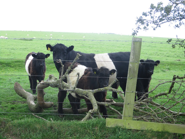
Parking at Seahouses Farm south of Craster. Fine looking animals too, those Limousins
                                                                                                                                We then walked the short distance to the village of Howick where we caught a bus to the seaside town of Seahouses, turned south and walked back. The walk stretches over two OS maps:332 Alnwick and Amble and 340 Holy Island and Bamburgh. (The bus is a joint operation with Travelsure and Arriva, X18 or 418. If you want to use it check times first.)

Actually we only went as far as Beadnell, about 1.5 miles south of the town of Seahouses but the title appealed to me. The bus stopped near the church, outside the Salt Water Cafe , some of the team purchased takeaway coffee, we live well.

Walking west away from the cafe we then turned left, went through a field and caravan park to the beach on Beadnell Bay.


                 Lime kilns on Beadnell Harbour, used as storage for fishing gear.

Beadnell Bay, like so many other Northumberland bays has a fine stretch of sandy shore, popular with wind surfers, boating and generally splashing about or sunbathing. After a short distance however we had to leave the beach, using a temporary staircase, and follow what in different places is England Coastal Path, Northumberland Coast Path or St. Oswald's Way. On the shore here there is a colony of Little Terns, their breeding area is roped off during the breeding season. We crossed the wonderfully named Long Nanny Burn by the footbridge and then  diverted to the National Trust shack where several rangers, whose job is to protect the birds mainly from humans, showed us the nesting site.


 A couple of Little Terns, different from Arctic Terns but there is a season for all terns.

Moving on we returned to the beach at the first opportunity and although we had not walked far we settled down on the sand for a Herbie.


We watched this family of Eider ducklings as we shared apple pies, almond slices, flapjacks and sweet and sour offerings from Mrs A.

Herbie over we continued along the beach for a while before climbing over the dunes to rejoin St Oswald until we reached Low Newton by the Sea.

The square of fishermen's cottages at Low Newton by the Sea. The Ship in the corner is a popular pub/restaurant, frequently mentioned in newspaper supplements. 

The footpath goes behind the square and passes the Low Newton Pool Nature Reserve, so naturally we stopped to see what was on the water.

                        Bloody Cranesbill, Northumberland's county flower, lots about today

                                     Life on the pool.

Leaving the bird hide we continued with St Oswald, noticing however many new signposts for the England Coastal Path. The path crosses the golf course, watch out for spliced drives. Eventually St O reaches the famous anticline and the magnificent ruin of Dunstanburgh Castle.


                 My favourite anticline and my favourite ruin.
Having crossed the fields we were soon in the old fishing of Craster, famous for kippers.


Craster harbour and some lobster pots.
The footpath goes through the village, passing the pub, the cafe and a small art gallery before joining the trail along the cliff tops. At one point there is a cliff side home to Kittiwakes, Guillemots and fulmars, plus an occasional crow.

                      Very quiet day at Kittiwake house.
 soon we were at the bathing house, constructed for the use of the gentile ladies of nearby Howick Hall but now a holiday let. Turning right beyond the house we were on the short footpath across fields and back to the cars.

                    Bathing house for the Howick ladies, there are pools below the cliffs for elegant water fun.

On the way home we stopped at the Ridley Arms in Stannington which had several hand pulled ales on offer, very good too!


Both maps contain OS data, copyright. Crown copyright and database right 2022.

The walk is about 10 miles, easy going, beautiful views out to sea and inland.


Saturday 11 June 2022

Back to Scot's Gap

 A walk from Scot's Gap (Northumberland) June 10th (A tale of two weddings)

 Another fairly local and flat walk. It helps the knees. Three of us only because several of the regular team are walking the West Highland Way from Milgavie to Fort William. (Harry, John L. and I are out today)

Scot's Gap is a small village west of Morpeth. Its name is connected to the ancient rivalries between the totally innocent English and the kilted marauders from the borderlands who failed miserably to rustle the local flocks one night. The animals were corralled in a fold, defended by a dyke with a narrow entrance or Gap!

Just beyond the village there is parking at the National Trust offices, free too.

A map is advisable: OS OL 42, Kielder Water and Forest

Today's car park behind the old National Trust Office in Scot's Gap. Shame about the skip. (This is not a reference to John's car)

At the back of the car park there is a posted but overgrown footpath that leads to the dismantled railway line, the beginning of our walk. We followed the old railway line north across open fields, following a small flock of sheep which were carefully shepherding their lambs.


 Old railway lines are easy walking. 

After about a mile and a half we left the line, taking the steps on the left, crossing a field and entering the Delf Plantation, the footpath following the stream until it emerges  near Toot Hill. (Mile 2) We crossed a field, taking a slight diversion to admire yet another of the region's Lime Kilns:

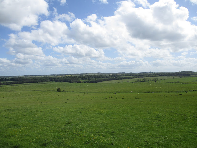
                                      A fine line of trees
                 Sheep sheltering from the sun in the old Lime Kiln.
We took a footpath heading north for a short distance, turned left and passed the point on the map labelled Pump House. It looked like a large metal water tank. Following the track we crossed more fields, a ford and Low Fairnley before reaching the farm at  Fairnley. The path goes round the buildings.
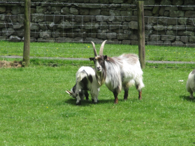
                  The goats of Fairnley

Beyond the farm (mile 4) we joined St. Oswald's Way.

The footpath here goes alongside Catcherside North Plantation which had suffered greatly in the winter storms, nearly every tree on the edge of the wood having been uprooted. And the field was very boggy too. Finding the point where St. Oswald changes direction (mile 5)we headed south on a good farm track alongside Catcherside Plantation until we reached the farm of the same name. We decided, as the wind had got up, that a wall in the yard would offer some protection as we enjoyed a Herbie. meanwhile chatting to the people at he farm who were preparing for a wedding to be held in a field, and a couple on a long distance walk who were looking for the route to Knowesgate.

We continued following the saint for a short while. There seemed to have been a considerable mount of fencing going on, the path was hard to follow but eventually we said farewell to Oswald, struggled in vain to get through a small plantation which was littered with fallen trees (mile 6) but eventually made it to the farm at East White Hill. (mile 7) 

Just beyond the farm we turned left on the road and after about half a mile took the footpath on the right which joined a track taking us to the farm at Fawns  which has Manorial Earthworks too.


                                           Fawns

Walking across the fields in a south east direction we came to Broom House,  (mile 9)the footpath goes through the garden! We turned north east, joined a track, walked the edge of a field of wheat rather than tramp directly across it on the actual footpath and were soon in the village of Cambo.

                                   Row of cottages and gardens in Cambo

     Holy Trinity Church, Cambo

Once the village school, then the village hall, thanks to the generosity of the Trevelyan family. Capability Brown, famed for his landscaping skills attended school here. A lady came out of the hall, she admitted she knew little of its history, she was preparing the place for a wedding.

An almost hidden signpost sent us across fields. Eventually we joined the road and walked back to the cars. Then home, unusually perhaps.


Contains OS data, copyright. Crown copyright and database right 2022

Also contains a mistake, we lunched at Catcherside and not the HS marked on the map.

The walk is just over 11 miles, mostly flat and easy going.


Saturday 4 June 2022

The Mitford Boys

 The Mitford Boys on a Jolly Jubilee Walk

(Northumberland) June3rd

 I missed last week's gadgie walk because I was on holiday, in Madeira. Warm, a bit wet, and a bit windy.

This week we are off on a very local walk based on Mitford, a village a couple of miles west of Morpeth and the country home of the Mitford family. 

North on A1, go through Morpeth and turn left at the top of the high street. 

OS Explorer 325 Morpeth and Blyth is the map and the team is: Brian, Margaret, Harry, Dave and me.

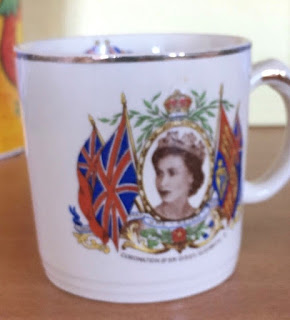
June 2nd was the 70th anniversary of the Coronation of Elizabeth II, an event that did more for the sale of TVs than any other event in the country. We kids were given souvenirs of the great event, mine was a Coronation cup, donated by the council and distributed through schools My family did not have a TV so lots of us crowded into Mrs Bevan's front room to watch on a small set in black and white.

                                                         My coronation souvenir.

            Today's car park, a few hundred yards beyond the entrance to Mitford Hall. Room for several cars and free!

Booted up and lightly dressed, it is summer, we walked west for a few hundred yards along the road before accepting the advice of the fingerpost on the right and heading down a track towards Newton Mill.


Newton Mill. The inhabitants had a number of friendly dogs. More important they pointed out the footpath we needed to follow, it was  not posted.

The footpath we followed, directly opposite the farm buildings was narrow, through woodland, and ran close to the River Font. Eventually we reached Nunriding Moor but didn't see any.

Turning just south of west we crossed fields before heading north on track to Nunriding Hall.

                    Sheep rustling has become a problem.


                                                       Margaret enjoys a swing

Several fields later we reached Woodhouse Strip and a straight piece of farm track took us to Wood House and beyond, passing the hardly visible remains of a Roman camp too.

Just before a ford a few yards beyond Wood House we called a Herbie and settled on a handy pile of timber for lunch. Today's sharings were apple pies, almond slices, savoury buns and lemon cake from Mrs A.


Ford and footbridge close to lunch spot at Woodhouse.

Just before the ford, on the left, we spotted a footpath through the wood and across fields to Longshaw.

Unfortunately, shortly after lunch Dave began to feel unwell. A change of plan sent us east on a track to the roundabout where Dave and I headed north back to Woodhouse, this time crossing the stream and walking up to a road where we found what I think was meant to be a mounting block for horse riders and we waited for the others to complete the walk and come and pick us up.

As we waited a couple arrived on horseback, dismounted and loaded their mounts into a horse box.

I'm not sure exactly where the others went to complete the walk. I could ask but I suggest they continued east from the Roundabout and turned south along a track to the road at Throphill. From there they turned east and walked the road back to the car. And from there they nobly came to rescue Dave and me.

On the way home we stopped at the Plough Inn in Mitford, a special Jubilee Blonde was on offer brewed by the Great North East Brewery.


                                                                  Plough Inn, Mitford. Very friendly

                                           The walk Dave and I took
                                   The planned route
                     Both maps contain OS data, copyright. Crown copyright and database right 2022

Dave and I did about 7 miles, the others managed 9.5. Easy going, beautiful country and one for the future too.