Featherstone Rovers (Northumberland) February 15th
WARNING: THIS WALK CAN BE MUDDY

Back to full strength the gadgie team is, at last, going on the Haltwhistle Ring (qv) walk round Featherstone,
There are eight of us, John x 3, Harry, Brian, Ray, Dave and me. The walk starts in Haltwhistle which is easily reached by driving west on the A69 until you get there, Free parking near Sainsbury's supermarket. We had breakfast at Brockbushes Farm shop just off the roundabout for Corbridge.
The map for the walk is OS OL 43 Hadrian's Wall, and it could prove useful.
Haltwhistle claims to be the geographical centre of the island of Great Britain. It's name has nothing to do with railways, it means "where the two rivers meet by the hill". (Haefod =hill and twisel =fork in the river). And Featherstone has nothing to do with a rugby league team in Yorkshire, it means a cromlech.(three upright stones and a headstone, but you probably guessed that.
The weatherman on local BBC TV promised a warm sunny day for February and he was right, perfect day for a winter walk, 11C, bright skies, little wind.


WARNING: THIS WALK CAN BE MUDDY

Boots at the end. Gaiter Velcro is wearing out
Back to full strength the gadgie team is, at last, going on the Haltwhistle Ring (qv) walk round Featherstone,
There are eight of us, John x 3, Harry, Brian, Ray, Dave and me. The walk starts in Haltwhistle which is easily reached by driving west on the A69 until you get there, Free parking near Sainsbury's supermarket. We had breakfast at Brockbushes Farm shop just off the roundabout for Corbridge.
The map for the walk is OS OL 43 Hadrian's Wall, and it could prove useful.
Haltwhistle claims to be the geographical centre of the island of Great Britain. It's name has nothing to do with railways, it means "where the two rivers meet by the hill". (Haefod =hill and twisel =fork in the river). And Featherstone has nothing to do with a rugby league team in Yorkshire, it means a cromlech.(three upright stones and a headstone, but you probably guessed that.
The weatherman on local BBC TV promised a warm sunny day for February and he was right, perfect day for a winter walk, 11C, bright skies, little wind.

It was a sunny day. And parking was free
Leaving the
free car park on the roadside above Sainsbury’s
we walked through the supermarket car park downhill, crossed several
streets and along a footpath until we reached Haltwhistle Station where we crossed
both the railway line and the River South Tyne before reaching Bellister
Road. The road took us beneath the A69
Haltwhistle bypass and close to Bellister Castle before we left it and turned
off to the right at the first “Daft as a Brush “ * marker we saw.

Daft as a Brush marker on Tyne trail

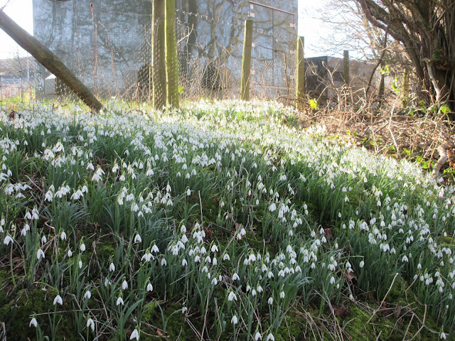
February fair maids, snowdrops

South Tyne
The footpath
climbed through woodland above the river past Broomhouse to the bridge across the Park Burn near Park
Village. Still on the south bank of the
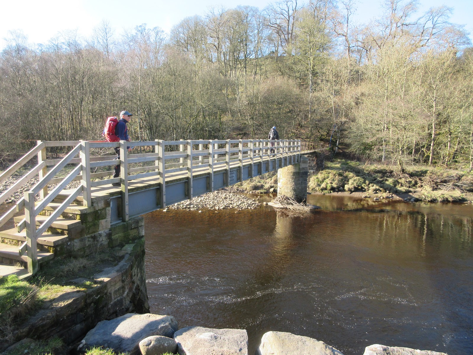
river we walked on road to Bridge End and continued to a footbridge over the
Tyne.

Beautiful bridge at Bridge End
Now on the
north bank we walked on and just beyond Burnfoot we called a Herbie near
Burnfoot and sat on a grassy bank to share the day’s goodies; ginger biscuits, flapjacks,
mini chocolate cakes, vegan sausage rolls from Greggs the great bakers of the
north and cheese scones from Mrs A.
Having eaten
well we walked a little further down the road before, at a sign post on the
right we climbed across a field until we joined the Pennine Way**.

Tyne at Bridge End

Lost souls at Bridge End
Crossing the river
This took us
to the farm at Batey Shield but we left the long distance way there and headed
for Kellah, net farm on the route. Beyond Kellah, near Peat Gate we crossed a
road at the War Memorial, crossed undulating fields and reached the footbridge
across the Tyne where we had crossed previously.

Someone left their bike

War Memorial (1914-18)

War Memorial
We did not
cross the river but walked the footpath through Crow Wood. Steep in parts,
narrow in others and with a few logs to negotiate, some of us have had problems
with these in the past.

I'm getting better with logs.
Back at Bridge
End we remained on the north bank following the sign for Wydon Eals. From here
footpaths across fields took us to Wydon then on to the A69 bypass again, there
is a path beneath it.
Back in
Haltwhistle we made our way to the cars, remov3d very muddy boots and went to
the Boathouse Tavern in Wylam to rehydrate. As has been mentioned before this
pub has at least a dozen hand pulled beers, among them today Timothy Taylor’s
Landlord, the second best thing to come from Keighley in Yorkshire. As driver I
managed to abstain and had coffee. Curses.

Boathouse, Wylam

Contains OS data, copyright. Crown copyright and database right 2019
* Daft as a Brush. A cancer charity which has sponsored trails on the Tyne. A guide to the walks is available, £12.99, well worth every penny
** Pennine Way. Longest walk in Britain from Derbyshire to the Scottish border.
Super Matrix
MMXIX 3c
Steps miles
NAK
29547
10.72
Iphone 22551 9.8
Dave’s NAK
1
21809
10.32
“”””””NAK2 21750 10.3
“””””USB 21919 10.3
“””””””SM 22214 10.47
Etrex 3hr 32 min walk 1hr 23min talk 10.02
OUTDOOR
GPS
10
The following are from Dave


The following are from Dave


No comments:
Post a Comment