A gadgie Christmas walk. (Northumberland ) Dec 16th
This is the last walk before Christmas as several of us will be away next Friday and we always walk on a Friday unless it is the annual Gentlemen's Week or a mid week special or walking from Stanhope which is best done on a Saturday because of the bus.
There are eight of us out today and we are walking from Rothbury in Northumberland. Take the A1 north from Newcastle, turn off at Morpeth on the A697 and turn left at Weldon Bridge on the road to the small town.
The magnificent eight are John x 3, Dave, Harry, Brian, Ben and me and we had morning tea at Tomlinsons café and Bunkhouse on Bridge Street. Always a warm welcome. The maps to use are:
OS Explorer 332 Alnwick and Amble
OS OL 42 Kielder Water and Forest
The walk:
Breakfast over we moved the cars to the park on the south side of the river Coquet, booted up and set off.
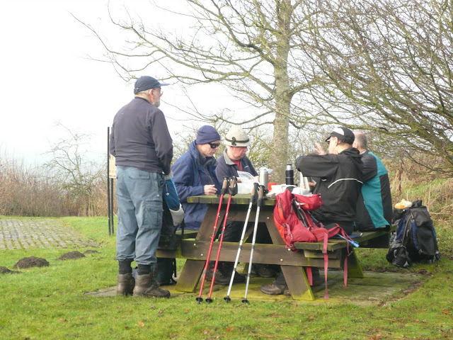
The team prepares to go from the Yorkshire car park in Rothbury.
We crossed the footbridge and headed for the main street, turning right and then left on Brewery Lane on the north side of the village. There is a footpath off the road that crosses fields to Hillside Road and another, also on the left that leads to woodlands. Turning left at the first gate we followed a Rhododendron bush lined footpath that eventually turned into one of the semi metalled "carriage drives" on the Cragside Estate. (Cragside for new readers was the home built for Lord Armstong, Tyneside armaments manufacturer. The house is well worth a visit, run by the National Trust).
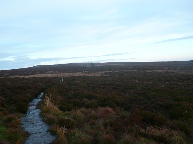
One misty moisty morning near Rothbury.
The track follows a semicircle across the heather, passing standing stones, cairns, ancient fort and a modern radio mast. Just beyond Brae Head, marked on the map, a footpath turns off on the left and
becomes the delightfully named Physic Lane above the village of Thropton. (Possibly "the farm at the crossroads")
When we reached the village we turned right, crossed the footbridge, turned left and followed the footpath on the right that crossed fields to the footbridge across the River Coquet.
Simonside Christmas tree
The descent from the plateau ends at Lordenshaws car park, From here we took the footpath (now St. Oswald's Way) across the moor to Whittondene where we took the road back to Rothbury, passing Sharp's Folly, a tower built at the expense of the vicar in 1720 to alleviate unemployment amongst the locals.
Sharps Folly
After another really good walk we retired to Angela's Arms at Weldon Bridge to celebrate John C's birthday and Harry's approaching Golden Wedding. They had Youngs Gold, Black Sheep and Greene King Rocking Rudolph beers.
Contains OS data, Copyright. Crown copyright and data base right 2016
The matrix MMXVI Christmas
steps miles
NAK 29586 12.14
iPhone 28448 11.1
Dave's 3D 26623 12.25
"" USB 25674 12.15
"" NAK 25393 12.02
etrex 11.84
Brian 11.44
John C 11.97
4 hours 14 minutes walking 1hour 17 minutes talking
When we got home we discovered we had missed out on Rothbury's day of excitement. A WW2 bomb was discovered, removed and exploded safely, under control.
Gallery
And from Harry, two photographs of a Simonside Sunset
Aren't we lucky living near here.
And some from Dave
The walk:
Breakfast over we moved the cars to the park on the south side of the river Coquet, booted up and set off.
The team prepares to go from the Yorkshire car park in Rothbury.
We crossed the footbridge and headed for the main street, turning right and then left on Brewery Lane on the north side of the village. There is a footpath off the road that crosses fields to Hillside Road and another, also on the left that leads to woodlands. Turning left at the first gate we followed a Rhododendron bush lined footpath that eventually turned into one of the semi metalled "carriage drives" on the Cragside Estate. (Cragside for new readers was the home built for Lord Armstong, Tyneside armaments manufacturer. The house is well worth a visit, run by the National Trust).
One misty moisty morning near Rothbury.
The track follows a semicircle across the heather, passing standing stones, cairns, ancient fort and a modern radio mast. Just beyond Brae Head, marked on the map, a footpath turns off on the left and
When we reached the village we turned right, crossed the footbridge, turned left and followed the footpath on the right that crossed fields to the footbridge across the River Coquet.
Simonside Christmas tree
The descent from the plateau ends at Lordenshaws car park, From here we took the footpath (now St. Oswald's Way) across the moor to Whittondene where we took the road back to Rothbury, passing Sharp's Folly, a tower built at the expense of the vicar in 1720 to alleviate unemployment amongst the locals.
Sharps Folly
After another really good walk we retired to Angela's Arms at Weldon Bridge to celebrate John C's birthday and Harry's approaching Golden Wedding. They had Youngs Gold, Black Sheep and Greene King Rocking Rudolph beers.
Contains OS data, Copyright. Crown copyright and data base right 2016
The matrix MMXVI Christmas
steps miles
NAK 29586 12.14
iPhone 28448 11.1
Dave's 3D 26623 12.25
"" USB 25674 12.15
"" NAK 25393 12.02
etrex 11.84
Brian 11.44
John C 11.97
4 hours 14 minutes walking 1hour 17 minutes talking
When we got home we discovered we had missed out on Rothbury's day of excitement. A WW2 bomb was discovered, removed and exploded safely, under control.
Gallery
And from Harry, two photographs of a Simonside Sunset
Aren't we lucky living near here.
And some from Dave
Happy Christmas to all our readers and
Cчастливого Pождества to the one Russian who has hit the blog this month 1000 times or the 1000 Russians who have hit it once and all possible combinations in between.


No comments:
Post a Comment