On the banks of the Allen (Northumberland)
September 4th
Promised a dry but breezy day six of us are setting off for a walk from the National Trust car park near Allen Banks. (The forecast got it slightly wrong, we suffered several showers) We are John H., John L., Harry, Dave, Ian and me.
To find the start head west on the A69 and turn off for Ridley Hall, National trust brown sign just before Bardon Mill and just after the road sign that says "SMOKE!" Follow the road round a few twisty bits and there is the National Trust car park. Free to members, £2 for four hours, £4 for a full day.
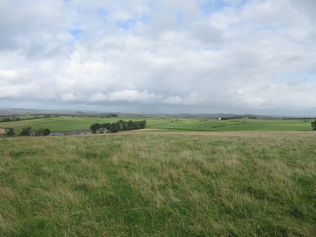
The walk is covered by OS OL 43 Hadrian's Wall. The problem is that OL43 is a double sided map and naturally this walk is covered by both sides. A sure case of copying and laminating, even if mocked by daughters.
 An attractive car park this week, if a bit puddly.
We set off in the direction of the building at the back of the car park and soon hit the footpath that climbs high above the River Allen. (There are several colour coded walks in the area, no idea which we followed.) Surprisingly, considering recent rain, the paths were quite dry and the slope back down to the river was not too slippy.
 The River Allen

The footbridge at Plankey Mill.
We crossed the footbridge to the picnic, camping area at Plankey Mill and continued over the fields alongside the river to the gate for Hag Bank and the woods. Again there are at least two footpaths to follow here, we took the lower one, still close to the bank. The wood has been cleared of many trees and it looks a mess. Eventually we reached the "staircase " which climbs steeply up to Staward Peel, a ruin.


 Staward Peel ruins and an information board.
The path away from the ruin is on a narrow neck of land between two streams and the sides are steep. Crossing a field we came to the gate to the path that leads downhill to a footbridge across Harsondale Burn then uphill and across a field to Harsondale farm.
 Harsondale Farm.
We followed the road away from the farm but soon crossed into a field (by stile) and after a few more stiles and fields found ourselves at Silly Wrea. The name may mean the nook where sallows or shrubby willows grow or it could mean happy nook, Silly being OE for innocent.

 The work horses at Silly Wrea.
This farm uses traditional horse drawn implements although it looks like a day off today. I like it, it reminds me of my childhood days spent on my uncles farm near Haworth where all the heavy work was done by a horse.
From the farm we followed the track north west until it became a footpath over fields, emerging at last on to a road. Turning left we passed Strother House.(Strother means marsh land) and walked down a steep road to Plankey Mill where we called a Herbie.
 Our Herbie Spot on the banks of the Allen. battenberg, apple pies, ginger biscuits and flapjacks. In an act of rebellion I brought a pork pie.
Lunch over we crossed the river by means of the footbridge but instead of taking the footpath along the water we climbed the steep path out of the gorge to Briarwood Farm. From here we followed the farm road, turned left at the first junction and after a couple of hundred yards went through the gate on the right and walked the fields to Wool House. From here we took the footpath to Shaws and then the road into the village of Beltingham.
A pretty little place with connections to the Bowes family to which the late Queen Mother belonged.
 This ancient Yew tree in the churchyard at Beltingham is held together with iron bands . Not much room to manoeuvre to get a better picture.
 St. Cuthbert's church, Beltingham. Sadly closed because you know what so we couldn't look in.
Having admired the church, the tree and the graveyard we retraced our steps to a road junction and turned left. Not far along the road a sign post on the right sent us across the fields and back to the footpath above the Allen. Turning left we were soon back at the car park.

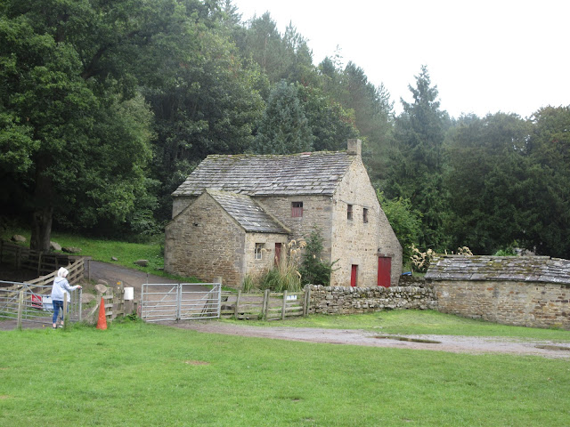
Ridley Hall. Variously a home for several families then a school then a boarding wing for Haydon Bridge High School. (Northumberland is a large county and children from far flung villages stayed here during the week before heading home to annoy their parents.) The hall is also used as a conference centre.
 Contains OS data, copyright. Crown copyright and database right 2020
Rather surprisingly we had finished the walk by 3.30 so we went home. Various instruments gave various readings for the length but it is about 8.5 miles. A lovely walk at any time of year.


September 4th
Promised a dry but breezy day six of us are setting off for a walk from the National Trust car park near Allen Banks. (The forecast got it slightly wrong, we suffered several showers) We are John H., John L., Harry, Dave, Ian and me.
To find the start head west on the A69 and turn off for Ridley Hall, National trust brown sign just before Bardon Mill and just after the road sign that says "SMOKE!" Follow the road round a few twisty bits and there is the National Trust car park. Free to members, £2 for four hours, £4 for a full day.
The walk is covered by OS OL 43 Hadrian's Wall. The problem is that OL43 is a double sided map and naturally this walk is covered by both sides. A sure case of copying and laminating, even if mocked by daughters.

We set off in the direction of the building at the back of the car park and soon hit the footpath that climbs high above the River Allen. (There are several colour coded walks in the area, no idea which we followed.) Surprisingly, considering recent rain, the paths were quite dry and the slope back down to the river was not too slippy.


The footbridge at Plankey Mill.
We crossed the footbridge to the picnic, camping area at Plankey Mill and continued over the fields alongside the river to the gate for Hag Bank and the woods. Again there are at least two footpaths to follow here, we took the lower one, still close to the bank. The wood has been cleared of many trees and it looks a mess. Eventually we reached the "staircase " which climbs steeply up to Staward Peel, a ruin.


The path away from the ruin is on a narrow neck of land between two streams and the sides are steep. Crossing a field we came to the gate to the path that leads downhill to a footbridge across Harsondale Burn then uphill and across a field to Harsondale farm.

We followed the road away from the farm but soon crossed into a field (by stile) and after a few more stiles and fields found ourselves at Silly Wrea. The name may mean the nook where sallows or shrubby willows grow or it could mean happy nook, Silly being OE for innocent.


This farm uses traditional horse drawn implements although it looks like a day off today. I like it, it reminds me of my childhood days spent on my uncles farm near Haworth where all the heavy work was done by a horse.
From the farm we followed the track north west until it became a footpath over fields, emerging at last on to a road. Turning left we passed Strother House.(Strother means marsh land) and walked down a steep road to Plankey Mill where we called a Herbie.

Lunch over we crossed the river by means of the footbridge but instead of taking the footpath along the water we climbed the steep path out of the gorge to Briarwood Farm. From here we followed the farm road, turned left at the first junction and after a couple of hundred yards went through the gate on the right and walked the fields to Wool House. From here we took the footpath to Shaws and then the road into the village of Beltingham.
A pretty little place with connections to the Bowes family to which the late Queen Mother belonged.


Having admired the church, the tree and the graveyard we retraced our steps to a road junction and turned left. Not far along the road a sign post on the right sent us across the fields and back to the footpath above the Allen. Turning left we were soon back at the car park.

Ridley Hall. Variously a home for several families then a school then a boarding wing for Haydon Bridge High School. (Northumberland is a large county and children from far flung villages stayed here during the week before heading home to annoy their parents.) The hall is also used as a conference centre.

Rather surprisingly we had finished the walk by 3.30 so we went home. Various instruments gave various readings for the length but it is about 8.5 miles. A lovely walk at any time of year.


No comments:
Post a Comment