Somewhere beside the Sea. (Northumberland) June 15th
Last Friday, June 12th was so wet that for the first time the usual gadgie walk was postponed until Monday June 15th. First time in gadgie history!
After several days of rain we are promised a warm, mostly dry day and we are having a coastal/country walk from Warkworth. From Newcastle follow the A189 coastal route and after about thirty miles head past Warkworth Castle, down the main street and drive into the square, past the church. Nearby, on the river bank there is a free car park.
 Warkworth Castle, a Percy stronghold now run by English Heritage
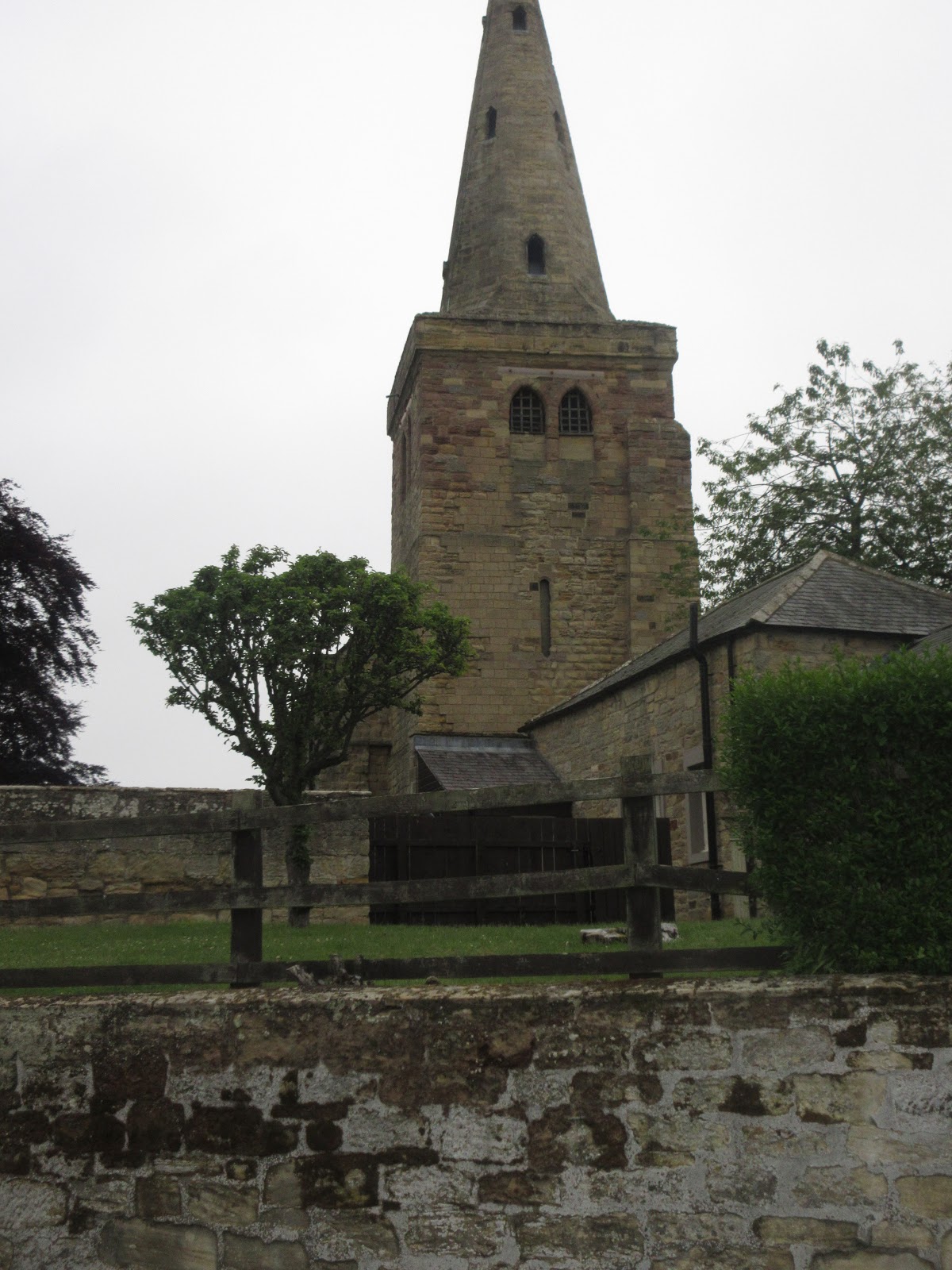
The church of St. Lawrence was originally built of wood in 737 AD. Destroyed by the Vikings in the 9th century a stone church was built on the site in late 9th/early 10th century. The present building dates to the 12th century.

 St Lawrence and a cyclist. The church is a fine example of a Norman church, almost completely Norman. The cyclist had a squeaky bike.
The whole of the walk is covered by OS Explorer 332 Alnwick and Amble

 Top class car park, the river Coquet
 Goosander ducklings beneath the bridge
 Slightly out of focus bridge built in 1397, just for pedestrians now.
We crossed the bridge, crossed the road and headed on a slight incline towards the beach car parks but turned off the road and walked across fields, much more pleasant. Walking past the golf course we decided to take our old friend St. Oswald's Way, also the Northumberland Coast Path. The way wanders through the dunes, turning inland for a short distance, passing under a footbridge for golfers and passing, but ringing, the bell provided to warn players walkers are crossing the fairway.
 Pond, with golfers and club house.
As we approached the Aln estuary we turned left on to a metalled road but almost immediately went through an almost hidden gate on the right and followed a footpath on the edge of the fields almost to Waterside House. The well made track here took us round a stone building and across fields (back on St. O's) until we reached an information board close to the mud flats. Nearby there were two benches, enough for four of us under lockdown rules and a fine place for a Herbie, looking over the river to the village of Alnmouth.. The other two sat on the grass nearby. Sharing is currently suspended because of the rules.
 Alnmouth from Herbie Spot. It was a good place for bird watching; herons, egrets, Canada geese, shelducks, black headed gulls and one single solitary deer. On the walk we also spotted whitethroats, reed warblers, kestrels and a kingfisher, and two other deer.
After the break we headed north on the track to the Alnmouth road, turned left and headed for Hipsburn. Just before Alnmouth Station which really is in Hipsburn we turned left, crossed a field and walked under the railway.

 There had been some dispute over exactly what it was. A bridge for the railway going over the track or a tunnel going under the railway. I maintained that in Europe a tunnel had to be 50metres long but in the US only 23m. Dave kindly counted his steps, which are of known length, dis a quick calculation and said the underpass was 22metre long. A bridge. These things can be important to a gadgie! (some of them)
From the bridge we crossed several fields to Wooden Farm. The footpath is well marked and from this farm we continued to High Buston, a hamlet rather than just a farm.
 Cages for raising either pheasnts, partridges or grouse. Not sure what they were although they asked if it was August yet.

High Buston
If you follow this route watch out at High Buston, ignore the first signpost on the left and walk uphill to the second. Take it and cross fields on good tracks to Buston Barns. (Between High Buston and Buston Barns Brian and Margaret took a slightly different route and we didn't meet up until we were back at the cars).Cross the railway on the bridge and turn right. After a couple of hundred yards there is a wonky sign post on the left which points the way close to Spinney Covert and then on to Mill Cottage. We crossed the road and followed the track due south until we came to the woods on the side of the river Coquet. We walked through the woods, fighting off brambles, and following the curve of the river, passing, although we didn't see it, the remains of the hermitage on the river bank.
After a short steep climb we were on a road, turned right, walked downhill to the main village road and we were back at the medieval bridge and the footpath back to the cars.
 View of the castle from close to the remains of the hermitage. (you can visit the hermitage but you need a boat)
 Plaque on the bridge.
As pubs are still not open, and you may have noticed an absence of breakfast too, we went home.

Contains OS data, copyright. Crown copyright and data base right 2020.
And a matrix
steps miles
NAK 28016 10.9
Dave's NAK 1 22053 10.44
"""""""""""2 22033 10.43
SM 22039 10.44
OUTDOOR GPS 10.2
Garmin (walked for 4 hours, talked for 1h 50 minutes) 10.63
Brian (slightly shorter route) 9.6
And a few pretty pictures


Last Friday, June 12th was so wet that for the first time the usual gadgie walk was postponed until Monday June 15th. First time in gadgie history!
After several days of rain we are promised a warm, mostly dry day and we are having a coastal/country walk from Warkworth. From Newcastle follow the A189 coastal route and after about thirty miles head past Warkworth Castle, down the main street and drive into the square, past the church. Nearby, on the river bank there is a free car park.

The church of St. Lawrence was originally built of wood in 737 AD. Destroyed by the Vikings in the 9th century a stone church was built on the site in late 9th/early 10th century. The present building dates to the 12th century.

The whole of the walk is covered by OS Explorer 332 Alnwick and Amble


We crossed the bridge, crossed the road and headed on a slight incline towards the beach car parks but turned off the road and walked across fields, much more pleasant. Walking past the golf course we decided to take our old friend St. Oswald's Way, also the Northumberland Coast Path. The way wanders through the dunes, turning inland for a short distance, passing under a footbridge for golfers and passing, but ringing, the bell provided to warn players walkers are crossing the fairway.

As we approached the Aln estuary we turned left on to a metalled road but almost immediately went through an almost hidden gate on the right and followed a footpath on the edge of the fields almost to Waterside House. The well made track here took us round a stone building and across fields (back on St. O's) until we reached an information board close to the mud flats. Nearby there were two benches, enough for four of us under lockdown rules and a fine place for a Herbie, looking over the river to the village of Alnmouth.. The other two sat on the grass nearby. Sharing is currently suspended because of the rules.

After the break we headed north on the track to the Alnmouth road, turned left and headed for Hipsburn. Just before Alnmouth Station which really is in Hipsburn we turned left, crossed a field and walked under the railway.


From the bridge we crossed several fields to Wooden Farm. The footpath is well marked and from this farm we continued to High Buston, a hamlet rather than just a farm.


High Buston
If you follow this route watch out at High Buston, ignore the first signpost on the left and walk uphill to the second. Take it and cross fields on good tracks to Buston Barns. (Between High Buston and Buston Barns Brian and Margaret took a slightly different route and we didn't meet up until we were back at the cars).Cross the railway on the bridge and turn right. After a couple of hundred yards there is a wonky sign post on the left which points the way close to Spinney Covert and then on to Mill Cottage. We crossed the road and followed the track due south until we came to the woods on the side of the river Coquet. We walked through the woods, fighting off brambles, and following the curve of the river, passing, although we didn't see it, the remains of the hermitage on the river bank.
After a short steep climb we were on a road, turned right, walked downhill to the main village road and we were back at the medieval bridge and the footpath back to the cars.


As pubs are still not open, and you may have noticed an absence of breakfast too, we went home.

Contains OS data, copyright. Crown copyright and data base right 2020.
And a matrix
steps miles
NAK 28016 10.9
Dave's NAK 1 22053 10.44
"""""""""""2 22033 10.43
SM 22039 10.44
OUTDOOR GPS 10.2
Garmin (walked for 4 hours, talked for 1h 50 minutes) 10.63
Brian (slightly shorter route) 9.6
And a few pretty pictures


No comments:
Post a Comment