In the footsteps of Alexander (Northumberland)
June 19th.
This is my favourite Cheviot walk that does not climb to the tops. Two years ago I took grandson Alex on the walk and he enjoyed it so much he wanted to do it again last year. So we did. He's 10.
Today there are four of us escaping lockdown; Dave, Brian, Margaret and me. The weather forecast is promising, cloudy but warm with the possibility of a few showers.
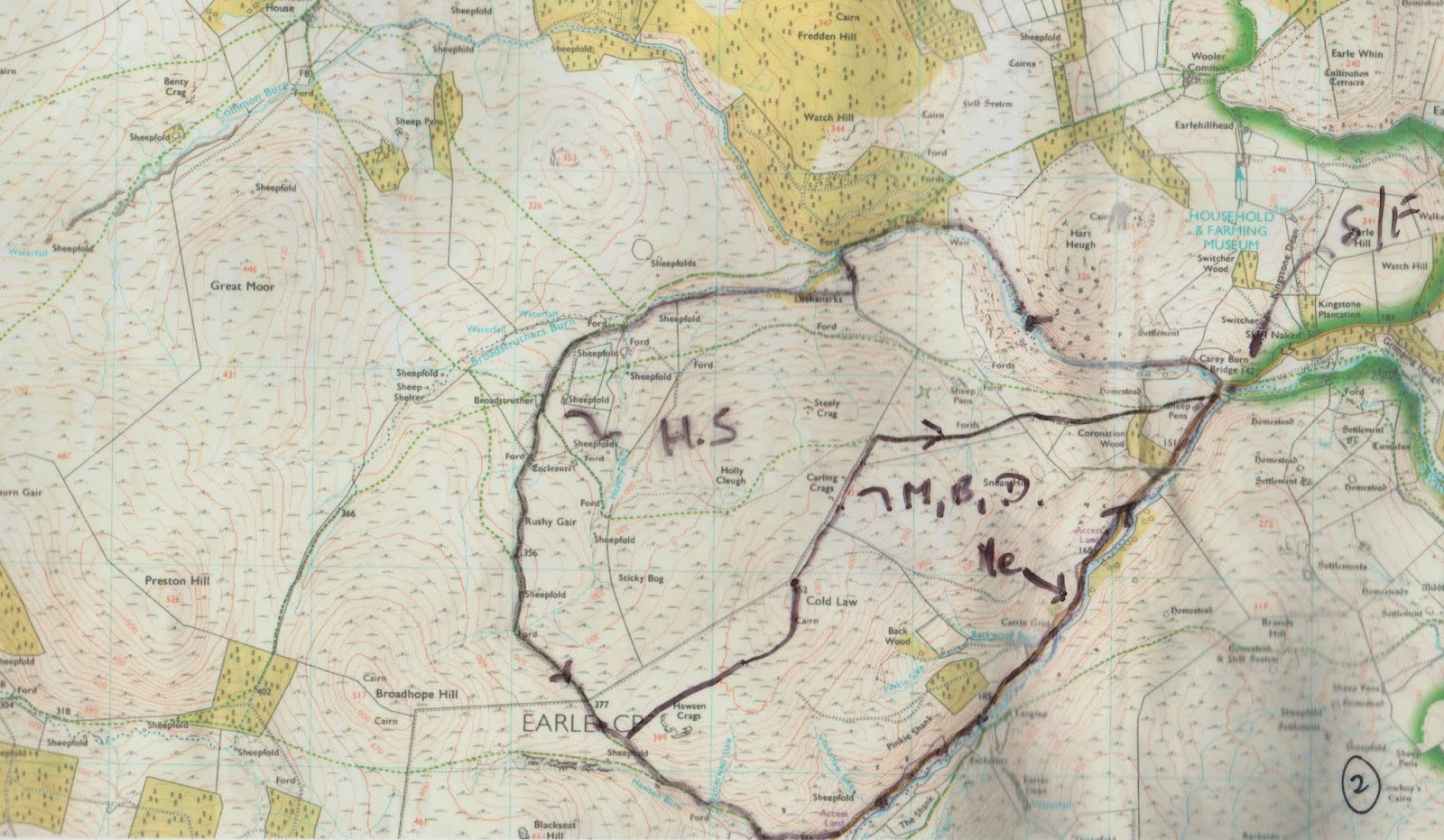
The walk starts from the Carey Burn bridge in the Harthope Valley. North on the A1, take the A697 at Morpeth, turn into Wooler, turn left up Cheviot street, take the right fork, turn right at the signpost for Langleeford and park on the grass verge by the Carey Burn bridge'
The walk is covered by OS OL 16, Cheviot Hills.
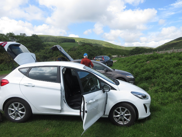 Regular readers will be as familiar with this car park as we are but I will repeat the warning: do not park parallel to the road. Cows use the road and have been known to decorate the sides of vehicles with liquid manure. Just saying.
The start of the walk is very close, go through the gate just before the bridge.
 The start.
The footpath, not marked on older maps, follows the Carey Burn closely. Initially across a field and then on a path close to the water. On the opposite side of the stream there are some steep looking rocky cliffs. Once we saw a peregrine there but today there were at least two buzzards flying over the woods and a kestrel. A grey wagtail sat on a rock in the stream before moving on, but no dippers. There are a couple of short scrambles across rocks close to the water but nothing to deter walkers.
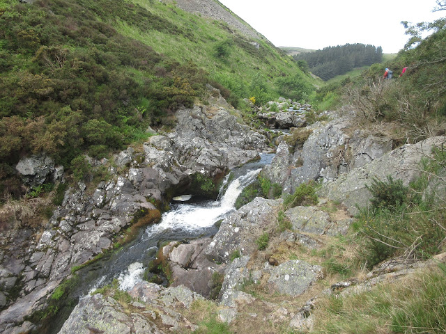 The waterfall on the burn. Considering the amount of rain that has fallen in the last few days I thought there would have been more water even though May was exceptionally dry
 For several years this has been the site of a wooden shed, shelter for shooters and swallows. No idea what happened.
Beyond the remains of the shed the path enters a plantation.
 Looking back down the burn
 Still not seen the HIGLAND cattle and a little concerned about exactly what black game is.
After a while, and it is a while, the footpath reaches a footbridge over the burn, marked as Ford on older maps.
 View from a bridge
 This bridge, across the Carey Burn.
Once over the bridge there is a short climb before the path crosses open land to the next footbridge which crosses the Broadstruther Burn.
 Broadstruther Burn Bridge.
once over the bridge the footpath curls round and joins a farm track which climbs fairly gently to Broadstruther.

 Broadstruther, front and back. Once a farm house, then left derelict for years before being taken over and spruced up for a shooting lodge. Some thought it had been abandoned again but the door and windows were freshly painted, the grass in front was neatly cut and new, deciduous trees had been planted at the back.
It makes an excellent Herbie Spot so we stopped and had lunch, as did several other walkers out enjoying a warm day in lockdown.
Lunch over we followed the track for a short distance before taking the footpath on the left that leads across the moorland.
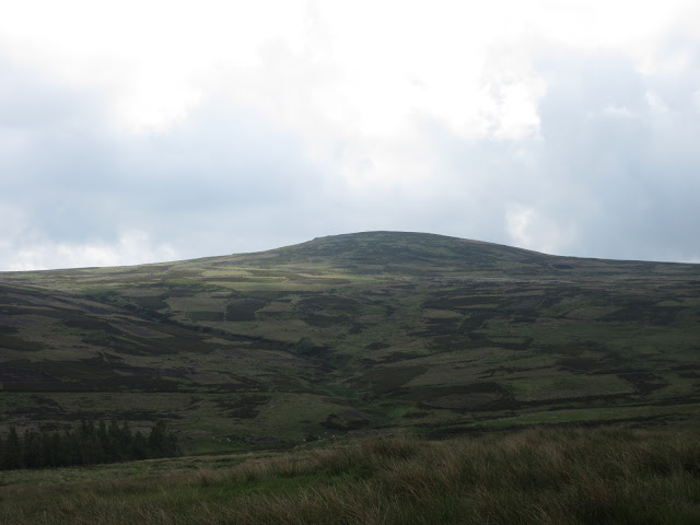 Cold Law from Broadstruther.
The footpath eventually meets a farm track and comes to a gate; decision time, turn left up Cold Law or continue on the track. We continued on the track.
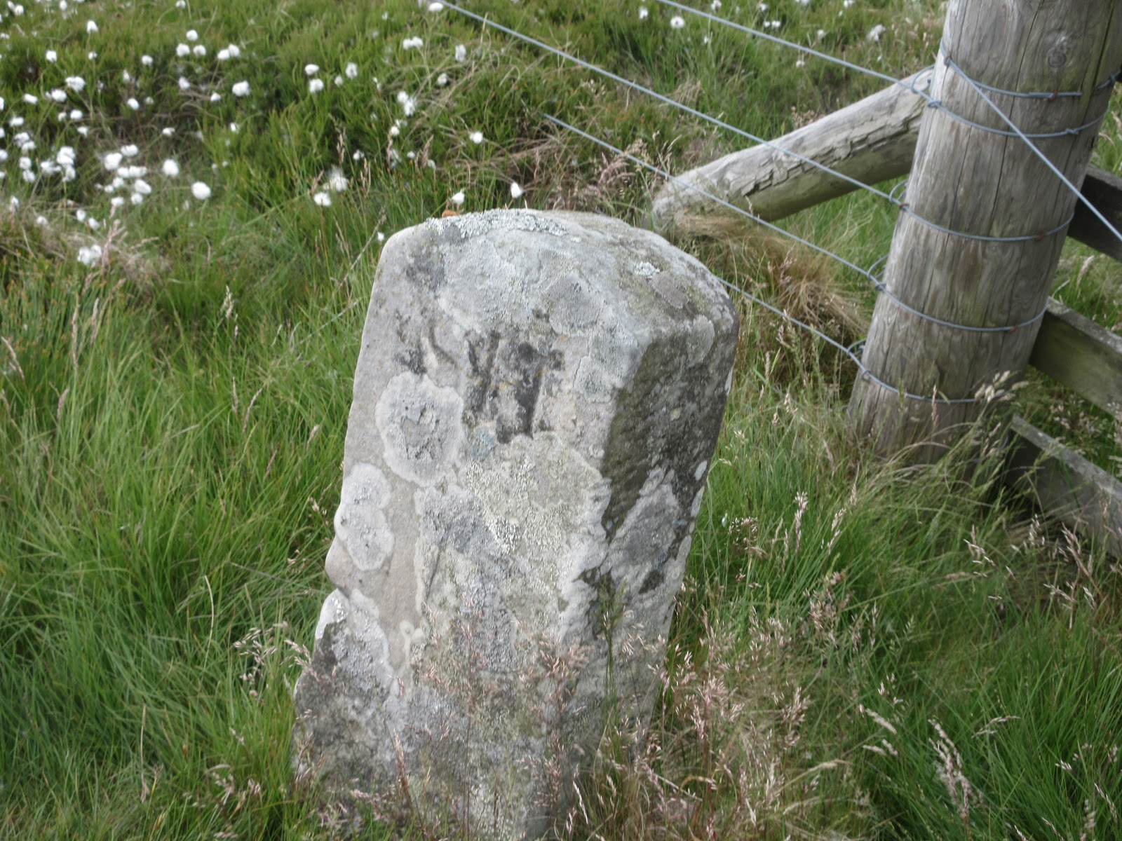
 Old Boundary Stone.
Through the gate and on for a few hundred yards until we reached a track going off to the left. The other three decided to go up the track to the top of Cold Law and then follow shooters tracks down to the Carey Burn Bridge. I opted to continue south east, going downhill on the farm track before taking a footpath on the left which follows Hawson Burn down to the valley road. A couple were out hoping to spot Ring Ousels. They would probably be disappointed, we have seen them here but usually much earlier in the year
 Car park and stell at bottom of Hawson Burn. This is as far as visitors can drive
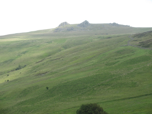
 Hedgehope
 Cloud over Cheviot.
Once on the road I walked back to the cars and had just changed my boots for lightweight trainers when the other three arrived. No pub again so we went home.
 Contains OS data, copyright. Crown copyright and database right 2020.
A short walk but a lovely one on a warm day out.
MATRIX
steps miles
NAK 19148 8.15 (!)
Dave's NAK 1 16031 7.59
"""""""""""""2 16004 7.57
SM 15950 7.55
Garmin walked 2 h 47 min talked 1 h 19 min 7.07
OUTDOOR 7.01
Brian 7.02


June 19th.
This is my favourite Cheviot walk that does not climb to the tops. Two years ago I took grandson Alex on the walk and he enjoyed it so much he wanted to do it again last year. So we did. He's 10.
Today there are four of us escaping lockdown; Dave, Brian, Margaret and me. The weather forecast is promising, cloudy but warm with the possibility of a few showers.
The walk starts from the Carey Burn bridge in the Harthope Valley. North on the A1, take the A697 at Morpeth, turn into Wooler, turn left up Cheviot street, take the right fork, turn right at the signpost for Langleeford and park on the grass verge by the Carey Burn bridge'
The walk is covered by OS OL 16, Cheviot Hills.

The start of the walk is very close, go through the gate just before the bridge.

The footpath, not marked on older maps, follows the Carey Burn closely. Initially across a field and then on a path close to the water. On the opposite side of the stream there are some steep looking rocky cliffs. Once we saw a peregrine there but today there were at least two buzzards flying over the woods and a kestrel. A grey wagtail sat on a rock in the stream before moving on, but no dippers. There are a couple of short scrambles across rocks close to the water but nothing to deter walkers.


Beyond the remains of the shed the path enters a plantation.


After a while, and it is a while, the footpath reaches a footbridge over the burn, marked as Ford on older maps.


Once over the bridge there is a short climb before the path crosses open land to the next footbridge which crosses the Broadstruther Burn.

once over the bridge the footpath curls round and joins a farm track which climbs fairly gently to Broadstruther.


It makes an excellent Herbie Spot so we stopped and had lunch, as did several other walkers out enjoying a warm day in lockdown.
Lunch over we followed the track for a short distance before taking the footpath on the left that leads across the moorland.

The footpath eventually meets a farm track and comes to a gate; decision time, turn left up Cold Law or continue on the track. We continued on the track.
Through the gate and on for a few hundred yards until we reached a track going off to the left. The other three decided to go up the track to the top of Cold Law and then follow shooters tracks down to the Carey Burn Bridge. I opted to continue south east, going downhill on the farm track before taking a footpath on the left which follows Hawson Burn down to the valley road. A couple were out hoping to spot Ring Ousels. They would probably be disappointed, we have seen them here but usually much earlier in the year


Once on the road I walked back to the cars and had just changed my boots for lightweight trainers when the other three arrived. No pub again so we went home.
A short walk but a lovely one on a warm day out.
MATRIX
steps miles
NAK 19148 8.15 (!)
Dave's NAK 1 16031 7.59
"""""""""""""2 16004 7.57
SM 15950 7.55
Garmin walked 2 h 47 min talked 1 h 19 min 7.07
OUTDOOR 7.01
Brian 7.02


No comments:
Post a Comment