It's wonderful to be here,
It's certainly a hill...………………..June 5th
(Northumberland)
At last we are allowed out, in groups from different household up to a maximum of six.
Harry, Dave, John H., Brian and I are meeting for a walk near Rothbury with special guest Mrs A.
The walk starts at a car park near Lordenshaw south of Rothbury. North on the A1, A697 at Morpeth, turn left for Rothbury at Weldon Bridge, turn down Bridge Street, turn right and go to Great Tosson. Turn left and follow the minor road to the car park on the left hand side, it's free. Alternatively turn left at Longhorsley and work your way through a network of country lanes, but don't follow signs for Rothbury.
Or use a satnav.
The map to use is OS EXplorer 42, Kielder Water and Forest.
And after the driest and hottest May since records began in 1929 on the first gadgie walk since March it is going to rain! The temperature has fallen from mid twenties to twelve, sweaters will be fished out.
Not far north of the car park, just off St. Oswald's way, are the remains of an iron age fort and settlement. Close by on exposed rocks are some cup and ring markings;

 Cup and rings; Neolithic, megalithic, monolithic, lithographic, who knows. Nobody knows for sure their purpose but they are found all over Europe and Asia and in Hawaii too apparently.
 This week's car park. Free and pretty full, nice to see people out again now that travel has been eased for us normal folk.
The walk begins across the road from the car park. A path, paved with redundant flag stones from northern textile mills, climbs gently from the road side. Once we had got to the top of the first rise we took the left fork which just happens to be St. Oswald's Way and is not flagged.
 Starting off. A distant figure in the landscape?
St Oswald's way heads south west across undulating moorland. At one point, rebels that we are, we left his path for no particular reason but re-joined it at Spy Law, once a farm house, now slowly falling to pieces.
 Spy Law
The footpath goes almost arrow straight to the corner of a plantation at Coquet Cairn.
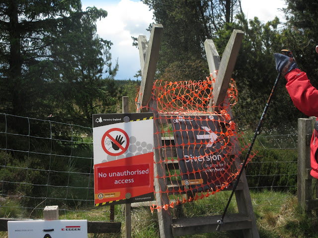 The plantation is being harvested, euphemism for cutting down trees so we followed the diversion
 Coquet Cairn. Disappointing really and it doesn't look down on the river Coquet.
 Apart from the chap at the back I think we are social distancing. I am at least I took the picture.
We walked along the fence line, a footpath overgrown with trip causing heather, until we reached the corner at Blackcock Cairn. Here we climbed a wooden stile, walked the track north west until we reached the forest road and turned right, passing Fernybed Hill and Weather Head. At the end of the plantation we paused for a Herbie, sitting on a couple of large slabs of rock and keeping the required distance between us. Sharing food is frowned on at the moment and only Mrs A and Dave brought contributions: a savoury cake and almond slices.
Lunch over we continued to the foot of Simonside, a short distance away.
 Simonside from the Herbie Spot
 Beware of the Duergars of Simonside, they, ugly little dwarves, capture late evening and night time walkers, taking them to become slaves in their mines deep underground. Fortunately it was daylight.
 The footpath up Simonside has been stepped. The first time I came here, 55 years ago it was a slippy, muddy track.
Once on the top of Simonside we followed the ridge footpath. Nearly all of it has been flagged as it is a popular walk and had become very worn and muddy in winter. The footpath is pretty level for most of the way as it passes several cairns, Old Stell Crag, (no sign of a sheep fold ), Dove Crag Cairn and The Beacon Cairn before it starts the descent to the car park. Back at the car park we changed and went home in our separate cars, no pubs open! But it is so good to get out again after ten weeks of lock down. The gadgie walks are back.
 Most of the path on Simonside is like this. Perhaps it doesn't suit the purist but it suits me
 Looking over the Coquet Valley to the Cheviot
 Nice memorial stone
 Looking down on Rothbury town
 Contains OS data. Copyright. Crown copyright and data base right 2020
And a matrix, just to show!
steps miles
NAK 20279 8.64
Dave's NAK 1 17603 8.33
""""""""""""""2 17643 8.35
""""""SM 17739 8.40
OUTDOOR GPS 7.5
Garmin 7.7
Brian's GPS 7.7
It's certainly a hill...………………..June 5th
(Northumberland)
At last we are allowed out, in groups from different household up to a maximum of six.
Harry, Dave, John H., Brian and I are meeting for a walk near Rothbury with special guest Mrs A.
The walk starts at a car park near Lordenshaw south of Rothbury. North on the A1, A697 at Morpeth, turn left for Rothbury at Weldon Bridge, turn down Bridge Street, turn right and go to Great Tosson. Turn left and follow the minor road to the car park on the left hand side, it's free. Alternatively turn left at Longhorsley and work your way through a network of country lanes, but don't follow signs for Rothbury.
Or use a satnav.
The map to use is OS EXplorer 42, Kielder Water and Forest.
And after the driest and hottest May since records began in 1929 on the first gadgie walk since March it is going to rain! The temperature has fallen from mid twenties to twelve, sweaters will be fished out.
Not far north of the car park, just off St. Oswald's way, are the remains of an iron age fort and settlement. Close by on exposed rocks are some cup and ring markings;


The walk begins across the road from the car park. A path, paved with redundant flag stones from northern textile mills, climbs gently from the road side. Once we had got to the top of the first rise we took the left fork which just happens to be St. Oswald's Way and is not flagged.

St Oswald's way heads south west across undulating moorland. At one point, rebels that we are, we left his path for no particular reason but re-joined it at Spy Law, once a farm house, now slowly falling to pieces.

The footpath goes almost arrow straight to the corner of a plantation at Coquet Cairn.


We walked along the fence line, a footpath overgrown with trip causing heather, until we reached the corner at Blackcock Cairn. Here we climbed a wooden stile, walked the track north west until we reached the forest road and turned right, passing Fernybed Hill and Weather Head. At the end of the plantation we paused for a Herbie, sitting on a couple of large slabs of rock and keeping the required distance between us. Sharing food is frowned on at the moment and only Mrs A and Dave brought contributions: a savoury cake and almond slices.
Lunch over we continued to the foot of Simonside, a short distance away.


Once on the top of Simonside we followed the ridge footpath. Nearly all of it has been flagged as it is a popular walk and had become very worn and muddy in winter. The footpath is pretty level for most of the way as it passes several cairns, Old Stell Crag, (no sign of a sheep fold ), Dove Crag Cairn and The Beacon Cairn before it starts the descent to the car park. Back at the car park we changed and went home in our separate cars, no pubs open! But it is so good to get out again after ten weeks of lock down. The gadgie walks are back.


And a matrix, just to show!
steps miles
NAK 20279 8.64
Dave's NAK 1 17603 8.33
""""""""""""""2 17643 8.35
""""""SM 17739 8.40
OUTDOOR GPS 7.5
Garmin 7.7
Brian's GPS 7.7
Good to see you back in reality. Nice to think we can,with care, take the first few steps towards normality.
ReplyDelete