All along the Watchtower. (Northumberland)
March 1st.
This week the weather in the UK has been summer like. This is good, it allowed me to cut the grass and gives the BBC lots of things to talk about on the news; "hotter than Toremelinos (21.2C)", "sun bathers on Brighton Beach", "in the future, this is what we will get."
Today it is back to normal, overcast and 8C with a cool wind.
There are six of us braving the average March temperature, and it's officially the first day of spring, John H., John Ha, Harry, Brian, Ben and me and we are walking from that old favourite Rothbury. The chaps have kindly agreed to a local walk so I can get home to see The Johnny Cash Show at Newcastle City Hall. Really good of them.
Rothbury; A1 North, A697 at Morpeth, turn left at Weldon Bridge and park across the river in Rothbury. It's free!
The map to use is OS OL 42 Kielder Water and Forest.
Teas/coffees and bacon were taken at Tomlinsons Café and Bunkhouse on Bridge Street, busy this morning but always worth a visit. Amusing posters about cycling in the back room, lots of Double entendres
 Yorkshire car park in Rothbury


Tomlinson's café and bunkhouse. Good food, great staff, great place
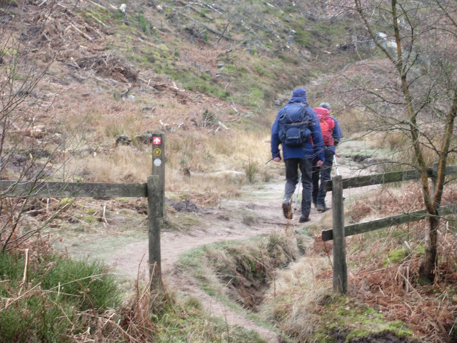
Finished in Tomlinson’s we returned to the car park and booted up for the walk.
 Car park footbridge Crossing by the footbridge to the north side of the
River Coquet we headed west on the footpath before crossing fields back down to
the river. Another footbridge and we were soon on the track to Great Tosson, so
small it hardly qualifies as a hamlet, never mind a village. Tosson comes from
Old English tot stan and means “ a
look out stone”. (Ah, I see now). Great Tosson has a ruined tower or Peel and a
signpost for Little Tosson.
Car park footbridge Crossing by the footbridge to the north side of the
River Coquet we headed west on the footpath before crossing fields back down to
the river. Another footbridge and we were soon on the track to Great Tosson, so
small it hardly qualifies as a hamlet, never mind a village. Tosson comes from
Old English tot stan and means “ a
look out stone”. (Ah, I see now). Great Tosson has a ruined tower or Peel and a
signpost for Little Tosson.
 Ruined Tower at Great Tosson
 Take this path from Great Tosson
A short distance past the houses the footpath on the left goes a short way through a farm yard before going uphill past the ancient fort on the right and through a gate into the wood. After a few yards on the forest road there is a footpath on the left which climbs steadily. There are several woodland walks marked, at the first junction we turned left and continued to climb until we reached Bob Pyle’s Studdie and the foot of the western end of the Simonside Hill.
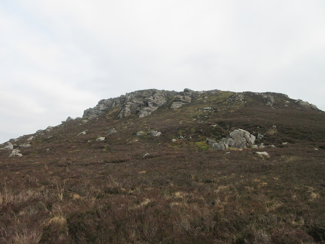
 Grey day in Northumberland
 Turning off the forest road
 There is a good path through the rocks
On previous walks we have taken the steep path up to the Simonside Plateau but today we continued heading south on footpaths towards Selby Cove. For some reason we split into two parties, three of us taking the Nagel Cut Off on the map and struggled through heather and lauder grass until we met up with the other party at the Cove and called a Herbie, we had done approximately four miles. Grand views from the designated spot although it was rather a grey day.
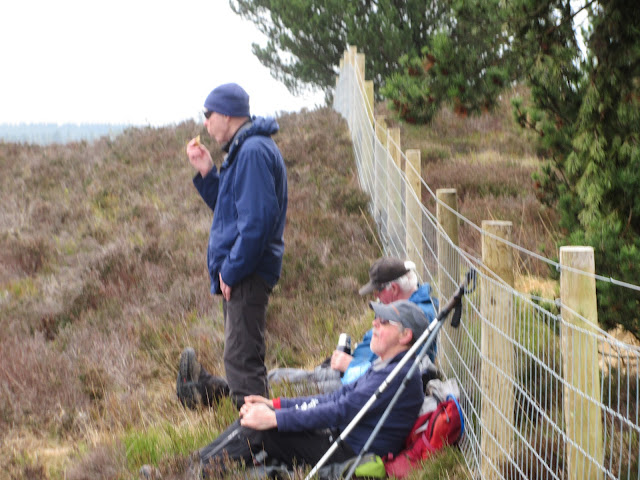 Herbie time. We shared frangepange, ginger biscuits, flapjacks, chocolate and Mrs A sent savoury scones
 Selby Cove
Lunch over we continued on the footpath due south. Well marked but narrow, the path has boards over the boggiest bits.
When we reached the plantation we turned sharp left and followed the fence line until we reached Coquet Cairn, a pile of stones and not particularly impressive.
 Harry examines Coquet Cairn
From the cairn we followed St. Oswald’s Path north east, crossing Forest Burn by footbridge and climbing up to Spylaw, once a farm, once a Scout building, now looking fairly derelict.
 Spylaw
A slight detour from St. Oswald’s but back on track we were soon at the paved staircase leading down to the car park near Lordenshaw.
From here, and cheerfully ignoring the many Cup and Ring Marks on the rocks, and the ancient fort we walked to Whittondean and then on the road past Sharpe’s Folly and back to the car park.


I went home to prepare for the Johnny Cash Roadshow, the others presumably went to a pub to rehydrate.
Not having Dave the matrix is severely limited;
NAK 30558 steps 11.08 miles
Etrex 4hr 6 min walk 1h 7m talk 10.07 Brian 10.5(?)

Contains OS data, copyright. Crown copyright band database right
And some more


March 1st.
This week the weather in the UK has been summer like. This is good, it allowed me to cut the grass and gives the BBC lots of things to talk about on the news; "hotter than Toremelinos (21.2C)", "sun bathers on Brighton Beach", "in the future, this is what we will get."
Today it is back to normal, overcast and 8C with a cool wind.
There are six of us braving the average March temperature, and it's officially the first day of spring, John H., John Ha, Harry, Brian, Ben and me and we are walking from that old favourite Rothbury. The chaps have kindly agreed to a local walk so I can get home to see The Johnny Cash Show at Newcastle City Hall. Really good of them.
Rothbury; A1 North, A697 at Morpeth, turn left at Weldon Bridge and park across the river in Rothbury. It's free!
The map to use is OS OL 42 Kielder Water and Forest.
Teas/coffees and bacon were taken at Tomlinsons Café and Bunkhouse on Bridge Street, busy this morning but always worth a visit. Amusing posters about cycling in the back room, lots of Double entendres


Tomlinson's café and bunkhouse. Good food, great staff, great place
Finished in Tomlinson’s we returned to the car park and booted up for the walk.


A short distance past the houses the footpath on the left goes a short way through a farm yard before going uphill past the ancient fort on the right and through a gate into the wood. After a few yards on the forest road there is a footpath on the left which climbs steadily. There are several woodland walks marked, at the first junction we turned left and continued to climb until we reached Bob Pyle’s Studdie and the foot of the western end of the Simonside Hill.


On previous walks we have taken the steep path up to the Simonside Plateau but today we continued heading south on footpaths towards Selby Cove. For some reason we split into two parties, three of us taking the Nagel Cut Off on the map and struggled through heather and lauder grass until we met up with the other party at the Cove and called a Herbie, we had done approximately four miles. Grand views from the designated spot although it was rather a grey day.


Lunch over we continued on the footpath due south. Well marked but narrow, the path has boards over the boggiest bits.
When we reached the plantation we turned sharp left and followed the fence line until we reached Coquet Cairn, a pile of stones and not particularly impressive.

From the cairn we followed St. Oswald’s Path north east, crossing Forest Burn by footbridge and climbing up to Spylaw, once a farm, once a Scout building, now looking fairly derelict.

A slight detour from St. Oswald’s but back on track we were soon at the paved staircase leading down to the car park near Lordenshaw.
From here, and cheerfully ignoring the many Cup and Ring Marks on the rocks, and the ancient fort we walked to Whittondean and then on the road past Sharpe’s Folly and back to the car park.


I went home to prepare for the Johnny Cash Roadshow, the others presumably went to a pub to rehydrate.
Not having Dave the matrix is severely limited;
NAK 30558 steps 11.08 miles
Etrex 4hr 6 min walk 1h 7m talk 10.07 Brian 10.5(?)

Contains OS data, copyright. Crown copyright band database right
And some more


No comments:
Post a Comment