Whittle Dene the Wind (Northumberland) March 15th
Storm Gareth hit the British Isles this week, bringing strong wind, rain and snow, in some parts. The wind persuaded us to postpone the proposed walk on Hadrian’s Wall which is a bit open to weather and we opted for a relatively sheltered walk from Wylam, small Tyneside town. We were promised a windy bright day with some showers.
Easy to reach, take the A69 west and turn left at the sign that says Wylam. Follow the road through the town centre to the car park just before the bridge, it’s free!
 Wylam free car park!!
There are four of us out, numbers reduced again by holidays (in March?) and family commitments. We are Ben, Dave, John H. and me.
The map to use is OS Explorer 316 Newcastle upon Tyne.
There are a couple of benches in the car park, useful for booting up
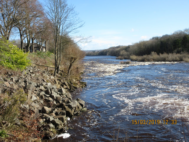 . The Tyne at Wylam
Once ready, booted and wearing windproof tops we left the car park for the bridge over the Tyne. A footpath on the Wylam side goes under the bridge and follows the river bank to the Hagg Bank Bridge, once a Tyne crossing for the railway. The Newcastle – Carlisle route is on the south bank.
 Hagg Bank Railway Bridge, now a footpath
 The Shadow of a man
Now on the south bank we followed the “Daft as a brush “ trail, passing the “Spetchells”. These are like slag heaps, left over from the days when ICI had a chemical plant nearby. The factory produced fertiliser and explosives, it has been long gone but the heaps which are covered with vegetation remain.
Beyond the Spetchells (the name is of uncertain origin but the area was used for recreation before the heaps appeared) We crossed to the north side of the Tyne at Ovingham, walked past the church yard, turned left and found the signpost for Whittle Dene.

 The Spetchells, old industrial slag heaps
 Signpost at Ovingham
The footpath climbed steadily through the dene which has a number of weekend cottages and the ruins of an old mill. It also has plenty of woodland and in a few weeks when the flowers are out it will be a pretty country walk.


 Whittle Dene
Near the top we called an early Herbie, deciding that the small quarry there would probably be the most sheltered spot on the day.
Break over we continued upwards to the A69, safely crossed by means of a footbridge. We continued on the footpath through fields to Welton Hill Farm. The farm was busy; mountains of timber were being cut up. The farmhouse itself is very interesting. Dating back to the 13th and 14th centuries it started life a fortified tower providing some defence against marauding Scots at a time when Welton was a sizeable village which could raise a number of defendents.

 Welton Hill Farm
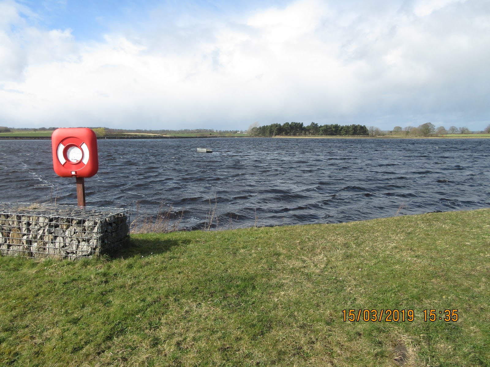
Beyond the farm we walked on the track to the B6318 road, usually known as the military road. On both sides of the road are reservoirs, the one on the north is a nature reserve with a small picnic area and bird hide. Not much happening today.
This stretch of the road is built on top of Hadrian’s Wall and is part of the Wall path, long distance walk from end to end.


 Whittle Dene
We walked east to Harlow Hill, a few cottages and a Congregational Chapel which seemed to be undergoing conversion to a house.
A short distance along the road we crossed at a signpost (Just before Albemarle Barracks) and headed down a track, passing close to Northside Farm,crossing the vallum, the ditch and earth works built by the Romans on the south side of the wall, and down to the A69. This is a busy road, dual carriageway and although there is a designated crossing point the road needs negotiating with care, especially for ageing gadgies.
Once safely across we approached the village of Horsley and headed east. Almost at the end of the village, on the right, is a partly hidden signpost that led us through a few buildings and then over fields to the road into Wylam and back to the car park.
Once changed we headed over the bridge to the Boathouse pub which had its usual selection of a dozen hand pulled beers. The Hexham Brewery “Shire” was very tasty!.

Contains OS data copyright. Crown copyright and database right 2019
MATRIX MMXIX 3c
Steps Miles
NAK 31827 11.5
Dave’s NAK 1 24802 11.74
“”””””””””””2 24799 11.74
“””””””””USB 25110 11.88
“”””””””””SM 25699 11.76
Etrex 4hr 7min walk 49 min talk 12.14
OUTDOOR GPS 11.5
And a few more


Storm Gareth hit the British Isles this week, bringing strong wind, rain and snow, in some parts. The wind persuaded us to postpone the proposed walk on Hadrian’s Wall which is a bit open to weather and we opted for a relatively sheltered walk from Wylam, small Tyneside town. We were promised a windy bright day with some showers.
Easy to reach, take the A69 west and turn left at the sign that says Wylam. Follow the road through the town centre to the car park just before the bridge, it’s free!

There are four of us out, numbers reduced again by holidays (in March?) and family commitments. We are Ben, Dave, John H. and me.
The map to use is OS Explorer 316 Newcastle upon Tyne.
There are a couple of benches in the car park, useful for booting up

Once ready, booted and wearing windproof tops we left the car park for the bridge over the Tyne. A footpath on the Wylam side goes under the bridge and follows the river bank to the Hagg Bank Bridge, once a Tyne crossing for the railway. The Newcastle – Carlisle route is on the south bank.


Now on the south bank we followed the “Daft as a brush “ trail, passing the “Spetchells”. These are like slag heaps, left over from the days when ICI had a chemical plant nearby. The factory produced fertiliser and explosives, it has been long gone but the heaps which are covered with vegetation remain.
Beyond the Spetchells (the name is of uncertain origin but the area was used for recreation before the heaps appeared) We crossed to the north side of the Tyne at Ovingham, walked past the church yard, turned left and found the signpost for Whittle Dene.


The footpath climbed steadily through the dene which has a number of weekend cottages and the ruins of an old mill. It also has plenty of woodland and in a few weeks when the flowers are out it will be a pretty country walk.


Near the top we called an early Herbie, deciding that the small quarry there would probably be the most sheltered spot on the day.
Break over we continued upwards to the A69, safely crossed by means of a footbridge. We continued on the footpath through fields to Welton Hill Farm. The farm was busy; mountains of timber were being cut up. The farmhouse itself is very interesting. Dating back to the 13th and 14th centuries it started life a fortified tower providing some defence against marauding Scots at a time when Welton was a sizeable village which could raise a number of defendents.


Beyond the farm we walked on the track to the B6318 road, usually known as the military road. On both sides of the road are reservoirs, the one on the north is a nature reserve with a small picnic area and bird hide. Not much happening today.
This stretch of the road is built on top of Hadrian’s Wall and is part of the Wall path, long distance walk from end to end.


We walked east to Harlow Hill, a few cottages and a Congregational Chapel which seemed to be undergoing conversion to a house.
A short distance along the road we crossed at a signpost (Just before Albemarle Barracks) and headed down a track, passing close to Northside Farm,crossing the vallum, the ditch and earth works built by the Romans on the south side of the wall, and down to the A69. This is a busy road, dual carriageway and although there is a designated crossing point the road needs negotiating with care, especially for ageing gadgies.
Once safely across we approached the village of Horsley and headed east. Almost at the end of the village, on the right, is a partly hidden signpost that led us through a few buildings and then over fields to the road into Wylam and back to the car park.
Once changed we headed over the bridge to the Boathouse pub which had its usual selection of a dozen hand pulled beers. The Hexham Brewery “Shire” was very tasty!.

Contains OS data copyright. Crown copyright and database right 2019
MATRIX MMXIX 3c
Steps Miles
NAK 31827 11.5
Dave’s NAK 1 24802 11.74
“”””””””””””2 24799 11.74
“””””””””USB 25110 11.88
“”””””””””SM 25699 11.76
Etrex 4hr 7min walk 49 min talk 12.14
OUTDOOR GPS 11.5
And a few more


No comments:
Post a Comment