SHIPLEY? (Northumberland) April 21st
There is a town between Leeds and Bradford in the good old West Riding of Yorkshire called Shipley.
The nearest name to it in Northumberland is Shilbottle, the starting point for today's walk. Easy to find, head north on the A1 and turn right at the signpost. The name comes from Old English Scipleanigas-botl, meaning "The Shipley people's buildings. " Shipley apparently means sheep pasture. There are places near Alnwick called Shipley, and thousands of them in Australia. The walk is covered by OS Explorer 332 Alnwick and Amble.
Because of holidays and family commitments there are four of us out today on a cool, breezy, cloudy Friday.
Entering the village we passed the Running Fox, an excellent cafe. At five pm it closes and one half of it becomes the Farrier Inn.
We parked on the side of the road near the church. There is small car park nearer the church, opposite the health spa, but it was full.
Free parking. Follow the road to the church.We walked down the road, passing the secret health spa, a peel tower and the church and turned left.
The old vicarage with its peel towerSt James'church. Mid 19th century on the site of a demolished 12 century church.
Beyond the church we turned right and followed a road to Townfoot, a farm with several new build houses on the site. From here we walked the edge of the field to Longdyk, making navigational error which led to a lengthy discussion but all was resolved. Crossing a field to a road, crossing that and several fields and a stretch of road to Spy Law.
We had a sign.
From Spy Law the route crossed fields and followed tracks in a direction a few degrees east of south to High Buston. Once through the farm and its many outbuildings we were back crossing fields. Some of the fields were already sprouting crops, some were recently ploughed and harrowed. The footpath crosses fields, if not seeded we crossed them. But some farmers leave paths between the crops.
We don't feel guilty crossing fields when a path has been left.
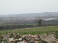
From this part of the walk we could not only see the North Sea, the coastal village of Alnmouth, and Coquet Island but we could here the noise of the waves hitting the beach.
Alnmouth on a grey day.
We hit the road between Buston Barns and Low Buston Hall. Four large stones, placed in a gap in the hedge to stop people driving vehicles into the field made good if cold seats for a Herbie. Slim pickings again, Skinny Whips and mini malt loaf.
Lunch consumed we headed south, entertained by a couple of horses who hoped we had apples. They were disappointed.
Had Dave been with us we would probably gone to see the remains of the Medieval village. Fortunately he was away.
Moving on wehit a road at mile 5, followed it for a short time before spotting a finger post that pointed the way across fields to the farm at Southside, another large Northumberland set up. Seral sections of farm track later we arrived at a road, turned right and walked uphill past Harty Law. On the corner we found the finger post for Shilbottle and walked several more fields back to the village.It was 4pm. th Farriers Inn opened at 5. The coffee in the Running Fox was excellent.
Contains OS data, copyright. Crown copyright and data base right 2023.
The walk is just over 9 miles and is the first mud free walk of the year.


No comments:
Post a Comment