Out with the Gosforth Greens again. (Northumberland) Sept 19
Unable to join the gadgies this week I made up for missing a walk by joining the Gosforth Greens walking group for a familiar stroll round Allen Banks.
There were seven of us out, we met at the National Trust Car Park close to Ridley Hall. Head west on the A69 and some ten miles beyond Hexham turn left, go under the railway and follow the road to the car park.
Two views of the car park. Unfortunately the ticket machine was not working so we were not able to pay the £4 parking fee. Every cloud and all that.
The map to use is OS OL 43 Hadian's Wall, which I am beginning bto think covers the whole of the north of England.
From the back of the car park we took the psth that follows close to the River Allen. Easy going with some short climbs, beautiful river and woodland views as Autumn starts to turn the leaves.
River Allen, with pebble beach.Just over a mile later we came to Plankey Mill, a popular picnic spot usually but very quiet today with only one family watching the dad burn the burgers.
Having crossed the river we crossed a field to the gate which is the entrance to more National Trust property. Almost immediately the path starts to climb, quite steeply in parts, as it makes its way to the ruin of Staward Peel.
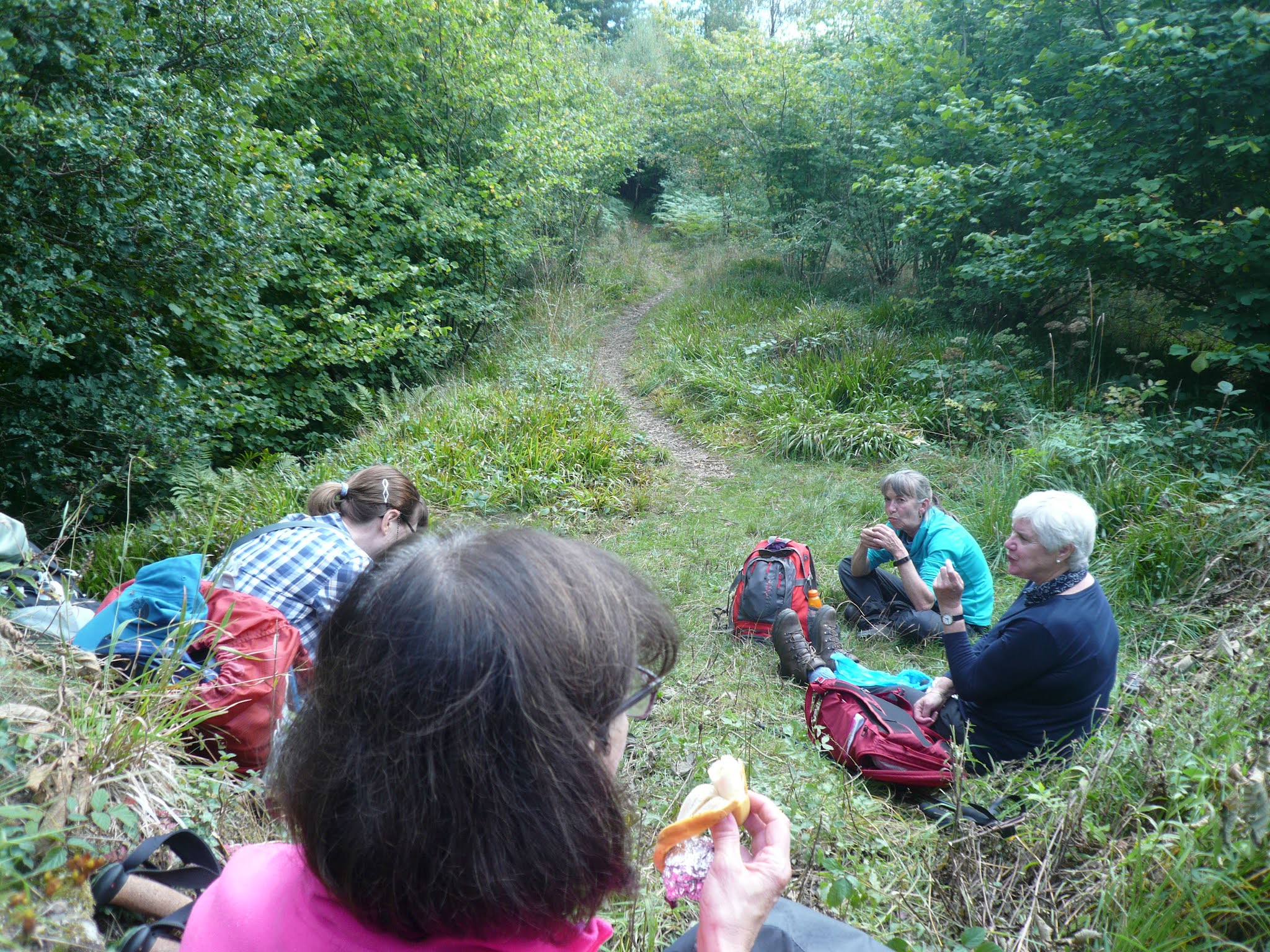
There is not much left of this unconquered peel tower but the remaining walls made a suitable place to have lunch although we had only covered about 2.7 miles. Not being a gadgie walk there was no sharing, I kept my chocolate covered flapjack to myself.
The walls of Staward Peel Dining alfresco at Staward. My vegan pasty was much admired. The peel tower was built on a promontory, steep sided with one access route made it impregnable.Lunch over we followed the path high above two streams to a gate. Having crossed the field to another well marked gate we headed down a steep path, crossed the stream by means of a footbridge and climbed up the opposite side. The footpath down is fairly slippy, even in summer, walking poles are a help.
Steps down to the footbridge, most of the path is not stepped.
Emerging from the wood we crossed a field to Harsondale Farm, turned right along the road for a short distance before spotting the stile on the left for Sillywrea.
There were some fine looking rams in the field, waiting for their raddles. A raddle is, apparently, the jacket the tups wear this time of year to show they have found the affections of ewes.
Woolly Tup, a bit distant for my camera.
Crossing the fields we came to Sillywrea farm which still operates with Clydesdale horses. Not much happening today.
Sillywrea horse. It is thought the name comes from Sallow Willows which may have grown here. Or Silly means happy which means the place is a "happy nook"
Just beyond the farm house we turned left down a track across fields to a road. Turning left we walked downhill and back to Plankey Mill.
Plankey Mill footbridge.
We had planned to walk back to the cars on the east side of the river but the path was fenced off. Rather than risk a landslide we crossed the stream and returned the way we came.
Contains OS data, copyright. Crown copyright and database right 2021
The walk is about 6.5 miles with a couple of stiff climbs.
A few more


No comments:
Post a Comment