Just a covid walk with three. (Northumberland)
October 2nd
Actually there were six of us which is the maximum number permitted to go for a walk in the current restrictions for the north east of England. And the daring six are Brian, Margaret, John H., John L., Dave and I, meeting at Dunstan Steads for a walk devised by Brian.
To find Dunstan Steads take the A1 north, leave north of Alnwick and follow road signs going through Rennington Rock and Embleton before finding the lane that goes down to the parking area at Dunstan Steads. The parking, at the roadside, is limited but free. It is very close to the beach at Embleton Bay too, and handy if you just want to walk to Dunstanburgh Castle.
The map for the walk is OS Explorer 332 Alnwick and Amble and is very useful. Much of this walk is over arable land, fairly well marked with the traditional little yellow arrows but they are missing in some places. (Maybe we went the wrong way.)
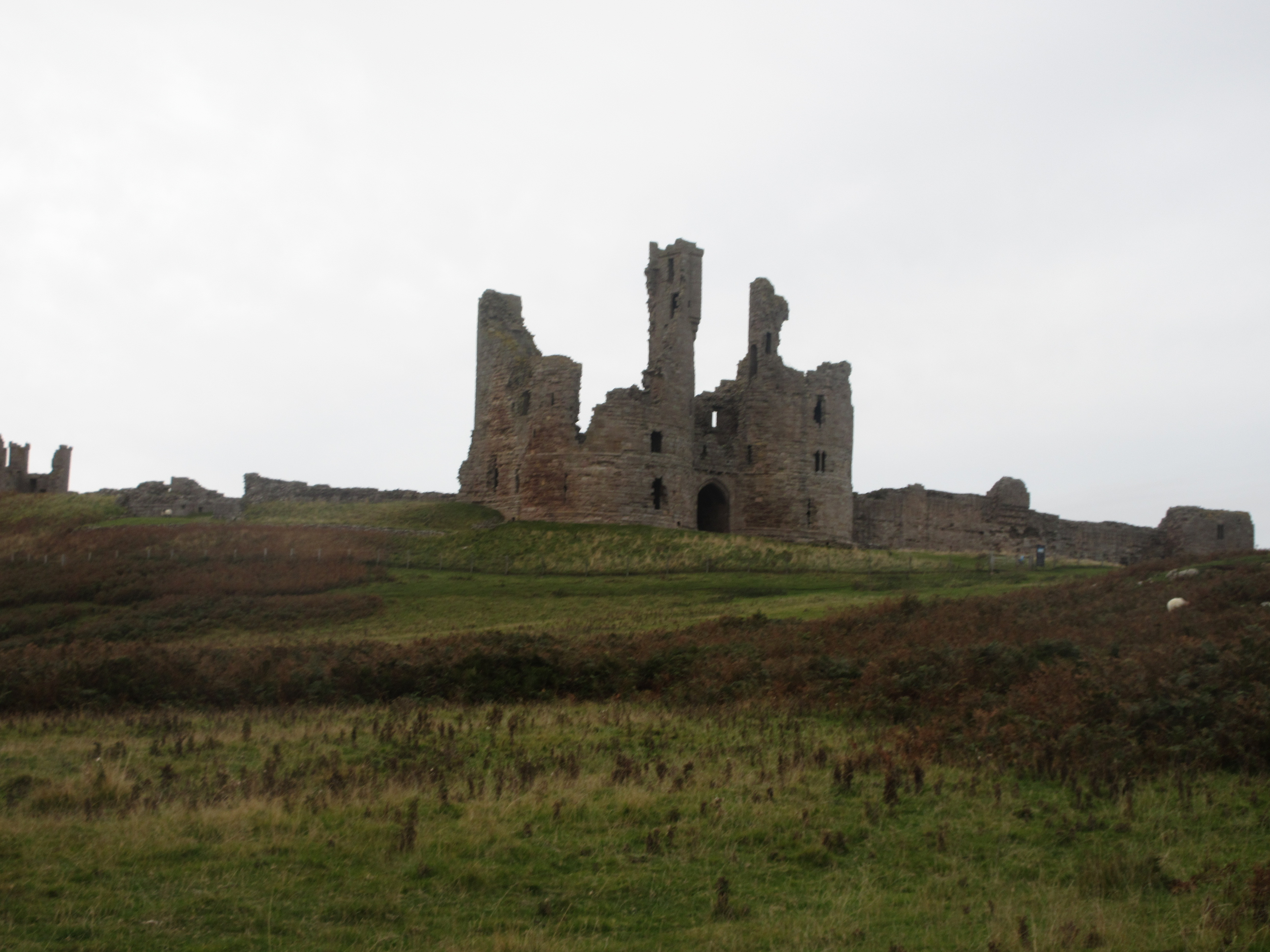
Very tidy parking at Dunstan Steads. I thought about cropping out the grey sky but changed my mind. Distant Dunstanburgh.The walk;
From the parking area we walked up the road, through the farm and on to Embleton. Turning left at the Blue Bell pub we continued past Holy Trinity Church and the village green, turned left again and watched out for the sign post for Rock on the left.
Holy Trinity Church, Embleton, dating back to 14th century with later changes.The footpath goes in a straight line in a direction slightly south of west, along the edges of recently ploughed fields until it meets the Main East Coast railway line. The path goes across the line, there is good visibility in both directions but care is needed, some trains go very fast.
Across the line the path continues for a short distance before coming to a small wood. We crossed the stream by the footbridge, walked the edges of several fields and reached the minor road into Rock.
Rock Hall. 13th century origins with many additions over the years. Rebuilt and remodelled after a fire in the 18th century it has served as a home, a Youth Hostel, a school and now a home again
There is a short walk round the pond nearby, we took it and settled down at one point for a Herbie (HS1)
Herbie view at Rock. We shared Bramley pies, flapjacks, chocolate bars and savoury tarts and ginger cake from Mrs A. Don't even think about it, we walked it off.
St Philip and St James church at Rock. Mid 12th century Norman church
Lunch over we walked the edges of more fields heading south west to a point just before South Rock Farm. Here we spotted, with some difficulty, the track by the side of fields that took us to Rennington.
All Saints, Rennington. Built as recently as 1831.From the village we crossed more fields to Lee Moor and then continued to the railway line. This time there is a bridge taking the track over the walk. Not quite long enough to be a tunnel, definitely a bridge. Once through we walked parallel to the line, round the edges of fields to the hamlet of Stamford. After a short distance by road we followed the sign post on the left for Dunstan walking through plantations and fields.
Not all fields grow crops. some support cows and sheepOn one gadgie walk this bus shelter in Dunstan served as a Herbie Spot on a wet day.
The footpath by the bus shelter took us to the road near Craster Tower and from there we walked into the village to a well earned second Herbie (HS2) on benches overlooking the harbour.
Craster Harbour from HS2 A lady commented on how well we socially distanced ourselves on the benches! Craster War Memorial.Herbie two over we walked the grassy path that is St. Oswald's Way towards Dunstanburgh Castle and took the footpath alongside the golf course back to the cars.
Pub visits are a problem, you can only drink in a family bubble which we aren't, apart from Brian and Margaret, so we went home.
Couldn't walk this way without the castle and the anticline, high tide today.
Contains OS data copyright. Crown copyright and data base right 2020
NOTE: Brian's route is marked in blue. His arrows go in a clockwise direction but we went anti-clockwise, or anti Clarkewise as it is known to gadgies. Instead of walking behind the Heughs on the last stretch we walked across the fields towards the castle.
The walk is about 13 miles long, mostly flat though.
Gallery:


No comments:
Post a Comment