Five go off to the Yorkshire Dales, August 2020.
This year's long distance walk was supposed to take place in June but had to be postponed by the pandemic.
Five of us are taking on the Tributaries Walk in the Yorkshire Dales. Brian and Margaret, Dave and I are making use of a package of hotels and luggage transport, Paul is joining us daily, brought over from Cumbria by his wife Maureen who is acting as support and bringing some essential items such as bread, cheese and pickle.
The Tributaries Walk.
The walk was originally devised by Mike Schofield. It is a circular walk, starting from Settle although I suppose you could start at any point. The route crosses 41 tributaries to t
he main rivers of the dales, hence the name. There is a guide book, written by Stuart W. Greig which describes the different sections and is full of useful pointers, which is as well because although the walk shares parts of the Pennine Way, A Pennine Journey and The Dales Way, it does not have its own markers.
Also, if you buy the book, you can download 16 maps which cover the walk and have useful notes printed on them.
The Tributaries Walk by Stuart W. Greig Published by Pocket Routes and highly recommended.
If you prefer to just use OS maps you need;
OL 2 Yorkshire Dales Southern and Western Areas and OL 30 Yorkshire Dales North and Central.
OL 19 Howgill Fells and OL 41 Forest of Bowland.
I recommend the guide book.
We used a company called BRIGANTES to organise our hotels and transfer our luggage. More about them on day 7

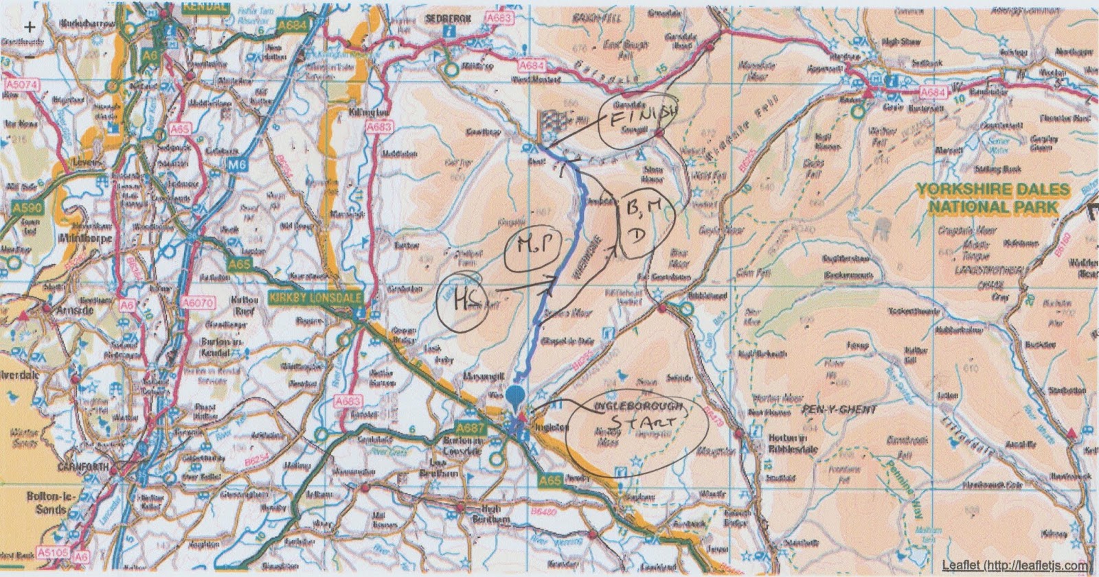
Outline map of the route.
This blog is not going to be a guide, buy the book. It is just an account of our walk.
Getting there.
Apart from Paul we all live on Tyneside and decided to add to the adventure by travelling to Settle by rail. Leaving Newcastle we took a train to Carlisle and changed to one going on the Settle to Carlisle line, possibly the most scenic route in the north of England as it winds its way down the dales, through tunnels and across viaducts, the most famous being the 440 yard Ribblehead viaduct. Unfortunately you don't get to see it as you ride the train.
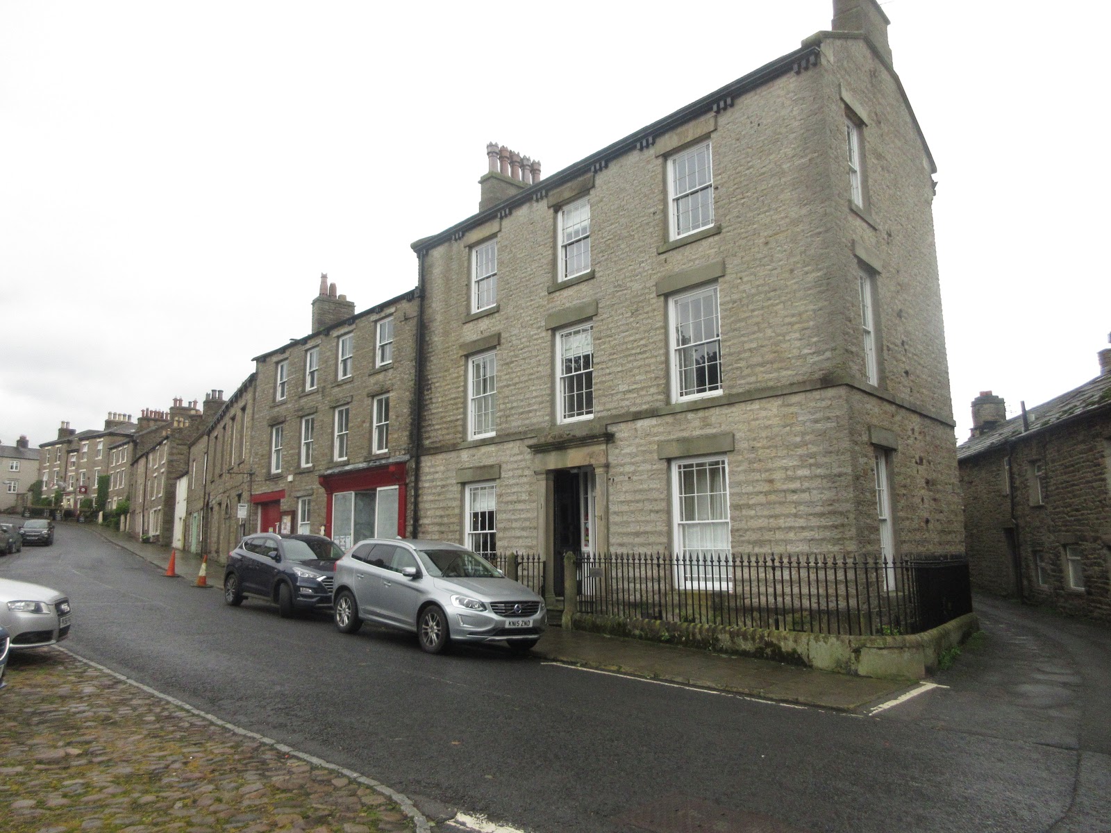
In Settle, a small Yorkshire town, we headed for the Golden Lion Hotel and prepared ourselves for the walk.
 The Golden Lion. Considering the problems hotels have under present conditions it was a great place to stay. Good food, selection of beers and comfortable rooms.
Day one. Settle to Ingleton
The Golden Lion offers The Yorkshire Grill for breakfast. It is made up of bacon, egg, sausage, beans, mushrooms, tomatoes and hash browns. Fuel for a day's walk.
Following thr directions in the guide book (and they are good) we left Settle and climbed up Giggleswick Scar. The footpath runs parallel to Buck Haw Brow, the road out of Settle and always a challenge to my father's trusty Morris 1000, although I peddled up it at least once in my youth. The path crosses fields and reaches the hamlet of Feizor where we found Elaine's tea room. It started to rain so we took time over coffee in the outdoor shelter.
 Misty moisty morning. From the ridge you can look over the Forest of Bowland, but not today.
 Elaine's lovely tea room in Feizor.
Once the rain had stopped we walked on. The path from Elaine's to the next village of Austwick is mostly on a narrow wall lined lane. Not wide enough to be a drove way or carriers way but easy walking.

Hale Lane between Feizor and Austwick
Austwick's claim to fame is that it was the site of the original "One man and his dog" TV series on sheep dog trials, so I am told.
From Austwick we walked on to Clapham, destroyed by the Scots after Bannockburn in 1314 and now a pretty tourist centre which also manages to produce some electricity by means of a water driven turbine.
Leaving Clapham we continued through Newby and on to Ingleton. I insisted the two tiny rectangles on the horizon were Heysham Nuclear Power stations and a closer look through binoculars proved me right. They must be about 25 miles away.
In Ingleton we stayed at the Riverside Lodge, BnB run by the delightful Debbioe who made us very welcome, but it is Yorkshire after all.
Having settled in and changed we went to the Masons Arms for dinner and rehydration.
 Riverside Lodge, Ingleton. Run by Debbie, brilliant.
 Contains OS data, copyright. Crown copyright and data base right 2020.
I'm not adding detailed maps as I usually do. Frankly cutting and pasting would take too much time. Buy the Guide
The day's mileage; 11 Running total 11 miles
Day two Ingleton to Dent.
After another cooked breakfast we left Ingleton for Dent.
The guide book suggests two routes at the beginning of the day's walk. A road walk towards Twistleton Scar or the Waterfall route which climbs alongside the River Twiss and passes several spectacular falls. It costs £7 and is along a narrow footpath with sections on wooden stairs but it is well worth it.
A popular day out though, we joined a crocodile of people following the narrow path and pausing to photograph cataracts. Niagra they are not but the Pecca Falls and Thornton Force make the journey uplifting and upwards.
 Dave, Paul, Margaret and Brian at the "Money Tree". Walkers hammer coins into the wood. They are very difficult to get out
 Pecca Falls
 Thornton Force
Not far from the exit to the falls walk we split the company. Dave, Margaret and Brian opted for the long haul up and over Whernside, highest peak in Yorkshire and one of the Three Peaks. Having done the walk at least twice I opted for the valley walk and so did Paul.
The valley walk crosses several fields in Kingsdale before joining the road. A quiet road with little traffic, but still steep in parts. At the head of the dale we took the footpath on the right and walked down into Deepdale. The local farmer has kindly painted rocks and posts a bright yellow so the path is easy to follow. Nevertheless at one point Paul and I missed a stile and after a bit of aimless wandering found the road down into Dentdale and along to the village of Dent.
Dent's most famous son is probably Adam Sedgwick who single headedly invented geology. (With a little help from a Scot possibly) Anyway he gave employment to an army of geography teachers.
The other three soon joined us. Whernside had been windy, the views not great because of low cloud.
We stayed and ate in the George and Dragon which had only recently reopened. Another comfortable night and we dined and drank there too.
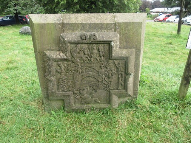
 A large stone, appropriate memorial to a geologist

George and Dragon hotel, Dent.

Contains OS data, copyright. Crown copyright and database right 2020.
Day's mileage 11 Running total 22
Day three. Dent to Garsdale Head.
After the usual refuelling breakfast we set off down Dentdale, which is home to the River Dee. At this point Tributaries shares the Dalesway path. The first section was along the valley bottom, easy walking across wet fields, climbing over many stiles which came in a variety of designs but mostly with a spring loaded gate too which had to be carefully negotiated or you got a slap across the backside.
Eventually we reached the road near Cow Dub, close to the Sportsmans Inn where we had stayed on the Dalesway walk two years ago. Because of the pandemic the inn is only open at certain times and this wasn't one of them so we couldn't pop in and say Hello.

The Sportsmans Inn, Cow Dub.
A few hundred yards beyond the pub, at Stonehouse farm we started the long climb up Arten Gill, walking under the viaduct as we reached Dent Fell. We walked under the viaduct, stopped to talk to a family who were admiring a small hedgehog, before turning back on ourselves to walk the track to the Coal Road and to admire the viaduct from above.

 Artengill Viaduct from below and above. Built from Dent Marble which is really a limestone quarried locally.
The Coal Road is named for what it was, to bring coal down from the moorland pits to the industrial areas in Dentdale.
We reached Garsdale Station, went under Dandrymire viaduct and missed the train passing over it before we reached the night's accommodation and refuelling stop the Moorcock Inn.
The Inn has a reputation for being haunted. The tale is sad, a couple who ran the inn were killed in a fire the day they retired and of course, their spirits need help. Only Dave heard strange knockings in the night.
 Dandrymire viaduct

Contains OS data, copyright. Crown copyright and database right 2020
Day's mileage 12 Running total 34 miles
Day four;Garsdale to Thwaite.
We were informed by the weatherman that today the UK would be hit by Storm Ellen with winds in excess of 55mph. For this reason we decided to make a change from the official route which goes over Great Shunner Fell and take the slightly lower road over the Butter Tubs.
Leaving the Moorcock Inn, after breakfast of course, we walked across fields and crossed stiles until we reached Hardraw. At this village we took a road heading north and climbed the steep tarmac up to Butter Tubs. It was windy. Margaret was seen at one point hanging on to Brian, Dave opened his jacket and tried to fly along, Paul and I walked on, with hope in our hearts and poles adding support, over the top and began the descent to Thwaite. About a mile from our next hotel a car pulled up beside me and Maureen said "Hi, would you like a lift?" Not being a purist I accepted her offer, as did Margaret and we went to the Kearton Country House in style. The tearoom next to the hotel was closed but the publican/innkeeper offered us tea and ginger biscuits, which we also accepted. The others soon joined us.
 Contains OS data, copyright. Crown copyright and database right 2020 (and a 1:25000 map)

Kearton Country house is not serving dinner at the moment. We were advised (by Brigantes) to order take away meals from the Farmers arms at nearby Muker. The manager of Kearton House would take one of us to collect and we could eat in the hotel. It was Fishy Friday so we ordered fish, chips and mushy peas x 3 and a fish pie. The mushy peas did not arrive so we tucked in. After about five minutes a lady arrived with three portions of peas and an apology.
Because of the pandemic the hotel offered a limited breakfast too. Ordered the previous night the food was brought to our rooms. Bacon roll instead of the full English!
Day's mileage 12 Running total 46 miles
Day five; Thwaite to Askrigg
The official route has walkers staying at Muker, a village to the east of Thwaite. We left Thwaite and started the day walking to Muker . (Not Mucker we were told, but Mooker)
At the village we headed north and uphill on footpaths to Swinner Gill where weturned east across moorland before descending into Gunnerside Gill. There is much evidence of the days when the area was busy with men mining lead, silver, lime and coal. The old offices and workshops are ruined but one made a good shelter for lunch before we started the long walk down Gunnerside Gill to the village of the same name. A narrow stony path at the bottom end near the village and an air ambulance above.
From Gunnerside we headed west along the River Swale before turning south at Ivelet Bridge. The air ambulance was parked near the bridge as were several police trucks and a car which seemed undamaged. The police were not forthcoming on the incident so we soldiered on, following the Pennine Journey until we reached the village of Askrigg and Thornsgill House, residence for the evening. Thornsgill was run by Barry, mountaineer and general adventurer. Happy to tell of his exploits he had reached the South Col on Everest and several other Himalayan peaks as well as running a fish and chip shop in Buckie, Scotland.
Dinner in the nearby Crown Hotel.
 Contains OS data, copyright. Crown copyright and database right 2020
 Air ambulance taking off
 Preparing for another damp day at Thornsgill House Askrigg
 We were told this house in Askrigg was used as the vets' house in the James Herriot tales.
Day's mileage 15 Running total 61 miles
Day 6: Askrigg to Hubberholme.
Barry served a filling breakfast, waved a fond farewell and sent us on our way. After a relatively gentle startb we found ourselves in the village of Bainbridge. Being Sunday it was busy with tourists but we decided to have a break and enjoy a coffee, watching the world go round a very large village green. Bainbridge generates much of its own electricity by means of a water powered turbine.
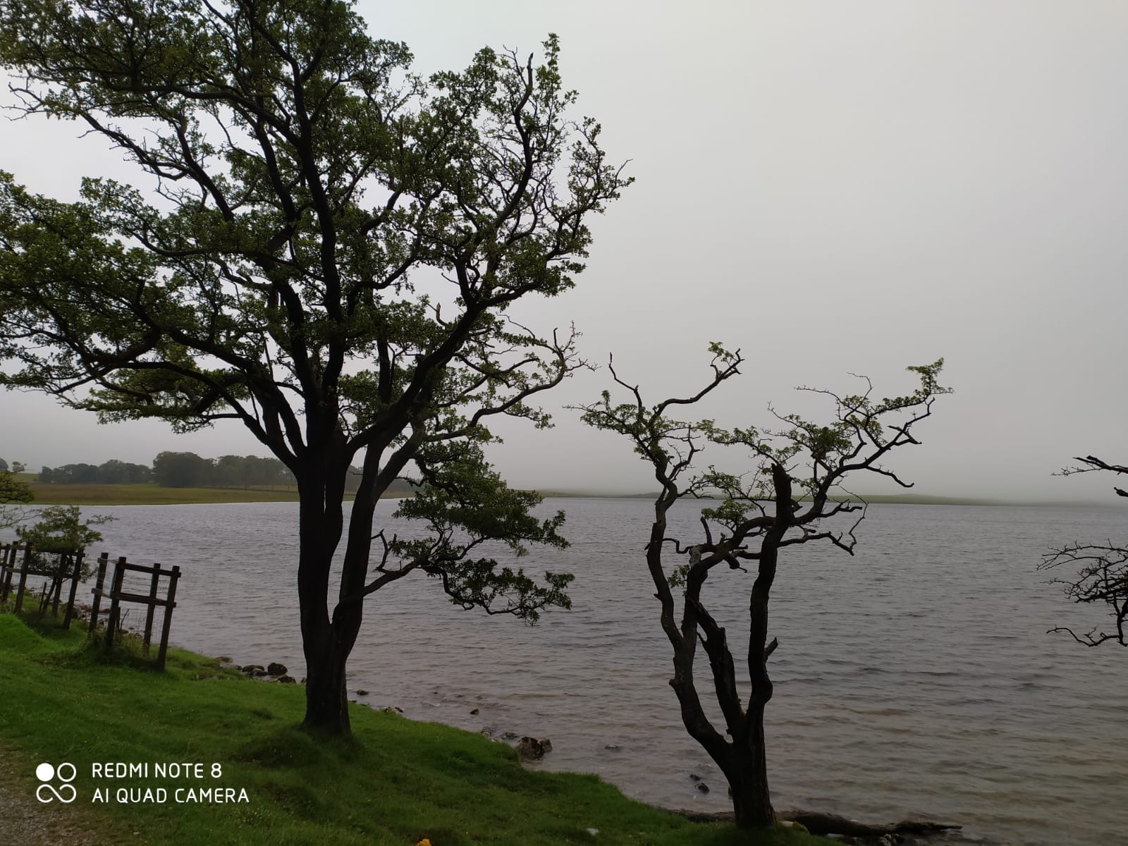
Coffee over we followed paths across fields, stiles and gates to Semer Water, a fairly large tarn used by fishermen, swimmers and kayakers. We walked round the eastern edge and headed uphill to Stalling Busk, a small village with a small church. We decided to lunch here and of course it immediately started to rain.
 Bainbridge
 Semer water
 A big softy, but I wouldn't argue
Lunch and rain over, although it was still windy, we headed south across moorland along Gilbert Lane before descending through the village of Cray and finding the George at Hubberholme.
Apart from the George and a church there is little at Hubberholme. The pub/inn is run by Ed who we have met before and he made us very welcome, taking temperatures before we could go in.
Being a Sunday he had roast dinners on offer and several different beers.

 Two sides of the George at Hubberholme. J B Priestley's favourite pub
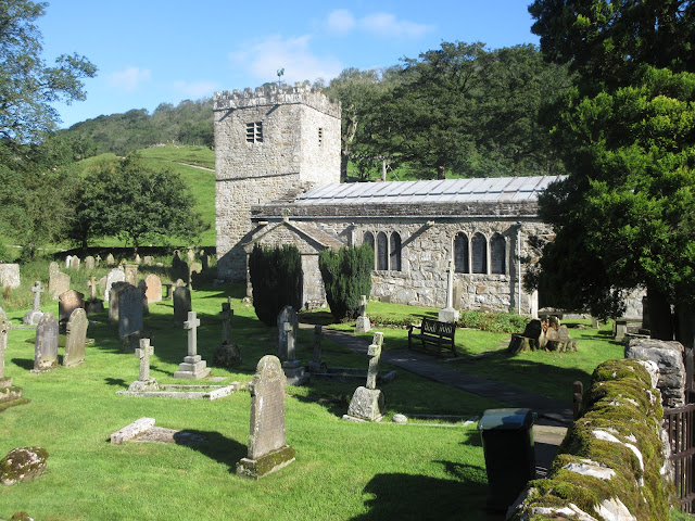 Hubberholme church (St Michael and all Angels) Priestley's ashes are buried in an unmarked spot in the churchyard.

Contains OS data, copyright. Crown copyright and database right 2020
Day's mileage 12 Running total 73 miles
Day seven; Hubberholme to Arncliffe
Ed waved a cheery goodbye, mounted his bicycle and set off pedalling uphill. We set off walking uphill on what was to be a fine, warm and sunny day, the best of the week. We walked up Littondale after the initial morning climb until we came to the village of Halton Gill.
Passing one building we noticed it was the Brigantes Headquarters and outside was one of the ladies who runs it. I've sent so many emails because of problems with the epidemic we were almost good friends and it was nice to meet.It was another pretty little village too so we stopped for lunch, sitting on benches near the church and discussing electric bikes with a lady who was trying one out.
 Brigantes Headquarters, read the vertical post.

Halton Gill church.
Lunch and bike talk over we set off again on the way to Arncliffe. The path took us along the riverside, crossing even more stiles until we reached the village of Litton. It was such a warm afternoon it seemed a shame not to have a drink at the Queen's Arms in the village. So we did, then carried on across fields to Arncliffe.
The hotel/pub in Arncliffe is the Falcon but it was once the pub in the ITV soap Emmerdale, the Woolpack. The public rooms are decorated with country articles and many pots and plates. Present conditions made service a little difficult but food and beer were good. The only drawback was that we had no ensuite facility in the bedroom, wandering to the bathroom at night does not encourage too much drink!
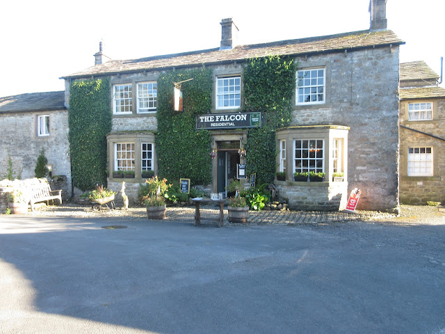 The Falcon at Arncliffe, aka as the Woolpack

 A rare dry moment

 Malham Tarn
 Walking in the rain


This year's long distance walk was supposed to take place in June but had to be postponed by the pandemic.
Five of us are taking on the Tributaries Walk in the Yorkshire Dales. Brian and Margaret, Dave and I are making use of a package of hotels and luggage transport, Paul is joining us daily, brought over from Cumbria by his wife Maureen who is acting as support and bringing some essential items such as bread, cheese and pickle.
The Tributaries Walk.
The walk was originally devised by Mike Schofield. It is a circular walk, starting from Settle although I suppose you could start at any point. The route crosses 41 tributaries to t
he main rivers of the dales, hence the name. There is a guide book, written by Stuart W. Greig which describes the different sections and is full of useful pointers, which is as well because although the walk shares parts of the Pennine Way, A Pennine Journey and The Dales Way, it does not have its own markers.
Also, if you buy the book, you can download 16 maps which cover the walk and have useful notes printed on them.
The Tributaries Walk by Stuart W. Greig Published by Pocket Routes and highly recommended.
If you prefer to just use OS maps you need;
OL 2 Yorkshire Dales Southern and Western Areas and OL 30 Yorkshire Dales North and Central.
OL 19 Howgill Fells and OL 41 Forest of Bowland.
I recommend the guide book.
We used a company called BRIGANTES to organise our hotels and transfer our luggage. More about them on day 7

Outline map of the route.
This blog is not going to be a guide, buy the book. It is just an account of our walk.
Getting there.
Apart from Paul we all live on Tyneside and decided to add to the adventure by travelling to Settle by rail. Leaving Newcastle we took a train to Carlisle and changed to one going on the Settle to Carlisle line, possibly the most scenic route in the north of England as it winds its way down the dales, through tunnels and across viaducts, the most famous being the 440 yard Ribblehead viaduct. Unfortunately you don't get to see it as you ride the train.
In Settle, a small Yorkshire town, we headed for the Golden Lion Hotel and prepared ourselves for the walk.

Day one. Settle to Ingleton
The Golden Lion offers The Yorkshire Grill for breakfast. It is made up of bacon, egg, sausage, beans, mushrooms, tomatoes and hash browns. Fuel for a day's walk.
Following thr directions in the guide book (and they are good) we left Settle and climbed up Giggleswick Scar. The footpath runs parallel to Buck Haw Brow, the road out of Settle and always a challenge to my father's trusty Morris 1000, although I peddled up it at least once in my youth. The path crosses fields and reaches the hamlet of Feizor where we found Elaine's tea room. It started to rain so we took time over coffee in the outdoor shelter.


Once the rain had stopped we walked on. The path from Elaine's to the next village of Austwick is mostly on a narrow wall lined lane. Not wide enough to be a drove way or carriers way but easy walking.

Hale Lane between Feizor and Austwick
Austwick's claim to fame is that it was the site of the original "One man and his dog" TV series on sheep dog trials, so I am told.
From Austwick we walked on to Clapham, destroyed by the Scots after Bannockburn in 1314 and now a pretty tourist centre which also manages to produce some electricity by means of a water driven turbine.
Leaving Clapham we continued through Newby and on to Ingleton. I insisted the two tiny rectangles on the horizon were Heysham Nuclear Power stations and a closer look through binoculars proved me right. They must be about 25 miles away.
In Ingleton we stayed at the Riverside Lodge, BnB run by the delightful Debbioe who made us very welcome, but it is Yorkshire after all.
Having settled in and changed we went to the Masons Arms for dinner and rehydration.


I'm not adding detailed maps as I usually do. Frankly cutting and pasting would take too much time. Buy the Guide
The day's mileage; 11 Running total 11 miles
Day two Ingleton to Dent.
After another cooked breakfast we left Ingleton for Dent.
The guide book suggests two routes at the beginning of the day's walk. A road walk towards Twistleton Scar or the Waterfall route which climbs alongside the River Twiss and passes several spectacular falls. It costs £7 and is along a narrow footpath with sections on wooden stairs but it is well worth it.
A popular day out though, we joined a crocodile of people following the narrow path and pausing to photograph cataracts. Niagra they are not but the Pecca Falls and Thornton Force make the journey uplifting and upwards.


Not far from the exit to the falls walk we split the company. Dave, Margaret and Brian opted for the long haul up and over Whernside, highest peak in Yorkshire and one of the Three Peaks. Having done the walk at least twice I opted for the valley walk and so did Paul.
The valley walk crosses several fields in Kingsdale before joining the road. A quiet road with little traffic, but still steep in parts. At the head of the dale we took the footpath on the right and walked down into Deepdale. The local farmer has kindly painted rocks and posts a bright yellow so the path is easy to follow. Nevertheless at one point Paul and I missed a stile and after a bit of aimless wandering found the road down into Dentdale and along to the village of Dent.
Dent's most famous son is probably Adam Sedgwick who single headedly invented geology. (With a little help from a Scot possibly) Anyway he gave employment to an army of geography teachers.
The other three soon joined us. Whernside had been windy, the views not great because of low cloud.
We stayed and ate in the George and Dragon which had only recently reopened. Another comfortable night and we dined and drank there too.


George and Dragon hotel, Dent.
Contains OS data, copyright. Crown copyright and database right 2020.
Day's mileage 11 Running total 22
Day three. Dent to Garsdale Head.
After the usual refuelling breakfast we set off down Dentdale, which is home to the River Dee. At this point Tributaries shares the Dalesway path. The first section was along the valley bottom, easy walking across wet fields, climbing over many stiles which came in a variety of designs but mostly with a spring loaded gate too which had to be carefully negotiated or you got a slap across the backside.
Eventually we reached the road near Cow Dub, close to the Sportsmans Inn where we had stayed on the Dalesway walk two years ago. Because of the pandemic the inn is only open at certain times and this wasn't one of them so we couldn't pop in and say Hello.

The Sportsmans Inn, Cow Dub.
A few hundred yards beyond the pub, at Stonehouse farm we started the long climb up Arten Gill, walking under the viaduct as we reached Dent Fell. We walked under the viaduct, stopped to talk to a family who were admiring a small hedgehog, before turning back on ourselves to walk the track to the Coal Road and to admire the viaduct from above.


The Coal Road is named for what it was, to bring coal down from the moorland pits to the industrial areas in Dentdale.
We reached Garsdale Station, went under Dandrymire viaduct and missed the train passing over it before we reached the night's accommodation and refuelling stop the Moorcock Inn.
The Inn has a reputation for being haunted. The tale is sad, a couple who ran the inn were killed in a fire the day they retired and of course, their spirits need help. Only Dave heard strange knockings in the night.


Contains OS data, copyright. Crown copyright and database right 2020
Day's mileage 12 Running total 34 miles
Day four;Garsdale to Thwaite.
We were informed by the weatherman that today the UK would be hit by Storm Ellen with winds in excess of 55mph. For this reason we decided to make a change from the official route which goes over Great Shunner Fell and take the slightly lower road over the Butter Tubs.
Leaving the Moorcock Inn, after breakfast of course, we walked across fields and crossed stiles until we reached Hardraw. At this village we took a road heading north and climbed the steep tarmac up to Butter Tubs. It was windy. Margaret was seen at one point hanging on to Brian, Dave opened his jacket and tried to fly along, Paul and I walked on, with hope in our hearts and poles adding support, over the top and began the descent to Thwaite. About a mile from our next hotel a car pulled up beside me and Maureen said "Hi, would you like a lift?" Not being a purist I accepted her offer, as did Margaret and we went to the Kearton Country House in style. The tearoom next to the hotel was closed but the publican/innkeeper offered us tea and ginger biscuits, which we also accepted. The others soon joined us.


Kearton Country house is not serving dinner at the moment. We were advised (by Brigantes) to order take away meals from the Farmers arms at nearby Muker. The manager of Kearton House would take one of us to collect and we could eat in the hotel. It was Fishy Friday so we ordered fish, chips and mushy peas x 3 and a fish pie. The mushy peas did not arrive so we tucked in. After about five minutes a lady arrived with three portions of peas and an apology.
Because of the pandemic the hotel offered a limited breakfast too. Ordered the previous night the food was brought to our rooms. Bacon roll instead of the full English!
Day's mileage 12 Running total 46 miles
Day five; Thwaite to Askrigg
The official route has walkers staying at Muker, a village to the east of Thwaite. We left Thwaite and started the day walking to Muker . (Not Mucker we were told, but Mooker)
At the village we headed north and uphill on footpaths to Swinner Gill where weturned east across moorland before descending into Gunnerside Gill. There is much evidence of the days when the area was busy with men mining lead, silver, lime and coal. The old offices and workshops are ruined but one made a good shelter for lunch before we started the long walk down Gunnerside Gill to the village of the same name. A narrow stony path at the bottom end near the village and an air ambulance above.
From Gunnerside we headed west along the River Swale before turning south at Ivelet Bridge. The air ambulance was parked near the bridge as were several police trucks and a car which seemed undamaged. The police were not forthcoming on the incident so we soldiered on, following the Pennine Journey until we reached the village of Askrigg and Thornsgill House, residence for the evening. Thornsgill was run by Barry, mountaineer and general adventurer. Happy to tell of his exploits he had reached the South Col on Everest and several other Himalayan peaks as well as running a fish and chip shop in Buckie, Scotland.
Dinner in the nearby Crown Hotel.


Day's mileage 15 Running total 61 miles
Day 6: Askrigg to Hubberholme.
Barry served a filling breakfast, waved a fond farewell and sent us on our way. After a relatively gentle startb we found ourselves in the village of Bainbridge. Being Sunday it was busy with tourists but we decided to have a break and enjoy a coffee, watching the world go round a very large village green. Bainbridge generates much of its own electricity by means of a water powered turbine.
Coffee over we followed paths across fields, stiles and gates to Semer Water, a fairly large tarn used by fishermen, swimmers and kayakers. We walked round the eastern edge and headed uphill to Stalling Busk, a small village with a small church. We decided to lunch here and of course it immediately started to rain.


Lunch and rain over, although it was still windy, we headed south across moorland along Gilbert Lane before descending through the village of Cray and finding the George at Hubberholme.
Apart from the George and a church there is little at Hubberholme. The pub/inn is run by Ed who we have met before and he made us very welcome, taking temperatures before we could go in.
Being a Sunday he had roast dinners on offer and several different beers.


Contains OS data, copyright. Crown copyright and database right 2020
Day's mileage 12 Running total 73 miles
Day seven; Hubberholme to Arncliffe
Ed waved a cheery goodbye, mounted his bicycle and set off pedalling uphill. We set off walking uphill on what was to be a fine, warm and sunny day, the best of the week. We walked up Littondale after the initial morning climb until we came to the village of Halton Gill.
Passing one building we noticed it was the Brigantes Headquarters and outside was one of the ladies who runs it. I've sent so many emails because of problems with the epidemic we were almost good friends and it was nice to meet.It was another pretty little village too so we stopped for lunch, sitting on benches near the church and discussing electric bikes with a lady who was trying one out.


Halton Gill church.
Lunch and bike talk over we set off again on the way to Arncliffe. The path took us along the riverside, crossing even more stiles until we reached the village of Litton. It was such a warm afternoon it seemed a shame not to have a drink at the Queen's Arms in the village. So we did, then carried on across fields to Arncliffe.
The hotel/pub in Arncliffe is the Falcon but it was once the pub in the ITV soap Emmerdale, the Woolpack. The public rooms are decorated with country articles and many pots and plates. Present conditions made service a little difficult but food and beer were good. The only drawback was that we had no ensuite facility in the bedroom, wandering to the bathroom at night does not encourage too much drink!


Contains OS data, copyright. Crown copyright and Database right 2020
Daily mileage 12 miles Running total 85 miles
Day Eight Arncliffe to Settle
Encouraged by the weather forecast; heavy rain all day with the possibility of thunderstorms we set off in full waterproofs on the last day of our journey.
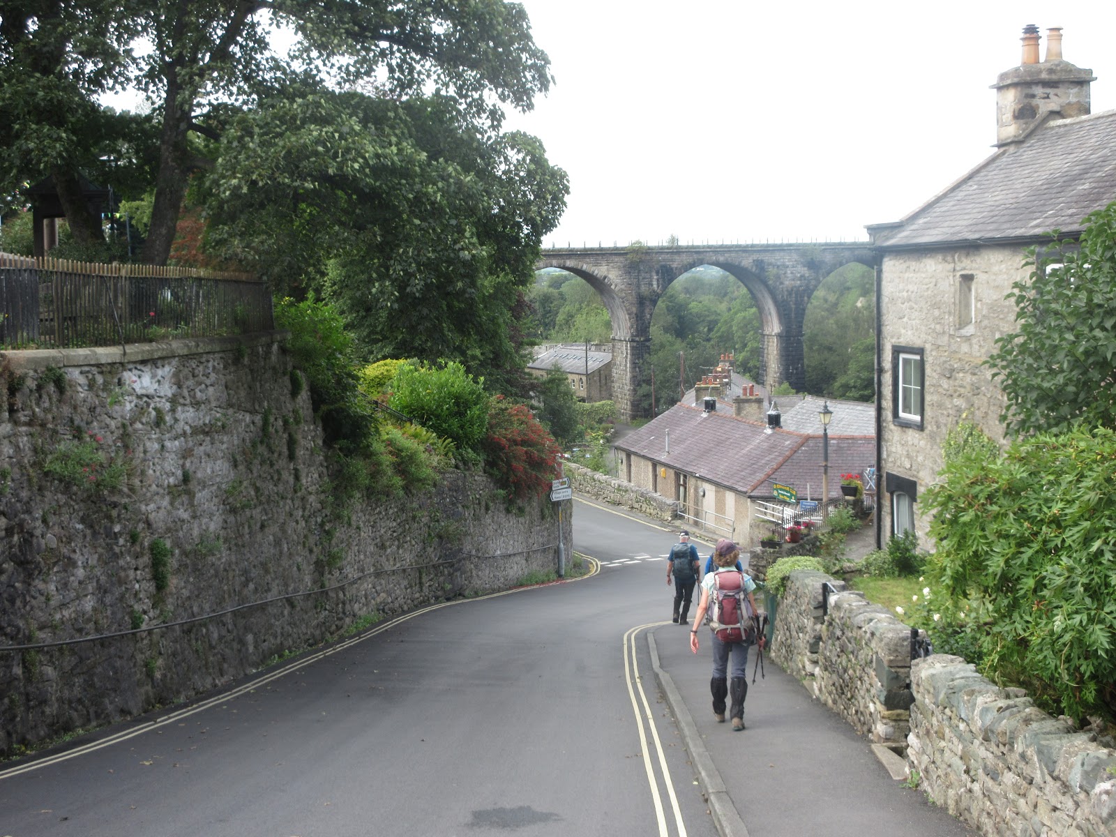
Leaving the Falcon we climbed the steep Monk's Road , claimed to be the best of paths to walk, but not in the pouring rain. Heading southwest we walked on in very poor visibility until we reached Malham Tarn. Notices forbade swimming or barbecues, not that we were interested in either. In a rare moment of no rain we talked to a couple out for a stroll before following the Pennine Way to Malham Cove. I first came here as a Boy Scout, I remember it was dry. Today the heavy rain made the limestone pavement slippy and the rocky paths needed to be followed with care. From the Cove we headed west along the Pennine Bridleway, more fields, more gated stiles, more rain until we reached a tarmac road that led downhill into Settle and the Golden Lion. A young man advised us to change and hand our soaking clothes to him and he would put them in the drying room. This was the only place with such a facility I think and the offer was accepted.
Changed and warmed we had a celebratory dinner in the hotel, even going to the expense of enjoying a sweet and several drinks to round off the week.
Because of the rain I left my camera in the suitcase to be transported so the following photos are from Margaret.


Contains OS data, copyright. Crown copyright and database right 2020
Day's mileage 12 miles Final total 97 miles (But I'm claiming 100)
And next day we went home on the train, wearing our masks of course.
Just a few pictures


No comments:
Post a Comment