We used to have good walks together...
So sad to watch them all go by.....
(Thanks Phil and Don)
The United Kingdom of Great Britain and Northern Ireland is still under lockdown. The government asks, very politely, that we only walk from home. Wish I lived in Seathwaite or Rothbury at the moment!
So here is another virtual walk to keep me busy.
As you may have noticed we go to a pub after a walk and talk about manly things like football and Nietzsche over a pint or two. We then make suggestions for the next walk. Eventually somebody will cry "Brough Law" and there will be a few giggles. This is our Mornington Crescent* moment and is a bit of a joke. Brough Law is a pleasant walk with a bit of bird watching thrown in and some large piles of stones.
It's another perfect walking day too, sunny, light cooling breeze which is always on our backs regardless of our direction.
This week's virtual walk is the famous Brough Law outing. It starts at the Muddy Boots Café in Ingram Valley. Muddy Boots (I think it is now called Ingram Café) used to be a café and information centre but cuts caused the information side to be closed. It does have in a side rom a display of valley artefacts and some information on the area. Ingram, before the Middle Ages, was heavily populated but the area went into decline. Today it is a grassy valley and always has been, Ingram comes from Old English angr-ham meaning grassy settlement or farm.
To get there A1 north, A697 at Morpeth and just beyond Powburn turn left between two rows of cottages (there is a finger post saying Ingram) and drive a few miles, cross the Breamish, turn left down the lane past the church and there is the car park and café.
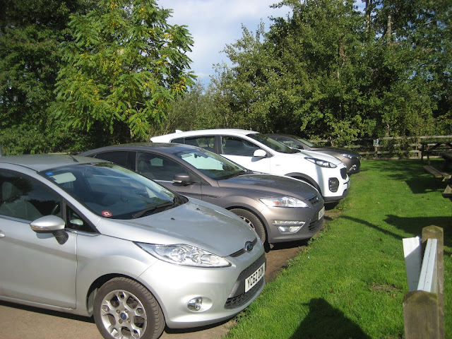 The car park at Ingram, small but perfectly formed
 Muddy Boots (Ingram café?) and small museum of valley life.
 Small museum of valley life
 A quern, for grinding corn
There are two ways of starting the walk;
Walk up the lane past the church of St. Michael which has 11th century origins and 13 and 14th century additions plus a font dated 1662, past the few houses on the right and join the valley road.
Alternatively take the footpath in the bottom corner of the car park which goes through a small wood and joins the valley road near a bridge over the River Breamish, turn left.
Either way walk along the valley road west past Ingram farm which usually has strutting peacocks until you reach the next car park on the right, which also has toilets.
 a pride, ostentation or muster of peacocks. I think a lot of collective nouns are just made up on the spot.
On the left hand side of the road take the grassy track, which is not sign posted, but climbs steadily, no steeply, and alongside a wood, until you reach the top of Brough Law.
 The path to Brough Law.
On the top of Brough Law are the remains of an ancient fort, maybe Iron Age. All that remains are circles of stone but the experts reckon that when constructed there would have been a palisade about 9 feet high.
I have much faith in experts. Recently I read of one who had calculated that older and disabled people took longer on a pedestrian crossing than "normal" people. Real expert work there.

 Remains of the Iron Age fort on Brough Law.
Once you have examined and marvelled at the stone circles on the top of the hill continue to walk on the grassy track that goes slightly east of south. There are a number of tracks in the area but be firm and stay on the same bearing past the enclosure marked Fort and Settlement on the OS map and walk over Cochrane Pike.
From the pike head south east downhill to a farm track, turn right and shortly after turn left at the marker and walk down to, and cross, Rocky Burn.
Once over the burn and through the gate turn north east and walk to the top of Old Fawdon Hill.
 Follow the footpath up Old Fawdon Hill to the trig point at the top
On the way up, or from the top, admire the outline of another Iron Age fort to the east.
 Sheep safely grazing in the fort. Ridge and furrow in the foreground
 Trig point on Old Fawdon. (They were used for mapping before satellites)
 A fine display of baseball caps as we dined close to the trig point.
Almond slices, mini apple pies, flapjacks, Ben's ginger biscuits,other biscuits and Cheese scones from Mrs A.
If you lunch here too continue your journey down the hill and along the footpath that crosses fields to the farm at Fawdon. In the north west corner of the farm is a footpath that goes across fields, contouring at the base of the hill marked Hang Gliding Club on the OS map, not that I've ever seen any.
 Part of Fawdon Farm buildings
At a point where the footpath begins to turn north west take the footpath east across a field to the minor road that goes to Branton. Turn left and then take the gate on the right that takes you into the Branton Nature Reserve. Follow the path round the north side of the ponds, admiring the bird life on the water. At one point there is a bird hide offering views over the water.
 Canada geese on the Branton Pond
 And a swan
 Inside the bird hide. Please be quiet and do not disturb the Kingfisher when it lands on the branch just in front of the building. Patient photographers can get annoyed, I am told.
Once you have had enough of the hide continue circumnavigating the ponds and return to the road. Turn right and walk towards the footbridge over the Breamish.
 At the footbridge you have another choice;
Cross the bridge and walk along the road back to the car park, you might see Sand Martins which nest on the river bank.
Do not cross the bridge but walk along the south side of the river until you meet the path to Ingram Mill.
 Cultivation Terraces and ridge and furrow on Heddon Hill, north side of the river.
 Probably the resting place of old sheepdogs rather than somebody's human victims.
Not far beyond Ingram Mill is the church and the cafe and car park. On the way home there are several pubs to call in. The Anglers'Arms at Weldon Bridge or The Shoulder of Mutton at Longhorsely are both pretty good
*Mornington Crescent is a phrase used on the BBC radio programme “ I’m sorry I haven’t a clue”
 The walk is about 10 miles with a couple of steepish climbs but the views are worth the effort.
And a few more pictures from the day


So sad to watch them all go by.....
(Thanks Phil and Don)
The United Kingdom of Great Britain and Northern Ireland is still under lockdown. The government asks, very politely, that we only walk from home. Wish I lived in Seathwaite or Rothbury at the moment!
So here is another virtual walk to keep me busy.
As you may have noticed we go to a pub after a walk and talk about manly things like football and Nietzsche over a pint or two. We then make suggestions for the next walk. Eventually somebody will cry "Brough Law" and there will be a few giggles. This is our Mornington Crescent* moment and is a bit of a joke. Brough Law is a pleasant walk with a bit of bird watching thrown in and some large piles of stones.
It's another perfect walking day too, sunny, light cooling breeze which is always on our backs regardless of our direction.
This week's virtual walk is the famous Brough Law outing. It starts at the Muddy Boots Café in Ingram Valley. Muddy Boots (I think it is now called Ingram Café) used to be a café and information centre but cuts caused the information side to be closed. It does have in a side rom a display of valley artefacts and some information on the area. Ingram, before the Middle Ages, was heavily populated but the area went into decline. Today it is a grassy valley and always has been, Ingram comes from Old English angr-ham meaning grassy settlement or farm.
To get there A1 north, A697 at Morpeth and just beyond Powburn turn left between two rows of cottages (there is a finger post saying Ingram) and drive a few miles, cross the Breamish, turn left down the lane past the church and there is the car park and café.


There are two ways of starting the walk;
Walk up the lane past the church of St. Michael which has 11th century origins and 13 and 14th century additions plus a font dated 1662, past the few houses on the right and join the valley road.
Alternatively take the footpath in the bottom corner of the car park which goes through a small wood and joins the valley road near a bridge over the River Breamish, turn left.
Either way walk along the valley road west past Ingram farm which usually has strutting peacocks until you reach the next car park on the right, which also has toilets.

On the left hand side of the road take the grassy track, which is not sign posted, but climbs steadily, no steeply, and alongside a wood, until you reach the top of Brough Law.

On the top of Brough Law are the remains of an ancient fort, maybe Iron Age. All that remains are circles of stone but the experts reckon that when constructed there would have been a palisade about 9 feet high.
I have much faith in experts. Recently I read of one who had calculated that older and disabled people took longer on a pedestrian crossing than "normal" people. Real expert work there.


Once you have examined and marvelled at the stone circles on the top of the hill continue to walk on the grassy track that goes slightly east of south. There are a number of tracks in the area but be firm and stay on the same bearing past the enclosure marked Fort and Settlement on the OS map and walk over Cochrane Pike.
From the pike head south east downhill to a farm track, turn right and shortly after turn left at the marker and walk down to, and cross, Rocky Burn.
Once over the burn and through the gate turn north east and walk to the top of Old Fawdon Hill.

On the way up, or from the top, admire the outline of another Iron Age fort to the east.


Almond slices, mini apple pies, flapjacks, Ben's ginger biscuits,other biscuits and Cheese scones from Mrs A.
If you lunch here too continue your journey down the hill and along the footpath that crosses fields to the farm at Fawdon. In the north west corner of the farm is a footpath that goes across fields, contouring at the base of the hill marked Hang Gliding Club on the OS map, not that I've ever seen any.

At a point where the footpath begins to turn north west take the footpath east across a field to the minor road that goes to Branton. Turn left and then take the gate on the right that takes you into the Branton Nature Reserve. Follow the path round the north side of the ponds, admiring the bird life on the water. At one point there is a bird hide offering views over the water.


Once you have had enough of the hide continue circumnavigating the ponds and return to the road. Turn right and walk towards the footbridge over the Breamish.

Cross the bridge and walk along the road back to the car park, you might see Sand Martins which nest on the river bank.
Do not cross the bridge but walk along the south side of the river until you meet the path to Ingram Mill.


Not far beyond Ingram Mill is the church and the cafe and car park. On the way home there are several pubs to call in. The Anglers'Arms at Weldon Bridge or The Shoulder of Mutton at Longhorsely are both pretty good
*Mornington Crescent is a phrase used on the BBC radio programme “ I’m sorry I haven’t a clue”

And a few more pictures from the day


No comments:
Post a Comment