Mark Anthony's Helm. (Cumbria ) May 17th.
Reduced to a team of three, Harry, Dave, and I are going to walk to the top of Cross Fell, at 853 metres (2798 feet), the highest point in the English Pennines. It is a while since we have done this walk and we are hoping for a fine day as the views from the top can be spectacular.
The walk starts in the village of Blencarn, which sounds Scottish but isn't. To reach the village from Newcastle take the A69 west, turn off onto the A686 close to Haydon Bridge, drive through Alston, over Hartside and head south from Melmerby village. The map to use is OS OL 31 North Pennines and is recommended.
Close to Blencarn are the hanging Walls of Mark Anthony. Highly unlikely he ever walked up Cross Fell. He may have been with his mate Caesar when they came to Britain in 55BC but they only went to London before going home. It is thought the name may have been given because the Maiden Way, a Roman Road going from Kirby Thore on the A66 to Carvoran on Hadrian's Wall. The walls are Medieval Cultivation Terraces lynchets, ploughing on the slope, following contours and maximising the arable land on a hillside.
The only named wind in England is the Helm which lows from the north east across the south west face of Cross Fell and forms a cloud or helmet above the hill. Said to be a sign of rain coming. But we started off in warm sunlight with high thin clouds

Car parking in Blencarn, Cumbria, a Yorkshire style car park. Last week a reader asked how I could have a Durham car park in Yorkshire. The reason is that, as Yorkshire folk are known for being careful with their money (or tight) a free parking place is a bonus, happily snapped up. Another regular complains I have become to organised in my accounts, must rectify that.
We were parked at the end of the village, literally the end of the road and once booted and gaitered we set off following the finger post's suggested direction across fields towards the farm at Wythwaite.
 Wythwaite
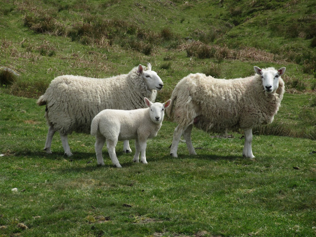
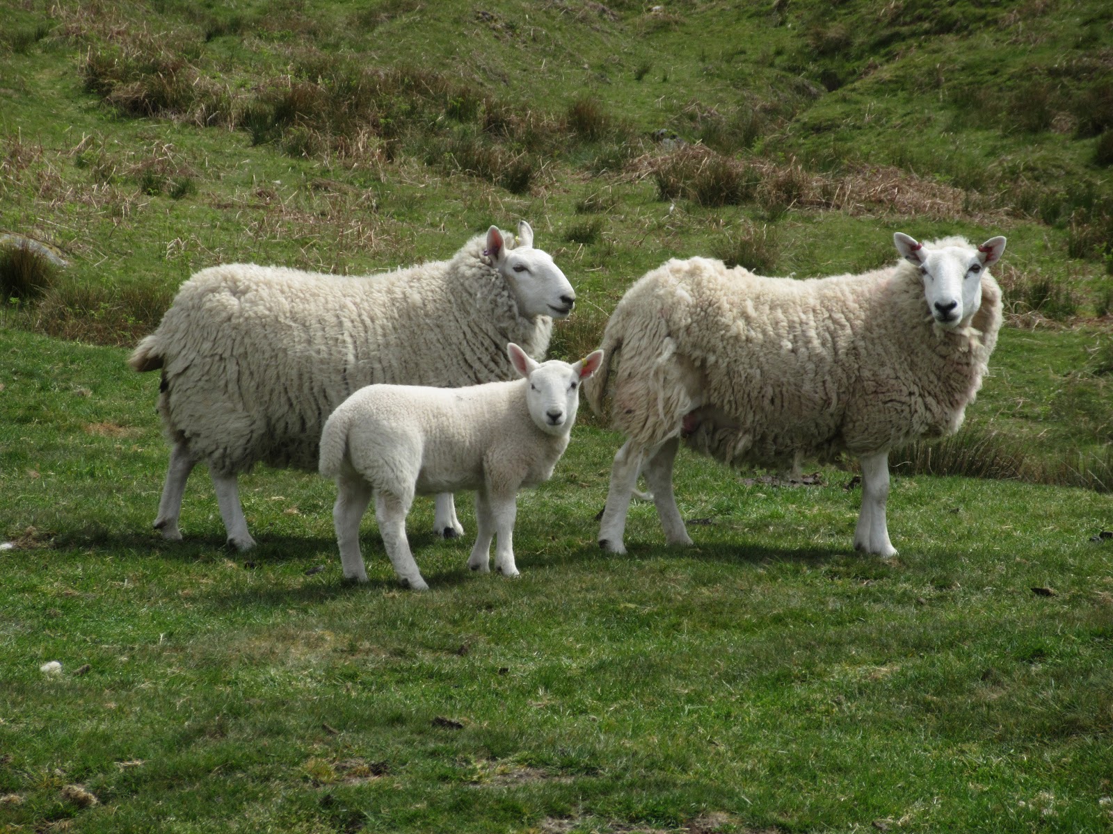
 Some of the locals we met beyond Wythwaite

 Two sides of an old boundary stone.
Beyond the farm we left the path marked on the map and made our way on narrow footpaths up the north edge of Wildboar scar, the first of several steep climbs during the day. We continued climbing up the slope of Kirkland Fell, passing several shake holes and other geological features guaranteed to have pleased the man in the jacket.
Finally we reached the last steep section leading to the plateau summit of Cross Fell. The route we had chosen, not the usual one which heads north east from Wythwaite until it reaches the Pennine Way at Tees Head, was another knee killing section, I mentally prayed for a beach walk next week.
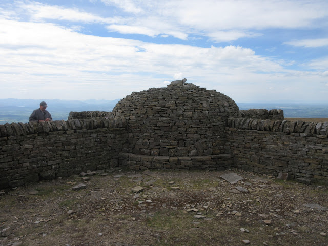
On the summit point of Cross Fell some organisation has built a very welcome cross shaped shelter with a beehive. The shelter provides protection from the wind regardless of direction, today the wind was blowing in quite strongly from the east. Not the Helm then, but cold enough to encourage extra lagging.
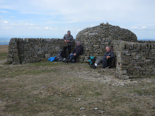 Lunch on Cross Fell. We shared Titans and lemon slices. The man on the right was walking a section of the Pennine Way.

 Cross Fell has a trig point too, and several cairns.
It was a bit on the chilly side so rather than hang around too long we moved on but not before admiring the views. To the west the long range of the Lake District fell with the corner of one lake just visible, I'm guessing it was Haweswater. Hills to the north, Dufton fells and the Air Traffic Ball to the south and even more hills on the east side.
 Too hazy really but this is the lakes from Cross Fell.
We headed a few degrees west of north down a track from the top until we reached a junction. Going right takes walkers past Greg's Hut, an isolated bothy, and down to Garrigil. We turned left and headed a little south of east on the track back to Blencarn.
 A distant view of Greg's Hut (Centre right) The tree beside the hut is the highest tree in England, apparently; Krumholz.
The track down was mostly grassy and only steep in a few places, as well as my little legs were tired. Again the best part was the spectacular views of the hills around.

 On the route down.
Eventually we came to the village of Kirkland which has a few houses and a church dedicated to St. Lawrence. Thought to have 13th century origins with 19th century renovation, a pretty, small church.
 St Lawrence Church Kirkland.
From Kirkland we walked back on the road, passing the Blencarn Lake, a fishing pond.
Changed we drove back home, stopping at the Elk's Head Inn, Whitfield where the two non drivers enjoyed a pint or two of Allandale "Curlews Return" and the unlucky driver had coffee.
 No arrows but we went anti clockwise and Herbied on the top of Cross Fell
MATRIX MMXIX 5c
steps miles
NAK 28388 10.3
Dave's NAK 1 23298 10.05
""""""""""""2 23308 10.66
"""""""" USB 23494 10.75
"""""""""SM 23426 10.72
OUTDOOR GPS 9.61
iPhone 25023 10.1
GARMIN 4hr 29 min walk 45 min talk 10.05


Reduced to a team of three, Harry, Dave, and I are going to walk to the top of Cross Fell, at 853 metres (2798 feet), the highest point in the English Pennines. It is a while since we have done this walk and we are hoping for a fine day as the views from the top can be spectacular.
The walk starts in the village of Blencarn, which sounds Scottish but isn't. To reach the village from Newcastle take the A69 west, turn off onto the A686 close to Haydon Bridge, drive through Alston, over Hartside and head south from Melmerby village. The map to use is OS OL 31 North Pennines and is recommended.
Close to Blencarn are the hanging Walls of Mark Anthony. Highly unlikely he ever walked up Cross Fell. He may have been with his mate Caesar when they came to Britain in 55BC but they only went to London before going home. It is thought the name may have been given because the Maiden Way, a Roman Road going from Kirby Thore on the A66 to Carvoran on Hadrian's Wall. The walls are Medieval Cultivation Terraces lynchets, ploughing on the slope, following contours and maximising the arable land on a hillside.
The only named wind in England is the Helm which lows from the north east across the south west face of Cross Fell and forms a cloud or helmet above the hill. Said to be a sign of rain coming. But we started off in warm sunlight with high thin clouds

We were parked at the end of the village, literally the end of the road and once booted and gaitered we set off following the finger post's suggested direction across fields towards the farm at Wythwaite.


Beyond the farm we left the path marked on the map and made our way on narrow footpaths up the north edge of Wildboar scar, the first of several steep climbs during the day. We continued climbing up the slope of Kirkland Fell, passing several shake holes and other geological features guaranteed to have pleased the man in the jacket.
Finally we reached the last steep section leading to the plateau summit of Cross Fell. The route we had chosen, not the usual one which heads north east from Wythwaite until it reaches the Pennine Way at Tees Head, was another knee killing section, I mentally prayed for a beach walk next week.
On the summit point of Cross Fell some organisation has built a very welcome cross shaped shelter with a beehive. The shelter provides protection from the wind regardless of direction, today the wind was blowing in quite strongly from the east. Not the Helm then, but cold enough to encourage extra lagging.


It was a bit on the chilly side so rather than hang around too long we moved on but not before admiring the views. To the west the long range of the Lake District fell with the corner of one lake just visible, I'm guessing it was Haweswater. Hills to the north, Dufton fells and the Air Traffic Ball to the south and even more hills on the east side.

We headed a few degrees west of north down a track from the top until we reached a junction. Going right takes walkers past Greg's Hut, an isolated bothy, and down to Garrigil. We turned left and headed a little south of east on the track back to Blencarn.

The track down was mostly grassy and only steep in a few places, as well as my little legs were tired. Again the best part was the spectacular views of the hills around.


Eventually we came to the village of Kirkland which has a few houses and a church dedicated to St. Lawrence. Thought to have 13th century origins with 19th century renovation, a pretty, small church.

From Kirkland we walked back on the road, passing the Blencarn Lake, a fishing pond.
Changed we drove back home, stopping at the Elk's Head Inn, Whitfield where the two non drivers enjoyed a pint or two of Allandale "Curlews Return" and the unlucky driver had coffee.

MATRIX MMXIX 5c
steps miles
NAK 28388 10.3
Dave's NAK 1 23298 10.05
""""""""""""2 23308 10.66
"""""""" USB 23494 10.75
"""""""""SM 23426 10.72
OUTDOOR GPS 9.61
iPhone 25023 10.1
GARMIN 4hr 29 min walk 45 min talk 10.05


No comments:
Post a Comment