Wild in the country. Or a tale of five villages.(Northumberland) August 17th.
After the heat we are back to normal British summer. Showers. Again a planned walk has been postponed and four of us: Ben, Dave, John H. and me are off for a walk in a gentler part of Northumberland, starting at the village of Ingoe and visiting several other hamlets and settlements.
The map to use is OS Explorer 316, Newcastle upon Tyne and to reach the start take the A69 west, join the B6318 at Heddon on the Wall and turn north for Matfen then follow signs for Ingoe, except that in Matfen the signpost cheerfully omits Ingoe but it's the road on the left.
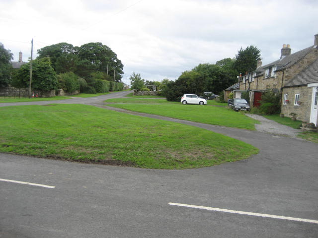
 Possibly the prettiest car park we have used in a long time. Hope the locals don't mind too much.
Parking spot is approximately at OS GR NZ 038748
Ingoe (means Ing's Hill; it is on the top of a small hill.) is another attractive Northumberland hamlet. Little to offer other than its own attractiveness and a prehistoric standing stone nearby which we couldn't find in spite of it being over six feet high.
Booted up, and with jackets too as the temperature has dropped to a low 16Cwe went back down the road in a westerly direction to a signpost near the point marked 206 on the OS map. From here we headed across fields in a north west direction to the farm at Kearsley. Some of the fields are arable land, recently harvested, we were surprised at the amount of grain left on the ground. Gleaners required.
Going round the farm at Kearsley we passed a number of sheds housing hens, several of which seemed to have escaped. They do have access to a run outside the sheds but some had made it through the wire fences too; Chicken Run.
Crossing Kearsley Fell and observing a old water filled quarry on our left, we came to the village of Kirkheaton (Settlement on the hill with a church).
 The village green at Kirkheaton, bigger than the village
 Kirkheaton manor, started life as a 16th century bastle(Fortified house) to defend against the Scots.
We chatted to an elderly gentleman who lived in the manor. He was walking his collie which seemed to want to come with us.
Following the road west from the manor house we soon arrived at Kirkheaton Wind farm. Three turbines, and very noisy in the strong breeze.
 John and Ben go tilting at a windmill.
Leaving the whirling turbines we spotted the signpost on the left that pointed the way across fields to the farm at Moot Law and the beacon on top of Mootlaw. Dave, who understands these things, climbed the low hill and admired the ancient remains, we three wandered down the farm track, turning at point 204 on OS and heading for the village of Ryal. (=Rye Hill). Here we called a Herbie and sat on a bench outside the village church, sharing PORK PIES, Eat natural, nature nutties and ginger biscuits.
 All Saints, Ryal. 12th C chapel of ease rebuilt in 1870. It's most interesting feature is the interior west wall, into which have been built 19 medieval cross slabs ,several with fascinating carvings.
 The medieval slabs in the west wall of All Saints, Ryal. Need a better flash.
 Ryal village green, another small Northumberland village.
 Dave and All Saints, Ryal
A few yards down the road going south from Ryal, just beyond East Farm, we took the footpath across fields arable and pasture, much to the interest of small herds of cows, to a point marked Grizzly Hill on OS map and then on the road a short way into the village of Matfen (=Matties' Fen)
 Approaching Matfen village
 Holy Trinity Church Matfen. 19th C and it doesn't really lean.
Matfen Hall is a popular eating place, spa and wedding venue. It also has a golf course.
We walked past the village pub, The Black Bull and headed east along the road labelled Jingling Gate on the OS map. This brought us to houses at Fenwick Shield where the road turned north to Fenwick itself, a small hamlet.
From here we crossed more fields, watched with great interest by more cows, until we came to the farm at Moralees where we followed the farm track back to Ingoe.
Worth noting that because of the recent spell of dry weather the fields are dry, normally crossing the ploughed fields would be claggy to say the least. (The ancient footpaths do cross fields and don't follow the perimeter. They are clearly marked too.)
After a fruitless search for the Warrior Stone we headed back to Matfen and called in at the Black Bull to rehydrate. A very cheery, and very Geordie, landlord offered us a choice of four hand pulled ales:, Abolition, Theakston's Black Bull, Collingwood and Galatia. I enjoyed the Collingwood.
 Contains OS data, copyright. Crown copyright and database right 2018.
And a matrix of considerable size
steps miles
NAK 32972 12.48 (ridiculous)
Dave's NAK 2 24562 11.62
""" USB 24698 11.69
""" NAK 1 24612 11.62
""" SM 25224 11.55
iPhone 25982 11.6
OUTDOOR GPS 11.5


After the heat we are back to normal British summer. Showers. Again a planned walk has been postponed and four of us: Ben, Dave, John H. and me are off for a walk in a gentler part of Northumberland, starting at the village of Ingoe and visiting several other hamlets and settlements.
The map to use is OS Explorer 316, Newcastle upon Tyne and to reach the start take the A69 west, join the B6318 at Heddon on the Wall and turn north for Matfen then follow signs for Ingoe, except that in Matfen the signpost cheerfully omits Ingoe but it's the road on the left.

Parking spot is approximately at OS GR NZ 038748
Ingoe (means Ing's Hill; it is on the top of a small hill.) is another attractive Northumberland hamlet. Little to offer other than its own attractiveness and a prehistoric standing stone nearby which we couldn't find in spite of it being over six feet high.
Booted up, and with jackets too as the temperature has dropped to a low 16Cwe went back down the road in a westerly direction to a signpost near the point marked 206 on the OS map. From here we headed across fields in a north west direction to the farm at Kearsley. Some of the fields are arable land, recently harvested, we were surprised at the amount of grain left on the ground. Gleaners required.
Going round the farm at Kearsley we passed a number of sheds housing hens, several of which seemed to have escaped. They do have access to a run outside the sheds but some had made it through the wire fences too; Chicken Run.
Crossing Kearsley Fell and observing a old water filled quarry on our left, we came to the village of Kirkheaton (Settlement on the hill with a church).


We chatted to an elderly gentleman who lived in the manor. He was walking his collie which seemed to want to come with us.
Following the road west from the manor house we soon arrived at Kirkheaton Wind farm. Three turbines, and very noisy in the strong breeze.

Leaving the whirling turbines we spotted the signpost on the left that pointed the way across fields to the farm at Moot Law and the beacon on top of Mootlaw. Dave, who understands these things, climbed the low hill and admired the ancient remains, we three wandered down the farm track, turning at point 204 on OS and heading for the village of Ryal. (=Rye Hill). Here we called a Herbie and sat on a bench outside the village church, sharing PORK PIES, Eat natural, nature nutties and ginger biscuits.


A few yards down the road going south from Ryal, just beyond East Farm, we took the footpath across fields arable and pasture, much to the interest of small herds of cows, to a point marked Grizzly Hill on OS map and then on the road a short way into the village of Matfen (=Matties' Fen)


Matfen Hall is a popular eating place, spa and wedding venue. It also has a golf course.
We walked past the village pub, The Black Bull and headed east along the road labelled Jingling Gate on the OS map. This brought us to houses at Fenwick Shield where the road turned north to Fenwick itself, a small hamlet.
From here we crossed more fields, watched with great interest by more cows, until we came to the farm at Moralees where we followed the farm track back to Ingoe.
Worth noting that because of the recent spell of dry weather the fields are dry, normally crossing the ploughed fields would be claggy to say the least. (The ancient footpaths do cross fields and don't follow the perimeter. They are clearly marked too.)
After a fruitless search for the Warrior Stone we headed back to Matfen and called in at the Black Bull to rehydrate. A very cheery, and very Geordie, landlord offered us a choice of four hand pulled ales:, Abolition, Theakston's Black Bull, Collingwood and Galatia. I enjoyed the Collingwood.

And a matrix of considerable size
steps miles
NAK 32972 12.48 (ridiculous)
Dave's NAK 2 24562 11.62
""" USB 24698 11.69
""" NAK 1 24612 11.62
""" SM 25224 11.55
iPhone 25982 11.6
OUTDOOR GPS 11.5


No comments:
Post a Comment