The Dales Diary from Ilkley to Bowness. June 2018
This year's long distance walk is the Dales Way, from Ilkley in Yorkshire to Bowness on Windermere in Cumbria.
There are five of us taking part, Brian and Margaret, Dave, John H. and me. And, with luggage; we all squeezed into Brian's car to take us to the start in Ilkley. As on previous walks of this nature our luggage is carried on for us, as arranged with super friendly Mickledore Company in Keswick, and we spend a day in the country armed with food and waterproof clothing, just in case.
Mickledore not only organise accommodation and between hotel transport, they also provide copies of a guide book and a waterproof map of the walk. The map is Harvey's Dalesway map, preferable to carrying several OS maps. The guide book is very useful too, it even includes points where there is an ice cream van. The book is Dales Way, by Henry Stedman. This blog is not a guide, it's a record of our trip, buy a map.
We arrived in Ilkley mid afternoon and walked round town, buying some last minute essentials such as bread buns, cheese and apples. We had tea on the pavement outside a café and watched the world go by, noticing that Ilkley must be a little up market, didn't hear too many "Eeh by gums" or "Sithees".
I remembered coming here as a child when we lived in Silsden, just over the hill, and asked a lady if she knew where the paddling pool of memory was. From what she said it was just where I remembered it!
After dinner in the Riverside Hotel and a good night's sleep we were ready for the off on Friday June 8th.
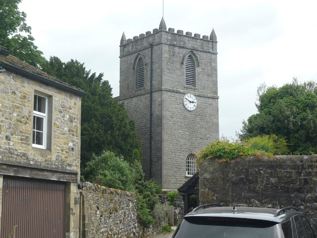
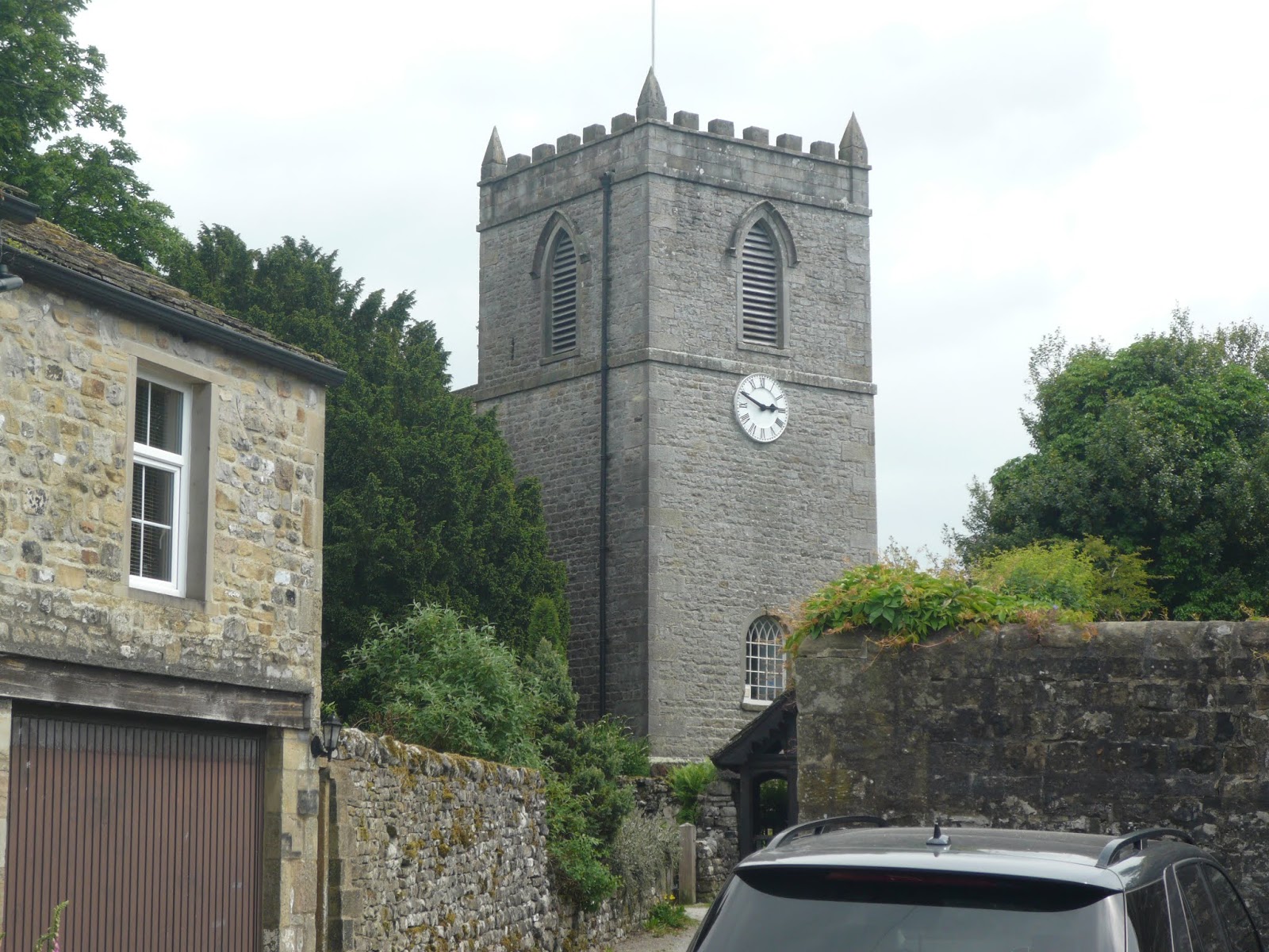
 Riverside Hotel and car park, Ilkley. The car was left all week, free.
Day 1, Friday June 8th
The start of the Dales Way walk is behind the hotel, close to a bridge that crosses the River Wharfe.
 The Wharfe at the start in Ilkley
 You need a bigger map.

 Dave, Margaret, me, Brian and John as we set off.
For much of the first day the path was alongside the river, easy walking. We passed through the houses at Low Mill, made apparently from the stones of the old mill itself.
 Low Mill cottages. The mill was the site of a Luddite uprising.
Charlotte Bronte wrote about Luddites in her novel "Shirley" not with much sympathy.
Beyond Low Mill we came to Addingham church yard, a place of some interest for me as my ancestors hailed from the village. I looked in the church yard and found some graves with my surname but differently spelt. Who knows?
 St Peter's Addingham
 My paternal ancestors hailed from Addingham, , possibly one of them ? Who knows?
Further on we came to Fairfield Friends Meeting house, almost in its original state although it has not been used for years.


 No caption required.
The first Herbie of the week was at Bolton Abbey, really Bolton Priory, a ruined monastery. Apart from sandwiches, we shared fruit cake from www.jesmondcakecompany.com and savoury muffins fro Mrs A.


Bolton Priory, and Margaret and Dave take the stepping stones. Chicken me took the bridge.
After lunch we continued on the path, clinging mostly to the river but also crossing meadows bright with buttercups.
Beyond the priory we came to the Strid, a point at which the river narrows and the water is forced through a cleft in the limestone. Notices warned us it was dangerous but:
My mother said,
I never should,
Jump the Strid,
As if I would.
She did too, say that, not jump it.

 The Strid
And it was a warm day, what a great start. After a cup of tea at Burnsall tearooms we eventually reached Burnsall and checked in at the Red Lion Hotel. Accommodation was behind the pub in the Mansion House, a comfortable room. For dinner we returned to the pub. My fish and chips were delayed, they gave me an extra fish as compensation.
 Friendly blackbird at the Red Lion
 And here he is again (Brimar photo)
 Manor house, resting place for the night.
 Contains OS data. Copyright. Crown copyright and data base right 2018
Day one mileage 14.2. Running total 14.2
Day two Saturday June 9th. Burnsall to Hubberholme.
After a full English breakfast, needed to power us on the walk, we left the Mansion House/Red Lion in Burnsall and headed back to the Dales Way.
The first section stayed on the bank of the Wharfe. More yellow meadows and sycamores for some shade on another warm day.
Leaving the river we walked uphill to the village of Grassington, a bustling little town with plenty of tourists and plenty of tea shops, so we stopped for a drink.
Grassington has a long history, going back to the stone age. The name is a corruption of "gars", or enclosures. In later times it was a centre for lead mining and textiles but these industries shrank in the 19th century and now the town depends largely on tourism, although there is a large milk processing plant.

 Grassington
Leaving Grassington we climbed into rougher country, land which supports sheep in fields bordered by dry stone walls. At the delightfully named outcrop Conistone Pie we called a Herbie. The site overlooked Kilnsey Crag, a favourite place for climbers.
 Lime Kiln near Grassington
 Herbie time on Conistone Pie
 Looking back at Conistone Pie and a pair of knees.
Sandwiches, fruit cake and ginger cake devoured we continued on our merry way to the next village, Kettlewell. Another ancient settlement, possibly named for an Irish- Norse chieftain named Ketel the village was also a centre for lead mining but is now a tourist spot. We had another drink, it was a hot day.

Kettlewell church and village
Back on the road, and on the riverside, we passed the village and ended the day at Hubberholme, a hamlet with a pub, The George, our place for the night.

 The George at Hubberholme, front and back.
We had been in the inn for about twenty minutes when it rained, good timing.
The pub was run by Ed, friendly and with a very dry sense of humour. He was fully booked for eating, we were told it would be our turn at eight and like good children we were on time. Dinner over we helped the locals with a crossword puzzle from the Yorkshire Post. I think it is possible Ed sent us off to bed.
 Contains OS data. Crown copyright and data base right 2018
Distance walked 15.2 miles Running total 29.4 miles
Day 3, June 10th, The Longest Day
After the usual full English, cooked and served, by dour Ed, we returned to the path, heading for Cowdub, our next resting place.
The first section of the walk was along the Wharfe, walking close to the river in Langstrothdale. At Oughtershaw we left the river and climbed slowly, some time on a road but mostly on paths through sheep fields until we came to Nethergill. The owners of this isolated farm ran an art gallery and serve yourself snack bar. Tea and coffee and hot water were provided, biscuits too, and an honesty box. They kept shorthorn cattle too, and they had a bird hide but we didn't go in it.
 Tea break at Nethergill
 Oh, I think this is Pen y Ghent, Ingleborough is behind it.
 So which is Ingleborough? (Brimar photo)
From Nethergill we walked west to Cam Houses, a farm that appeared to be redeveloped as country homes, like a lot more in the area.
 Cam Houses

And close to Cam Houses we joined the Pennine Way or the Pennine Bridleway or the Ribble Way. One, if not all of them.
After a Herbie, still eating fruit cake and ginger cake for afters, we headed north on what the map calls Black Rake Road. Meeting a road we turned right and then almost immediately turned left to take the "Kear cut off" across Wold fell, which fortunately had a flat top. A group of Mountain bikers passed us, one had a bell, an improvement! Once across the fell we contoured round Great Knoutberry Hill until we came to the Coal Road, turned left and headed downhill past Dent station to Cowgill. Turning left we walked the best part of a mile to our accommodation, The Sportsman Inn, "A family chain of One".
 A distant view of Artengill Viaduct, one of several on the famous Settle to Carlisle Railway
 The Sportsman Inn, run by Ron and Sandra. Ron was quiet, Sandra wasn't. On the day they only had one hand pulled beer, but it was a good one. No mobile phone service either (Like The George) and no wifi, but a promise for the future. Did we care, not really. No TV in the bedroom either and poor radio reception. I could live like this, sometime.
Sandra was an excellent cook who made us well earned dinner and regaled us with tales of other walkers. Some Americans had expected a hamburger stall at Cam Houses! Australians were the worst complainers, and they call us whinging poms! Ball tamperers.
 Contains OS data, copyright. Crown copyright and data base right 2018
Distance for the day 18 miles Running distance 47.4 miles
We think this is the second longest gadgie walk. The longest was the Llarig Ghru some years ago in Scotland.
Day 4 Cowgil to Howgill or the day Dave got lost.
After a fine full English cooked by Sandra we walked from the pub at Cowdub and rejoined the Dales Way at Cowgill. We had not gone far when we reached a farm, an elderly farmer asked if we were out to buy a tractor! He had a fine collection of Fergusons, Massey, Fordson and so on, including a Fordson from the 1930's. He told us he sold spares for older tractors and was waiting for a customer who wanted a gear lever.
Not having a great use for a tractor we walked on through fields close to the River Dee which is in Dentdale.
Some miles on we came to Dent, another pretty Yorkshire village with a shop, pubs, BnBs and a heritage museum which not only had tractors but also sold refreshments. Four of us settled for tea or coffee as Dave explored the village, birthplace of Adam Sedgwick, Victorian geologist. Dave has been studying the Quaternary period almost since it started.
 Dent Church, St. Andrew's with 12th Century origins


Tractors at the heritage centre.
As I bought a drink in the centre I talked to a young lady who had a very small baby in a sling on her front.
Drinks over and no Dave we decided to push on and headed away from Dent's cobbled streets and whitewashed cottages back to the Way. The path continued close to the river, crossing fields waiting to be cut for hay. We met a couple finishing their picnic. Dave had walked past them some twenty minutes earlier, asking them if they had seen four wanderers. Further on we found him, lunching by the river bank. It looked rather like the scene in the Magnificent Seven where Chico finally gets invited to join the troop. Except we didn't have horses.
 A fuzzy photo of one of the many, many field barns that are scattered round the dales. Some are ancient, some are falling in to disrepair.
After a Herbie (fruit cake, ginger cake too) we walked on to Millthrop, a suburb of the small town of Sedbergh, famous for its school, founded in 1525.The town is also mentioned in the Domesday Book, one of the few northern settlements to get recorded, after all William was not over fond of the area.
One of the houses in the village of Millthrop had a spectacular garden, winner of several prizes.
 Millthrop cottage garden, winner of Cumbria in Bloom prizes. Sedbergh was in Yorkshire until 1974 when the government moved it to Cumbria. (And eradicated Westmorland).
As we admired it the young lady I had spoken to in Dent walked by, baby fast asleep in the sling. She told me she had walked from Dent and the tiny girl had enjoyed the walk. Good start to a life of tramping the countryside.
(Photo by kind permission of BriMar collections)
From Millthrop the walk follows the River Rathey round the town of Sedbergh, passing some of the school's playing fields.
We walked under a spectacular iron bridge and just missed finding Briggflatts, home of one of the earliest Friends' Meeting Houses, site of a sermon by preacher George Fox and later the subject of a poem by Basil Bunting.
 Spectacular iron bridge on a disused railway line.
Not too far further on at Lincolns InnBridge across the Lune we left the way and took footpaths to our resting place for the night, Ash hining where we met Big Jim.
The farm had been turned into a BnB and several holiday cottages. Big Jim greeted us by saying "I'm just starting me tea, would you like a cup and a piece of cake?" What a friendly welcome. We accepted. As part of the whole holiday deal, once we were showered and changed, Big Jim and his friend took us into Sedbergh nwhere we dined at the Dalesman pub and drank a few. Later Big Jim picked us up and took us back to his place.

 Big Jim's. At breakfast he asked if we would mind if he stripped the beds as he and his companion were setting off to walk the West Highland Way that afternoon and wanted the washing done. We were able to point out the joys of the WHW as we did it two years ago.
 Contains OS data, copyright. Crown copyright and database right 2018
Distance 15.18 miles Running distance 62,58 miles
Day 5 Ash hining to Burneside
After another full English' prepared by Big Jim, we returned to Lincolns Inn Bridge where we met Paul and his wife Maureen who had decided to join us for the last two days of the walk. The fantastic five were now the super seven.
The footpath on this section follows the River Lune which eventually enters Morecambe Bay south of Lancaster where I lived for fifteen years.
Now out of the Dales and into Eastern Lakeland there is a change. Fewer meadows, rougher ground with more rocky outcrops and even more sheep.
We passed the Lune Viaduct, another disused but spectacular bridge.

Lune viaduct
And further on we came to the Crook of Lune. There is another with the same name at Caton, north of Lancaster. Close by we crossed the Crook of Lune Bridge:
 Crook of Lune Bridge
 And we walked under Low Gill Viaduct, disused. I have seen this bridge for about fifty years as I have driven up and down the M6, but this is the first time I've been near it.
Further on we crossed the M6 motorway, busy as usual and then we crossed the West Coast Railway Line. The path wound its way through hamlets and across fields, through farmyards until we reached Burneside.
After a refreshing glass or two at The Jolly Anglers we were picked up, as arranged, by a taxi, mini bus really and taken into Kendal where we were booked in to the Premier Hotel.

 Premier Inn Kendal and the Wheatsheaf Arms next door.
The other six went off to eat in a restaurant but I had arranged to meet a friend from school. I don't think we had met for fifty four years, there was lot to talk about.
Before meeting I ate alone in the Wheatsheaf. Service was very slow and after I had waited for my burger and chips (Didn't have my glasses, couldn't read the menu) I told the waitress I was now in a hurry. She apologised on her behalf, the chef's behalf and the company's behalf, tore up the bill and offered me a free. drink. They also serve who only sit and wait. I waited outside for my old school friend too. After a while the waitress came outside and asked if I was looking for a lady! She told me there was a lady inside looking for a man she hadn't seen for years. All's well that ends well, and we did have a lot to talk about.

Contains OS data, copyright. Crown copyright and database right.
Distance for the day 12.85 miles Running total 75.43
Day Six Burneside to Bowness.
The taxi took us back to Burneside (After a full English of course) and we set off on the last leg of the walk.
This final section follows the River Kent which flows into Morecambe Bay near Arnside.
Typical south Lakeland country, low rocky fells and farms. About half way between the start and the end we came to the village of Stavely.
A small village, inhabited since about 4000 BC, colonised by the Romans. It became the centre of the bobbin making industry but that declined in the 19th century. The village now makes paper and has a brewery and a very large cycle shop for such a small place.
After tea/coffee at a small café next to the brewery we returned to the walk
 The Stavely Clematis
The path meandered through more farmyards and across more sheep pasture until we came to our first view of Windermere, England's largest lake although it would fit into Lake Superior many hundred times (Everything in the US and Canada is bigger)
 The last Herbie, I had run out of fruit cake but we had ginger cake.
The path, like us, continued its meandering through farms and fields until finally we had our first glimpse of Windermere, England's largest lake but it would fit into Lake Superior several hundred times. Everything in the US and Canada is bigger.
 Windermere through the trees.
And soon we came to the end!
 The end of the road.
Back row, Dave, Paul and Maureen
Front row Margaret John, me and Brian. (Brimar photo)

Contains OS data copyright. Crown copyright and database right 2018
Distance for the day 10.54 miles Running and final tota 85.97
We walked into Bowness and went to the first pub we saw but it only had electric pumps so we went next door to the Royal Oak and celebrated the end of the walk.
Next stop the Lingwood Lodge guest house run by Carl and Sandra Owen.
Lingwood Lodge, last on the trail.
Showered and changed we hit the town, ate at the Flying Pig and drank in several pubs.
Coming home
We had booked rail tickets from Windermere/Bowness>Oxenholme>Manchester>Leeds>Ilkley
 Because the railway companies had introduced new timetables which turned out to be chaotic all trains to Oxenhome were cancelled. Fortunately, and kindly, as it turned out, Paul and Maureen had both their cars in Bowness and we squeezed in to Oxenholme.
During the night storm Hector had brought trees down on the railway line between Carlisle and Penrith but we were luck y enough to board one starting from Oxenholme to Manchester. We just about caught the Leeds train and just missed the Ilkley train but caught the next one. Then we squeezed back into Brian's car and came home.
And a few more


This year's long distance walk is the Dales Way, from Ilkley in Yorkshire to Bowness on Windermere in Cumbria.
There are five of us taking part, Brian and Margaret, Dave, John H. and me. And, with luggage; we all squeezed into Brian's car to take us to the start in Ilkley. As on previous walks of this nature our luggage is carried on for us, as arranged with super friendly Mickledore Company in Keswick, and we spend a day in the country armed with food and waterproof clothing, just in case.
Mickledore not only organise accommodation and between hotel transport, they also provide copies of a guide book and a waterproof map of the walk. The map is Harvey's Dalesway map, preferable to carrying several OS maps. The guide book is very useful too, it even includes points where there is an ice cream van. The book is Dales Way, by Henry Stedman. This blog is not a guide, it's a record of our trip, buy a map.
We arrived in Ilkley mid afternoon and walked round town, buying some last minute essentials such as bread buns, cheese and apples. We had tea on the pavement outside a café and watched the world go by, noticing that Ilkley must be a little up market, didn't hear too many "Eeh by gums" or "Sithees".
I remembered coming here as a child when we lived in Silsden, just over the hill, and asked a lady if she knew where the paddling pool of memory was. From what she said it was just where I remembered it!
After dinner in the Riverside Hotel and a good night's sleep we were ready for the off on Friday June 8th.

Day 1, Friday June 8th
The start of the Dales Way walk is behind the hotel, close to a bridge that crosses the River Wharfe.


For much of the first day the path was alongside the river, easy walking. We passed through the houses at Low Mill, made apparently from the stones of the old mill itself.

Charlotte Bronte wrote about Luddites in her novel "Shirley" not with much sympathy.
Beyond Low Mill we came to Addingham church yard, a place of some interest for me as my ancestors hailed from the village. I looked in the church yard and found some graves with my surname but differently spelt. Who knows?


Further on we came to Fairfield Friends Meeting house, almost in its original state although it has not been used for years.


The first Herbie of the week was at Bolton Abbey, really Bolton Priory, a ruined monastery. Apart from sandwiches, we shared fruit cake from www.jesmondcakecompany.com and savoury muffins fro Mrs A.


After lunch we continued on the path, clinging mostly to the river but also crossing meadows bright with buttercups.
Beyond the priory we came to the Strid, a point at which the river narrows and the water is forced through a cleft in the limestone. Notices warned us it was dangerous but:
My mother said,
I never should,
Jump the Strid,
As if I would.
She did too, say that, not jump it.


And it was a warm day, what a great start. After a cup of tea at Burnsall tearooms we eventually reached Burnsall and checked in at the Red Lion Hotel. Accommodation was behind the pub in the Mansion House, a comfortable room. For dinner we returned to the pub. My fish and chips were delayed, they gave me an extra fish as compensation.


Day one mileage 14.2. Running total 14.2
Day two Saturday June 9th. Burnsall to Hubberholme.
After a full English breakfast, needed to power us on the walk, we left the Mansion House/Red Lion in Burnsall and headed back to the Dales Way.
The first section stayed on the bank of the Wharfe. More yellow meadows and sycamores for some shade on another warm day.
Leaving the river we walked uphill to the village of Grassington, a bustling little town with plenty of tourists and plenty of tea shops, so we stopped for a drink.
Grassington has a long history, going back to the stone age. The name is a corruption of "gars", or enclosures. In later times it was a centre for lead mining and textiles but these industries shrank in the 19th century and now the town depends largely on tourism, although there is a large milk processing plant.


Leaving Grassington we climbed into rougher country, land which supports sheep in fields bordered by dry stone walls. At the delightfully named outcrop Conistone Pie we called a Herbie. The site overlooked Kilnsey Crag, a favourite place for climbers.


Sandwiches, fruit cake and ginger cake devoured we continued on our merry way to the next village, Kettlewell. Another ancient settlement, possibly named for an Irish- Norse chieftain named Ketel the village was also a centre for lead mining but is now a tourist spot. We had another drink, it was a hot day.

Kettlewell church and village
Back on the road, and on the riverside, we passed the village and ended the day at Hubberholme, a hamlet with a pub, The George, our place for the night.


We had been in the inn for about twenty minutes when it rained, good timing.
The pub was run by Ed, friendly and with a very dry sense of humour. He was fully booked for eating, we were told it would be our turn at eight and like good children we were on time. Dinner over we helped the locals with a crossword puzzle from the Yorkshire Post. I think it is possible Ed sent us off to bed.

Distance walked 15.2 miles Running total 29.4 miles
Day 3, June 10th, The Longest Day
After the usual full English, cooked and served, by dour Ed, we returned to the path, heading for Cowdub, our next resting place.
The first section of the walk was along the Wharfe, walking close to the river in Langstrothdale. At Oughtershaw we left the river and climbed slowly, some time on a road but mostly on paths through sheep fields until we came to Nethergill. The owners of this isolated farm ran an art gallery and serve yourself snack bar. Tea and coffee and hot water were provided, biscuits too, and an honesty box. They kept shorthorn cattle too, and they had a bird hide but we didn't go in it.


From Nethergill we walked west to Cam Houses, a farm that appeared to be redeveloped as country homes, like a lot more in the area.


And close to Cam Houses we joined the Pennine Way or the Pennine Bridleway or the Ribble Way. One, if not all of them.
After a Herbie, still eating fruit cake and ginger cake for afters, we headed north on what the map calls Black Rake Road. Meeting a road we turned right and then almost immediately turned left to take the "Kear cut off" across Wold fell, which fortunately had a flat top. A group of Mountain bikers passed us, one had a bell, an improvement! Once across the fell we contoured round Great Knoutberry Hill until we came to the Coal Road, turned left and headed downhill past Dent station to Cowgill. Turning left we walked the best part of a mile to our accommodation, The Sportsman Inn, "A family chain of One".


Sandra was an excellent cook who made us well earned dinner and regaled us with tales of other walkers. Some Americans had expected a hamburger stall at Cam Houses! Australians were the worst complainers, and they call us whinging poms! Ball tamperers.

Distance for the day 18 miles Running distance 47.4 miles
We think this is the second longest gadgie walk. The longest was the Llarig Ghru some years ago in Scotland.
Day 4 Cowgil to Howgill or the day Dave got lost.
After a fine full English cooked by Sandra we walked from the pub at Cowdub and rejoined the Dales Way at Cowgill. We had not gone far when we reached a farm, an elderly farmer asked if we were out to buy a tractor! He had a fine collection of Fergusons, Massey, Fordson and so on, including a Fordson from the 1930's. He told us he sold spares for older tractors and was waiting for a customer who wanted a gear lever.
Not having a great use for a tractor we walked on through fields close to the River Dee which is in Dentdale.
Some miles on we came to Dent, another pretty Yorkshire village with a shop, pubs, BnBs and a heritage museum which not only had tractors but also sold refreshments. Four of us settled for tea or coffee as Dave explored the village, birthplace of Adam Sedgwick, Victorian geologist. Dave has been studying the Quaternary period almost since it started.


Tractors at the heritage centre.
As I bought a drink in the centre I talked to a young lady who had a very small baby in a sling on her front.
Drinks over and no Dave we decided to push on and headed away from Dent's cobbled streets and whitewashed cottages back to the Way. The path continued close to the river, crossing fields waiting to be cut for hay. We met a couple finishing their picnic. Dave had walked past them some twenty minutes earlier, asking them if they had seen four wanderers. Further on we found him, lunching by the river bank. It looked rather like the scene in the Magnificent Seven where Chico finally gets invited to join the troop. Except we didn't have horses.

After a Herbie (fruit cake, ginger cake too) we walked on to Millthrop, a suburb of the small town of Sedbergh, famous for its school, founded in 1525.The town is also mentioned in the Domesday Book, one of the few northern settlements to get recorded, after all William was not over fond of the area.
One of the houses in the village of Millthrop had a spectacular garden, winner of several prizes.

As we admired it the young lady I had spoken to in Dent walked by, baby fast asleep in the sling. She told me she had walked from Dent and the tiny girl had enjoyed the walk. Good start to a life of tramping the countryside.
(Photo by kind permission of BriMar collections)
From Millthrop the walk follows the River Rathey round the town of Sedbergh, passing some of the school's playing fields.
We walked under a spectacular iron bridge and just missed finding Briggflatts, home of one of the earliest Friends' Meeting Houses, site of a sermon by preacher George Fox and later the subject of a poem by Basil Bunting.

Not too far further on at Lincolns InnBridge across the Lune we left the way and took footpaths to our resting place for the night, Ash hining where we met Big Jim.
The farm had been turned into a BnB and several holiday cottages. Big Jim greeted us by saying "I'm just starting me tea, would you like a cup and a piece of cake?" What a friendly welcome. We accepted. As part of the whole holiday deal, once we were showered and changed, Big Jim and his friend took us into Sedbergh nwhere we dined at the Dalesman pub and drank a few. Later Big Jim picked us up and took us back to his place.


Distance 15.18 miles Running distance 62,58 miles
Day 5 Ash hining to Burneside
After another full English' prepared by Big Jim, we returned to Lincolns Inn Bridge where we met Paul and his wife Maureen who had decided to join us for the last two days of the walk. The fantastic five were now the super seven.
The footpath on this section follows the River Lune which eventually enters Morecambe Bay south of Lancaster where I lived for fifteen years.
Now out of the Dales and into Eastern Lakeland there is a change. Fewer meadows, rougher ground with more rocky outcrops and even more sheep.
We passed the Lune Viaduct, another disused but spectacular bridge.

Lune viaduct
And further on we came to the Crook of Lune. There is another with the same name at Caton, north of Lancaster. Close by we crossed the Crook of Lune Bridge:


Further on we crossed the M6 motorway, busy as usual and then we crossed the West Coast Railway Line. The path wound its way through hamlets and across fields, through farmyards until we reached Burneside.
After a refreshing glass or two at The Jolly Anglers we were picked up, as arranged, by a taxi, mini bus really and taken into Kendal where we were booked in to the Premier Hotel.


The other six went off to eat in a restaurant but I had arranged to meet a friend from school. I don't think we had met for fifty four years, there was lot to talk about.
Before meeting I ate alone in the Wheatsheaf. Service was very slow and after I had waited for my burger and chips (Didn't have my glasses, couldn't read the menu) I told the waitress I was now in a hurry. She apologised on her behalf, the chef's behalf and the company's behalf, tore up the bill and offered me a free. drink. They also serve who only sit and wait. I waited outside for my old school friend too. After a while the waitress came outside and asked if I was looking for a lady! She told me there was a lady inside looking for a man she hadn't seen for years. All's well that ends well, and we did have a lot to talk about.

Contains OS data, copyright. Crown copyright and database right.
Distance for the day 12.85 miles Running total 75.43
Day Six Burneside to Bowness.
The taxi took us back to Burneside (After a full English of course) and we set off on the last leg of the walk.
This final section follows the River Kent which flows into Morecambe Bay near Arnside.
Typical south Lakeland country, low rocky fells and farms. About half way between the start and the end we came to the village of Stavely.
A small village, inhabited since about 4000 BC, colonised by the Romans. It became the centre of the bobbin making industry but that declined in the 19th century. The village now makes paper and has a brewery and a very large cycle shop for such a small place.
After tea/coffee at a small café next to the brewery we returned to the walk

The path meandered through more farmyards and across more sheep pasture until we came to our first view of Windermere, England's largest lake although it would fit into Lake Superior many hundred times (Everything in the US and Canada is bigger)

The path, like us, continued its meandering through farms and fields until finally we had our first glimpse of Windermere, England's largest lake but it would fit into Lake Superior several hundred times. Everything in the US and Canada is bigger.

And soon we came to the end!

Back row, Dave, Paul and Maureen
Front row Margaret John, me and Brian. (Brimar photo)

Contains OS data copyright. Crown copyright and database right 2018
Distance for the day 10.54 miles Running and final tota 85.97
We walked into Bowness and went to the first pub we saw but it only had electric pumps so we went next door to the Royal Oak and celebrated the end of the walk.
Next stop the Lingwood Lodge guest house run by Carl and Sandra Owen.
Lingwood Lodge, last on the trail.
Showered and changed we hit the town, ate at the Flying Pig and drank in several pubs.
Coming home
We had booked rail tickets from Windermere/Bowness>Oxenholme>Manchester>Leeds>Ilkley

During the night storm Hector had brought trees down on the railway line between Carlisle and Penrith but we were luck y enough to board one starting from Oxenholme to Manchester. We just about caught the Leeds train and just missed the Ilkley train but caught the next one. Then we squeezed back into Brian's car and came home.
And a few more


Your blog is interesting and I am pleased to read your article in which you shared images. All images attracted me. Now I am keen to explore all the places after enjoying local tours from Washington DC.
ReplyDelete