Once more unto the wall dear friends once more
Sept 22nd.(Hadrian's Wall)
As Shakespeare almost said.
An extra gadgie walk for Roman Wall spotters, from Housesteads to Chesters, two Roman forts along Hadrian's frontier. There are two of us out today, Dave and I, and we are making use of the AD122 bus that runs along the wall but only in the summer months. It finishes this year on September 27th and hopefully it will run again in 2016.
We drove from base to Chollerford along the A69, turning right beyond Hexham and going through Acomb and Wall before turning left at the cross roads, over the bridge at The George and driving a few hundred yards up the B6320. There is a lay by capable of at least six cars. Booted we walked the quarter mile to Chesters on the B6318 and caught the bus to Housesteads. This walk is easy to follow as the Hadrians Wall path is very well signed but it is covered by OS OL 43 Hadrians Wall. Better still if you want detail of the turrets and Milecastles buy the English Heritage Archaeological Map of the wall, but they shoot anybody who reproduces it. The Ordnance Survey don't mind, provided you give them credit.
 Look out for signs
 Information Centre at Housesteads car park


 Milecastle 35

Ditch, north of the wall.
Lunch over we continued the march, probably much slower than any Roman Legion, spotting bits of wall, turrets, some of which have completely vanished though, and mile castles along the way.
Just beyond Carraw we crossed the road and walked down to the Mithraum at Brocolitia. Mithras was an eastern god adopted by the Romans, particularly soldiers, and there are several temples in England. This one has three altars, one of which had 67p on it. We also looked for Coventina's Well in the area but presumably it has been covered up after excavation. We also looked at the remains of the fort. One of the information boards referred to Procolitia, I need to check that out.
 One of the few Information Boards on the wall that is legible. Some have vanished,
shame on you English Heritage.

Mithraum at Brocolitia. The altars are reproduction, the real ones are in the museum in Newcastle.
Back on the Hadrian's Wall path we walked across fields, some containing short stretches of the wall. At "Limestone Corner" we paused to look at the large stone the Romans had failed to break up, for whatever reason. The corner is incorrectly named, the rock is dolerite on the Whin Sill.

 The cuts were made at an early stage of the breaking of the stone to go into the construction of the wall. For some reason it was left.
 Part of the wall
 Turret. The groove in the stone left of centre allowed the door pivots to be inserted
or removed.
The footpath goes round the settlement of Walwick and then down the road to Chesters, a Roman Fort (Cilurnum). We returned to the car and headed for the Wetherspoons in Hexham, marching is thirsty work.
If you want to walk the wall this part is probably the easiest, not having the ups and downs west of Housesteads. We met a good number of people who were walking the length of the frontier (74 miles), mostly Canadians and Germans, but all enjoying the experience.
The Matrix MMXV TT
steps miles
LIDL3D 26752 9.53
Dave's LIDL3D 23369 10.98
Dave's USB 22722 10.75
eTrex GPS 10.69


 Contains OS data, copyright. Crown copyright and database right 2015
Sept 22nd.(Hadrian's Wall)
As Shakespeare almost said.
An extra gadgie walk for Roman Wall spotters, from Housesteads to Chesters, two Roman forts along Hadrian's frontier. There are two of us out today, Dave and I, and we are making use of the AD122 bus that runs along the wall but only in the summer months. It finishes this year on September 27th and hopefully it will run again in 2016.
We drove from base to Chollerford along the A69, turning right beyond Hexham and going through Acomb and Wall before turning left at the cross roads, over the bridge at The George and driving a few hundred yards up the B6320. There is a lay by capable of at least six cars. Booted we walked the quarter mile to Chesters on the B6318 and caught the bus to Housesteads. This walk is easy to follow as the Hadrians Wall path is very well signed but it is covered by OS OL 43 Hadrians Wall. Better still if you want detail of the turrets and Milecastles buy the English Heritage Archaeological Map of the wall, but they shoot anybody who reproduces it. The Ordnance Survey don't mind, provided you give them credit.


Housesteads car park
After a pleasant chat with Carol in the information centre who told us all about the cuts that were happening in the National Park, two members of the First Mikedavinius Legion set off to walk east along the wall from Vercovicium to Cilurnum.
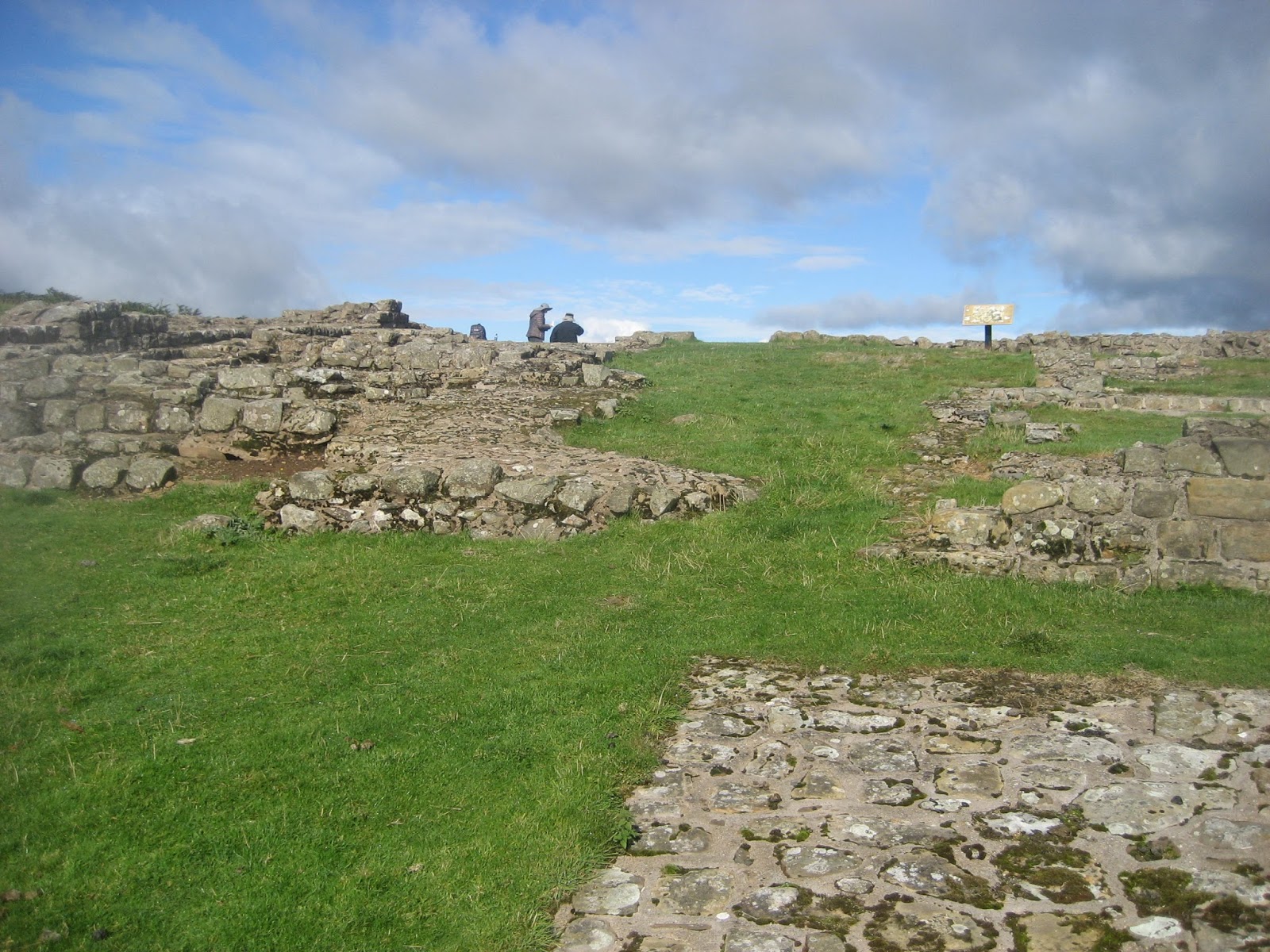
We walked up to the fort which was being prepared for the day's visitors, round the west side and through the gate onto the wall path, turned and marched east on a warm but cloudy day with the wind on our backs. The first few miles of the walk are high on the Whin Sill affording glorious views to the north and south.

West gate in the fort at Vercovicium (Housesteads)
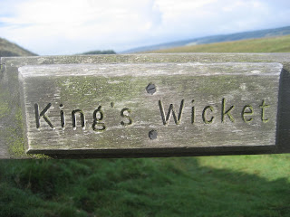
This short section is the only part of today's walk which has any climbing, even then it is easy going and we ticked off several turrets and a milecastle before coming to a gate in the wall, the King's Wicket.

Gate in the wall, but not Roman.
Soon we reached Sewingshields Crags and the farm at Sewing Shields. Nothing to do with stitchcraft it comes fro Old English Sigewine's shiels, the shelter of one Sigewine, the local boss.
Although we had been walking for only an hour it was noon and we called a Herbie Spot at Turret 35A, overlooking Broomlee Lough to the west and the medieval fish ponds (dry) to the north. To the north there is also a ring and bailey, plainly visible.

Turret 35A, excellent dining room on a sunny day.

Lunch over we continued the march, probably much slower than any Roman Legion, spotting bits of wall, turrets, some of which have completely vanished though, and mile castles along the way.
Just beyond Carraw we crossed the road and walked down to the Mithraum at Brocolitia. Mithras was an eastern god adopted by the Romans, particularly soldiers, and there are several temples in England. This one has three altars, one of which had 67p on it. We also looked for Coventina's Well in the area but presumably it has been covered up after excavation. We also looked at the remains of the fort. One of the information boards referred to Procolitia, I need to check that out.

shame on you English Heritage.

Mithraum at Brocolitia. The altars are reproduction, the real ones are in the museum in Newcastle.
Back on the Hadrian's Wall path we walked across fields, some containing short stretches of the wall. At "Limestone Corner" we paused to look at the large stone the Romans had failed to break up, for whatever reason. The corner is incorrectly named, the rock is dolerite on the Whin Sill.


or removed.
The footpath goes round the settlement of Walwick and then down the road to Chesters, a Roman Fort (Cilurnum). We returned to the car and headed for the Wetherspoons in Hexham, marching is thirsty work.
If you want to walk the wall this part is probably the easiest, not having the ups and downs west of Housesteads. We met a good number of people who were walking the length of the frontier (74 miles), mostly Canadians and Germans, but all enjoying the experience.
The Matrix MMXV TT
steps miles
LIDL3D 26752 9.53
Dave's LIDL3D 23369 10.98
Dave's USB 22722 10.75
eTrex GPS 10.69


No comments:
Post a Comment