Journey from the centre of the Kingdom. Sept 8th(Northumberland)
Haltwhistle in Northumberland claims to be the centre of Britain. It is a small town in the Tyne Valley with little old fashioned shops and a stop on the Newcastle Carlisle Railway. The name has nothing to do with railways, it comes from "Hautwisel", old English for the place where streams meet by a hill. "Twizell" is common for confluences in England and also Germany.
Haltwhistle is quiet but in the 19th century supported a fulling mill, brickworks and several drift mines. The works were on the side of the Haltwhistle Burn and a small railway was built along the stream to move products to the main line. The old track is now a footpath up the side of the burn, and a very pretty walk it is too.
Today's walk,an extra gadgie walk with only two of us, Dave and me, is another wall walk, specifically designed to spot forts, milecastles and turrets.
We left the car in Hexham Wentworth Car Park** and caught the 685 bus to Haltwhistle to start the walk. (If you drive A69 west and turn off into Haltwhistle)
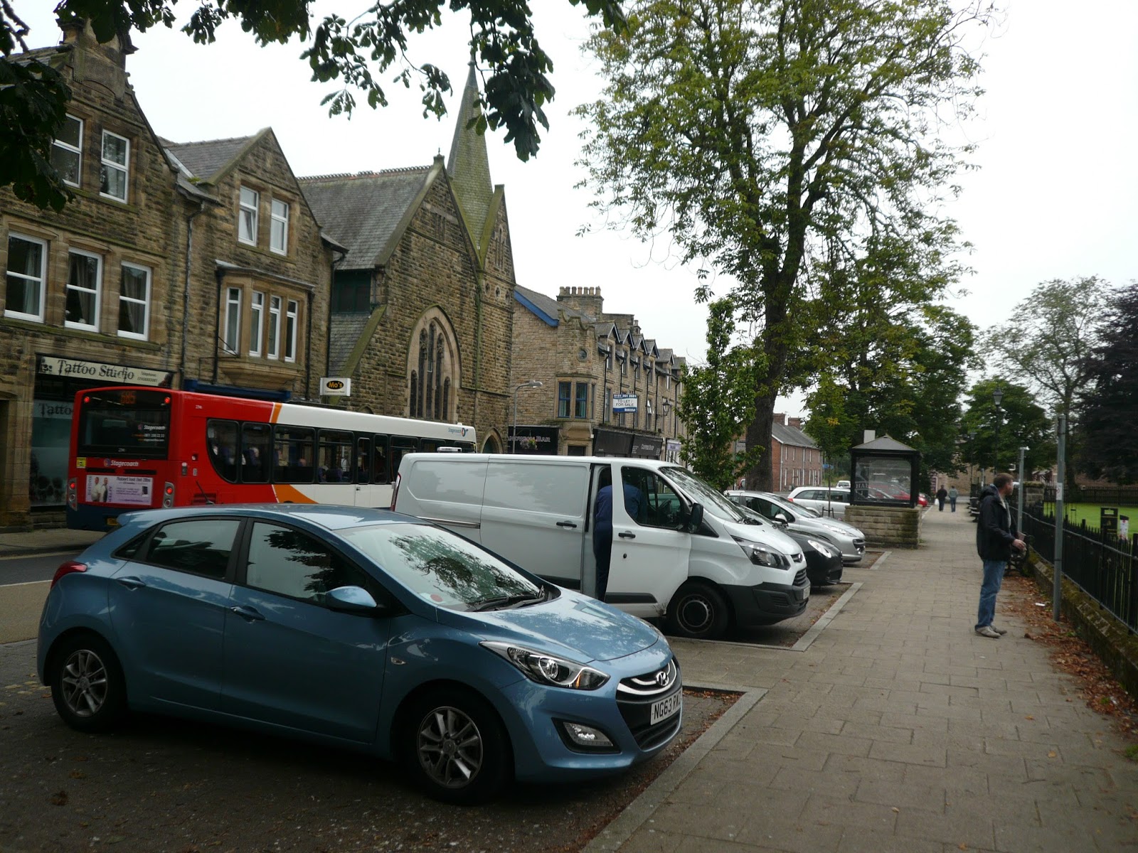
 Starting point in Haltwhistle, not the car park in Hexham.
Near the Community Hospital a brown sign points towards the Hadrian Wall Footpath. A series of three information boards gives a history of the industry of Haltwhistle and nearby the footpath gives a choice; left or right. Go left.
 Information board at the entrance to the burn walk.
 Haltwhistle's old brick works.
The walk up the burn crosses the stream several times as it meanders uphill. The weather today is disappointing, grey and misty but on a sunny spring or summer day this must be a really pleasant stroll. We saw a heron which kept flying along the burn in short stretches and a dipper.
 Haltwhistle Burn.
 Old Lime Kiln near the top of the burn.
The footpath eventually emerges into fields, one of which had rather old fashioned style hay bales, not the modern ones wrapped in plastic.

Hay in cuboids.
The footpath crosses the military road near the Milecastle pub and goes through Roman camps and a fort before reaching the Milecastle 47 at Cawfields. There are only earth embankments to be seen on the fort and camps but the milecastle foundations are clearly visible.

Entrance to Milecastle 47
At this point on the wall we turned east and headed for Housesteads, ticking off turrets and milecastles as we went, almost like an old Ian Allen Locospotters book!
At Steel Rigg carpark we called a Herbie Spot. The park was full, many of the cars were foreign and we met walkers from America, Sweden, Germany and Holland, all having at least short strolls along the wall. A shame about the mist, it spoiled the views north and south of Hadrian's frontier, but everybody was enjoying the walk.
 Turret and wall.
 Friendly creature on the barbarian side of the wall.

Milecastle, including the outlines of barrack blocks.
 Robin's famous tree, a sycamore, Acer pseudoplatanus as the Romans called it.
Eventually we reached Housesteads Roman fort (Vercovicium) and sneaked in the back way for a look round.
 The granary at housesteads.
 Commanders house, offices, temple
We caught the AD122 bus back to Hexham, relaxed and revived ourselves in the Wetherspoons and went home after another good day on the wall.
Matrix MMXV RR
steps miles
LIDL3D 25696 8.68
Dave's LIDL3D 20746 9.12
Dave's USB 19773 8.83


Contains OS Data copyright Crown copyright and Data Base right 2015
** The good burghers (Have I spelled that right?) have made changes to the car park. Up to September 8th it was possible for cars to park all day free. Now there are bays with white, red or blue outlines. The few white ones allow parking free all day, but there are not enough for the people who work in the town. Red ones allow two hours, free, the blue ones four hours free with a parking disc displayed. How to drive people away. People like us will have to find a space in town, residents will complain. There was ample free parking for all previously, what jobsworth came up with this!
PS The ordnance survey Map OS OL 43 Hadrian's Wall covers this walk but if you want details of the wall buy the English Heritage Archaelogical Map of Hadrian's Wall. I haven't included it because there is a note on it saying" anybody who copies this map will be shot"
Haltwhistle in Northumberland claims to be the centre of Britain. It is a small town in the Tyne Valley with little old fashioned shops and a stop on the Newcastle Carlisle Railway. The name has nothing to do with railways, it comes from "Hautwisel", old English for the place where streams meet by a hill. "Twizell" is common for confluences in England and also Germany.
Haltwhistle is quiet but in the 19th century supported a fulling mill, brickworks and several drift mines. The works were on the side of the Haltwhistle Burn and a small railway was built along the stream to move products to the main line. The old track is now a footpath up the side of the burn, and a very pretty walk it is too.
Today's walk,an extra gadgie walk with only two of us, Dave and me, is another wall walk, specifically designed to spot forts, milecastles and turrets.
We left the car in Hexham Wentworth Car Park** and caught the 685 bus to Haltwhistle to start the walk. (If you drive A69 west and turn off into Haltwhistle)
Near the Community Hospital a brown sign points towards the Hadrian Wall Footpath. A series of three information boards gives a history of the industry of Haltwhistle and nearby the footpath gives a choice; left or right. Go left.


The walk up the burn crosses the stream several times as it meanders uphill. The weather today is disappointing, grey and misty but on a sunny spring or summer day this must be a really pleasant stroll. We saw a heron which kept flying along the burn in short stretches and a dipper.


The footpath eventually emerges into fields, one of which had rather old fashioned style hay bales, not the modern ones wrapped in plastic.

Hay in cuboids.
The footpath crosses the military road near the Milecastle pub and goes through Roman camps and a fort before reaching the Milecastle 47 at Cawfields. There are only earth embankments to be seen on the fort and camps but the milecastle foundations are clearly visible.

At this point on the wall we turned east and headed for Housesteads, ticking off turrets and milecastles as we went, almost like an old Ian Allen Locospotters book!
At Steel Rigg carpark we called a Herbie Spot. The park was full, many of the cars were foreign and we met walkers from America, Sweden, Germany and Holland, all having at least short strolls along the wall. A shame about the mist, it spoiled the views north and south of Hadrian's frontier, but everybody was enjoying the walk.


Milecastle, including the outlines of barrack blocks.

Eventually we reached Housesteads Roman fort (Vercovicium) and sneaked in the back way for a look round.


We caught the AD122 bus back to Hexham, relaxed and revived ourselves in the Wetherspoons and went home after another good day on the wall.
Matrix MMXV RR
steps miles
LIDL3D 25696 8.68
Dave's LIDL3D 20746 9.12
Dave's USB 19773 8.83


Contains OS Data copyright Crown copyright and Data Base right 2015
** The good burghers (Have I spelled that right?) have made changes to the car park. Up to September 8th it was possible for cars to park all day free. Now there are bays with white, red or blue outlines. The few white ones allow parking free all day, but there are not enough for the people who work in the town. Red ones allow two hours, free, the blue ones four hours free with a parking disc displayed. How to drive people away. People like us will have to find a space in town, residents will complain. There was ample free parking for all previously, what jobsworth came up with this!
PS The ordnance survey Map OS OL 43 Hadrian's Wall covers this walk but if you want details of the wall buy the English Heritage Archaelogical Map of Hadrian's Wall. I haven't included it because there is a note on it saying" anybody who copies this map will be shot"
No comments:
Post a Comment