Barn at the end of the Lake...............April 25th
One of the many books I loved as a child was Fell farm for Christmas by Marjorie Lloyd, published in 1954. A companion to Fell farm Holiday it was a simple story of a family of children enjoying a Yuletide romp on a hill farm. Much more fun than The Famous Five, by Enid Blyton although I did read and reread her Shadow the Sheepdog. I have often wondered which farm Marjorie used as a model, could it have been Watendlath which is the chosen walk of today?
Watendlath comes from Old Norse vatna endi hlada, meaning "the barn at the end of the lake" or possibly, "the lane to the end of the lake". I vote for the former.
There are five of us out today, Dave, John, Brian, Harry and me and w
e have chosen this short walk in the Lake District because the weatherman has promised heavy rain in the afternoon and the north east is shrouded in mist and it's not even autumn.
The starting point is at the car park in Rosthwaite down Borrowdale. To get there from base : A69, M6 South, A66 to Keswick, follow signs for Borrowdale, but do stop at the Keswick coffee lounge for a grade nine bacon sandwich and tea. (Or try the Flock Inn up the lane from the car park, it specialises in Herdwick sheep products as well as bacon and is popular with HRH the Prince of Wales). The car park is not free unless you have joined the middle classes and can display your National Trust card on the windscreen..
The map to use, and it is advisable, is OS OL 4 The English Lakes North Western Area and the car park is at NY257148(approx).
 National Trust car park. Next to it is a small
car park belonging to the village institute and
available for a donation. It has a mysterious
request to park facing the wall.
The walk:
We left the car park and walked down the lane back to the village, turned left and almost immediately right up another lane, crossing the Derwentwater Beck by means of a beautiful arched bridge.
 A bridge over Derwent Beck water.
From here we followed the steep path between Belt Knot and Yew Crag, past the well named Resting Stone, and down Bowdergate Gill towards the hamlet of Watendlath. (It is possible to drive to the hamlet from a point off Derwentwater near a landing stage some miles north of Rosthwaite. Popular because it gives people the opportunity to visit the Lodore Falls, not exactly Niagara, but pretty)
There is a tea room at Watendlath and it is possible to fish on the lake. It is a very peaceful place and very pretty. Could be the fell farm of the book for all I know.
 Watendlath farm
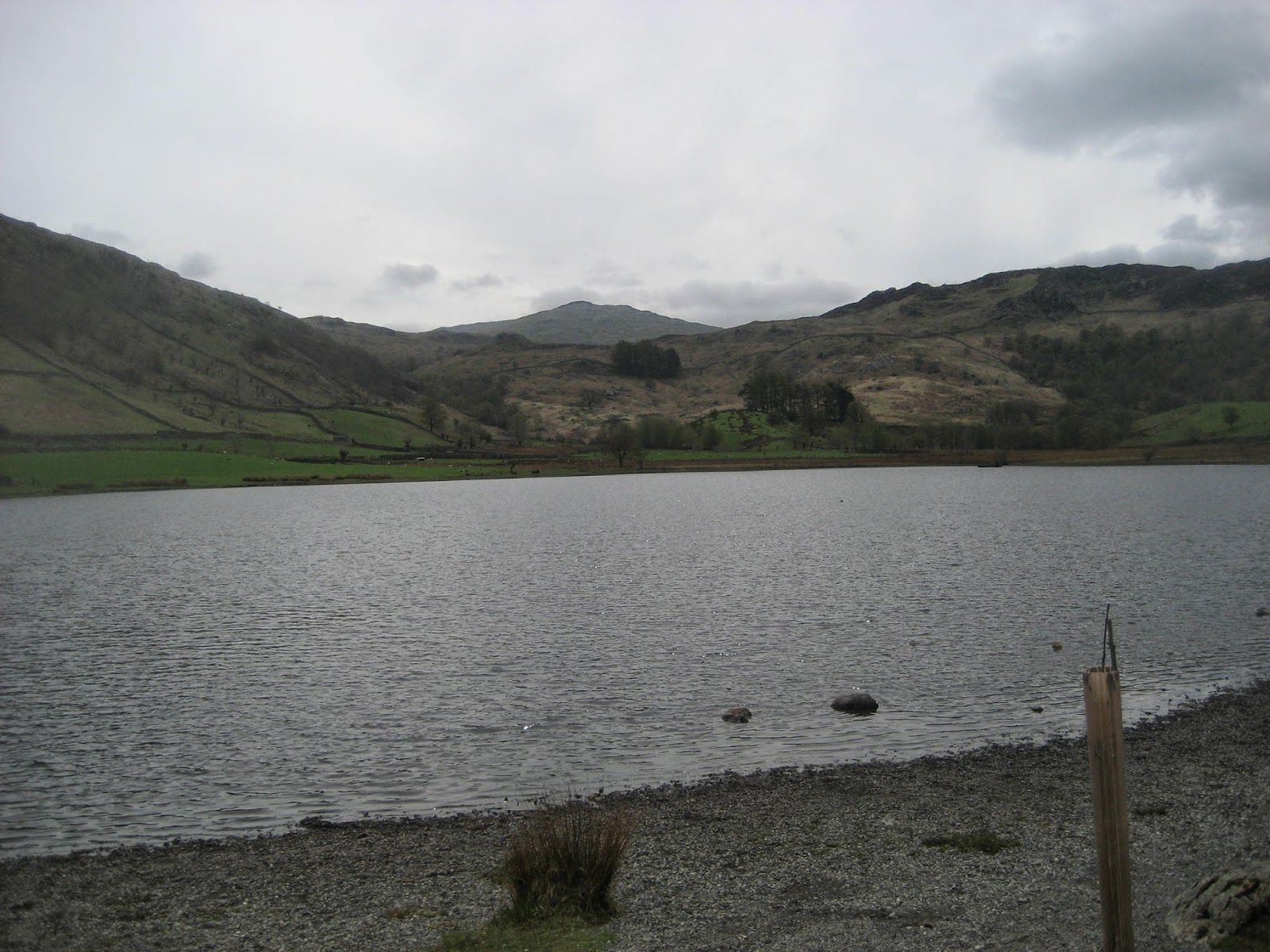 Watendlath tarn
 Looking back at Watendlath.
The next stage of the walk took us to Dock Tarn. It is easy to find as there is a signpost at Watendlath pointing the way along the west side of the tarn. If you follow this walk take a good look at the map and find the footpath that leads directly to the tarn. Some of us are so confident that we know the way we wandered around Great Crag and the Knotts before reaisling we were off piste. Turning instinctively east we found the elusive Dock Tarn. (Brian who had decided to take a slightly different route sat smugly on the shore, snoozing.)
We declared a Herbie Spot and sat on rocks on the east side of the tarn. Sandwiches, chocolate cake from Miss E of cakepoppins fame, chocolate biscuits, Mr. Kipling's somethings and Mrs A's weekly offering. ( I apologise Margaret I have forgotten the flavour, it's my age).
 Dave, Harry, John and Brian lunching at Dock Tarn.
 Dock Tarn and Brian's hat. There were some mysterious objects moving just
below the surface, possibly mini submarines sent by Vlad Putin
Lunch over we considered hiking across th Ullscarf but decided that by the time we got there the rain would have set in so we followed the path south west to Lingy End. Here the path goes very steeply downhill through a wood. (Or uphill if you go the other way of course.) The footpath has been very well built up with large stones but it could be a problem in wet weather, and a nightmare in icy conditions. It emerges in the Derwentwater Beck Valley near the campsite. There are some top class stiles on the way too.
 Great Gable with gathering clouds
 Wooden stile.
As the path levels out we came across one of the Lake District;s finest wall crossings and I have persuaded Harry to demonstrate the correct way of crossing.
 The stile
 The approach, taking care
if using walking poles, or you may trip. It would be
advisable to retract your poles and strap them
to your rucsac before attempting to cross the stile.
Not wearing a rucsac? How will you carry the
essentials for a walk; spare clothes, food and drink
iphone, ipad, camera, portable printer etc
 Take one step at a time
 And cross safely, remember
stiles are not to be trifled with.
I am thinking of sending this series of pictures to the Health and Safety Executive.
The footpath joins the Cumbria Way, the walk back to Rosthwaite is between dry stone walls and alongside the river. The only thing to watch out for is the dog owners and their pets. They own the path, apparently.
 Dry stone walls, called rock fences in
the North American Dominion

 Views along the river.
 Herdwick major and minor. These sheep are black at birth
grey at one and brown at two. Well known for hefting which means they
stay on their own patch in the hills.
As we reached the car the rain began to fall, the weatherman was spot on. On the way home we stopped at the Shepherd Inn at Langwathby which offered Independent Lakeland Brewery ales,
Old School Brewery Caretaker, Tirril Brewery beer and Thatchers,(witches brew probably).
It was a very bad day for pedometers and GPS systems but in total, with a bit of wandering we managed about six miles. A short but pleasant walk with a couple of stiff climbs.
Gadgie Distance is now 168 miles

Steep descent at the end
One of the many books I loved as a child was Fell farm for Christmas by Marjorie Lloyd, published in 1954. A companion to Fell farm Holiday it was a simple story of a family of children enjoying a Yuletide romp on a hill farm. Much more fun than The Famous Five, by Enid Blyton although I did read and reread her Shadow the Sheepdog. I have often wondered which farm Marjorie used as a model, could it have been Watendlath which is the chosen walk of today?
Watendlath comes from Old Norse vatna endi hlada, meaning "the barn at the end of the lake" or possibly, "the lane to the end of the lake". I vote for the former.
There are five of us out today, Dave, John, Brian, Harry and me and w
e have chosen this short walk in the Lake District because the weatherman has promised heavy rain in the afternoon and the north east is shrouded in mist and it's not even autumn.
The starting point is at the car park in Rosthwaite down Borrowdale. To get there from base : A69, M6 South, A66 to Keswick, follow signs for Borrowdale, but do stop at the Keswick coffee lounge for a grade nine bacon sandwich and tea. (Or try the Flock Inn up the lane from the car park, it specialises in Herdwick sheep products as well as bacon and is popular with HRH the Prince of Wales). The car park is not free unless you have joined the middle classes and can display your National Trust card on the windscreen..
The map to use, and it is advisable, is OS OL 4 The English Lakes North Western Area and the car park is at NY257148(approx).
car park belonging to the village institute and
available for a donation. It has a mysterious
request to park facing the wall.
The walk:
We left the car park and walked down the lane back to the village, turned left and almost immediately right up another lane, crossing the Derwentwater Beck by means of a beautiful arched bridge.
From here we followed the steep path between Belt Knot and Yew Crag, past the well named Resting Stone, and down Bowdergate Gill towards the hamlet of Watendlath. (It is possible to drive to the hamlet from a point off Derwentwater near a landing stage some miles north of Rosthwaite. Popular because it gives people the opportunity to visit the Lodore Falls, not exactly Niagara, but pretty)
There is a tea room at Watendlath and it is possible to fish on the lake. It is a very peaceful place and very pretty. Could be the fell farm of the book for all I know.
The next stage of the walk took us to Dock Tarn. It is easy to find as there is a signpost at Watendlath pointing the way along the west side of the tarn. If you follow this walk take a good look at the map and find the footpath that leads directly to the tarn. Some of us are so confident that we know the way we wandered around Great Crag and the Knotts before reaisling we were off piste. Turning instinctively east we found the elusive Dock Tarn. (Brian who had decided to take a slightly different route sat smugly on the shore, snoozing.)
We declared a Herbie Spot and sat on rocks on the east side of the tarn. Sandwiches, chocolate cake from Miss E of cakepoppins fame, chocolate biscuits, Mr. Kipling's somethings and Mrs A's weekly offering. ( I apologise Margaret I have forgotten the flavour, it's my age).
below the surface, possibly mini submarines sent by Vlad Putin
Lunch over we considered hiking across th Ullscarf but decided that by the time we got there the rain would have set in so we followed the path south west to Lingy End. Here the path goes very steeply downhill through a wood. (Or uphill if you go the other way of course.) The footpath has been very well built up with large stones but it could be a problem in wet weather, and a nightmare in icy conditions. It emerges in the Derwentwater Beck Valley near the campsite. There are some top class stiles on the way too.
As the path levels out we came across one of the Lake District;s finest wall crossings and I have persuaded Harry to demonstrate the correct way of crossing.
if using walking poles, or you may trip. It would be
advisable to retract your poles and strap them
to your rucsac before attempting to cross the stile.
Not wearing a rucsac? How will you carry the
essentials for a walk; spare clothes, food and drink
iphone, ipad, camera, portable printer etc
stiles are not to be trifled with.
I am thinking of sending this series of pictures to the Health and Safety Executive.
The footpath joins the Cumbria Way, the walk back to Rosthwaite is between dry stone walls and alongside the river. The only thing to watch out for is the dog owners and their pets. They own the path, apparently.
the North American Dominion
grey at one and brown at two. Well known for hefting which means they
stay on their own patch in the hills.
As we reached the car the rain began to fall, the weatherman was spot on. On the way home we stopped at the Shepherd Inn at Langwathby which offered Independent Lakeland Brewery ales,
Old School Brewery Caretaker, Tirril Brewery beer and Thatchers,(witches brew probably).
It was a very bad day for pedometers and GPS systems but in total, with a bit of wandering we managed about six miles. A short but pleasant walk with a couple of stiff climbs.
Gadgie Distance is now 168 miles
Steep descent at the end
No comments:
Post a Comment