The Beast from the East
Great Britain (and Ireland ) has been blasted by cold winds and snow from Siberia this week. Because the minor roads we gadgies use to get to starting points are mostly closed we have decided to cancel this week's proposed walk from Wark and spend the day decorating the house, shopping, visiting art galleries or sitting reading the paper.
Countries such as Canada, Scandinavia and Siberia itself are amused by our predicament, 15cm of snow and the country shuts down; roads close, railways stop running, airports cancel flights and supermarket shelves are stripped.
 No car park this week, but my car, parked.
When the local supermarkets, Sainsbury's and ASDA started selling newspapers several years ago they quickly closed down the newsagent who had a team of paperboys for deliveries and of course the big stores won't deliver so most of us have to go out for a paper.
In summer I go on my bike the half mile to a mini market that sells but don't deliver. Normally in winter I drive but because of the snow I donned my wellies (rubber boots) and trudged nobly down the street, doing a Captain Oates. And walking carefully because some years ago, pushing my neighbour's wheelie bin down her slightly sloping drive on an icy day I slipped and had to join a long queue of equally old men with broken wrists waiting to be plastered in Newcastle General Hospital. It had been, apparently, one of the days. The nurses and doctors were brilliant and dealt with us all with great understanding and skill. The morphine was a bonus My wife says I lectured the young Asian doctor on the glories of cricket.
Yesterday, after my half mile trudge I got talking to another older chap in the shop and suggested he would remember the big freeze of 1962/63. He said he remembered the super freeze of 1947.
I remember 1962, it was cold. One day I was travelling from Lancaster to Bradford by coach, the old man sitting in front of me had a mild heart attack, his wife took care of him, it was mild.
I remember 1947 too, although I was very young, three to be precise. We lived a few fields from my uncle's farm and I was there as often as possible watching him milk the cows.
I had suffered a very bad bout of whooping cough and suffered a hernia, which needed an operation.
My parents bought me a milkmaid and cow to occupy my tiny mind in hospital. (now it would be an ipad). I waved goodbye and off they went, leaving me happily playing with my two new toys. No sooner had they left than a nurse came and took the toys away; I have never seen them since.
The other traumatic event was the post op. Elastoplast. My mother took me to the doctors once we were home and he took one end of the plaster and ripped it off. I remember the agony and I was about 18 before I would allow anybody to remove a plaster.
!947 was before the NHS started, I don't know how the operation was paid for.
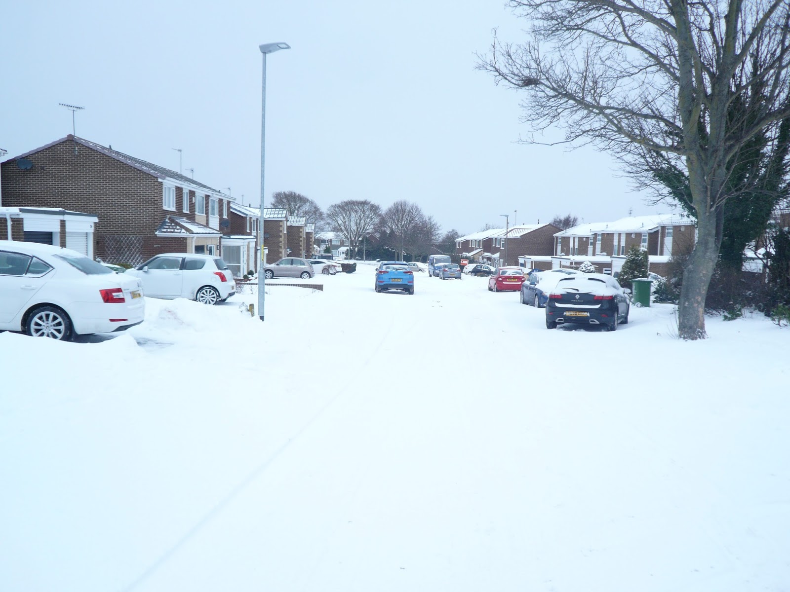
 Our street
Some weeks ago the BBC had a news story about the storm which hit Moscow. Looked like a couple of feet of the stuff (60cm) Traffic was moving, babushkas were clearing the pavements (sidewalks) and although life appeared to be operating at a slower rate it seemed to go on pretty much as normal. I was once in Moscow with my daughter Kate in the snow. She was in her student vegan phase, walking the slushy cold streets in her canvas Doc Martens. Might as well have been barefoot.
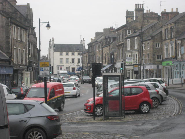
 Not sure where this is but it looks nice
Back to the BBC. The snow has given them the best programme filling story for years. Never mind the awful things going on elsewhere, we have snow, get out there reporters.
I live in the north east, the stuff arrives here first when it comes from Siberia. The local BBC advises us to travel only if essential but sends reporters and film crews to different towns in the region to tell us the roads are blocked. Up to five separate reports telling us it's cold, travel is difficult and stay indoors. And look after the elderly.
 My dear little daughters, Kate and Lucy. This picture was taken in 1979. We've had snow before then!
Today should have been gadgie day but we have cancelled because minor roads are a problem, not to mention the A1, main east coast road to Scotland which is closed north of Alnwick, but the BBC are there to tell us. I walked to the paper shop again, it's good for you when you are 73, only to be greeted by empty shelves. The papers had not got through and wouldn't today. I did think the supermarket might have them so I walked there too, waste of time but I bought some chewing gum. Fortunately we have access on a computer, except you can't do the crossword.
A few pictures to show you how badly we have been hit
 Icicles hang by the wall (Cultured too eh?)
 St. Nicholas' church Cramlington.
 Not the prettiest village in Northumberland
 Probably the worst snowman I ever made. Like British Rail I blame the snow, it's the wrong kind. But it's the only one on our street. What's matter with kids today.
On the plus side the wintry weather brought an usual visitor to our garden; a redwing. I wanted to call him/her Running Bear but he loved Little White Dove so the feathery friend has been called Kenny.
 Kenny Redwing. My ornithologist friend told me. rather snootily, they were common where he lived. Not in our yard.
Well that's my moan for the week. Back to walking next time
Great Britain (and Ireland ) has been blasted by cold winds and snow from Siberia this week. Because the minor roads we gadgies use to get to starting points are mostly closed we have decided to cancel this week's proposed walk from Wark and spend the day decorating the house, shopping, visiting art galleries or sitting reading the paper.
Countries such as Canada, Scandinavia and Siberia itself are amused by our predicament, 15cm of snow and the country shuts down; roads close, railways stop running, airports cancel flights and supermarket shelves are stripped.

When the local supermarkets, Sainsbury's and ASDA started selling newspapers several years ago they quickly closed down the newsagent who had a team of paperboys for deliveries and of course the big stores won't deliver so most of us have to go out for a paper.
In summer I go on my bike the half mile to a mini market that sells but don't deliver. Normally in winter I drive but because of the snow I donned my wellies (rubber boots) and trudged nobly down the street, doing a Captain Oates. And walking carefully because some years ago, pushing my neighbour's wheelie bin down her slightly sloping drive on an icy day I slipped and had to join a long queue of equally old men with broken wrists waiting to be plastered in Newcastle General Hospital. It had been, apparently, one of the days. The nurses and doctors were brilliant and dealt with us all with great understanding and skill. The morphine was a bonus My wife says I lectured the young Asian doctor on the glories of cricket.
Yesterday, after my half mile trudge I got talking to another older chap in the shop and suggested he would remember the big freeze of 1962/63. He said he remembered the super freeze of 1947.
I remember 1962, it was cold. One day I was travelling from Lancaster to Bradford by coach, the old man sitting in front of me had a mild heart attack, his wife took care of him, it was mild.
I remember 1947 too, although I was very young, three to be precise. We lived a few fields from my uncle's farm and I was there as often as possible watching him milk the cows.
I had suffered a very bad bout of whooping cough and suffered a hernia, which needed an operation.
My parents bought me a milkmaid and cow to occupy my tiny mind in hospital. (now it would be an ipad). I waved goodbye and off they went, leaving me happily playing with my two new toys. No sooner had they left than a nurse came and took the toys away; I have never seen them since.
The other traumatic event was the post op. Elastoplast. My mother took me to the doctors once we were home and he took one end of the plaster and ripped it off. I remember the agony and I was about 18 before I would allow anybody to remove a plaster.
!947 was before the NHS started, I don't know how the operation was paid for.
Some weeks ago the BBC had a news story about the storm which hit Moscow. Looked like a couple of feet of the stuff (60cm) Traffic was moving, babushkas were clearing the pavements (sidewalks) and although life appeared to be operating at a slower rate it seemed to go on pretty much as normal. I was once in Moscow with my daughter Kate in the snow. She was in her student vegan phase, walking the slushy cold streets in her canvas Doc Martens. Might as well have been barefoot.

Back to the BBC. The snow has given them the best programme filling story for years. Never mind the awful things going on elsewhere, we have snow, get out there reporters.
I live in the north east, the stuff arrives here first when it comes from Siberia. The local BBC advises us to travel only if essential but sends reporters and film crews to different towns in the region to tell us the roads are blocked. Up to five separate reports telling us it's cold, travel is difficult and stay indoors. And look after the elderly.

Today should have been gadgie day but we have cancelled because minor roads are a problem, not to mention the A1, main east coast road to Scotland which is closed north of Alnwick, but the BBC are there to tell us. I walked to the paper shop again, it's good for you when you are 73, only to be greeted by empty shelves. The papers had not got through and wouldn't today. I did think the supermarket might have them so I walked there too, waste of time but I bought some chewing gum. Fortunately we have access on a computer, except you can't do the crossword.
A few pictures to show you how badly we have been hit


On the plus side the wintry weather brought an usual visitor to our garden; a redwing. I wanted to call him/her Running Bear but he loved Little White Dove so the feathery friend has been called Kenny.

Well that's my moan for the week. Back to walking next time