Translate

Thursday, 8 October 2015

And next day we went to the Lakes.............Oct 9th(Lake District)
  A tale of two forecasts. One said the Lake District would suffer high light cloud and be dry apart from a light afternoon shower. The other claimed a heavy cloudy day, possible rain. Regardless, six of us (Ray, Dave, Harry, John H, John C and I) set out in two cars for a walk in the Cumbrian Hills. With nothing prearranged we met at Rheged, shopping Mall and Viking exhibition centre near Penrith. Over tea/coffee we chose a variation of the ever popular Coldale Round from Braithwaite village near Keswick.
To get to Braithwaite from base, A69 West to Carlisle, almost, south down the M6, west along the A66 past Keswick and turn left into Braithwaite. There is a good camp site in the village, chalets, space for caravans and lots of room for tents. Beyond the village itself a right turn brings voyagers to an open area next to a hall occasionally used by the Orthodox Church. Parking is limited but free and is at NY229235. A map for the walk is very useful, OS OL 4 The English Lakes North West covers the whole of the walk.
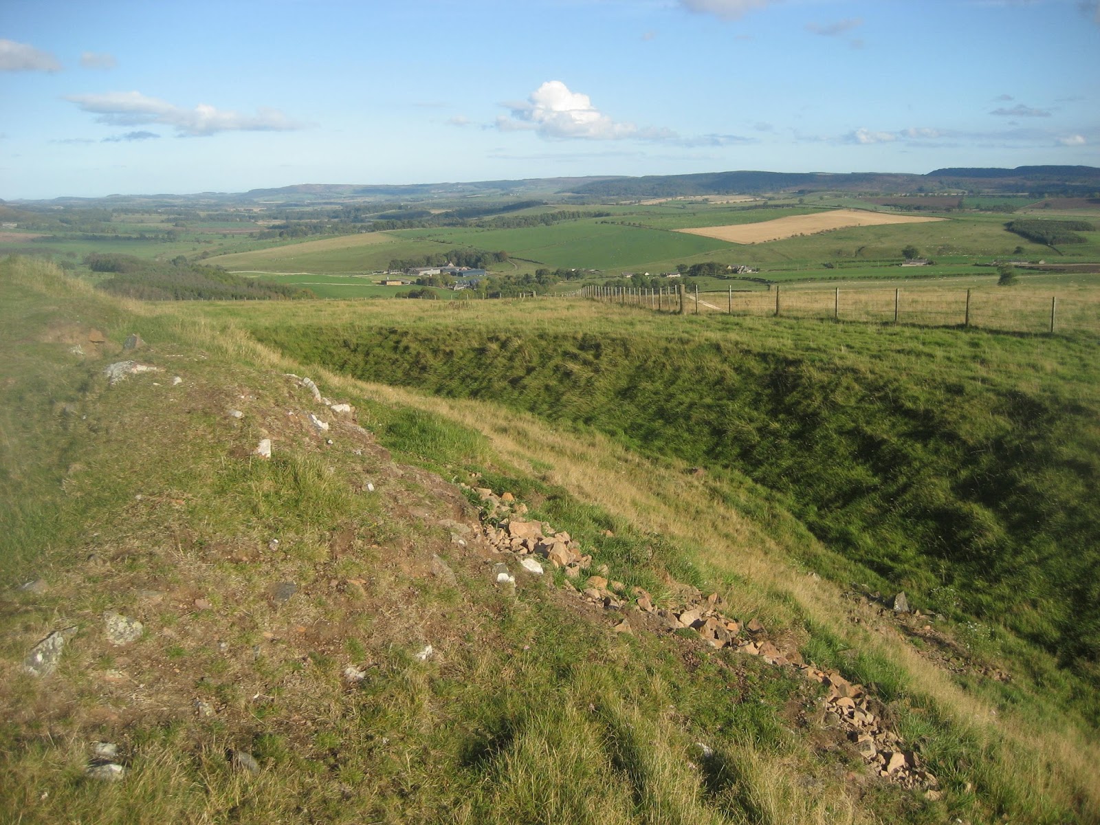
                         Today's car park, limited.
   Booted we set off. Turning right at the bottom of the parking area we followed the road past the Coldale Inn and turned up a rough track that led to several houses before it turned into a grassy track that climbed steadily upwards in a south west direction.  Although cloudy it was warm enough to walk in T shirts only, apart from trousers and boots of course. The path became a stony track, then a footpath befrore, beyond Barrow Door, it joined  the track leading alongside Outerside and then climbing quite steeply on a narrow precipitous path to the top of Sail. (743 m, 2437 feet) 

                          Looking back at Derwentwater.
             From Sail the footpath along the Scar is narrow and rocky, high above  Coldale and needs a little care in poor conditions. Fortunately it was so misty I couldn't see what lay below, good job the gadgette wasn't there. At the end of the Scar another short steep section leads to the summit of Crag Hill, a plateau with a broken trig point. (834m  2736 feet) By now it was drizzling steadily and the view wasn't up to much so we pressed on downhill to a cross roads of footpaths and turned right. Once in a sheltered spot we pulled up rocks and called a Herbie Spot. It's a bit like communion really, gadgies making offerings to each other, or at least to those who join in. We shared Club biscuits, carrot cake and individual bramley apple pies. Sadly Mrs A is sunning herself in Crete, no cake from her then. Those who do not join in claim to be dieting. I offered them my diet for free. It has been successful and I have managed to lose 16 pounds over the last couple of months. It works like this: you eat and drink exactly the same stuff as before but in smaller quantities (Well not the drink). Be patient, try it.
Lunch over we continued to Coldale Hause, another meeting place for footpaths. Here the party split, unable to agree on a single route. Three, all under 66 years old  headed up   Hopegill Head, probably adding another half mile to the walk. The 70+ contingent headed straight up Grisedale Pike, a steep climb.
On the way up I spotted a dotterel. Quite rare  the only other I have seen was On Anoch Beag in Scotland.
                           Dotterel, bird of the blog.Member of the plover family, likes mountains.
So unusual the Scottish SPB likes to hear about them. The one in Scotland was named as Emmett's Dotterel.
                                            Grisedale Pike from Herbie Spot
                                and from a little closer The straight line is the remains of a boundary wall.
                                                    Local resident
As we approached the top of Grisedale it started to rain quite heavily so we pushed on without waiting for the other three. The descent from Grisedale is very steep and the footpath initially has a lot of loose stone. It can be very slippy, especially in the rain, and requires some care. And should you go the other way round it is a long steady ascent.
                                       Grey day above Derwentwater
                              Season of mists alright.
Eventually we reached the grassy slope beyond Sleet Howe, the path levelled and we walked through acres of bracken. The footpath, still slippy, emerges in a small car park off the road to Whinlatter. We turned right down the road, took the footpath through a wood and used the footbridge across Coldale beck to get back to the car park.

                                               Coldale Beck in Braithwaite.
Changed, and dried, we headed for the Royal Oak in Braithwaite. A popular pub for walkers with a large version of The New York Times headlined "Titanic Sinks" and a strange collection of foreign bank notes. It sells Jennings Beer, Bitter, Cumberland and Cock a Hoop. Not the world's greatest beers.
It was however a good day out in spite of the disappointing weather.

The Matrix MMXV     UU
                                                             steps                              miles
LIDL3D                                              28867                             8.86
Dave's LIDL3D                                  24733                             10.16
Dave's USB                                        23923                              9.81
OUTDOOR GPS                                                                        8.4
Etrex                                                                                            9.1


Contains OS data, Copyright. Crown copyright and database right 2015.
Looking for Nellie Heron.......October 8th.(Northumberland)
In December 1863 Nellie Heron, aged fifty, had been treating a poorly shepherd in Alnham. Against advice she set out to walk home across the moors to her home at Hartside about five miles away. It was a cold day, snowing and drifting and sadly Nellie didn't make it home. Stopping to rest, presumably, about halfway into her journey she was overcome by the conditions. Her body was found next day, still in a sitting position and still with her basket. She is buried in Whittingham Churchyard.
In 1962 two shepherds returning from Rothbury were also caught out by the weather, they abandoned their tractor but perished near Ewarty Shank.
Today Dave and I are out to find the memorial stone to Nellie. We are walking from Alnham, a tiny Northumbrian Village tucked away near Whittingham. To get there, A1 north, A697 north of Morpeth and watch out for signs on the left for Whittingham. After that go through Whittingam village and follow the road signs for Alnham. Park off the road by St. Michael's Church. (NT991109) This church has origins dating back to about 1200 although it was ruined for a long time, being restored in 1870. Next door is the Tower House or vicar's pele, built originally in 1541 and redecorated on several occasions since. The whole of the walk is covered b y OS OL 16 The Cheviot Hills.
The weather forecast, for October in the north of England, was promising; no snow.
On the way we stopped in Whittingham to look at Nellie's gravestone in St Bartholomew's Church:
                                                 Heron family grave, Whittingham.
                                               The tower on St. Bartholomew's.  The church has Saxon origins
like many in Northumberland. Some of the stonework on the tower is Saxon. Another interesting fact is that the vicar was ejected at the time of the Civil War and replaced by Abraham Hume, a Presbyterian minister. The Vicar was reinstated in 1662 after the restoration. He was reinstated on St. Bartholomew's Day.
Onward to Alnham.  We parked on the grass outside the church, St. Michael and all Angels, also with Saxon origins but largely restored in the 19th century. In the churchyard are three Saxon Cross Stumps which were brought here at some time.
                                                  Car park outside the church.


                                                       St Michael's Alnham
                                                Saxon Cross Stump and a tree 
Leaving the church we walked along the road past the Tower House which started life as a vicar's pele tower about 1542 but now is privately owned and greatly extended.
Just beyond the tower house a hard to see sign points the way across a shallow stream and uphill by way of several fields until we reached the open moorland, pausing to look at the earth mounds that are all that is left of an ancient settlement. We continued following the fence line rather than the Salters' Road Track until we came to the White Gate. From here we headed north, carefully watching the Grid Reference on my mobile phone until we had reached NT978134, the point given for the memorial stone for Nellie. After a while we found it, low and surrounded by stones for protection.
                                       Memorial to Eleanor "Nellie" Heron. Simple but effective.
                                                     The memorial stone
Having found the stone, objective number one, we started a wander, as you can see from the map. Initially we walked  south east to Hart Law, a mistake, we thought we were heading for Leafield Edge. Hart Law has little to recommend it except the views.


                                                 Hart Law has  a trig point, and views!
Having realised our mistake we returned almost to Nellie's stone and found shelter from the breeze behind a sheep stell on Leafield Edge. Leafield is an abandoned village, the last inhabitants left in the 17th century. All that remains are the outlines of houses and gardens. As we ate we watched a Hen Harrier fly across the moors, hunting for lunch probably.
Lunch over we headed back to the White Gate, crossed the stile and looked for another settlement, it was not too clear exactly where but we headed uphill to look at the one High Knowes. We also visited the memorial to the two shepherds who died trying to get home in the snow in November 1962. Sadly they perished not too far from safety. The winter of 1962/63 was a cold one, I remember it well, the snow lasted until Easter in much of the country.
                                          Memorial to two shepherds lost in a storm
From the cairn we headed to the road below and headed back to the car, pausing for a good look at the fort and settlement on Castle Hill. This one is an excellent example of a bronze age fortification and settlement. The surrounding banks are well preserved and the outlines of several dwelling houses are clearly visible.


                       Views of the fort and settlement at Castle Hill above Alnham.
Back at the car we changed and headed home, calling at the Anglers Arms for beer or tea. Old Speckled Hen or English tea, can't go wrong there.

The Matrix MMXV TT
                                                               steps                           miles
LIDL 3D                                               26077                          7.86
Dave's LIDL3D                                    21884                          9.41
Dave's USB                                           20557                         8.76
etrex                                                                                            8.95
OUTDOOR GPS (edited)                                                       8.3

Saturday, 3 October 2015

From St Andrew's Church, Bolam....Oct 2nd.(Northumberland)

   St. Andrew's is a pretty church in Bolam Northumberand. Late Saxon in origin with Norman additions. Its most interesting feature is the window on the south side of the nave. In 1942 a German bomb went through the wall but failed to explode. The pilot was not trying to destroy the church, he was dumping his load destined for Tyneside and trying to get away. Years later he returned and apologised.
Today's walk starts at the church. It is a relatively easy stroll as several of the gadgie crew were out the previous evening consuming beer and curry, both can have disastrous effects.
The whole of the walk is covered by OS OL 42 Kielder Water and Forest A pleasant drive to the church from Newcastle is to head north on the A1, turn off at Morpeth, past County Hall and turn left at the golf course. Turn right at the village of Walton, just past the Beresford Arms and after about four miles the lane to the church is on the right.
The local TV had promised another sunny day, about the seventh in a row, a real Indian summer.
                                St. Andrew's Church Bolam, the small window............
                      is the one where a WWII bomb penetrated the wall of the church.
   At the back of the church a gate leads to the footpath across several fields to Angerton Steads, over the dismantled railway that once ran to Rothbury and across more fields to Low Angerton.
                      fine examples of Ridge and Furrow, the ancient way of agriculture before John Deere even thought of making a steel plough (plow).
A few hundred yards down the lane from Low Angerton the footpath to take is on the left and crosses several more fields and the disused railway line before staying close to the meandering River Wansbeck in which were at least two herons and a little egret. The latter is becoming increasingly common in the north of England, to Middleton Mill near the Medieval Village of South Middleton. Down a farm track to the road, turn left at Middleton Bridge and just across the bridge itself the footpath is on the right. A stell, or sheep fold, in the field makes an excellent Herbie Spot. (About mile 4 on the map)
                                  Feeding time at the stell.
 Lunch over the gadgies continued across fields  to Middleton South, passing close to a standing stone.
                                            Standing stone near Middleton South.
 Turning south east the lads soon came to the highlight of the walk, Shaftoe Crags. Interesting formations and an interesting name. The Shaftoe family  of the nearby Grange and Hall are not the one of nursery rhyme fame. Bobby Shaftoe, him of the silver buckles, came from Durham, cousins of the Northumberland branch.
                                             Shaftoe Crags, specifically Salter Nick.
                                         Punchbowl Stone at Shaftoe Crags. Tradition has it that one member of the family filled a hollow on the rock with wine for his wedding celebration. Hope it's not too porous.
 Beyond the crags the track leads to East Shaftoe Hall. beyond the hall the farm track is built from redundant concrete railway sleepers brought down from Glasgow.
Turn right at the road and after a short walk on the metalled surface the path enters Bolam Lale Country Park. Presumably built for the inhabitants of Bolam Hall this park and its lake is now a popular place for the citizens of the north east to pass a pleasant morning or afternoo looking at the birds on the lake. There are nearly always swans and geese on the water and the woods teem with other ornithological examples.


                                        A goose and several swans on Bolam Lake.
There is an information centre and car park at the north east corner of the park. Leaving the car park the team turned left on the road then right and back to the church and home, by way of the Waggonway Public House just north of Ponteland.
If by chance Mary Blood from Australia reads this, this is the pub I took you and your two world travelling mates to way back in 1965/6! And the young lady who came with us has been my wife for 46 years!!!
If readers are amateur Sherlocks you will notice that the photos look a bit wintery. This is because I was indisposed and didn't actually go on the walk. The pictures were taken in December 2013.
But the readings from Dave's pedometers are from today.

Matrix MMXV  VV
                                                                         steps                        miles
LIDL3D                                                           20272                    9.28
LIDLUSB                                                        19835                    9.07

Thanks for keeping the blog going chaps.
Contains OS data Copyright. Crown copyright and database right 2015.
PS  Current league positions for readers: (top 5 only)
                                 1  UK
                                 2  US
                                 3 Ukraine
                                 4 Canada
                                 5  Russia
Thanks

Friday, 25 September 2015

Swainby on the North Yorks Moors,  Sept 25th(Obvious)
   I have had a lot of German readers this week, perhaps they are considering taking up walking and leaving their Volkswagens at home.
  We were planning to go to the lake district again but for several reasons had a change of mind and went to the Cleveland Hills, starting the walk from the village of Swainby, or pretty near it.
To get there from base take the A19 south and turn off at the A172 which brings you back to the pretty village of Swainby. South of Swainby a very minor road leads to the houses at Huthwaite Green where there is very limited parking.  A map is advisable, OS OL26, North Yorks moors, western area covers about 95% of the walk and the start is at NZ492007.
There are six of us out today, a two car5 job. John H, John C, Dave, Harry, Brian and me.
                            Limited parking at Huthwaite Green, but there is a post box.
    Behind the cars in the picture there is a gate asking you to leave room for negotiating horses, the walk starts through the gate. The path is on the Cleveland Way long distance footpath and so is signed with white acorns. Almost immediately there is a steep but stoned path that leads uphill onto Round Hill and then continues across Live Moor and Carlton Moor. The views are good if hazy, Teeside to the north east and the flat fertile plain to the north with a view of distant Roseberry Topping.
                                        Roseberry Topping ,top left.
                                 The path is good, in places it has been paved with 
                                     redundant flagstones from Yorkshire Mills.
   We met a couple of American couples from Montana who were walking the coast to coast, all qualified gadgies or gadgettes. They had got the impression it never rained in England as they had not had a single bad day on their walk from St Bees, through the Lakes and now in the Cleveland Hills. How lucky is that.
Beyond Carlton Bank the path goes downhill to a picnic area. We considered calling a Herbie Spot but John C made us walk on, uphill again past a trig point and a view point and down again at the head of Raisdale. We finally called a Herbie Spot and settled behind a wall to keep out of the wind.
                                           John H and Dave examine the trig point
                            Escarpment on the Cleveland Hills


                             Herbie Spot. Treats today; Fruesli bars, Yorkshire flapjacks, ginger parkin from ALDI, Snickers and home made lemon cake from Mrs A. (I weigh a mere 175 pounds American, !2 stone & 7 lb in UK)
Break over and back on our heads we followed the footpath through what is obviously a pheasant nursery rather than follow the footpath alongside the wall which was hemmed in by bracken. At the end of the pheasant nursery we followed the footpath downhill through thick bracken to High Clay House and Hall Garth. At Hall Garth a track took us through a wood where we saw a roe deer and then across a few fields until we came to a minor road. We turned left down the road for a few hundred yards before turning right to Raisdale Mill. If you follow this walk take care at Raisdale. Turn left after the first house and walk past the old mill itself to a very old narrow stony track that leads steeply uphill and back onto the moors. We followed the track until we came to a sign post which we ignored, it leads to Bilsdale West Moor. Instead we followed a stony track downhill to Scugdale Hall. The track turned into a metalled road passing Fog Close Farm and Sparrow Hall Farm and eventually brought us back to Huthwaite Green.
Changed we headed home by way of the A19. Bad move,not only was it going home time round Middlesborough but there had been an accident which also contributed to our slow progress home. For once we did not have a drink on the way home, possibly a record.

The Matrix MMXV UU
                                                                          steps                          miles
LIDL3D                                                           27156                         8.85 (I was 4'7" today)
Dave's LIDL3D                                               23042                         10.13
Dave's USB                                                     22261                          9.8
Etrex                                                                                                     9.9
OUTDOOR GPS                                                                                 9.83
John C GPS                                                                                         10.3


Wednesday, 23 September 2015

Once more unto the wall dear friends once more
Sept 22nd.(Hadrian's Wall)
 As Shakespeare almost said.
  An extra gadgie walk for Roman Wall spotters, from Housesteads to Chesters, two Roman forts along Hadrian's frontier. There are two of us out today, Dave and I, and we are making use of the AD122 bus that runs along the wall but only in the summer months. It finishes this year on September 27th and hopefully it will run again in 2016.
 We drove from base to Chollerford along the A69, turning right beyond Hexham and going through Acomb and Wall before turning left at the cross roads, over the bridge at The George and driving a few hundred yards up the B6320. There is a lay by capable of at least six cars. Booted we walked the quarter mile to Chesters on the B6318 and caught the bus to Housesteads. This walk is easy to follow as the Hadrians Wall path is very well signed but it is covered by OS OL 43 Hadrians Wall. Better still if you want detail of the turrets and Milecastles buy the English Heritage Archaeological Map of the wall, but they shoot anybody who reproduces it. The Ordnance Survey don't mind, provided you give them credit.
                                                    Look out for signs
                                                  Information Centre at Housesteads car park

Housesteads car park
  After a pleasant chat with Carol in the information centre who told us all about the cuts that were happening in the National Park, two members of the First Mikedavinius Legion set off to walk east along the wall from Vercovicium to Cilurnum.
We walked up to the fort which was being prepared for the day's visitors, round the west side and through the gate onto the wall path, turned and marched east on a warm but cloudy day with the wind on our backs.  The first few miles of the walk are high on the Whin Sill affording glorious views to the north and south.
                                   West gate in the fort at Vercovicium (Housesteads)
  This short section is the only part of today's walk which has any climbing, even then it is easy going and we ticked off several turrets and a milecastle before coming to a gate in the wall, the King's Wicket.
                                                    Gate in the wall, but not Roman.
 Soon we reached Sewingshields Crags and the farm at Sewing Shields. Nothing to do with stitchcraft it comes fro Old English Sigewine's shiels, the shelter of one Sigewine, the local boss.
Although we had been walking for only an hour it was noon and we called a Herbie Spot at Turret 35A, overlooking Broomlee Lough to the west and the medieval fish ponds (dry) to the north. To the north there is also a ring and bailey, plainly visible.


                                                     Turret 35A, excellent dining room on a sunny day.
                                                        Milecastle 35

                                          Ditch, north of the wall.
  Lunch over we continued the march, probably much slower than any Roman Legion, spotting bits of wall, turrets, some of which have completely vanished though, and mile castles along the way.
Just beyond Carraw we crossed the road and walked down to the Mithraum at Brocolitia. Mithras was an eastern god adopted by the Romans, particularly soldiers, and there are several temples in England. This one has three altars, one of which had 67p on it. We also looked for Coventina's Well in the area but presumably it has been covered up after excavation. We also looked at the remains of the fort. One of the information boards referred to Procolitia, I need to check that out.
                       One of the few Information Boards on the wall that is legible. Some have vanished,
shame on you English Heritage.


                                      Mithraum at Brocolitia. The altars are reproduction, the real ones are in the museum in Newcastle.
  Back on the Hadrian's Wall path we walked across fields, some containing short stretches of the wall. At "Limestone Corner" we paused to look at the large stone the Romans had failed to break up, for whatever reason. The corner is incorrectly named, the rock is dolerite on the Whin Sill.

                                                The cuts were made at an early stage of the breaking of the stone to go into the construction of the wall. For some reason it was left.
                                                           Part of the wall
                           Turret. The groove in the stone left of centre allowed the door pivots to be inserted
                                              or removed.

                  The footpath goes round the settlement of Walwick and then down the road to Chesters, a Roman Fort (Cilurnum). We returned to the car and headed for the Wetherspoons in Hexham, marching is thirsty work.
If you want to walk the wall this part is probably the easiest, not having the ups and downs west of Housesteads. We met a good number of people who were walking the length of the frontier (74 miles), mostly Canadians and Germans, but all enjoying the experience.

The Matrix MMXV  TT

                                                                   steps                             miles
LIDL3D                                                      26752                            9.53
Dave's LIDL3D                                          23369                             10.98
Dave's USB                                                 22722                             10.75
eTrex GPS                                                                                         10.69

Contains OS data, copyright. Crown copyright and database right 2015