Translate

Friday, 13 February 2015

February 13th............what a grey day.
The weatherman, the very same jovial jock, declared Friday the 13th would be a cool day with rain.
The planned route was to drive to Embleton in Northumberland, catch a bus to Longhoughton, walk up the coast to Newton by the Sea and across country back to Embleton.
A full house turned out, Brian, Harry, Dave, John H, John C, Ben, Ray and me, an octogadge.
To get to Embleton take the A1 north and turn east just beyond Alnwick and follow road signs to the village.   It is apretty village with at least two pubs and a church, Holy Trinity, which has 14th C origins.  
Holy Trinity Church, Embleton. The Mothers' Union sell coffe two mornings a week,
but not Friday. Shame.
                                                                                                                                           Once booted up we waited for the X18 Arriva bus to take us to Longhoughton. This service runs very infrequently so if you wish to use it check the timetable. We got off at the SPAR shop in Longhoughton.
A map could be useful, particularly for the last section of the walk and the one to us is OS Explorer 332 Alnwick and Amble. It covers about 95% of the walk, missing the first few hundred yards and the bit round the village at Newton by the Sea.
                                              Parking in Embleton, near the Post Office.
From the bus stop in Longhoughton we walked a short distance south before turning left along a road which eventually became a track leading through the farmyard at Low Stead where we were met by a very friendly collie. Continuing our way we soon came to Northumberland Coastal Path/ St. Oswald's Way and headed north along a muddy footpath. The map is worth carrying just for the names. We joined the footpath at Howdiemont Sands, walked past Sugar Sands and crossed a footbridge at Iron Scars which has an interesting geological outcrop and a freshwater spring.
                                                  Footbridge at Iron Scars
                                                         Howick Burn from the footbridge
                                                              Spot the heron
                                              And how much longer will this last?
Continuing on the coastal path we passed a cottage overlooking the sea, probably a holiday let, or an ideal place to write a novel.
               A coastguard's lookout?
The names continue to amuse, Swine Den, Black Hole and Hole o' the Dike. Eventually we arrived in the fishing village of Craster, famous in the north-east for kippers. We decided to stop and make use of the benches overlooking the harbour for a Herbie Spot. Pork pies, two varieties of flapjack, (one the chocolate coated special from Mrs A.), almond slices and Ben's ginger biscuits. (183 pounds)
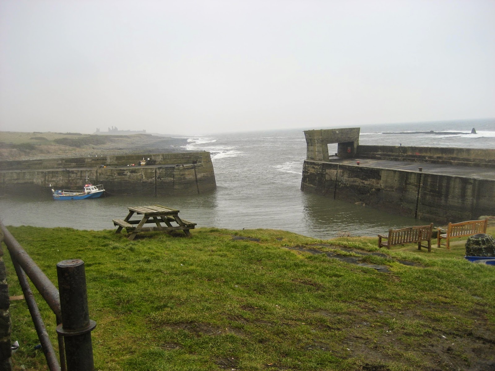


                                            Craster Harbour and distant Dunstanburgh in the top picture.
                                                        This turnstone and his mates joined us for lunch
Lunch over we said goodbye to the turnstones and continued north towards the always magnificent ruin of Dunstanburgh. On a grey misty day it looks even more mysterious than usual.
                                                        The ruined gateway at Dunstanburgh
                                                           and the ruined Lilburn Tower.
About half a mile north of the castle we left the path and walked down to the beach. The sandy Embleton Bay has a gentle curve until you reach Low Newton by the Sea, which has a pub called the Ship, famous for its meals and home brewed beer. We didn't stop.
                          The Ship at Low Newton by the Sea. It is in the corner of a square of cottages.
We followed the path round the back of the square and headed for the bird hides overlooking Newton Ponds to give the watchers among us the opportunity to watch the ducks and geese. A man who was already in the hide demanded we be quiet or we would frighten the birds, so like naughty children we walked away. From the hides, continuing south at the start is a well marked path across fields back to Embleton. The path goes directly across at least one field but it was ploughed and muddy, we stuck to the edge.
Back in Embleton we changed and headed for Grey's Inn. What a find. The pub kept six real ales, four of them on today including Tempest, Alnwick and Secret Kingdom. The landlord was enthusiastic about his beers, discussing the correct temperatures for each, his home brew and the pub in general. Five barrels, definitely.
Jock had the weather wrong, we had no rain until we were driving home, but it had been a cool and misty day, but a good one.

Matrix  MMXV             G
                                                                   steps                                  miles
LIDL 3D                                                  25311                                  11.46
Higear                                                      20938                                    9.5
Dave's 3D                                                21365                                    7.68
Dave's USB                                             21756                                    7.55
OUTDOOR GPS                                                                                  10.2
Brian's GPS                                                                                           10.4


Both maps;
Contains OS data copyright. Crown Copyright and data base right 2015

The Times has an eight page pull out on the glories of Northumberland today (14/02/15)
It invites readers to enjoy the glories of the county, the wall, the hills, the castles, the coast and the history, plus fine dining of course, at The Ship, Low Newton by the Sea. All well and good but having been invaded by Saxons, Vikings, Romans and Scots do we really want hordes of southerners clogging up our hilltops on a Friday? 

Saturday, 7 February 2015

Pennypies are in my mind.......February 6th
  The forecast, as given by the usual jovial jock on local TV was for a grey day with little or no wind and a temperature of about 5C. Spot on Paul, you were right.
After some discussion we opted for a walk from Baybridge just beyond Blanchland. It is a slight variation on the walk "We're going to Blanchland... 11th November 2012".
Five gadgies out today, Dave, Harry, John H, Brian and me.
The walk starts from the hamlet of Baybridge (possibly meaning the bridge where the river is banked up), a pretty spot on the border with County Durham. To get there take the A69 west, go almost through Hexham  but turn left by the Tap and Spile pub, following the sign for Blanchland. Unless you are me it is easy to follow, but we enjoyed a mystery tour of Northumberland before finally reaching the car park at Baybridge, just on the north side of the Beldon Burn. We had called in at the Wentworth cafe in Hexham's large car park near Waitrose for bacon sandwich, coffee or tea first.
A map could well be useful but as with many walks two are needed OL 43 Hadrian's Wall and Explorer 307 Consett and Derwent Reservoir The car park is at NY957499;
                                                       NY957499, one for the album.
Having booted up we turned left out of the car park and after a few yards spotted the yellow marker sign sending us on our way. The first three  miles of the walk are easy to follow, tarmacked road past the old Methodist Chapel, quirky gothic with gable headed windows as Pevsner says, Newbiggin Hall is on the right, complete with polygonal chimney. The road becomes a farm track across fields and  through plantations until it reaches the tumbledown farmhouse at Riddlehamhope. (3 miles on the map)
There had been snow and it was both melting and freezing which made progress a little difficult at times so we called a Herbie Spot at the farm and settled down with backs to a wall to feast.
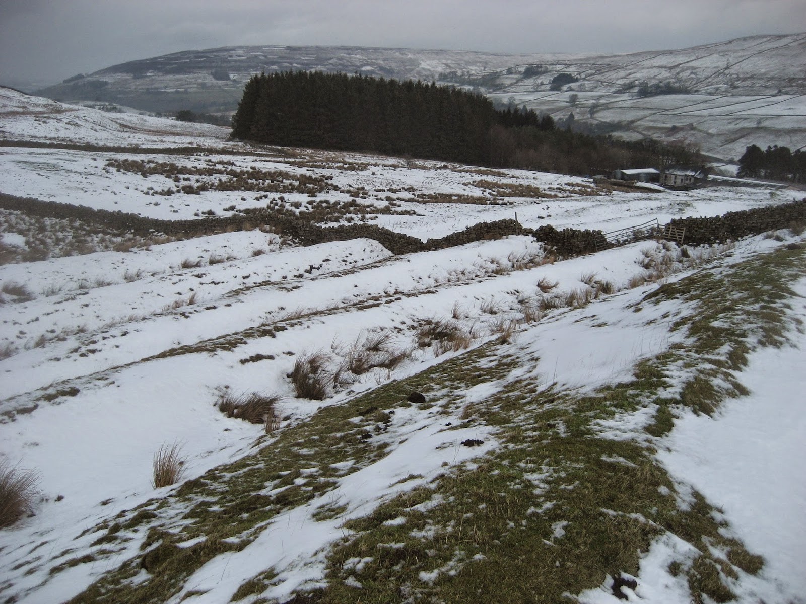
                                         The track towards Riddlehamhope


                                    Kathy from Goole, this is a human interest shot just for you, but I don't 
                                                     think we look very interesting.
Apart from the usual sandwiches today's lunch included McVities Hobnob flapjacks, Almond slices, Mrs. A's fabulous chocolate topped flapjacks and PORK PIES!! The good times are back.
                    The farm house is deserted but the hemel is in a good state, nice door.
The usual philosophical discussions took place. Brian remembered that on his trip to Africa to climb Kilimanjaro he had been in a nature reserve and had watched a couple of men burying the carcases of Widebeests. When he asked why bury them he was told it was to discourage vultures as the carcases were beginning to decompose. A good day to bury bad Gnus then.
Lunch over we continued the walk. (Hadrian's Wall map now). Through a gate beyond the farm and s short distance up hill and beyond a wrought iron sign saying NRUBYREHTAEH. Looks a bit Russian but once past it it read correctly, looking back. Not far beyond this sign a marker on the right took us over a stile on to The Carriers Way. The British Isles are criss crossed with ancient drove roads, Green lanes, Salters Roads and such. This is one of them. The track was difficult to follow in the snow but we trudged cheerfully on. At one point Dave pointed out we were crossing one of the finest glacial melt water channels in the north. It had a sheepfold (stell) too, but I don't suppose it was there when the hydraulic action of ice could force the ground water beneath uphill. At about the 6 mile marker on the map we came to the small stone hut used as a refuge by grouse shooters. Sitting in front of it, enjoying the sight of white smoke from distant Eggers factory in Hexham were four like minded, like aged people. They were from Ponteland, a large village north west of Newcastle.


                              The hut, inside and out.
I told them that the first date I had with the young lady who became my wife was in the Blackbird Inn, Ponteland some fifty years ago. Brian told us that his wife had been born in the same hospital as him within days of his arrival They could have met as mewling infants!
Somehow the chat got round to those adverts at the back of The Times and The Daily Telegraph on a Saturday morning. Why we asked, do the ads for walk in baths and showers always have pictures of young women who don't look as if they need help getting into a bath? And why do they bathe in swimsuits? And why does the man advertising chair lifts look as if he should be out with us. And why are the beauty counters in John Lewis usually deserted? I said that I had never been stopped by the young women on the beauty counters and persuaded to buy men's fragrances or anti wrinkle cream. One of the Ponteland Four looked at me and said it was impossible to improve on perfection. Don't you meet nice people when you're out?

The Carriers way continues through a gate in front of the hut,, we ignored the first cross roads but turned right at the next track, (Just under Bulbeck Common on the map. After about 0.75 of a mile we turned right again onto the track labelled Pennine Journey on later editions of the map. The track went downhill to Pennypie house, a farm which allegedly gets its name from selling food to passing carriers and offering accommodation when the road was used as a Carriers Way.
                                                No chance of a penny pie today. Health and 
                                                Safety would close it down!
At Pennypie we crossed the stream by the footbridge, walked the slushy track over the hill and joined the tarmacked road back to Baybridge, pausing to do a bit of snow walking on the way.
                                               Brian conquers a snow drift.
The Matrix MMXV  F

                                                          steps                          miles
Higear                                               17967                        8.16  ( Long shanks me today)
Dave's 3D                                         21447                        8.15
Dave's USB                                      20935                        7.92

OUTDOORGPS                                                                9.1
Briab]n's GPS                                                                    9.21

Both maps:
Contains  OS Data, Copyright. Crown copyright and database right 2015.

On the way home we stopped at The Boathouse in Wylam. It has fourteen beers on hand pull and I was driving.
Pictures from Harry, who is an excellent photographer and a fine gadgie
Approaching Riddlehamhope


                           Another for Kathy from Goole
                                                 Lunchtime at a Herbie Spot
                                                 Brian and John H crossing in stile
                                   The Ponteland Four  plus a gadgie or two

Saturday, 31 January 2015

We have often walked Carey Burn before and an AGM.........................January 30/31st.
 Much of the north has snow but the part of Northumberland we have chosen for today's walk has only a light dusting. The young lady who read the forecast on local TV  said Friday would be bright and breezy. She was right.
Eight gadgies out today, an octogadge; Ben, Brian, Ray John H, John C, Dave, Harry and me and we have decided to walk the Carey Burn. This is my favourite riverside walk in the Cheviots and it also liked by the rest of the gang.
It starts at the Carey Burn Bridge in the Harthope Valley, reached as you should know by now, by going north on the A1, turn onto the A697 at Morpeth, turn into Wooler, turn left onto Cheviot Street, past the YHA, take the right fork, turn right at the signpost saying Langleeford, drive carefully down the hill just past Skirl Naked and pull in on the grassy verge by the bridge. Be warned, there are often cows loose on this stretch of road, John H had his car beautifully decorated  but undamaged on one occasion. The map to use is OS OL42 The Cheviot Hills and the starting point is at NT 976249.
Stop in Wooler for tea, coffee  and bacon at the friendly Terrace Cafe.
                                                 This week's car park, free.
We went through the gate on the right just before the bridge  over the Carey  Burn and followed the footpath on the north side of the stream. The path is not on the OS map but is sign posted. It is close to the water for much of the way and there are a couple of places with a bit of a scramble but it is more like a valley in the Lakes than the Cheviots. With luck you will spot a heron or a dipper and possibly, near the craggy bits a peregrine. But not today.
                             Don't go near the waterfall
                                    A light dusting of snow in the burn valley.
 Some way up the stream the footpath is between the water and a plantation, eventually reaching a footbridge.(on my old map it says ford but it is a bridge.) Once across the bridge we stuck to the footpath across open fields until we reached another footbridge crossing the Broadstruther burn.(Also marked as a ford)
                                               The Carey Burn from the first footbridge
The footpath now joins a quite well made track which curves round to the old farm at Broadstruther. This farm, once derelict is now a hunting lodge used by grouse shooters. We sat outside in the sun and declared a Herbie Spot. Today's exchange of goodies meant we had Ben's ginger biscuits, Cadbury Brunch bar, Czech chocolate, flapjacks and some iced buns from Mrs A. (184 pounds today). I had left my flask on the kitchen bench (Counter in US, apparently) but was offered soup and tea which made up for it, what caring gadgies we are. Lunch over
.
                                        Ready to move out from Broadstruther
we headed roughly south from the lodge and after a few hundred yards spotted the footpath going across the moorland which eventually joins a good farm track and comes to the fence at the foot of Cold Law.


                                      The path to Cold Law, regardless of which side of the fence you are on.
                                            An old boundary marker at the foot of Cold Law.
                                        Broadstruther is right in the centre
On the Cold Law summit is a trig point. From it we headed south towards a cairn, took the footpath to the right of the cairn and followed it downhill. At the first grassy junction we took the right fork and followed the grassy path down Cockshaw Sike to the valley road. Turning left  we walked along the road for about half a mile before crossing the Private Bridge to Langlee. The footpath goes round the farm and then climbs steeply up a diagonal ramp. The tracks at the top of the ramp are not marked on the map, presumably they are fairly new, but if you do this walk on Brands Hill take the track east of north  and follow it downhill. At a fence go through the stile on the left and follow the muddy footpath  through woodland and above the river until it comes to a footbridge. Cross the bridge turn right and there is the car park. This walk is worthy of a Times "Good Walk", it has magnificent scenery, a bit of a climb and a terrific pub at the end.
Changed we headed for our favourite watering hole, the Anglers Arms at Weldon Bridge.

Brian heads for the bar.
On offer today, the last of Timothy Taylors Landlord, Speckled Hen and Directors.
The  Matrix MMXV E
                                                           steps                       miles


HiGear                                              19033                        8.64
Dave's LIDL3D                                 19723                       7.2
Dave's USB                                       19164                        7.25
OUTDOORGPS                                                                 8.2
Brian's GPS                                                                         8.3

Contains OS Data, copyright. Crown Copyright and database right 2015

After a couple of pints, or coffee for the driver, four of the team headed home. Brian, Ray,John H and I remained to hold the Annual General Meeting.
It must be said that our ramblings have reached foreign parts. The Northern Echo described us as a collection of bus pass walkers with amusing tales to tell and a penchant for humour. "They have an interest in music," the columnist wrote. "On one walk somebody asked what do you call a person who eats a fried egg sandwich at 6.12 pm? Answer; An 1812 ova chewer" One of Brian's better puns!
As I recounted this in the Anglers Arms, which has a number of stuffed fish decorating the walls, we were reminded of another joke.
"What sort of a fish is that," asked Dave.
"Don't tell him Pike," quipped the punster. (Think Dad's Army)

The four of us decided to have a shower, a brief rest and meet in the restaurant for the AGM at 7pm.
The agenda was pretty similar to last year's, ignoring the reading of minutes we got down to the business in hand.
                               1. Drink
                               2. Another drink
                               3  Eat, with drink
                               4 Drink
The Anglers Arms deserve more than just a mention as a meeting place.It is a cosy pub/resataurant/hotel. The staff are, without exception, friendly, the food is excellent, the vegetarian option was a "sizzler" my steak and ale pie was full of meat and the other two fairly drooled over the liver. And the starter: I had black pudding with potato and egg, almost a meal in itself. The wine went down well and the pub has a selection of whiskies fit for connoisseurs. Look it up at www.anglersarms.com. On one wall there is a photograph of Albert Tatlock of Coronation Street fame. There should be a photograph of the gadgies.
We retired about 11pm and rose for breakfast at 8.45. Full English was enjoyed by all, in spite of the evenings alcohol.
Breakfast over we headed for Rothbury, parked near Tomlinson's Cafe and bunkhouse and set off to clear our heads on a walk round the terraces.
To follow this walk, which is on OS Explorer 332 Alnwick and Amble, find the Queens Head pub on the high street of the pretty market town and turn left. Walk uphill past the first school and watch for the signpost that leads across fields  to Hillside Road. Across more fields to the woods near Addycombe and turn left on the track This track wanders vaguely west, past a radio tower before following a curve  south west the northwest, then north before going north east and finally it enters Primrose Wood. After a short stretch down hill turn right  and  after about a half mile take the footpath on the left leading across some very muddy fields before reaching a narrow lane that heads downhill between houses and back into the town. Walk round the church and you are back at Tomlinson's cafe.

                                                         A lonely cairn above Rothbury
                                               Keeps you on the right track
                                              Heading downhill in Primrose Wood
                                                  Distant view of a snow covered Cheviot

Once we had changed from boots to shoes we went to the cafe for early afternoon tea and scones.
Tomlinson's is well worth a visit too. An interesting menu, some beers and a bunkhouse. It also has bikes for hire and can arrange other outdoor activities. Look them up onwww.tomlinsonsrothbury.co.uk
                                               Tomlinson's cafe, Rothbury

The Matrix MMXV F
                                                                    steps                         miles
HiGear                                                          13047                       5.9
OUTDOOR GPS                                                                           5.8
Brian's GPS                                                                                    5.7
Contains OS data Copyright.Crown Copyright and database right 2015

Friday, 23 January 2015

Salve Romans Ex Epiacum......Jan 23rd.

The fine jock who did the BBC forecast for Friday January 23rd said in the northeast it would be windy and wet. Nevertheless  six of us set out to look at the Roman Fort known as Whitley Castle near Alston in Cumbria, namely; John H, Dave, Ben, Ray, Harry and me.
The planned walk starts at Alston which claims to be the highest market town in England and at approximately 1000 feet it probably is.
 A pretty little town, the centre is unspoiled. It has been used for scenes in a film of Jane Eyre and a TV series of Oliver Twist. It also has a narrow gauge railway which is open in summer for pleasure trips.
To get to Alston from base take the A69 west, beyond Hexham turn left on the A686 and follow  the road past castles, farms and churches, take care on a series of  hairpin bends, watch out for pheasants which have a habit of wandering across the road, go over a few miles of miserable looking moorland and come down to Alston at the confluence of the South Tyne and Nent rivers.
There is a car park by the station, closed in winter but we parked on the roadside. You can also park on the main street of the town which is beyond the station and up the cobbled hill on the left. Mind the parking is full of large farmers and their equally large 4x4s or tractors and muck spreaders.
Take a map; OSOL 31 North Pennines. The station, which is clearly signposted is at NY716467.


                            Parking by the station at Alston

The walk;
 We turned right at the junction by the station and walked along the road past the town, past the entrance to the hospital and the YHA, crossed the bridge over the South Tyne and walked a short distance up the road before spotting the sign post which is for the Pennine Way and the Isaac Tea Trail.
                            The South Tyne at Alston, with a scattering of snow on the banks.
The footpath was muddy and covered lightly with snow. At one point the path is a narrow lane down the side of a farm but mostly it crosses fields to Harbut Lodge.
Alston from the footpath on the west side of the South Tyne, with snow.
Harbut Lodge is guarded by a flock of white geese, descended tradition has it, from the very ones that saved Rome. Today they were quiet.
                                                                 Geese, with snow.
                                          Field barn, farm and sheep, with snow.
Beyond Harbut Lodge we came to a minor road and turned right, after a hundred yards we spotted the finger post  that sent us further uphill across snow covered fields.
                                                     A stile and gate, that should fool the sheep.
 By now the wind had risen and it had the effect of lowering the temperature by several degrees as we bravely walked on, across muddy fields, streams and stiles until we finally reached our target; Whitley Castle Roman Fort.

Apart from the welcome board there is little to offer at Epiacum. In the near future it is to be excavated and have a tea room. There will be interactive displays, the opportunity to dress as a Roman Soldier and a gift shop full of plastic swords. 
Today it was a snowy field. However it is worth recording that it is unusual for a Roman Fort in that it is not the standard "playing card shape." Ony two side are parallel, making it a trapezium to this retired teacher of relatively easy sums. English Heritage describe it as a rhomboid but the sides are not equal. It also has some defensive  embankments, clearly visible. The fort is built near to the Maiden Way, a Roman Road going from Kirby Thore in Yorkshire to Carvoran on Hadrian's Wall. It was possibly built as a resting place for troops or as a centre to control the wild tribes of the area who were led by a couple of chiefs named Red Nubes and Sedentum Taurus, notorious for swift attacks on a passing troop of cavalry. The area was a centre for mining lead, the fort could have offered some protection to the miners who also extracted silver and zinc in the area. The Romans used zinc to coat their poss tubs. (Ask your granny)


 It is thought the fort was built about 200AD, the embankments can still be seen.


An aerial photo of the fort
Having seen as much of the fort as we wanted and suffering from the cold wind that whipped in from the west, driving some sleet before it (Take me on Times, I can give you some good walks) we headed north to Kirkhaugh Bridge. From here we decided, as the sleet got a little heavier, to head back along the South Tyneside Railway footpath to Alston.
                                        The rails lead back to Alston
                            A friendly fellow by the railway
                                                           Trucks left from the mining days. (Not Roman of course)
                                                    A diesel called Hunslet, maybe it's from Leeds
                                                Paul Mooney is the jolly weather man from BBC 
                                                          Look North.
                                                A proper signal box
                                                              Alston Station, with snow.
  Back at the station we changed and sat in cars to eat sandwiches, Snickers flapjacks, Golf biscuits and bramley apple pies. Sadly Brian is away so no offering from Mrs. A. (No Herbie Spot today, too cold)
We headed for the pub with the lovely name of Carts Bog where the A686 turns off to Hexham. They had two Wylam beers, Angel and Gold Tankard. They also did a fine cup of tea.
This walk will be repeated in summer with an extension, but it was a bit chilly today and we are getting on a bit.


The Matrix   MMXV                                
                                                                steps                        miles

LIDL3D                                                 16512                       7.45
Higear                                                    15002                       6.8
Dave's 3D                                               16077                      5.78
Dave's USB                                            15444                      5.6
OUTDOOR GPS                                                                    6.4
Ben's GPS                                                                               7  (He parked in the town centre)

Gadgie distance       29 miles
Contains OS data, copyright. Crown copyright and database right 2015