Salve Romans Ex Epiacum......Jan 23rd.
The fine jock who did the BBC forecast for Friday January 23rd said in the northeast it would be windy and wet. Nevertheless six of us set out to look at the Roman Fort known as Whitley Castle near Alston in Cumbria, namely; John H, Dave, Ben, Ray, Harry and me.
The planned walk starts at Alston which claims to be the highest market town in England and at approximately 1000 feet it probably is.
A pretty little town, the centre is unspoiled. It has been used for scenes in a film of Jane Eyre and a TV series of Oliver Twist. It also has a narrow gauge railway which is open in summer for pleasure trips.
To get to Alston from base take the A69 west, beyond Hexham turn left on the A686 and follow the road past castles, farms and churches, take care on a series of hairpin bends, watch out for pheasants which have a habit of wandering across the road, go over a few miles of miserable looking moorland and come down to Alston at the confluence of the South Tyne and Nent rivers.
There is a car park by the station, closed in winter but we parked on the roadside. You can also park on the main street of the town which is beyond the station and up the cobbled hill on the left. Mind the parking is full of large farmers and their equally large 4x4s or tractors and muck spreaders.
Take a map; OSOL 31 North Pennines. The station, which is clearly signposted is at NY716467.

Parking by the station at Alston
The walk;
We turned right at the junction by the station and walked along the road past the town, past the entrance to the hospital and the YHA, crossed the bridge over the South Tyne and walked a short distance up the road before spotting the sign post which is for the Pennine Way and the Isaac Tea Trail.
 The South Tyne at Alston, with a scattering of snow on the banks.
The footpath was muddy and covered lightly with snow. At one point the path is a narrow lane down the side of a farm but mostly it crosses fields to Harbut Lodge.
 Alston from the footpath on the west side of the South Tyne, with snow.
Harbut Lodge is guarded by a flock of white geese, descended tradition has it, from the very ones that saved Rome. Today they were quiet.
 Geese, with snow.
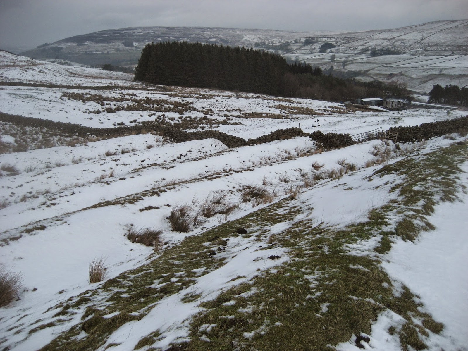
 Field barn, farm and sheep, with snow.
Beyond Harbut Lodge we came to a minor road and turned right, after a hundred yards we spotted the finger post that sent us further uphill across snow covered fields.
 A stile and gate, that should fool the sheep.
By now the wind had risen and it had the effect of lowering the temperature by several degrees as we bravely walked on, across muddy fields, streams and stiles until we finally reached our target; Whitley Castle Roman Fort.


It is thought the fort was built about 200AD, the embankments can still be seen.


 A friendly fellow by the railway
 Trucks left from the mining days. (Not Roman of course)
 A diesel called Hunslet, maybe it's from Leeds
 Paul Mooney is the jolly weather man from BBC
Look North.
 A proper signal box
 Alston Station, with snow.
Back at the station we changed and sat in cars to eat sandwiches, Snickers flapjacks, Golf biscuits and bramley apple pies. Sadly Brian is away so no offering from Mrs. A. (No Herbie Spot today, too cold)
We headed for the pub with the lovely name of Carts Bog where the A686 turns off to Hexham. They had two Wylam beers, Angel and Gold Tankard. They also did a fine cup of tea.
This walk will be repeated in summer with an extension, but it was a bit chilly today and we are getting on a bit.
The Matrix MMXV
steps miles
LIDL3D 16512 7.45
Higear 15002 6.8
Dave's 3D 16077 5.78
Dave's USB 15444 5.6
OUTDOOR GPS 6.4
Ben's GPS 7 (He parked in the town centre)
Gadgie distance 29 miles
 Contains OS data, copyright. Crown copyright and database right 2015
The fine jock who did the BBC forecast for Friday January 23rd said in the northeast it would be windy and wet. Nevertheless six of us set out to look at the Roman Fort known as Whitley Castle near Alston in Cumbria, namely; John H, Dave, Ben, Ray, Harry and me.
The planned walk starts at Alston which claims to be the highest market town in England and at approximately 1000 feet it probably is.
A pretty little town, the centre is unspoiled. It has been used for scenes in a film of Jane Eyre and a TV series of Oliver Twist. It also has a narrow gauge railway which is open in summer for pleasure trips.
To get to Alston from base take the A69 west, beyond Hexham turn left on the A686 and follow the road past castles, farms and churches, take care on a series of hairpin bends, watch out for pheasants which have a habit of wandering across the road, go over a few miles of miserable looking moorland and come down to Alston at the confluence of the South Tyne and Nent rivers.
There is a car park by the station, closed in winter but we parked on the roadside. You can also park on the main street of the town which is beyond the station and up the cobbled hill on the left. Mind the parking is full of large farmers and their equally large 4x4s or tractors and muck spreaders.
Take a map; OSOL 31 North Pennines. The station, which is clearly signposted is at NY716467.
Parking by the station at Alston
The walk;
We turned right at the junction by the station and walked along the road past the town, past the entrance to the hospital and the YHA, crossed the bridge over the South Tyne and walked a short distance up the road before spotting the sign post which is for the Pennine Way and the Isaac Tea Trail.
The footpath was muddy and covered lightly with snow. At one point the path is a narrow lane down the side of a farm but mostly it crosses fields to Harbut Lodge.
Harbut Lodge is guarded by a flock of white geese, descended tradition has it, from the very ones that saved Rome. Today they were quiet.
Beyond Harbut Lodge we came to a minor road and turned right, after a hundred yards we spotted the finger post that sent us further uphill across snow covered fields.
By now the wind had risen and it had the effect of lowering the temperature by several degrees as we bravely walked on, across muddy fields, streams and stiles until we finally reached our target; Whitley Castle Roman Fort.
Apart from the welcome board there is little to offer at Epiacum. In the near future it is to be excavated and have a tea room. There will be interactive displays, the opportunity to dress as a Roman Soldier and a gift shop full of plastic swords.
Today it was a snowy field. However it is worth recording that it is unusual for a Roman Fort in that it is not the standard "playing card shape." Ony two side are parallel, making it a trapezium to this retired teacher of relatively easy sums. English Heritage describe it as a rhomboid but the sides are not equal. It also has some defensive embankments, clearly visible. The fort is built near to the Maiden Way, a Roman Road going from Kirby Thore in Yorkshire to Carvoran on Hadrian's Wall. It was possibly built as a resting place for troops or as a centre to control the wild tribes of the area who were led by a couple of chiefs named Red Nubes and Sedentum Taurus, notorious for swift attacks on a passing troop of cavalry. The area was a centre for mining lead, the fort could have offered some protection to the miners who also extracted silver and zinc in the area. The Romans used zinc to coat their poss tubs. (Ask your granny)
An aerial photo of the fort
Having seen as much of the fort as we wanted and suffering from the cold wind that whipped in from the west, driving some sleet before it (Take me on Times, I can give you some good walks) we headed north to Kirkhaugh Bridge. From here we decided, as the sleet got a little heavier, to head back along the South Tyneside Railway footpath to Alston.
The rails lead back to Alston
Look North.
Back at the station we changed and sat in cars to eat sandwiches, Snickers flapjacks, Golf biscuits and bramley apple pies. Sadly Brian is away so no offering from Mrs. A. (No Herbie Spot today, too cold)
We headed for the pub with the lovely name of Carts Bog where the A686 turns off to Hexham. They had two Wylam beers, Angel and Gold Tankard. They also did a fine cup of tea.
This walk will be repeated in summer with an extension, but it was a bit chilly today and we are getting on a bit.
The Matrix MMXV
steps miles
LIDL3D 16512 7.45
Higear 15002 6.8
Dave's 3D 16077 5.78
Dave's USB 15444 5.6
OUTDOOR GPS 6.4
Ben's GPS 7 (He parked in the town centre)
Gadgie distance 29 miles
No comments:
Post a Comment