Translate

Wednesday, 16 June 2021

 John Martin with a variation (Northumberland)    June 14th

Another popular gadgie walk, based on the route along the River Allen that inspired the work of artist John Martin who created huge pictures, often with jolly biblical themes such as the destruction of Sodom and Gomorrah and the Last Judgement.

The walk starts from a small car park near the Shaftoe Academy for the sons and daughters of gentle folk in the small Tyne Valley town of Haydon Bridge. Drive west on the A69, turn off into Haydon Bridge, take first left, appropriately called John Martin Street, go past The Anchor Hotel and turn left by the club, up a short stretch and park, free.

The walk is covered by OS OL 43 Hadrian's Wall but is well marked.

Parking near the Shaftoe Academy for the children of gentlefolk.

Leaving the car park we walked down to the road, turned left, took the right fork and headed towards East Lands End, the farm where the artist was born


  Top: plaque recording John's birthplace

Middle, part of info board

Bottom Lovely warning sign.

Continuing on the lane, overtaken by a lady on an electric bike, we reached The Lees Farm.

                 When I was a lad, Old Shep was my dog, o'er hills and meadows we'd stray

The path goes through the farm yard, several dogs around, all friendly

The path goes through the farm yard and then climbs across several fields to a minor road. We turned right and walked downhill to the entrance to the National Trust Allen Banks Woods.


             Entrance to the wood and more information about the man.

The path passes a charcoal burner;

                 The people who operate the charcoal burner use Rhododendrons and sell their product

            Overgrown pond, hardly room for a pair of Mallards.

We walked through the woods to a junction on the paths, Normally we turn right and follow the path downhill to walk along the riverside and through fields. Feeling a little adventurous we took the left hand path and walked the higher ground above the valley.


                       Destined for the charcoal burners.

Eventually we left the woods and crossed a couple of fields to a small house on the road, turned right and wandered downhill to Plankey Mill, Herbie Spot.

                At Plankey Mill. Slim pickings today as there are only three of us; apple pies, savoury flapjacks and tarts from Mrs A. As Brian said, probably lose weight for a change on this walk.


                    River Allen near Plankey Mill
Back on the track we crossed the fields to Allen Banks Woods and climbed the footpath, quite steep too, until we reached the ruins of the old peel tower.


                 Top; remains of peel tower. Bottom , information board.
From the ruins we walked the narrow ridge to a field and crossed diagonally to th a gate. Through the gate the path goes steeply down to a footbridge and then steeply up to more fields. We crossed the field to the farm at Harsondale, turned right and walked the concrete track to the road end. Turning left we continued on the road to a junction. Straight across and down through sheep filled fields to West Deanraw. 
At this farm we turned right and walked even more hard tarmac to Langley Castle.

Look carefully, Langley castle through the trees.

We took the track opposite the entrance to the castle, walked uphill and then across fields above Haydon Bridge. The footpath turned left, went through woodland and emerged on a road heading for the town. We walked under the A69, turned right, crossed the playing field and were back at the car.

Today's rehydration point was the Duke of Wellington at Riding Mill which was serving its own brew, named for Arthur Wellesley, and Black Sheep. Both were in fine form.

Contains OS data, copyright. Crown copyright and data base right 2021.

The walk is about 10.5 miles with several short, steep climbs.


John Martin; The Last Judgement and The Garden of Eden

Wednesday, 9 June 2021

 Bolam and Shaftoe. (Northumberland) June 8th

Another favourite walk in midweek. Five of us, Brian, Harry, Dave, Kate the gadgette and I are walking from St Andrew's Church in the hamlet of Bolam on a circular stroll taking in Shaftoe Crags and Bolam Lake.

The walk is covered by OS Explorer 325 Morpeth and Blyth. To get to the church drive through Ponteland, on the far side of Belsay village take the right fork signposted for Bolam Lake. Just beyond the car park and visitor centre turn right, up the hill, down the lane and park outside the church.

Preparing for a day's walk at St. Andrew's. Saxon origins, particularly the west tower and the famous window pierced by a German bomb which fortunately failed to explode.

The walk starts through the churchyard, passing the tower at the west end and going through a gate into fields. The first few hundred yards seem to be permanently boggy but once having navigated the ditches the path goes almost due north to the farm at Angerton Steads which has its own tennis court. Moving on and walking round the edges of fields we made it to Low Angerton where we were met by a friendly puppy and its owner, much to Dave's delight. 

                              River Wansbeck

A little way beyond the farm we crossed the River Wansbeck and followed the finger post on the left across endless fields. At one point the path crosses a dismantled railway, so dismantled it's hard to make out, fortunately a bridge remains.


Once there was a railway..........

As we approached Middleton Mill we left pasture land and crossed a couple of fields of oil seed rape. The farmer had left a footpath for walkers by killing off a line of the crop but the dead plants had a habit of tripping us, we were all a bit tired at the end.


                           The path through the oil seed.

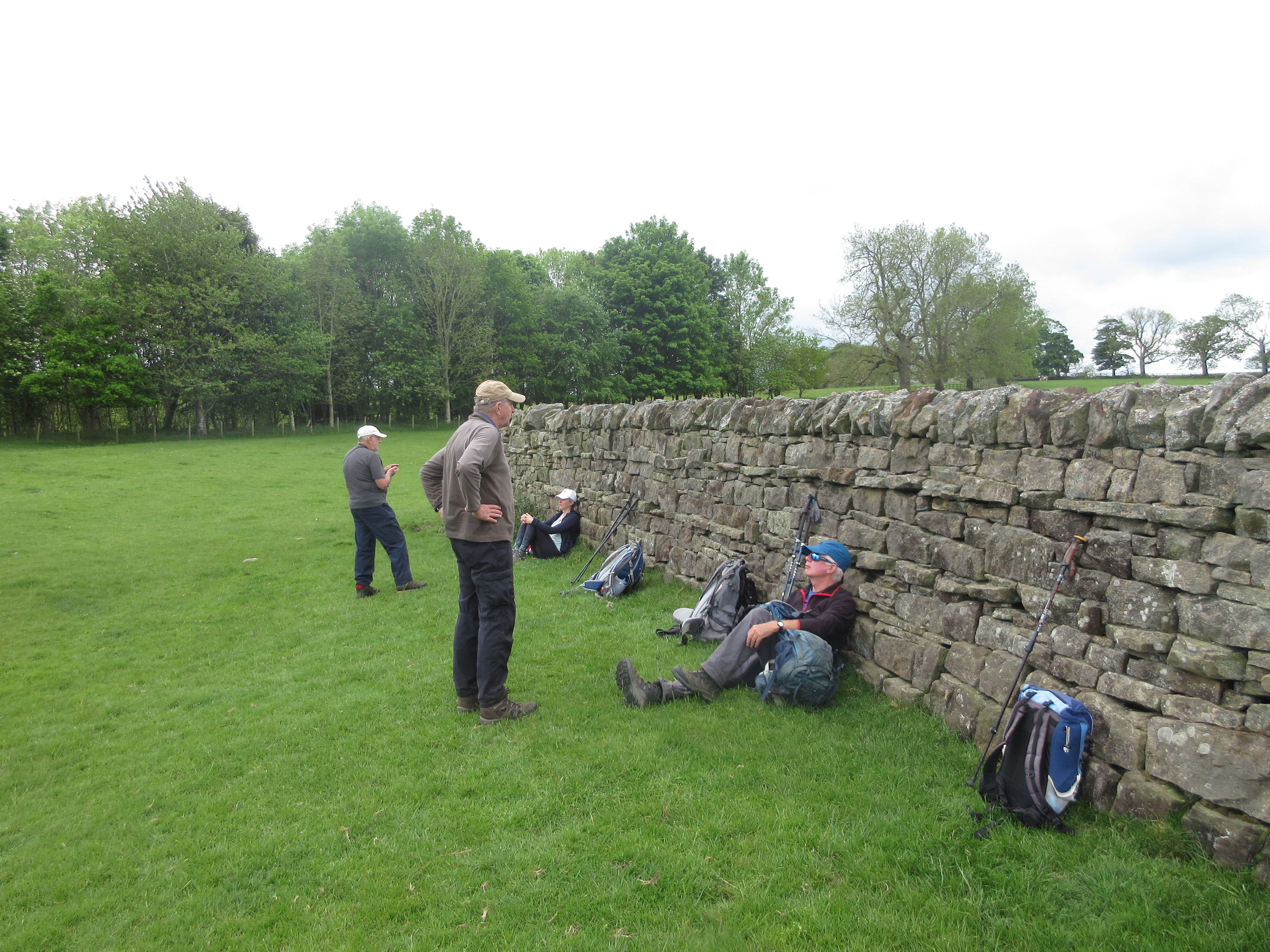
At Middleton Mill we walked the farm track to the road. On the opposite side of the river is a medieval village, at least in outline. At the road we turned left, crossed the river and took the footpath on the right up one of the only rises of the day and settled down against the wall of a sheep shelter for a Herbie.


          Herbie Time; sesame cookies, blackcurrant and apple pies, almond slices and savoury buns sent along by Mrs A who was otherwise engaged.

Lunch over we walked carefully across a field with a herd of young cattle to Middleton South Farm which has a few cut-outs about hunting.


                                                         Middleton South.

From the farm we edged a couple of fields, although Dave trotted off to see the Standing Stone that has remained immobile for several hundred years. Going through a gate we turned left up a track towards Salters Nick, a gap in the rocks and crags before passing Shaftoe Grange.

From the grange we followed the path towards the remains of an ancient fort and visited, as usual, the Piper's Chair, a large chunk of rock rumoured to have been the site of a Shaftoe Wedding feast.


                    An adventurous harry on the top and the rest of the gang too. 

Photo courtesy of the Jesmond Cake Company.

From this point we followed the path to East Shaftoe Hall and then turned south on a footpath across several fields.


                  Shaftoe Hall and its Walled Garden
                                The dark line across the field is the Devil's Causeway, ancient Roman road.
Having crossed several fields we came to a farm track, turned left and walked on towards Shortflatt Tower, passing the symmetric farm. Beyond it is a footpath off to the left which crosses a field to the old peel tower.
                             The symmetric farm.
Close to Shortflatt we headed across the fields to the infamous White gate and then on to Bolam Lake. 

                           Bolam Lake. Courtesy of Jesmond Cake Company.
We walked the edge of the lake to the visitor centre, hoping for ice cream but it was closed so we walked up the road back to the cars and the church. On the way home we sat in the garden of the Ridley Arms for some much needed refreshment, Blonde beer, lager or diet coke.

Contains OS data, copyright. Crown copyright and database right 2021

The walk is about 10.5 miles, easy going through a variety of fields.


Wednesday, 2 June 2021

 I'm going to Rooklands, again! (Northumberland)

June 1st

Another favourite walk revisited and slightly extended. Starting from Alwinton and calling at the ruined farm Old Rooklands before heading back.

There are four of us; Brian, Margaret, Harry and me. The weather is very warm after the wet month of May, might even need sun cream. To get to Alwinton:A1 north, A697 at Morpeth, turn off at Weldon Bridge, drive through Rothbury and turn right at  the sign post for Alwinton. Free parking on the right as you reach the village.

The walk is covered by OS OL Explorer 16 Cheviot Hills. 


                     Parking in Alwinton, pretty but no prize-winner.

At the back of the parking area is a stream, crossed by a wooden footbridge, the start of the walk. Over the bridge, troll free, we headed north on Clennel Street, one of several ancient drovers' roads in the area. The route passes several ancient sites too, including Castle Hills fort, several overgrown settlements and a Cross Dyke, once a barrier for cattle on the drive south to English markets.

                                      Castle Hills, spot the ancient  walls, I can't.
On previous occasions we have gone through a gate on the right and followed a gentle downhill path to the River Alwin Valley but on a warm and sunny day (about 20C) we continued on the Border County Ride route, passing the remains of what was once a Youth Hostel.

                   Ruins of a hostel. (Not the shed, the stones)
Beyond the ruin, at Wholehope Knowe on the map we joined a forestry road, headed initially east and descending slowly to the valley bottom. Several mountain bikers were slowly pedalling in the opposite direction. 

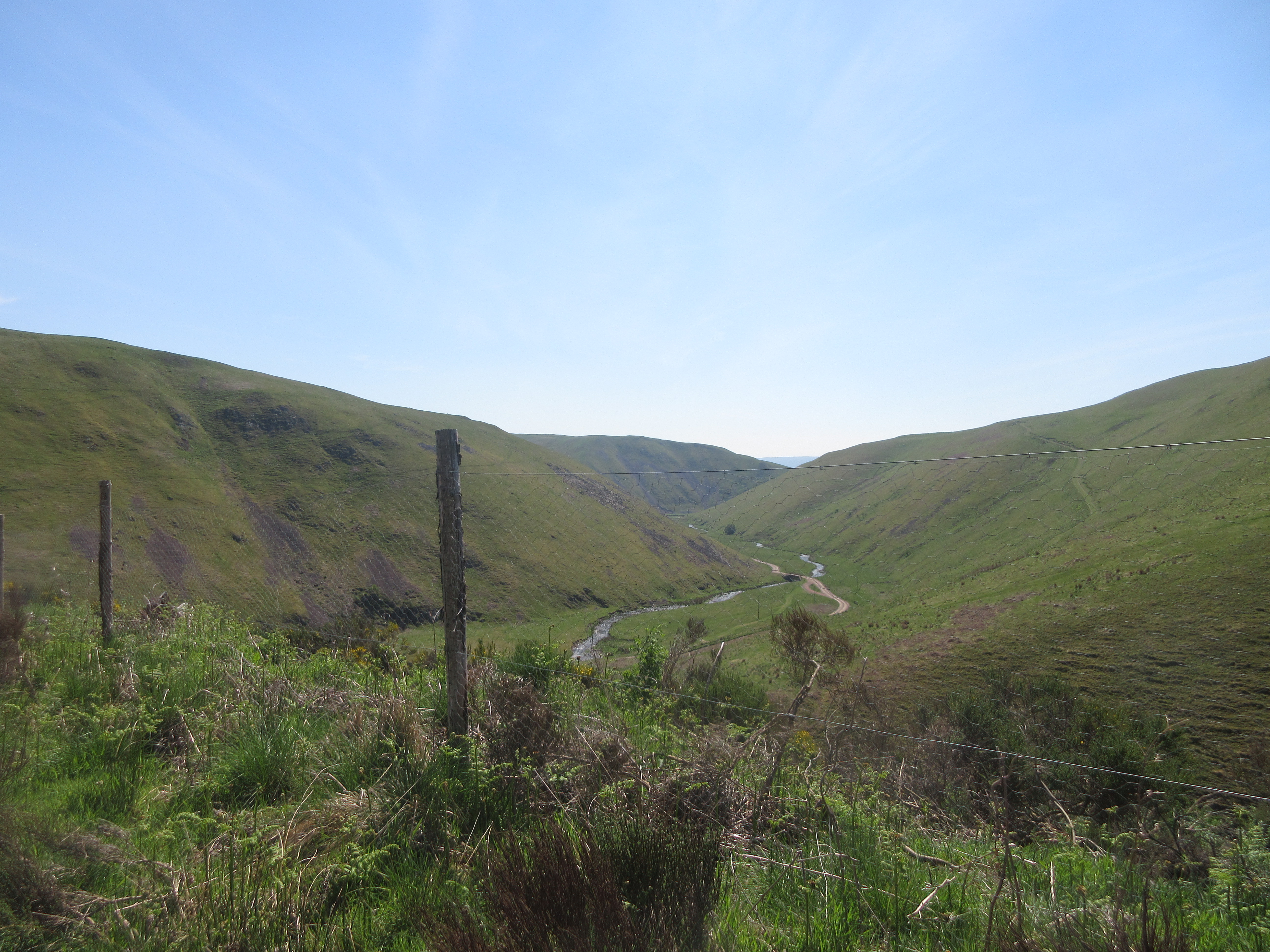
                  Looking down on the River Alwin.
The road follows the river, it is easier on the feet to walk on the grass verge. Brian, ahead of the others, spotted an adder which immediately took off. The first turn off is for Puncherton which we ignored, the second, signposted and close to a bridge is for Old Rooklands and this is the footpath we took. Narrow with a steep fall on one side we climbed slowly in the heat to a rocky outcrop on the wonderfully named Weasel Burn where we called a Herbie.
                   Lunch time view on Weasel Burn

Lunchtime. Titans, savoury buns and almond buns from Mrs A.
Lunch over we followed the footpath, for a change, alongside the Rooklands Syke instead of heading for the ruined farmhouse.

 Ruins of Old Rookland.
Eventually the narrow footpath joined the track over the hill and down to a road. Sharp turn left followed by a sharp turn right followed by a right turn brought us to Newton. (There is a footpath across a field but H and I took the long way round out of consideration for the hard work of the farmer who had ploughed, harrowed and plante)
Just beyond the farm at Newton a gate led to paths across fields to the end of Brownrigg Wood.

Is the sign about an animal or one of Harry's tales?
Walking the edges of recently ploughed fields again we came to Well House Farm. From the farm back to Alwinton the route is easy to follow, passing the Peels to rejoin the Border County Ride to Park House and Low Alwinton.

                  Lime Kiln near Low Alwinton, and instructions.
Changed we headed for the Shoulder of Mutton pub in Longhorsely which had Timothy Taylor's Landlord, Directors and Yorkshire Blonde on offer. Timothy Taylor's for me, every time.

Contains OS data, copyright. Crown copyright and data base right 2021.
The walk is about 11.5 miles with a couple of stiff climbs.