Translate

Saturday, 2 December 2017

A seven mile stretch of sand and several nature reserves too. (Northumberland) Dec 1st.
It has been a cold week with winds coming straight from the Arctic, depositing some snow on the east coast of northern England and on the hills. We mice have chickened out (mixed metaphor) of a walk on the Border Ridge to what probably will  be a very Windy Gyle and have opted for a walk down the coast.
It's a linear walk from Amble to Cresswell with some crafty planning  by Brian and use of bus passes.
Leaving cars at Cresswell beach and catching a bus
 to Amble so that we are walking south, wind on our backs. It's another repeat, covered by "How to escape Black Friday" November 2015, but then we walked south to north, must have been a better day.
The maps to use, but not essential are;
OS Explorer 332 Alnwick and Amble and OS Explorer 325 Morpeth and Blyth.
Another good turn out, John C., John Ha., Brian, Ray, Ben, Dave, Harry and me. The bus to catch from Cresswell car park is the no. 1 for Ellington and it connects with the X20 Arriva service from Ellington to Amble. It's that or cars at both ends. There was some confusion about the number 1 bus, my car load catching it going one way and Brian's car catching one the other way but all worked out in the end.
Before we get to the walk it has been pointed out to me that I forgot to mention that Ben, the gatemeister, met his nemesis last week when he failed to unravel the mysteries of one of the gates we needed to pass through. Not exactly a Gordian Knot but he was rescued by Brian, punmeister.
            Although not the starting point for the walk this is the car park at Cresswell. It was a miserable wet start to the day, everybody was dressed in waterproofs, somefelt we should just sit in the car for the day.
We all finally met up at a bus shelter in Amble, opposite a church on the main street, and began the walk.
                            Waiting for the boys at a bus stop in Amble
               Directly opposite this church
From the bus stop we headed down the street towards the harbour and joined the Northumberland Coastal Path.
                  harbour on a grim grey morning

                          You can just about see the harbour light.
From the harbour the footpath goes across the children's play ground, which looked pretty good but a large notice saying it was for under twelves put us off riding the swings and roundabouts.
The footpath, quite narrow, wanders through the dunes southeast. On a clear day there is a clear view of Coquet Island where St. Cuthbert once had a brief sojourn in a hermit's house and met a lady saint whose name I can't remember. The island is now a nature reserve.

                         Coquet Island and information board


The footpath turns south at Low Hauxley and soon we were at Hauxley Nature Reserve. A short detour from the coastal path took us to the visitor centre where we had tea or coffee  and were invited to sample turkey toastie. Very tasty too.
Some years ago the visitor centre at Hauxley Nature Reserve was destroyed by vandals. It has been replaced by a fine building which houses the information centre and café. Large windows down one side look over the pond which is home to a large variety of birds. Fairly quiet today, I blame the weather.
                            The pond at Hauxley nature reserve, taken through the window. The smear left of centre at the bottom is a bird's wing etched onto the glass.
Coffee time over we returned to the coastal path and walked south round the sweep of Druridge Bay finally stopping for a Herbie Spot at another Nature Reserve, Druridge Bay N.R..
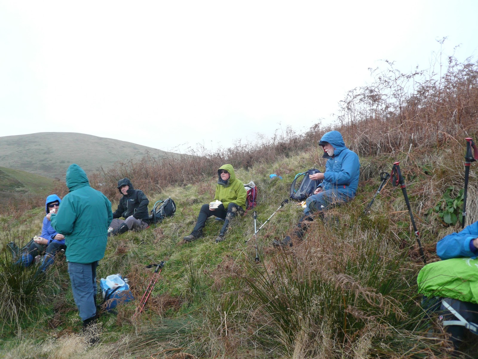
                     Herbie Time. Mince pies, ginger biscuits, biscuits, cake and savoury from Mrs A which looked like small Yorkshire Puddings and tasted fine.
Back on the path we continued south but at Druridge we took to the road and stayed on it to Cresswell. On previous occasions we have walked along the beach which is a little more interesting but wet sand is hard work, rather like soft snow.
Changed we headed for the Three Horseshoes Horton near Cramlington. A large pub, it had eight real ales on offer, including a favourite, Abbott. The coffee was real too.
Not one of our better walks but at least we were out, exercised and refreshed. Next time it will hopefully be on the beach for more of the walk.

Matrix MMXVII     nearly the last
                                                                         steps                                        miles
NAK                                                         24442                                               10.02
IPhone                                                       22843                                               10
Dave's 3D                                                 20178                                               9.98
 "" USB                                                     19420                                               9.8
  "" NAK                                                   19376                                               9.78
Sylvia's mother                                          20617                                              10.41
OUTDOOR                                                                                                          9.34
Brian                                                                                                                     9.32
Ben                                                                                                                      10
John C                                                                                                                 18.6!!!!!!!!!!!!!


Friday, 24 November 2017

Bolam, Wansbeck and Shaftoe....Northumberland November 24.
They sound like a firm of solicitors, but they are places on today's walk.  (The best known solicitors in the north east are Hadaway, Hadaway and s*****)*
Another familiar walk and another close to home, starting at St. Andrew's Church in Bolam. To get there, A1 north, turn off for Morpeth and turn left at the golf club shortly before going downhill into the town. At Whalton turn right for Bolam and after four miles take the lane on the right that goes to the church.
Interesting church, Saxon West Tower, Norman additions and a small window where a WW2 bomb pierced the wall but failed to explode. Some years ago the German pilot came over and apologised.
The map for the walk is OS Explorer OL 42 Kielder Water and Forest. (GR NZ 092825 for the church)
Another grand turnout too. Nine gadgies braving the cold day; John x 3, Dave, Harry, Ben, Brian, Ray and me.
Naturally we are having breakfast first, this time at the Kirkley Cycle café which is not on the route above but is close to Kirkley Hall College which teaches dry stone walling and hedge laying amongst other things. Very interesting café, specialising in supplying energy to cyclists and anybody else. Next door, in an old farm building, is a gym. This morning a group of lycred young ladies were going through their exercises, later, as we were having breakfast they came to the café. Too much.

                                    Gym and cafe

The walk; We left the café and went to the church at Bolam. There is parking on the grass verge outside the church yard.
                        St. Andrew's, Bolam, plus the shadow of the photographer
               The small window is where the bomb pierced the wall of the church.


                      This week's car park by the church, slightly out of focus, but free
Walking through the church yard and past the west end tower we went through a gate, with marker, and headed north across very muddy fields past the houses at Angerton Steads, which have their own tennis court, across the dismantled railway, so dismantled you hardly know it's there, to the farm at Low Angerton.
From here we walked a few hundred yards along the road to the sign post on the left hand side pointing west.
             Top line says Public Bridleway but the bottom line has faded, follow it anyway.
The path here crosses fields alongside the river Wansbeck. There are some markers but like the river itself it meanders. Could be some Ox bow lakes here in a few hundred years. The path crosses a stream by means of a footbridge (unmarked) and it also crosses a field that had been ploughed, seeded and had shoots of some cereal crop. The footpath, marked, goes straight across this field and reaches Middleton Mill Farm. Through the yard we went and along the farm track to a road. At the road we turned left, crossed the bridge over the Wansbeck and turned into a field on the right. Dave the archaeologist explained we had just passed the site of a Medieval Village and the field boundaries. Some few hundred yards further on we came to an open stone rectangle, presumably designed as a shelter for sheep. It made a classy Herbie Spot as we sat backs to the wall, keeping out of the cold west wind.

                Herbie time in the shelter, with shadows. Today's lunch included pork pies, quiche from Mrs A., ginger biscuits from Ben, Alpen Bars, Yorkshire flapjacks and home made cake from John Ha.. And soup for some of us. A good idea, it seldom got much higher than 2C today.
 Lunch over we walked south west to Middleton South Farm and having gone along the road infront of it for a short distance turned south along a grassy track alongside the field wall. Crossing a wall we turned south west on a farm track heading north of Half Moon Plantation and up a slight slope towards the Salters Nick.

              Salters Nick, part of the ancient drove road.
Rather than go through the nick we turned south and followed the boggy track to the Piper's Chair. Tradition has it that at the wedding of one of the Shaftoe family the bowl on top of the rock was filled with wine for the guests. There is quite a steep drop on the south side............
                       The Pipers's Chair.
After a short detour up the hill to admire the trig point, and the view, we headed east on a well paved road  to East Shaftoe Hall Farm.
                                               East Shaftoe Hall, the left hand side is 17th century at least.
From the hall we followed the farm track back to the road. Part of the road is made up from old concrete railway sleepers which came all the way from Glasgow. They make a good hard road too.
At Bolam West Houses we turned right on the road and after about a half mile turned into Bolam Lake Country Park. We followed the footpath through the wood which surrounds the lake eventually emerging on the road near the information centre. We turned left, then right and walked uphill on the road and back to the church.
On our way home we stopped at The Blackbird Inn, Ponteland, a pub with a special meaning for me. My wife and I had our first date there in 1965! Nowadays it's a dinner date, then it was a drink and a chat. My generosity obviously paid dividends. The pub has changed considerably, more of an eatery now but it did have a selection of real ales. I chose Supermac, named for a seventies Newcastle footballing hero. Nothing special, the beer that is, so I had a pint of Blackbird Hand Crafted Ale

The Matrix MMXVII          Z ^27

                                                                                   steps                                     miles
NAK                                                                          27273                                     11.19
IPhone                                                                       22836                                      10.2
Dave's 3D                                                                  21595                                      10.58
  "" USB                                                                     20946                                      10.57
  "" NAK                                                                    20622                                       10.41
Sylvia's mother                                                          21299                                       10.76
OUTDOOR GPS                                                                                                        9.87
Brian                                                                                                                           9.87
John C.                                                                                                                        10.5
 Contains OS data. Copyright. Crown copyright and database right 2017
* This refers to a Geordie joke. Copies of the joke are available free, with a SAE


Friday, 17 November 2017

Oh, no! Not another repeat...Alnham (Northumberland) November 17th.
 Winter walks tend to be nearer home, there's less daylight. Today's gadgie walk is from Alnham and again it's a repeat although I don't think  we have done it for some time.
Alnham is a tiny village on the edge of the Northumberland National Park. To find take A1 north, A697 at Morpeth, turn of for Whittingham and follow signs down narrow lanes. The village has a few houses, a hall a church dating to the 12th century but largely rebuilt in 1870, a green mound that was a castle destroyed by the Scots and a fine example of an Iron Age Hill Fort.
There are nine  out today, a noctet? a novgadge?: Brian, John x 3, Ben, Harry, Dave, Ray and me. Breakfast in Tomlinsons of Rothbury again, we are becoming regulars.
The map for the walk is OS Explorer 16, The Cheviot Hills.  The church is at GR NT990109 approx.
 There is not a car park at the church but it is permitted to park on the grass verge, free.
                   St Michaels church Alnham> By the lych gate there are the stumps of two medieval crosses.
The walk;
Just beyond the church and Tower House there is a footpath on the right, initially crossing a stream, and heading uphill in a lane. At the end of the lane the path crosses, still in a roughly north west direction. At the end of the field the path turns north and crosses moorland before turning to the corner of the wood at Cobden. There are a number of paths, quad bike tracks and trails in the area, take care to stay on the right path! Given time you can look for the memorial stone to Nellie Heron, the lady who sadly died on the moor in the 19th century as she walked home from Alnham to Hartside. (Looking for Nellie Heron, October 2015)
From the corner of Cobden we walked down to Alnhamoor Farm, usually a Herbie Spot but on this occasion we chose to push on, too soon after the bacon sandwich or toasted teacake at Tomlinsons.
                  The farm at Alnhamoor

Although it looks a little like a Katushka rocket launcher it is for launching discs of clay for shooting practise.
Passing the farm we headed west crossing a stream by means of a footbridge made from two old railway sleepers. The path, which is marked occasionally, heads uphill, and today it headed into a strong, cold wind. Again there are several tracks to follow and we probably wandered off the real one but we eventually met the Salter's Road Track at Little Dod. The well made track heads south east and downhill, and out of the wind too. At a bend in the track, where there was a high bank to offer shelter we called a Hebie Spot.
             Herbie time in the light rain; Pork pie, ginger cake, hobnobs, cake, ginger biscuits and a sandwich.
Lunch over we continued on the track, crossed a ford and headed uphill. At Green Knowe the path goes through a plantation and emerges at the wonderfully named Ewarty Shank farmhouse. Going through the farm yard, protected by barking dogs, we came to a stile and marker that took us  across an extremely boggy piece of land. As a recommended alternative there is a metalled farm track which we met at the point marked CG on the map.(Cattle Grid) At this point John Ha and I decided to stick to the road, having had enough of Lauder Grass (qv) and bog. After about two miles we were back at the church. The rest of the team took off along the Salter's Road Track and reached the cars a little later, giving John and I some time to look round the tiny church.
On the way home we stopped at the Anglers Arms for a change. Today's offerings were Spitfire, Bombardier and Black Sheep, or coffee for the drivers of course.

Matrix MMXVII                                              N3

                                                                                   steps                               miles
NAK                                                                          25692                              10.5 (too much)
iPhone                                                                        22326                                9.4
OUTDOOR GPS                                                                                                  9.4
Dave's 3D                                                                   23709                             11.14 (longer walk)
  ""        USB                                                               22642                             11.1
 ""          NAK                                                             22511                              11.01
Sylvia's mother                                                           23452                              11.47
Brian                                                                                                                   10.97
John C                                                                                                                 10.5
Contains OS data Copyright Crown copyright and data base right 2017