Oh, no! Not another repeat...Alnham (Northumberland) November 17th.
Winter walks tend to be nearer home, there's less daylight. Today's gadgie walk is from Alnham and again it's a repeat although I don't think we have done it for some time.
Alnham is a tiny village on the edge of the Northumberland National Park. To find take A1 north, A697 at Morpeth, turn of for Whittingham and follow signs down narrow lanes. The village has a few houses, a hall a church dating to the 12th century but largely rebuilt in 1870, a green mound that was a castle destroyed by the Scots and a fine example of an Iron Age Hill Fort.
There are nine out today, a noctet? a novgadge?: Brian, John x 3, Ben, Harry, Dave, Ray and me. Breakfast in Tomlinsons of Rothbury again, we are becoming regulars.
The map for the walk is OS Explorer 16, The Cheviot Hills. The church is at GR NT990109 approx.
 There is not a car park at the church but it is permitted to park on the grass verge, free.
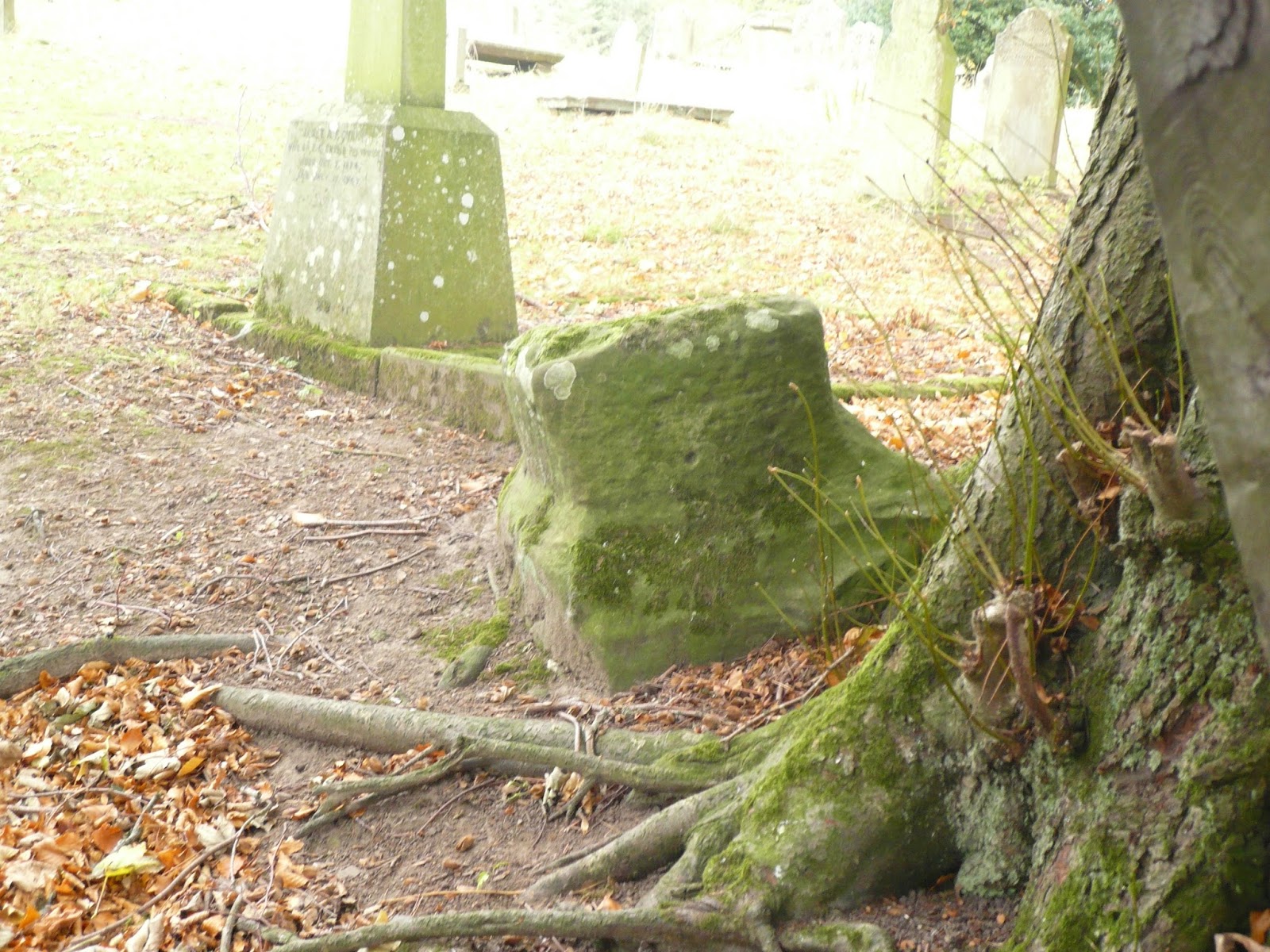
 St Michaels church Alnham> By the lych gate there are the stumps of two medieval crosses.
The walk;
Just beyond the church and Tower House there is a footpath on the right, initially crossing a stream, and heading uphill in a lane. At the end of the lane the path crosses, still in a roughly north west direction. At the end of the field the path turns north and crosses moorland before turning to the corner of the wood at Cobden. There are a number of paths, quad bike tracks and trails in the area, take care to stay on the right path! Given time you can look for the memorial stone to Nellie Heron, the lady who sadly died on the moor in the 19th century as she walked home from Alnham to Hartside. (Looking for Nellie Heron, October 2015)
From the corner of Cobden we walked down to Alnhamoor Farm, usually a Herbie Spot but on this occasion we chose to push on, too soon after the bacon sandwich or toasted teacake at Tomlinsons.
 The farm at Alnhamoor

 Although it looks a little like a Katushka rocket launcher it is for launching discs of clay for shooting practise.
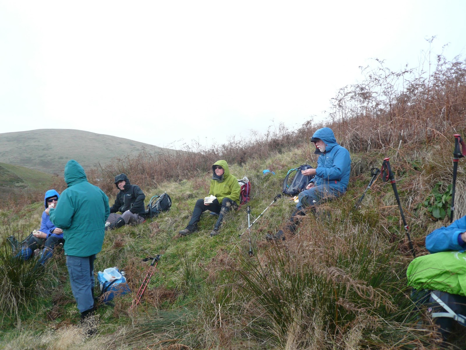
Passing the farm we headed west crossing a stream by means of a footbridge made from two old railway sleepers. The path, which is marked occasionally, heads uphill, and today it headed into a strong, cold wind. Again there are several tracks to follow and we probably wandered off the real one but we eventually met the Salter's Road Track at Little Dod. The well made track heads south east and downhill, and out of the wind too. At a bend in the track, where there was a high bank to offer shelter we called a Hebie Spot.
 Herbie time in the light rain; Pork pie, ginger cake, hobnobs, cake, ginger biscuits and a sandwich.
Lunch over we continued on the track, crossed a ford and headed uphill. At Green Knowe the path goes through a plantation and emerges at the wonderfully named Ewarty Shank farmhouse. Going through the farm yard, protected by barking dogs, we came to a stile and marker that took us across an extremely boggy piece of land. As a recommended alternative there is a metalled farm track which we met at the point marked CG on the map.(Cattle Grid) At this point John Ha and I decided to stick to the road, having had enough of Lauder Grass (qv) and bog. After about two miles we were back at the church. The rest of the team took off along the Salter's Road Track and reached the cars a little later, giving John and I some time to look round the tiny church.
On the way home we stopped at the Anglers Arms for a change. Today's offerings were Spitfire, Bombardier and Black Sheep, or coffee for the drivers of course.
Matrix MMXVII N3
steps miles
NAK 25692 10.5 (too much)
iPhone 22326 9.4
OUTDOOR GPS 9.4
Dave's 3D 23709 11.14 (longer walk)
"" USB 22642 11.1
"" NAK 22511 11.01
Sylvia's mother 23452 11.47
Brian 10.97
John C 10.5
Winter walks tend to be nearer home, there's less daylight. Today's gadgie walk is from Alnham and again it's a repeat although I don't think we have done it for some time.
Alnham is a tiny village on the edge of the Northumberland National Park. To find take A1 north, A697 at Morpeth, turn of for Whittingham and follow signs down narrow lanes. The village has a few houses, a hall a church dating to the 12th century but largely rebuilt in 1870, a green mound that was a castle destroyed by the Scots and a fine example of an Iron Age Hill Fort.
There are nine out today, a noctet? a novgadge?: Brian, John x 3, Ben, Harry, Dave, Ray and me. Breakfast in Tomlinsons of Rothbury again, we are becoming regulars.
The map for the walk is OS Explorer 16, The Cheviot Hills. The church is at GR NT990109 approx.


The walk;
Just beyond the church and Tower House there is a footpath on the right, initially crossing a stream, and heading uphill in a lane. At the end of the lane the path crosses, still in a roughly north west direction. At the end of the field the path turns north and crosses moorland before turning to the corner of the wood at Cobden. There are a number of paths, quad bike tracks and trails in the area, take care to stay on the right path! Given time you can look for the memorial stone to Nellie Heron, the lady who sadly died on the moor in the 19th century as she walked home from Alnham to Hartside. (Looking for Nellie Heron, October 2015)
From the corner of Cobden we walked down to Alnhamoor Farm, usually a Herbie Spot but on this occasion we chose to push on, too soon after the bacon sandwich or toasted teacake at Tomlinsons.


Passing the farm we headed west crossing a stream by means of a footbridge made from two old railway sleepers. The path, which is marked occasionally, heads uphill, and today it headed into a strong, cold wind. Again there are several tracks to follow and we probably wandered off the real one but we eventually met the Salter's Road Track at Little Dod. The well made track heads south east and downhill, and out of the wind too. At a bend in the track, where there was a high bank to offer shelter we called a Hebie Spot.
Lunch over we continued on the track, crossed a ford and headed uphill. At Green Knowe the path goes through a plantation and emerges at the wonderfully named Ewarty Shank farmhouse. Going through the farm yard, protected by barking dogs, we came to a stile and marker that took us across an extremely boggy piece of land. As a recommended alternative there is a metalled farm track which we met at the point marked CG on the map.(Cattle Grid) At this point John Ha and I decided to stick to the road, having had enough of Lauder Grass (qv) and bog. After about two miles we were back at the church. The rest of the team took off along the Salter's Road Track and reached the cars a little later, giving John and I some time to look round the tiny church.
On the way home we stopped at the Anglers Arms for a change. Today's offerings were Spitfire, Bombardier and Black Sheep, or coffee for the drivers of course.
Matrix MMXVII N3
steps miles
NAK 25692 10.5 (too much)
iPhone 22326 9.4
OUTDOOR GPS 9.4
Dave's 3D 23709 11.14 (longer walk)
"" USB 22642 11.1
"" NAK 22511 11.01
Sylvia's mother 23452 11.47
Brian 10.97
John C 10.5
 |
Contains OS data Copyright Crown copyright and data base right 2017
              |
No comments:
Post a Comment