Translate

Sunday, 6 April 2014

Brough Law, Birthdays, Branton, Birds and Beer   April 4th

  One of the advantages of having a birthday is that you get to choose the walk. April 5th is Harry's 69th birthday and it is my 70th so we have chosen the relatively local and well known walk from Ingram Centre to Brough Law, Old Fawdon Hill, the Conservancy ponds at Branton and the Anglers Arms at Weldon Bridge.
The disadvantage is that in a tradition stretching back over a year the birthday boys buy the beer. But as there are two of us, one with Yorkshire blood, we get to share a round or two.
The walk starts from the Muddy Boots cafe at the old Ingram Centre. To get there: A1 north, A697 at Morpeth and turn off left beyond Powburn on the road signed Ingram, turn left over the bridge  go past the holiday cottages and the church.  A map could well be useful, like all the best walks this one is covered by two maps: OL16 The Cheviot Hills and OS Explorer 332 Alnwick and Amble. The Cafe/centre is at GR  NU020163.
 Before we set out to walk we had breakfast at the Muddy Boots cafe, the place to eat in the Ingram Valley. A fine bacon sandwich in a bun, sauce and large tea pots, served by friendly ladies.
Because Mr. Gove the Minister of State for Education has decided to change the GCSE exam system (again) and have numbers instead of grades we thought we had better follow suit: on a scale of 1 to 9, 9 being the highest and only available to a few, we awarded an 8, slight problem with the quality of the bun!!
                                                  Muddy Boots cafe, and a car park.

   Leaving the car park we walked up the lane with the church and holiday cottages on the right. The church, St. Michael and all Angels, has origins going back to the  11th century but most of it is 19th century rebuilding. Today the village children were attending an Easter service, early but apparently school finishes today for the holiday.


St. Michael's and All Angels, Ingram.
 At the village hall we turned right  and continued walking west past Ingram Valley Farm, ignoring the first sign post we came to and following the metalled road for just over a mile before turning off on the left, walking a muddy path on the edge of a plantation before reaching the flattish top of Brough Law. Like many of the hilltops in this valley it has the remains of a fort, probably 4th C BC. A misty day not conducive to photography, but here is a picture of the remains of the rubble walls which once stood, possibly, 3 metres high.
                                                  Brough Law walls.
Having examined the fort (again!) but not the scenery as we couldn't see far, we headed south on a grassy  path that meanders over the moors, with few markers  to show the way. Avoiding the path that leads west to Chesters Burn  we turned south east at the three mile marker (see map) before turning east and to the top of Cochrane Pike. Turning south east the walk descended  to the Fawdon Burn and then we climbed up Old Fawdon Hill which has a trig point, an ancient settlement, (Given away on the map by Gothic Script) excellent views on clear days, unlike today, and, as it was quite warm and windy, was declared a Herbie Spot. Today's offerings included Mrs A's almond slices, ginger biscuits from Ben, Mr. Kipling's off cuts and ALDI chocolate.
                                                  Lunch on Old Fawdon Hill
Refreshed and rested after just over five miles the walk continued eastwards downhill. Normally we take the track heading north east to Fawdon Farm but today we walked  on the north side of a plantation and round Gibb's Hill, which has a fort, then headed north to a farm called The Clinch which had a proper dog.
                               Patiently waiting for the shepherd, I sit and guard the quad bike from 
                                                 old walkers.
From the Clinch there is a metalled road that took us to Fawdon Farm and following the signpost we walked north east across fields churned up by animals, eventually taking the marked  path east and downhill to a road, turning left and entering the Branton Conservation Area. Here two old gravel pits have been flooded, landscaped and turned into wild life area. In theory there are otters (too many dog walkers about today), adders (too cold) and a variety of birds. We saw grey lags, Canada, Moorhens, coots, teal, widgeon and a yellowhammer, plus the usual collection of lbjs.
                                                    All quiet on the western pond
                                          But they must have some big tits around here
                                                     My new best friend.
After a while we left the bird hide and returned to the road, crossed the river Breamish River by the footbridge
                                          The Breamish, some of the crew saw a heron.


Having crossed the river we walked up the road past Brandon farm before turning left on a track that leads to the cottage at Heddon. The marked route goes through the garden but, being polite,  we walked round the outside as requested and walked along the ancient cultivation terraces (Gothic script of course) on Heddon Hill.
                              Poor light and pocket camera don't really show up the terraces on 
                                                        Heddon Hill

                                           Ridge and furrow too (at Fawdon)
At Reavelly a lady was feeding a fairly new lamb from a bottle of pop, I expect it was really milk.
From Reavelly we were soon back at the car park, changed and heading for the Anglers Arms at Wheldon Bridge where Harry and I, the birthday boys, generously treated the crew to Wild Goose or Bombardier.
The Anglers is a fine country pub which we frequently visit, so visit them at www.anglersarms.com.

The Matrix MMXIVL
                                                              steps                          miles
LIDL3D                                                 28056                        12.62
ASDAped                                              18078                           8.49 ( A birthday gift, needs to be
                                                                                                             properly hung, sort of)
DAV's 3D                                              26288                        12
Dave's USB                                           25974                         12.29
OUTDOOR GPS                                                                      12.1
Brian's GPS                                                                              12.1
Ben's bragometer not available
Gadgie distance 142 miles

A good 12 miler, enjoyable even in the mist which, incidentally, we had been informed by the weatherman would clear in the afternoon. He was wrong.

For both maps; Contains OS data, Copyright. Crown copyright database right 2014
Ps
Last year a man asked if he could publish this blog in his new outdoor magazine. Thrilled I gave my permission, Sadly he could not get any advertising so the magazine only appeared on line.
Read the whole thing at:   www. outdoorsne.co.uk

Pps
It was my birthday on Saturday.My daughter  made me a brilliant, gadgie themed cake:
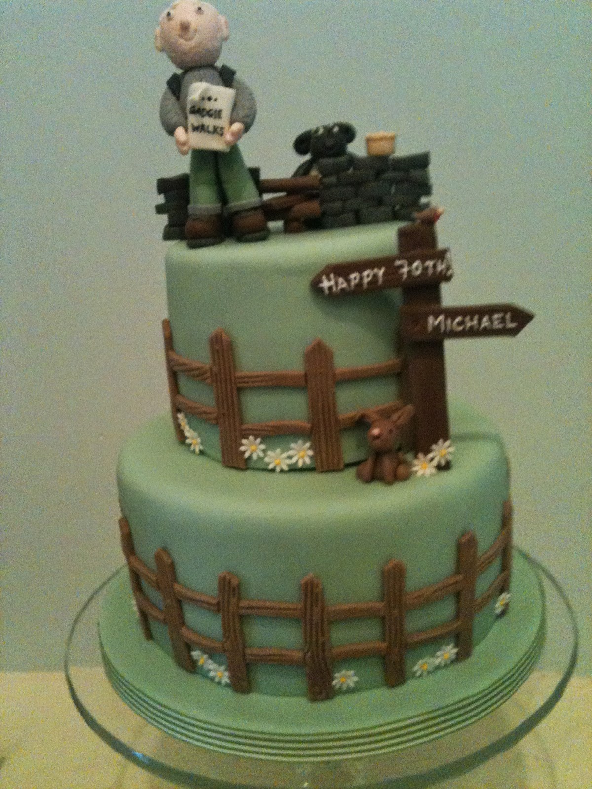
                                   There are some jokes in it. For the full story go to:
http:cakepoppins.blogspot.co.uk/2014/04/the-devil-is-in-the-detail
Anglers

Sunday, 30 March 2014

Where there's a Wear there's a way, even if it's muddy.                 March 29th.
  We had planned an easy local walk for Friday the 28th of March. However as four of us left home base it was raining heavily so we decide to visit the Blacksmith's tea room at Belsay for an extra breakfast. Nice place, lovely staff, disappointing bacon sandwich. It was still raining so we moved on to Rothbury. It was still raining so we decided to lunch in the car park of the Anglers Arms at Weldon Bridge. After a sandwich or two we chose to have a lunchtime pint in the pub as it was still raining. Then we went home.
The reason we had chosen an easy local walk was because we had planned an extra walk on Saturday from Wolsingham to Bishop Auckland. Unless you use cars at either end the simplest way of doing this walk is to catch the Weardale Motor Company X21 from Newcastle to Wolsingham.It only runs on Wednesday and Saturday, It brings shoppers and sight seers from Weardale to marvel at the big city and do some shopping. It leaves Newgate Street to return at 10am. (It comes back in the afternoon for the shoppers in case you worried)
                                                 The Weardale X21 in Newgate Street,
                                                     makes a change from a car park.
WARNING; THIS WALK CAN BE VERY MUDDY. Should you choose to follow the Weardale Way on this stretch a map is advisable. OS OL 31 North Pennines and OS Explorer 305 cover the route, and more.
The journey to Wolsingham takes roughly an hour so the five of us, Dave, Harry, Brian, guest Mrs A and I started our walk at 11am.
We walked down a street in the small town towards the railway station and crossed the river. A number of young men were busy donning wet suits preparing to kayak down the stream which was rather high, not surprising after all the rain that fell yesterday. The footpath runs alongside the river and was very muddy, an introduction for the slippery paths ahead. After two miles close to the south bank of the Wear the path, which is marked with little yellow signs, climbs away from the river through Black Bank Plantation.
                                           Watch out for these signs but be careful, Durham County Council
                                seem to have run out of them in places and there are other footpaths that                                             sometime share the route: the Mineral Valley Way and the Butterfly Path.
Once out of the plantation the path goes downhill across some fields (where we saw a stoat; How do you tell the difference? A weasel is easily recognised but a stoat is totally different), down through a plantation where it crosses the river by footbridge and the railway.
                                                      River Wear on its way to Durham, Chester le Street 
                                                and Sunderland.
The footpath heads for the ancient looking farm at Low Harperley where we made our first mistake, taking the footpath across a couple of fields full of expectant ewes and mums to the A689.  
                  
Ah!
 Realising our mistake we retraced our steps to the farm, spotted the correct marker and headed south east. Having covered roughly five miles we called a Herbie Spot on the track going through a plantation with the original name of New.
                                          Mrs A's hand, Brian and Harry enjoy lunch.
                                         Sandwiches, chocolate, green tomato cake.
Recharged and refreshed we continued on our way past Harperley Hall which has some connection with the Durham Constabulary to Wadley where we had a pleasant chat with Lady Diana de Burgh who lived in the lovely 16th century house looking over the valley. Shame it was foggy, not much to see. She told us she had come to Durham many years ago expecting to find a land of pits, shipyards and engineering works. Many people still think the same way.
 A second slight error took us downhill from the Lady's residence before turning right and rejoining the Weardale Way across fields all the way to Witton le Wear. Here it is necessary to cross the A68 and walk towards the village before spotting the sign that simply says Public Footpath and leads steeply downhill, crosses the railway and the river before entering Witton Park. In a loop of the river are Witton Castle Lakes, home to several Greylag geese today.


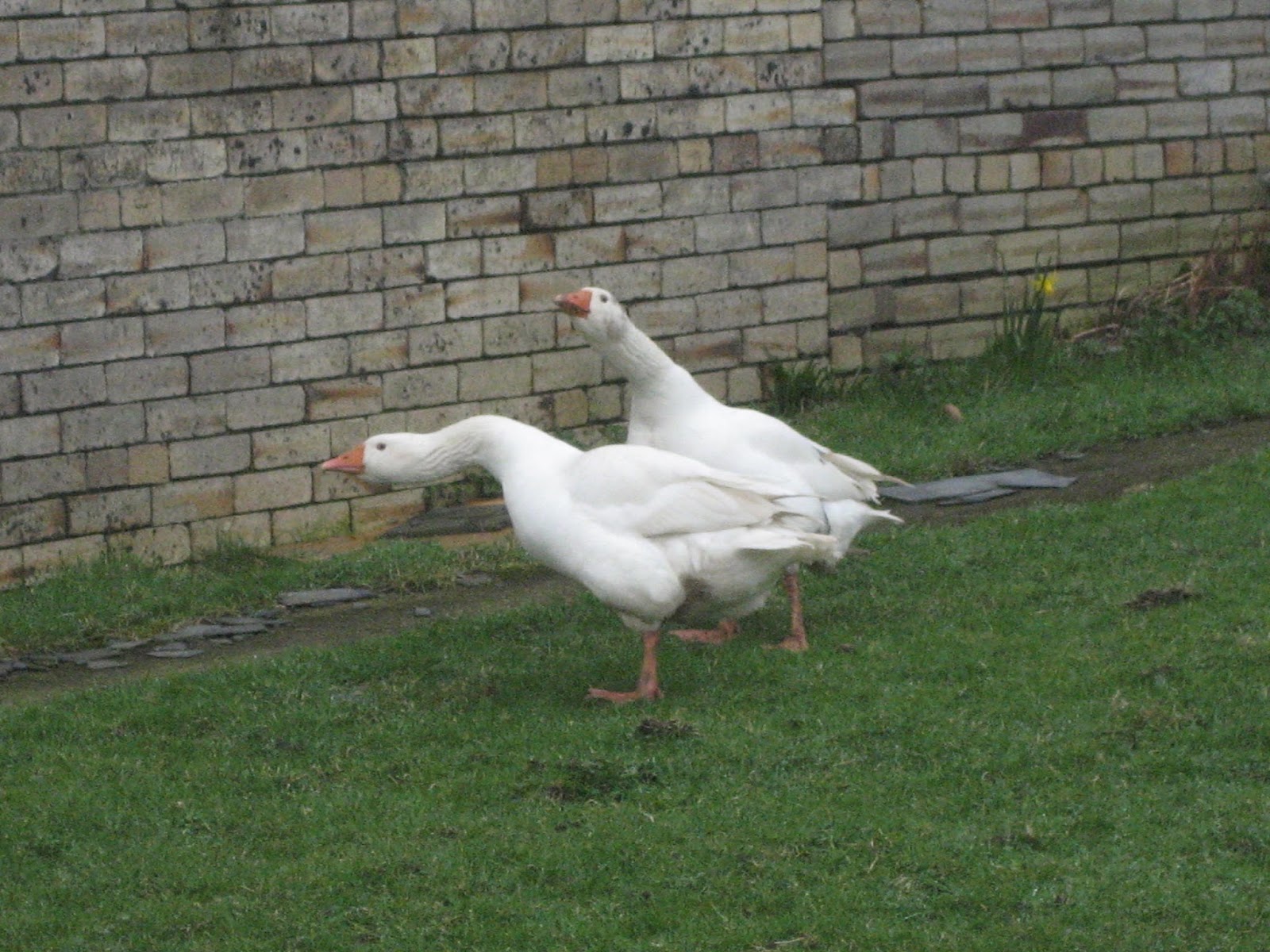
Not Greylags but with that wall they
could be defending Rome.
                                                 Witton Castle, just visible from the path.
After another muddy stretch we came to Paradise, which was a little disappointing, crossed the railway line again and walked across muddy fields before arriving at Escomb. The village itself has not much to offer but at its centre is the Saxon Church of Escomb, one of the most complete Celtic Saxon Churches in England.
                                   Escomb Saxon Church, built in 670 AD. It has one of the oldest sun dials 
                         in the country, visible to the left and above the central window.

                                                 Ancient time piece, the hole is for the gnomon.
                                           On the north wall is a stone inscribed LEG VI.
                                   Recycled stone from a nearby Roman Camp, home of the Sixth Legion.

Information outside the church.

From Escomb the path follows the river bank, muddy in places before  coming to Bishop Auckland Rugby ground. We followed the road past the ground and at Newton Cap turned right up the hill into the town, which is the home of the Bishop of Durham. In the town square we found a Wetherspoons, named the Stanley Jefferson after the man who was christened here, attended school here and changed his name to Stan Laurel............................
Journey's end as we approach the Stanley Jefferson.
 After a supper of fish and chips, washed down with Abbott Ale we caught a bus back to Newcastle from where we made our various ways home. A real gadgie walk as we used bus passes but, although we saw geese, ducks, oyster catchers, chaffinches, goosanders, curlews and a fox and stoat no heron.

MATRIX MMXIVK
                                                                    steps                                    miles
LIDL3D                                                       18490                                   8.32    rubbish
ASDA mini                                                  17696                                   8.31   rubbish
Daves 3D                                                     32022                                   14.73  How does he do it?
Dave's USB                                                  31158                                   14.75               ditto

OUTDOORGPS                                                                                        15
Brian's GPS                                                                                               15
Gadgie distance 129 miles


All three contain OS Data, copyright. Crown copyright and database right 2014

Sunday, 23 March 2014

Hellspath is for heroes.....and walks in the deep dark woods.....................February 21st
  For family reasons I could not walk with the gadgies today and two others were also away. The four remaining team members had a walk in the Cheviots on a bright windy day. Dave sent me this report:

    Harry was indefatigable yesterday, despite the fierce wind we  battled against for most of the time, I couldn't find Harry's on/off  or return to base switches.
   From Wooler Common we did the track north of Humbleton Hill to Gleadscleugh, battled to the top of the next summit heading west and eventually reached the fringes of Yeavering Bell. We made an effort and caught up with Harry and forced him to stop for lunch..
  Cornish Johnny and I were waving our white handkerchiefs by this stage, looking for an easy walk back on the St. Cuthbert's path trail with the wind on our backs. Harry had other ideas, and Ben, being an FTA was not going to squeal.
  Harry drove us up to Easter Tor, down towards Commonburn and then to Broadstruther. Avoiding a total collapse with exhaustion we staggered up Hellspath and completed the 13 miles back to "Who let the dogs out" car park.

Matrix MMXIVJ

                                        steps                                          miles
LIDL3D                           28447                                         13.10 
LIDLUSB                        27869                                         13.19
Ben's bragometer                                                              13.06

Measured by Dave with the magic German engineered wheel  12 miles
Gadgie distance 127

The walk is almost identical with:

The men who walk with goats    blogged on February 22nd,   2013

Meanwhile I was exploring Gosforth Park Nature Reserve with daughters, son in law and grandson Alex. It was breezy but obviously not as bad as the lads suffered. And it has a car park.
Kate arrives at the car park..............on time for once.

Alex explores with his stick

                                                And has his first visit to a bird hide.
                        Unfortunately it was a poor  day for wild life 
in the reserve. The powers that be have stopped
using the bird feeding station for now and all
we saw were two robins and a rat. There is a rumour that 
red kites have been spotted in the area, but not today.
    On Sunday morning we decided to visit Plessey Woods, a country park between Cramlington and Morpeth. Although the welcome board promised us kingfishers and otters the best we could come up with was a pair of Mallards. Still it has a car park, a visitor centre and a play area so it was a great success and a pleasant stroll.
                                                      There was  a car park
and a den

                                                         and Alex with his daddy
                                                                 and his grandad
                                                             and a stile
                                            I took a picture of my girls in this very spot
                                                     about thirty years ago.
                                                                   and here it is; spot Lucy
                                                                  poking her head out!
                                                      and a rabbit
                                                                     and a slide


Back next week!

Friday, 14 March 2014

One misty moisty morning.... March 14th.
 It had been unseasonally warm all week. Men had cleaned their lawn mowers and given the mossy lawns the first cut of the year. Washing waved in light breezes in gardens rather than tumbling in dryers. Children played out, who am I kidding, they stayed on their computers.
 So we decided to go to the Lake District for the first time this year, all seven of us; Dave, Harry, Ben, Brian, Ray, John and me, a two car job. And as we approached the west side of England the fog got thicker making it impossible to see the tops. But we were determined, moist but determined.
 The plan was to walk from Hartsop, a hamlet near Glenridding, up to Thornthwite Beacon and along High Street.
 To get to Hartsop from Newcastle go west on the A69, south on the M6, west at Penrith for a short time on the A66 and turn south at Rheged Centre on the road that goes alongside Ullswater through Glenridding and Patterdale finally turning left for Hartsop, Go through the small collection of cottages and there is a small carpark, a Yorkshire one, it's free.
  We stopped at the Rheged Centre for breakfast. It is an exhibition centre devoted to Vikings, and it has shops!
The map needed is the OS Outdoor Leisure 5, The English Lakes North East section and the car park is at  NY 410130.

This week's car park; Hartsop
  We left the car park in a south easterly direction  along a track that climbed gently alongside Pasture Beck. 

                                  Old mine workings in Hayeswater Gill. The building at
                                               the bottom could have been a water mill. 
                                                           Overshot as you have noticed.
The path gets steeper as it approaches Threshthwaite Crag and at the end, as it climbs up to Threshwaite Mouth it was hard work, as I had not been on a decent mountain since October last year. The path has been converted to a well maintained "stairway to heaven" with large flat stones embedded in the ground but a short break at the top was welcome. From here the path climbs, still very steeply, to Thornthwaite Beacon where we called a  Herbie Spot, after only 2.7 miles!
Tucked behind a wall out of a very strong wind we had, as well as sandwiches, Mr Kipling's Cherry Bakewell pies, chocolate, ginger biscuits and some delicious chocolate slices from John.
                                       The beacon in the mist.
Leaving the beacon we followed the line of the Roman road in a north east direction past High Street and Racecourse Hill before turning north for The Knott.
                                             The line of the Roman road on High Street
                                     This particular bit of Roman road connected Ambleside
                                           with Penrith. Most of the stones have been recycled.
 From the track, which fortunately is quite flat at this point we could look down on Hayeswater and later, as the path turned north east it went close to Angle Tarn which was hosting a small group of Canada Geese. They were probably keeping out of the wind which was still very strong.
                                                           Getting a little brighter.
                                                         Angle Tarn.
It is no longer possible to wander lonely as a cloud in  Lakeland. I blame William Wordsworth for being a Romantic and writing his daffodils poem, Sam Taylor Coleridge for climbing a few mountains and writing about them and Alfred Wainwright whose brilliant books on the Lakes encouraged others to follow in his footsteps. Today we came across a large group of walkers, some of them qualified gadgies, who had come for a weekend's walking from Derbyshire. In fact we saw more walkers than daffodils.
Beyond Angle Tarn, well beyond it actually we came to Boredale Hause. The path turned through 180 degrees almost and we headed downhill towards Brothers Water and the car park at Hartsop. On the way we had a view of Glenridding and the southern end of Ullswater but the tops remained under cloud, sadly.
                                                              Glenridding on Ullswater.
                                                            Waterfall on Angle Tarn Beck

A good work out for our first Lakes Trip of the year. On the way home we stopped at the Red
Lion Hotel in Patterdale which had a selection of beers, including Theakston's. It also sold coffee for me. Being intellectuals we discussed University Education, as you do on these occasions. It was observed that Newcastle and Northumbria Universities had a high number of students from South East Asia. "It's an occident waiting to happen"


The Matrix MMXIVJ

                                                         steps                            miles
LIDL3D                                              21050                         9.6
Higear suffered a catastrophic malfunction in that the belt clip broke
Dave's   LIDL 3D                               25875                        11.55
LIDLUSB                                           23529                         10.3

OUTDOORGPS                                                                     9.76
Brians GPS                                                                             9.7
Ben's Bragometer                                                                    9.8
Gadgie Distance  114.8


 A walk of two halves, but not necessarily equal
Contains OS data Copyright. Crown copyright and database right 2014
BIRD OF THE BLOG
Not the best of days for the ornithologists. We saw a pair of ravens and a pair of buzzards, a pied wagtail, two robins and the usual collection of lbjs, but the bird of the blog goes to.........
                                                           The grey wagtail

Saturday, 8 March 2014

RETURN OF THE PIES II...........March 7th
  We had intended to make our first trip to the Lake District today but the forecast for the west side of the country was for rain so we headed for the Coquet Valley with the intention of doing the ever popular Windy Gyle walk along, in part, the Scottish border. However, when we got to the car park at Rowhopeburn in the Coquet Valley the sleet was coming down in sheets and the wind was very strong so we chickened out and went to the comparatively low level Thrunton Woods.
 A man made plantation, Thrunton has a choice of country walks, marked with different coloured arrows. It has car parking and even picnic tables. To get there follow the A1 north, turn onto the A697 at Morpeth and watch out for signs for Thrunton on the left a fgew miles after Longframlington. (Watch out on the right  two miles before the turn off. The wigwam at Wellhope has returned)
The walk is covered by  OS 332 Alnwick and Amble and the car park is at GR NU 085097.


                                                 The inevitable car park. Thrunton Woods.
A few yards north of the car park a forest road leads off on the left. (Unless you park on the other side of it in which case it would be on your right of course.)
We followed this road for a few hundred yards, climbing gently uphill until we came to a junction and turned right.  We followed the road due north before it turned  south west. At this point it is close to the edge of the plantation and quite high up giving good views of Hedgehope and the Cheviot.
                                             Looking north.
The track here is quite muddy this time of year  but we soldierd on past Thrunton Crag until, after only two miles we came to the edge of the wood and, although we had not walked far, declared a Hebie Spot. (2 mile marker on the map) In fairness we had started off late because of the drive up the Coquet and so it was some time since breakfast at Tomlinsons Cafe and Bunkhouse in Rothbury where I had fought off the bacon sandwich and just had tea.
 This week's food scares are sugar and processed meats  so we stuck up our fingers to the health experts and ate Mr. Kipling's Almond Slices, ginger biscuits, dark chocolate and, most important, Brian had brought Pork Pies! Mrs A must have been too busy to bake. We had a sandwich too.
There are several tracks to follow from here, we chose the very muddy footpath  heading roughly north west in the direction of Hob's Nick and Macartney's cave. Turning south west at the cairn we headed  across Hard Nab turned south at the next cairn and shelter and went downhill to the Coe Burn.
                                               Meat pies in the sunshine.
                                                            Neatly framed view looking north.
  From the burn the path climbs steeply up to Long Crag. The path is quite rocky too and requires a little scrambling in places but once on the ridge the views back to Simonside make the effort worth while. There is also a redundant trig point on Long Crag

                                                    Heading for the crags.
The path meanders on the ridge  to Coe Crags, well worth a stop for the views.
                                                           Coe Crag
Another well framed view.
Beyond the crags the path heads downhill through Coe Crags Wood until it reaches the wooden footbridge across the stream and shortly after comes to a forest road.
Using our native tracking skills Ben and I decided that Brian, who had been well ahead, had turned left. Then we saw him, sitting at the side of the road. So much for tracking then.
                                                      Cross the bridge and turn left, roughly west.
The forest road leads through the wood, much of which has been recently cleared and approximately two miles later reaches the car park
It had been a dry afternoon, the clouds over the distant hills suggested we had probably made the right decision. For a change we retired to the Anglers Arms which had Directors, Speckled Hen and Timothy Taylor's Landlord which sadly ran out.

The Matrix MMXIVH
                                                         steps                         miles 
LIDL3D                                           20985                      9.44
HiGear                                            20104                       9.51
Dave's LIDL3D                               20115                       9.27
Dave's USB                                     19828                       9.38

OUTDOOR GPS                                                              8.43
Brian's GPS                                                                      8.43
Ben's Bragometer                                                             8.6
Consistent or what.

Gadgie distance105 miles