Translate

Friday, 3 January 2014

Stastny Novy Rok    с НовыМ  ГодоМ   
Novus annus
Bonne annee
Gluckliches neves Jahr  Happy New year
(Although it's January 3rd)
Gadgies usually start the new year with gentle walk, not because of Hogmanay hangovers but because of the weather. The local weather forecast is for another damp day but not as wet as the last few have been, and the wind has died down at least until Saturday. So we have agreed to repeat a walk last done on January 11th last year entitled Picnic at Stag Rock.
The walk starts at Seahouses on the Northumberland coast. Seahouses has fish and chip shops, souvenir shops and pubs, as well as a large car park in the centre of the fishing town. It also offers trips out to the Farne Islands which are now a nature reserve, home to a vast number of sea birds and seals. Should you opt to visit them, be warned, well worth it but the smell! The islands are National Trust properties and there is an additional landing fee, unless you are a member.
The whole of the walk is covered by OS Explorer 340 and the best way to get to Seahouses is to head north up the A1 and follow signs from Alnwick, or use a Satnav.
Six out today, Brian, Ben, Harry, Dave, John and me.

There had been more than the usual discussion on where to walk, mainly because of the uncertain weather. At one point Dave sent an email saying that "Like Lord Stanley at the Battle of Bosworth* he would wait and see how things were before joining in" to which Brian replied "Typical Stanley, wait to see who's winning and then stick the knife in!"**

The walk.
We started at the car park in Seahouses. at the back of the car park a gate leads to the Northumberland Coast Path which is the route we are to follow today. If you think this path is on an old railway line, you are right, it is.
                                           Yes it's a car park. (£3.50 for a whole day)
                                               Seahouses is famous for fish and chips


                                    The blue sign marks both paths and appears frequently
                                                making it an easy route to follow.


 At the end of the path we turned right on the road past a small industrial area and after about fifty yards crossed into a field, well sign posted. Being winter and having suffered a few days rain the path was muddy but easy to follow across several fields, past North Cottage, several more fields to Saddlershall, along a short stretch of road to Fowberry. From here we wandered across more muddy fields to Redbarns and Quarry Cottage. If you look on the OS map the path goes directly from here, behind Armstrong Cottages, to the road and on to the castle but we faithfully followed the signs across yet more muddy fields before arriving at the castle car park. From here new followed the road for a short distance to the cricket field.
                                                       Mighty Bamburgh. There is evidence of
                                                  pre Romano British occupation of the site.
                                                 The castle was built in the 12th century and
                                                 modernisation took place in the 18th and 19th.
                                              Beneath the walls at Bamburgh
                                         The Fugawee tribe were camped at Bamburgh,
                                                       they thought.
To the left of the cricket pavilion a footpath took us along the dunes  to The Wynding, and soon we reached Stag Rock and declared a Herbie Spot.  Stag Rock is not named on the map, it is at  Blackrocks Point next to a lighthouse and is quite sheltered from the westerly wind.
                                                  Stag Rock
                                                 Looking back at Bamburgh
Future archaeologists may well look into the lunchtime eating habits of groups of gadgies.
Excluding sandwiches we shared Guinness flavoured Truffles, ASDA flapjacks, Ben's superb ginger biscuits and Co-op cereal bars. This is becoming almost a ceremony or ritual. (This is a phrase used by archaeologists when they are not sure.)  Actually archaeologists wont know because we take our litter home.
Lunch over we climbed the steps behind the lighthouse and carefully crossed Bamburgh Golf Course.

      
                                       Trinity House runs British Lighthouses.
                                                       Budle Bay
The course is above Budle Bay and the footpath meanders between the holes and fairways, across a couple of fields. until it emerges on a road. We turned left and after a couple of hundred yards turned right at the sign for Dukesfield entered  and crossed several more fields, slipped, literally , down  a path through a wood and emerged on a road at the old Spindlestone Mill, now converted into luxury apartments.
                                                          Spindlestone Mill
From here we followed the road to the wonderful Outchester Ducket. Originally built as a Dovecote, they had very large doves in Northumberland, it was also used for storing food and manure! Now it is a holiday let, complete with great views and circular bedrooms.
                                                      The Outchester Ducket.
We turned right at the Ducket and took the left fork at the next junction until we came to the Warren Mill Caravan and Camping site. Beyond the gate to this camp a footpath led us alongside the site, past several static vans before we entered and crossed several more fields before arriving at the crossing on the main London Edinburgh line. A notice informs walkers to ring the signalman for permission to cross, this time the honour of making the call fell to Harry.
                                          I just called to say we're crossing

                                                      Perspective perspective
Once safely across we walked past the coastal grain stores to the A1, main road between London and Edinburgh, not that you would think so, it's a single carriageway here, but hat's what we get in the north of England.
                                            Northumberland produces much grain..
Across a couple more fields and we were in Belford, the end of the walk.
Belford possibly comes from Old English, bel haga a glade in a forest or dry land in a swamp, today it looks like the small town is dying, two pubs and a café up for sale. We waited a while and caught the Travelsure 418 bus which whisked us back to Seahouses in about 20 minutes. Debooted we headed for The Old Ship hotel hoping to annoy the locals by sitting in their seats but the pub was packed at 4pm with mostly visitors. Several beers on offer, I chose Directors as a second pint, the first, Alnwick Longstone, being disappointing.

The Matrix MMXIVA

                                                           steps                                       miles

LIDL 3D                                          25317                                      11.41
Higear                                              23947                                      11.32
Dave's LIDL3D                               23478                                       10.81
Dave's LIDLUSB                            23126                                        10.94

OUTDOOR GPS                                                                              10.81
Brian's GPS                                                                                       11
Ben's GPS                                                                                          10.9

Pretty consistent for once


Gadgie total for the year                                10.8miles

* Battle of Bosworth 1485. The end for that son of York the much maligned Richard III who, calling for a horse, died and was dragged to Leicester. His remains were discovered a couple of years ago under a council car park and lawyers are now making a fortune arguing where he should be buried. York Minster gets my vote.
** Lord Stanley fought in the battle of Bosworth. In the UK a Stanley knife is a short bladed knife with interchangeable blades, used for hobbies, opening boxes etc. A sharp remark from Brian.


Saturday, 21 December 2013

Clarty and claggy .......................December 20th


  Clarty and claggy are two delightful North East Dialect words that sum up this walk, a rerun of the John Martin Trail that has been covered at least twice before.
Clarty means muddy and claggy means sticky, clart without the y is mud, and most of the day's walk was in it.
 Because of Christmas when people tend to travel to see family or have family visiting today's walkers are reduced to three unwanted gadgies, Brian, John and me. The walk starts at Haydon Bridge and is covered by OS OL 43, Hadrian's Wall. Travel west from Newcastle on the A69, turn off for Haydon Bridge on the A686 but do not cross the Tyne. Before the river turn left and follow the road past the Anchor Hotel and turn sharp left at the Haydonite Club. Just beyond the Shaftoe School there is a small (free) car park at NY844640.
As a reminder John Martin (1789 1854) was an artist born in these parts and famous for his huge canvasses, often with biblical themes. His brother Jonathon set fire to York Minster and was sent to the local asylum.
We stopped for breakfast at the café in the large car park in Hexham; true to my promise I had a pot of tea and no bacon sandwich.


                                              A car park again, Shaftoe school behind.
The walk;
We walked downhill from the car park and, almost  directly opposite the Haydonite, followed the road past a few houses, a caravan site and the East Land Ends farm where the great man was born.
                             John Martin's birthplace, his mum and
                            dad probably didn't have the conservatory
                             in 1789.
We stayed on the farm road as far as Lees Farm, which has plenty of dogs and went through the yard, following the markers for the walk.
                                                 Lees farm

                                             Watch out for the markers, they are useful.
Through the farmyard the path crosses four muddy fields before hitting the road which goes to Tedcastle. We turned left and after a few hundred yards turned right on a road which goes downhill. After a few hundred yards we followed the heritage trail through a gate on the left (marker vanished!) and walked across a muddy field to Morrallee Woods, a National Trust property, currently being cleared of rhododendrons which can become a bit of a nuisance. If you follow this walk watch out for the John Martin trail markers as there are several other walks in the woods. The JM trail goes steeply down to the banks of the River Allen, crosses a field, goes through another short stretch of wood, and emerges onto a road which leads to Plankey Mill.
Plankey Mill means, possibly, the neck of floodable land where games are played, according to the book of Northumbrian place names. First recorded in 1673 and known as Naked ale or ele,
naked meaning neck and ele being an island.
                                Plankey Mill Farm
                                                     Field at Plankey Mill,
                              a popular picnic spot in summer
                             and a pleasant Herbie Spot today.
We called a halt for lunch; today's offerings were a mince pie, a Dorset Cereal Bar and a slice of Mrs. A's Apple cake. So much for the diet.
Lunch over we walked along the river bank over two fields before re-entering the National Trust property of Allen Banks.
                                        Quite possibly the driest part of the walk.
                                                   The River Allen
                                                           Again.
After a while the path climbs steeply towards Staward  Peel. The footpath has been "stepped" in places, just as well on a clarty day or it would be two forwards and one back.
The peel is in a very commanding position, built on a peninsula with steep banks on either side, not that there is much left now. 

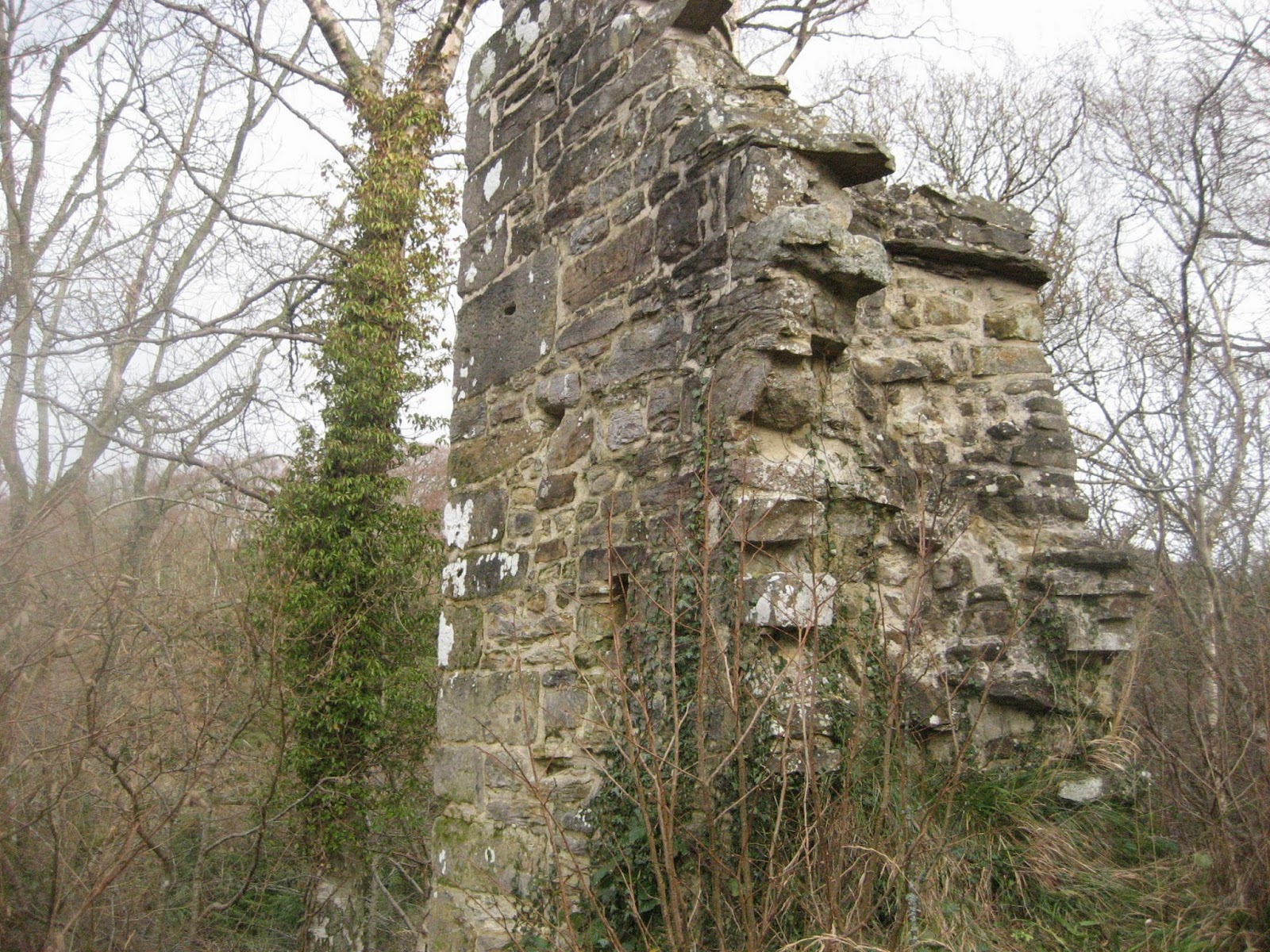
                                            Remains of the peel
                                                    And its gate house


Could have been impressive, once.
 
The footpath from the peel led us along a narrow path, be warned if you have small children with you and emerges into a field. We crossed the field and found the stile that took us into a wood with a steep path that led downhill, across a footbridge and up the other side, this path was very slippy because of the clarts which were claggy. Across another field and we came to the next farm, Harsondale, crossing a stile and turning right on the farm road.
Somewhere along this road Brian broke through his total walking mileage for last year, he had forgotten to bring a hip flask to celebrate, sad.
                                                       Harsondale
                                                        An artistic shot of trees.
 
 
At a point along this road a public footpath marker will take you
to Sillywrae, a farm that still relies on horsepower to carry out the work, but we continued on the track until we came to a road and turned left. Reaching a junction we took the marked path directly opposite the track we had walked  which took us down to the farm at West Deanraw. At the next junction we turned right but instead of following this road to Langley Castle we took the footpath across a field to Black Byre Plantation which surpassed anything we had seen for clarts. Another footpath, another field and we were at West Land Ends, another farm, with a classy hemel.
                           The hemel at West Land Ends farm.
Following the road we were soon passing East Land End again and were soon back at the car.
It was only 3.15pm. On the way home we called in at the Boathouse pub in Wylam, it had its usual large selection of hand pulled ales on offer.
 
The Matrix
Total disaster, Higear decided its battery was finished andLIDL3D defcided to shut down at the Herbie spot.
However Outdoor GPS gave a distance of 9.3 miles and Brian's GPS said 9.6.
 
Not a great day for birds but we saw a heron, a buzzard and probably a barn owl.


This map of the walk is from the
John Martin Heritage leaflet available
in the town and I shall probably
be in trouble for using it.
This map is from OUTDOOR GPS
and OS say I can publish it if I give
 them credit, which I have.
And this is Sadak searching for the waters
of oblivion. Why didn't he just go to the pub?
Gadgie walking total for the year: 462.6 miles. Must do better in 2014
 
This is the last walk of the year and therefore the last blog until January 3rd 2014 so a merry Christmas and Happy New year, let's hope it's a good one without any fear as John sang. And to quote that great Irish comedian Dave Allen, may your God go with you. 

Friday, 13 December 2013

A walk with the Common Broads..... Dec13th
(and it was a Friday.

  Whenever Frank Sinatra visited Britain he said he was going to Norfolk for the broads. How we laughed, the first time.
Today, five gadgies are out and we are walking from Langleeford in the Harthope Valley. The team consists of Brian, John, Ben, Dave and myself.  To get to Langleeford  from Newcastle take the A1, turn off at Morpeth on the A697, turn into Wooler and turn almost immediately into Cheviot Street. Follow this road to the fork, and take to the right, which now has a brown sign* directing you to the Harthope Valley. Turn right at the sign for Langleeford, drive past the still wonderfully named Skirl Naked and drive as far as it is permitted up the valley. There is a grassed parking area on the left.
A map is advisable, OS OL16 The Cheviot Hills, and the parking area is at NT954225.
The jovial Jock had promised us a cloudy day with the occasional shower and an unseasonally high temperature of 12 degrees C. He was right.
And of course we stopped at the Terrace Café in Wooler for breakfast but having added at least seven pounds to my weight recently I resisted the bacon and had a cup of tea.
 

                                                      Preparing for the off in the car park.

 We took the footpath directly opposite the parking area which leads up the Hawsen Burn and across moorland to a fence. The footpath, according to the map goes directly to the gate  and stile in the fence but we have always had to struggle the last few yards over boggy heather. Over the stile the footpath, wet in winter, leads downhill until it meets a well made track. It gives a great view of the College Valley, still my favourite Cheviot Valley, even on a grey day like this.
                                                The Cheviot, shrouded in cloud.
                                                   The College Valley ahead.


       We turned right and followed the track to the farm at Goldscleugh. If you follow this walk go past the farm and follow the signpost just beyond it which takes you across a ford onto a good farm track. Some of us tried a short cut and had to climb several fences, something that seems to be getting harder. Brian took off on a track before he got to the farm which took him to the plantation. The rest of the team followed the track uphill for a while  until we spotted the yellow marker that took us into the plantation.
                                                     Goldscleugh
                                          And a distant view of Dunsdale Farm.
                                           And a little yellow marker. Now you know what to look for.
The path through the plantation is a public right of way but is difficult to follow until about half way through where it joins a forest truck.
 Once out of the wood we followed the path in a north east direction. At a fork in the path we took the left fork, although there was some muttering about this being the wrong one. However as we came to a stream running down to the Common Burn a voice hailed us. It was Brian who had found an easier route. A Herbie Spot was declared. Apart from sandwiches we had ASDA flapjack,mince pies, Ben's famous ginger biscuits and Mrs A's cinnamon flavoured  muffins. Quite rightly Brian observed we were the only people who went out for a walk to put weight on. So much for declining the bacon sandwich.
Lunch over we continued on our muddy way towards Commonburn House. If you follow this walk look at the map. Shortly before the farm a footpath dips down towards the Common Burn, there is a ford and then a well made farm track leading uphill and over the moors towards Broadstruther.
                                    Look carefully, Commonburn House is visible
                                               above the wall in the background.
At Broadstruther, or near it, the footpath leads south before turning south east and coming to a fence.
On the south side is a boundary marker.
                                    Broadstruther, behind a large black box
                                             Moss covered boundary stone.
 At the fence  we turned left and followed the fence line  north east up Cold Law. There is a path on both sides of the fence, some took one side, some the other. Normally the path is boggy and it is a long slog to the top but today the trail was dry, an indication of a rain free week or so, and a tail wind drove us to the top.
                                                   Another Trig Point!
Should you follow this walk be careful on the way down from the top of the hill. There is a very good path leading approximately south south east from the top directly down to Cockshaw Syke and the car. Some of us, accidently I suppose followed a vague path across some Lauder Grass  and finished up near Back Wood (see the OS map) which meant we had to climb uphill one last time before finding the real path down to the valley bottom and the car where Brian, who had taken the proper route, was smugly waiting. Good day out though.
Just for a change we called in at the Anglers Arms on the way home. Today's beers were from Brains, a Welsh company, Adnams from Suffolk and a pint called Old Hooky. There is always  a warm welcome and a good pint at the Anglers.
Driving home we were entertained by a selection of carols sung by Maddy Prior and the Carnival Van,** at least that's what I think he said.

MATRIX MMCCVII

                                                                 steps                          miles
LIDL3D                                                  25897                         10.72
Higear                                                     23835                          11.27
Dave's 3D                                               24228                          11.14
LIDLUSB                                               23792                          11.26

OUTDOOR GPS                                                                         10.65
Ben's Bragometer                                                                         10.75
 Pretty good.


No bird or beast of the blog this week, plenty of grouse, (and grousing) possibly an owl but not a definite.
However a new feature:
 
I married a vegetarian and survived
 
My wife is a life long vegetarian, obviously I am not. But ever willing to try new things we bought some Quorn "bacon" and made sandwiches. I awarded one flitch and that was for the bun. If by any chance Carol Midgely, Times columnist and writer of one of the better articles on the struggle to be a veggie reads this, be warned, there is no substitute for a real bacon butty.
 
* On the first edition this was spelt as  "sine". Spotted by daughter who thought it might be an early indicator of a form of dementia, I prefer it to be the result of teaching sums for forty years.
 
** Should have been Band, deaf as well as demented.


Gadgie distance 453.3 

Friday, 6 December 2013

A winter's day, in a deep and dark December.

December 6th.

That was Thursday 5th of December when the northern part of the kingdom was battered by strong winds, heavy rain and even showers of hail and snow, causing the reporters on local TV to put on very serious faces. (Not helped by both Newcastle and Sunderland losing on the Wednesday evening.)
But the young lady who delivers the weather forecast for BBC Look North promised us a cold crisp day on Friday. Because some of us had enjoyed a surfeit of ale  and curry on Thursday evening we decided to have a relatively easy and local walk, starting from St. Andrew's Church  at Bolam. The easiest way to get there is to head north from Newcastle, turn off for Morpeth, turn left just after County Hall by the golf course and drive to the village of Whalton. Turn right after the pub (Beresford Arms) and follow the road to Bolam.  (Bolam means "settlement on a rounded hill") The church is on the right as you approach the tiny village and there is space for a few cars to park.
The whole walk is covered by map OS OL42, Kielder Forest and the church is at NZ092825.


St. Andrews is a pretty little church with a late Saxon west tower and Norman nave, the windows are 18th century, except for the small one in the south wall which was caused by a German bomb which penetrated the wall but failed to explode. Some  sixty years after the war the German pilot returned and apologised!
The church has a web site;  www.standrewsbolam.co.uk.  A few weeks ago some of us went for a bike ride and made use of the church porch for a rest and a drink. I was almost home when I realised I had left my cycling glasses in the church. (I only wear them to keep flies out of my eyes and there aren't many about in November.) I drove back next day, they were still there.


                                             St. Andrew's Church Bolam. I have noticed several churches
                                     in the region dedicated to Scotland's saint. I think it was to protect them
                                     against marauding bands from north of the border!
                                               
 
The rectangular window is the one caused by a
German bomb. It was not aimed at the church,
the crew jettisoned their load after failing to
attack their Tyneside target.
 
At last the walk:
In the north west corner of the churchyard is a gate, marked with the usual symbol. We went through it and across a couple of fields  to Angerton Steads, which has a tennis court. The fields would have been muddy but the freezing night time temperature made the ground firm underfoot, and kept your boots clean. Beyond Angerton Steads the footpath crosses a dismantled railway line, (1mile)  the footpath around the edge of the fields is well marked.
 
The old "Wanny" railway, now used as a run for horses.
 
The next farm is Low Angerton and the footpath  goes round the buildings before emerging on a metalled road. Just north of the River Wansbeck a sign post on the left hand side of the road directed us westward  but on the north bank of the river, across several fields (2m) before crossing the railway again; (And the line of the Devil's Causeway, a Roman road although there is nothing to see.)
Several fields later (3m) the footpath approaches Middleton Mill farm. A black arrow on a yellow background directed us round the farm buildings but we then had to go through the yard on to the farm track.
There is much evidence of ancient farming in the fields,many of them having ridges and furrows. The outline of the Medieval Village of South Middleton can be made out too.
                                                   R and F
                                                            More R and F  (and village site)
 
 
At the end of the farm track we turned left on the road, crossed Middleton Bridge and found a sign post on the right  that led us over the remains of the medieval village to an open rectangular shelter which made a Herbie Spot. Almost Christmas we dined on mince pies, chocolate flapjacks, ginger biscuits and a sandwich. Lunch over we continued on our way to Middleton South (5m) More fields in a generally south direction. Pausing to look at a standing stone we headed south east across more fields (6m) before passing through Salter's Nick and on to the rougher ground  around Shaftoe Crags.
A real stile.

                                                  A real standing stone.
                                                          Salter's Nick
  Bonny Bobby Shafto of yellow hair and sea travel  came from County Durham and not this part of the world. On the top of the crags is a stone  named  The Punchbowl. Legend has it that at his wedding, W Blackett of nearby Wallington celebrated his wedding on the crags and filled a depression on the rock with several gallons of wine.
                                         Listen children. These things, called "Trig Points" were
                                         used by map makers in the days before we had satellites.

                                                       Shaftoe Crags.
 
 
     Punchbowl Stone


Leaving the crags  (7m)we followed the road  past East Shaftoe Hall and through a muddy farm yard. The track beyond the farm is made from  old concrete sleepers, they work well. (8m)
At Bolam west houses we turned right along the road (9m) until we spotted the footpath, on the left which led us into Bolam Lake Country Park. Walking round the north side of the lake we halted to do a bit of duck spotting. A Canada Goose took off from the lake and flew at us, nearly hitting Dave, or goosing him! It was followed by several more and some swans. Obviously a popular bird feeding station. Sadly all our food had gone. My wife and I once bought some "Duck and swan food" and came out here to feed the birds. They ignored the food we had bought preferring bread.
Out of the park we turned left on the road and then right up the hill past the entrance to Bolam Hall(10m) and back to the church.
 
This has to be the bird of the blog;
 
                                                          Canada Goose
                                                              And swans
 
                                                        And Dave
 
The Matrix  MMXIIIB
 
                                                    steps                                               miles
High Gear                                   21466                                             10.15
LIDL3D                                     24100                                              10.84
 
Dave's LIDL3D                          23133                                              10.62
Dave's LIDLUSB                       22620                                               10.71
OUTDOORGPS                                                                                 10.28
Brian's GPS                                                                                         10.4
 
These must be the best results ever


         Contains OS data Copyright. Crown Copyright and Database right 2013


Gadgie total so far: 451.7