A winter's day, in a deep and dark December.
December 6th.
That was Thursday 5th of December when the northern part of the kingdom was battered by strong winds, heavy rain and even showers of hail and snow, causing the reporters on local TV to put on very serious faces. (Not helped by both Newcastle and Sunderland losing on the Wednesday evening.)
But the young lady who delivers the weather forecast for BBC Look North promised us a cold crisp day on Friday. Because some of us had enjoyed a surfeit of ale and curry on Thursday evening we decided to have a relatively easy and local walk, starting from St. Andrew's Church at Bolam. The easiest way to get there is to head north from Newcastle, turn off for Morpeth, turn left just after County Hall by the golf course and drive to the village of Whalton. Turn right after the pub (Beresford Arms) and follow the road to Bolam. (Bolam means "settlement on a rounded hill") The church is on the right as you approach the tiny village and there is space for a few cars to park.
The whole walk is covered by map OS OL42, Kielder Forest and the church is at NZ092825.
St. Andrews is a pretty little church with a late Saxon west tower and Norman nave, the windows are 18th century, except for the small one in the south wall which was caused by a German bomb which penetrated the wall but failed to explode. Some sixty years after the war the German pilot returned and apologised!
The church has a web site; www.standrewsbolam.co.uk. A few weeks ago some of us went for a bike ride and made use of the church porch for a rest and a drink. I was almost home when I realised I had left my cycling glasses in the church. (I only wear them to keep flies out of my eyes and there aren't many about in November.) I drove back next day, they were still there.
 St. Andrew's Church Bolam. I have noticed several churches
in the region dedicated to Scotland's saint. I think it was to protect them
against marauding bands from north of the border!

 R and F


 A real standing stone.

 Listen children. These things, called "Trig Points" were
used by map makers in the days before we had satellites.


 Canada Goose


December 6th.
That was Thursday 5th of December when the northern part of the kingdom was battered by strong winds, heavy rain and even showers of hail and snow, causing the reporters on local TV to put on very serious faces. (Not helped by both Newcastle and Sunderland losing on the Wednesday evening.)
But the young lady who delivers the weather forecast for BBC Look North promised us a cold crisp day on Friday. Because some of us had enjoyed a surfeit of ale and curry on Thursday evening we decided to have a relatively easy and local walk, starting from St. Andrew's Church at Bolam. The easiest way to get there is to head north from Newcastle, turn off for Morpeth, turn left just after County Hall by the golf course and drive to the village of Whalton. Turn right after the pub (Beresford Arms) and follow the road to Bolam. (Bolam means "settlement on a rounded hill") The church is on the right as you approach the tiny village and there is space for a few cars to park.
The whole walk is covered by map OS OL42, Kielder Forest and the church is at NZ092825.
St. Andrews is a pretty little church with a late Saxon west tower and Norman nave, the windows are 18th century, except for the small one in the south wall which was caused by a German bomb which penetrated the wall but failed to explode. Some sixty years after the war the German pilot returned and apologised!
The church has a web site; www.standrewsbolam.co.uk. A few weeks ago some of us went for a bike ride and made use of the church porch for a rest and a drink. I was almost home when I realised I had left my cycling glasses in the church. (I only wear them to keep flies out of my eyes and there aren't many about in November.) I drove back next day, they were still there.

in the region dedicated to Scotland's saint. I think it was to protect them
against marauding bands from north of the border!

The rectangular window is the one caused by a
German bomb. It was not aimed at the church,
the crew jettisoned their load after failing to
attack their Tyneside target.
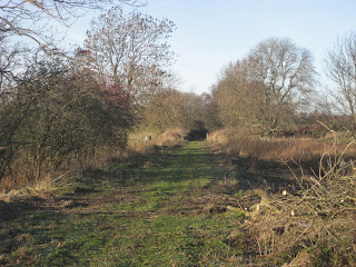
At last the walk:
In the north west corner of the churchyard is a gate, marked with the usual symbol. We went through it and across a couple of fields to Angerton Steads, which has a tennis court. The fields would have been muddy but the freezing night time temperature made the ground firm underfoot, and kept your boots clean. Beyond Angerton Steads the footpath crosses a dismantled railway line, (1mile) the footpath around the edge of the fields is well marked.

The old "Wanny" railway, now used as a run for horses.
The next farm is Low Angerton and the footpath goes round the buildings before emerging on a metalled road. Just north of the River Wansbeck a sign post on the left hand side of the road directed us westward but on the north bank of the river, across several fields (2m) before crossing the railway again; (And the line of the Devil's Causeway, a Roman road although there is nothing to see.)
Several fields later (3m) the footpath approaches Middleton Mill farm. A black arrow on a yellow background directed us round the farm buildings but we then had to go through the yard on to the farm track.
There is much evidence of ancient farming in the fields,many of them having ridges and furrows. The outline of the Medieval Village of South Middleton can be made out too.


More R and F (and village site)
At the end of the farm track we turned left on the road, crossed Middleton Bridge and found a sign post on the right that led us over the remains of the medieval village to an open rectangular shelter which made a Herbie Spot. Almost Christmas we dined on mince pies, chocolate flapjacks, ginger biscuits and a sandwich. Lunch over we continued on our way to Middleton South (5m) More fields in a generally south direction. Pausing to look at a standing stone we headed south east across more fields (6m) before passing through Salter's Nick and on to the rougher ground around Shaftoe Crags.

A real stile.


Salter's Nick
Bonny Bobby Shafto of yellow hair and sea travel came from County Durham and not this part of the world. On the top of the crags is a stone named The Punchbowl. Legend has it that at his wedding, W Blackett of nearby Wallington celebrated his wedding on the crags and filled a depression on the rock with several gallons of wine.

used by map makers in the days before we had satellites.

Shaftoe Crags.
Punchbowl Stone
Leaving the crags (7m)we followed the road past East Shaftoe Hall and through a muddy farm yard. The track beyond the farm is made from old concrete sleepers, they work well. (8m)
At Bolam west houses we turned right along the road (9m) until we spotted the footpath, on the left which led us into Bolam Lake Country Park. Walking round the north side of the lake we halted to do a bit of duck spotting. A Canada Goose took off from the lake and flew at us, nearly hitting Dave, or goosing him! It was followed by several more and some swans. Obviously a popular bird feeding station. Sadly all our food had gone. My wife and I once bought some "Duck and swan food" and came out here to feed the birds. They ignored the food we had bought preferring bread.
Out of the park we turned left on the road and then right up the hill past the entrance to Bolam Hall(10m) and back to the church.
This has to be the bird of the blog;


And swans

And Dave
The Matrix MMXIIIB
steps miles
High Gear 21466 10.15
LIDL3D 24100 10.84
Dave's LIDL3D 23133 10.62
Dave's LIDLUSB 22620 10.71
OUTDOORGPS 10.28
Brian's GPS 10.4
These must be the best results ever

Contains OS data Copyright. Crown Copyright and Database right 2013
Gadgie total so far: 451.7
No comments:
Post a Comment